Surveying & Mapping
Drone Corridor Mapping Service
Precision drone surveys for pipelines, power lines, railways, and road schemes. Capture kilometres of linear infrastructure in a single day.
Avg Response within 5 Mins | Or phone +44 1334 804554
Understanding Drone Corridor Mapping
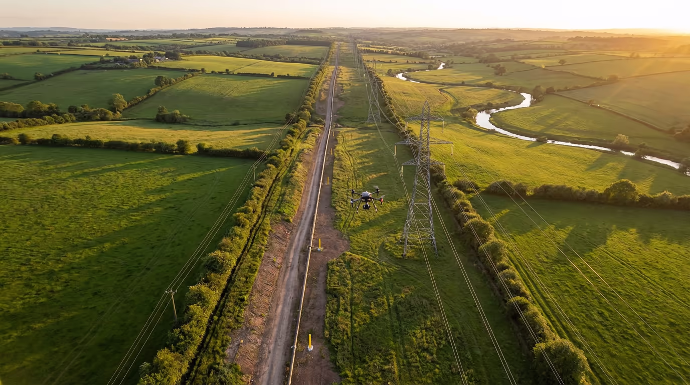
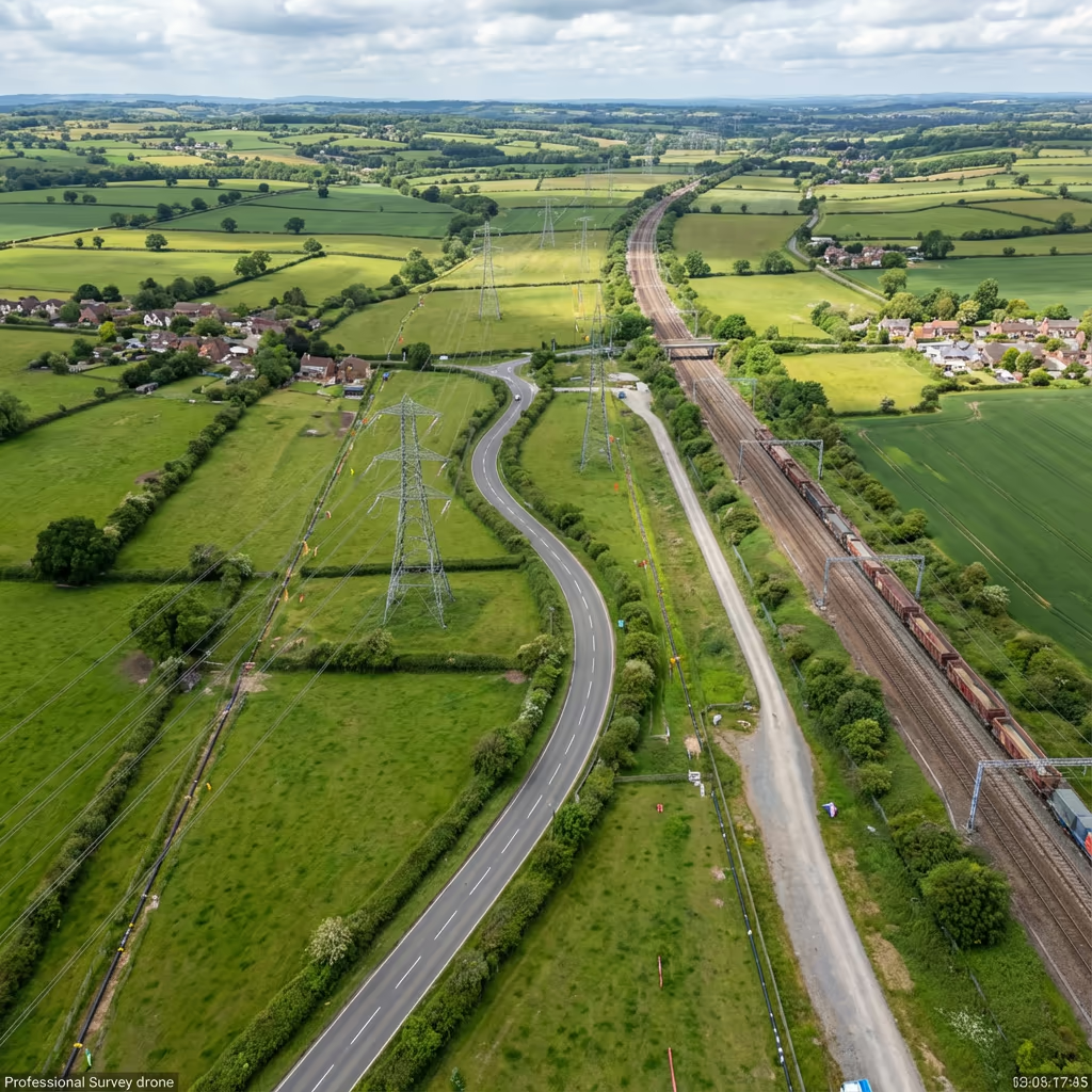
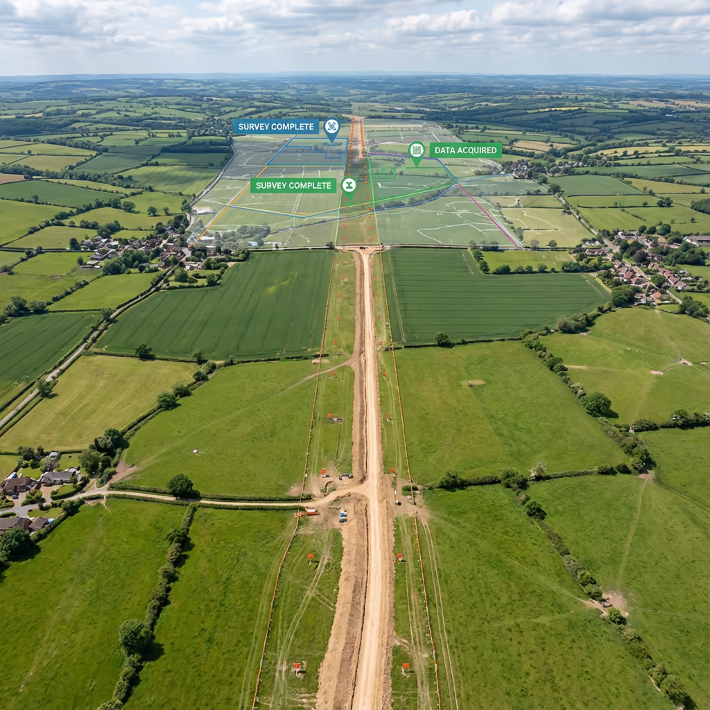
UAV corridor mapping is a specialist drone surveying technique designed for linear infrastructure such as pipelines, power lines, railways, roads, and waterways. Employing advanced drone technology, we capture continuous, high-resolution data along extended routes that would require conventional survey teams weeks to cover on foot.
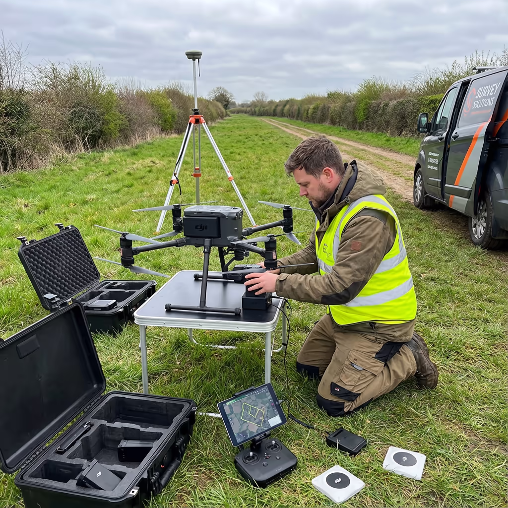
At Hire Drone Pilot, our corridor mapping missions combine photogrammetry and LiDAR sensors to deliver precise orthomosaics, digital terrain models, and cross-sectional profiles. We can survey corridors of 20km or more in a single day, supplying infrastructure operators with the detailed spatial data they require for planning, maintenance, and compliance.

Peter Leslie
Owner & Drone Pilot
"Have questions? Ring me directly - I'm happy to discuss your project requirements."
Call NowSurvey-Grade Corridor Data,Delivered Rapidly
What You'll Receive
- Continuous corridor orthomosaic
- Cross-sections at specified intervals
- Longitudinal profiles
- Survey-grade accuracy (±2-5cm)
Ready in 5-7 working days
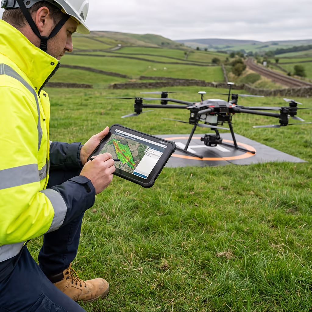
Why Use HireDronePilot
- CAA authorised & fully insured
- Extended BVLOS capabilities
- Latest DJI & sensor technology
- UK-wide coverage
Relied upon by utility companies, Network Rail contractors & infrastructure developers.
Relied upon by leading organisations
Drone Corridor Mapping Pricing Guide
Corridor mapping pricing depends on route length, terrain complexity, and required deliverables. Here is a guide to assist your budgeting:
| Corridor Length | Guide Price |
|---|---|
| ShortUnder 5km | £1,000+ |
| Medium5–20km | £2,500+ |
| Long20–50km | £5,000+ |
| Major Route50+km | POA |
| With LiDARAny length | +50% |
*Guide prices include standard deliverables. Final quote based on corridor complexity, access, airspace restrictions, and specific requirements.
What influences your quotation?
- Corridor length & width
- Terrain complexity
- Airspace restrictions
- Deliverable requirements
Our UAV corridor mapping typically saves 50–70% compared to conventional ground-based corridor surveys. Contact us with your route details and we will provide a tailored quote within 24 hours.
Prepared to receive a quote for your corridor project?
Complimentary, no-obligation quotes within 24 hours
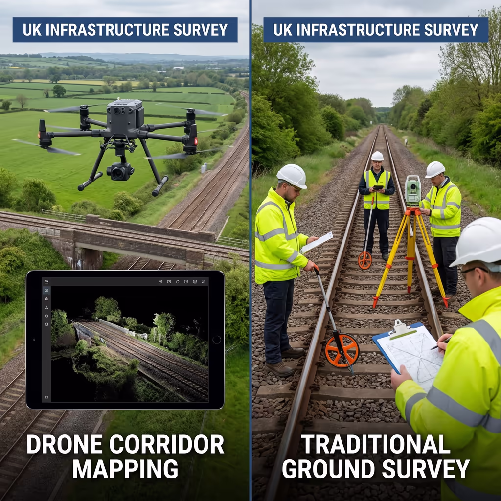
Comparing Drone Corridor Mapping and Conventional Methods
Conventional corridor surveys require ground teams to traverse the entire route, setting up equipment at regular intervals and physically accessing every section. This is time-consuming, expensive, and frequently impossible in challenging terrain or where access is restricted.
UAV corridor mapping captures the same data—and often more—by flying along the route at speeds of 10-15 metres per second. A 20km corridor that might take a ground team two weeks can be surveyed in a single day. The drone perspective also captures features that ground surveyors might miss, such as vegetation encroachment and structural defects.
When to Select Each Approach
Opt for UAV Corridor Mapping
Speed & efficiency
Conventional Methods Better For
Specific applications
Uncertain which approach suits your corridor project?
Precision Levels for Drone Corridor Mapping
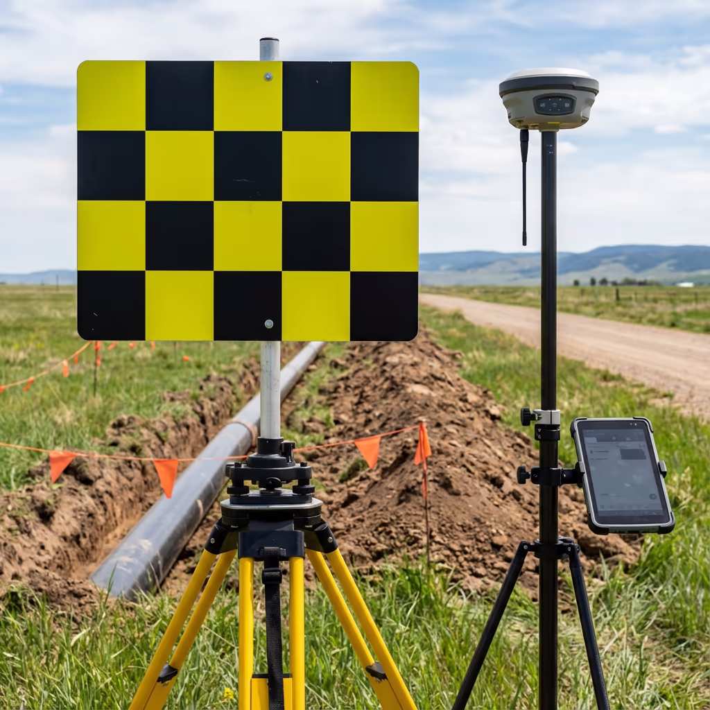
Our UAV corridor mapping routinely achieves vertical accuracy of plus or minus 2-5cm and horizontal accuracy of plus or minus 3-5cm when utilising ground control points. This level of precision meets the requirements for engineering design, construction planning, and regulatory compliance across the utility and infrastructure sectors.
We employ RTK/PPK-enabled drones with high-resolution cameras and optional LiDAR sensors to ensure precise positioning along the entire corridor. For extended routes, we establish ground control networks at regular intervals and apply rigorous adjustment workflows. The result is seamless, survey-grade data across the full corridor length.
Drone Corridor Mapping Applications
UAV corridor mapping serves infrastructure operators across multiple sectors. Here are the key applications where our clients realise the greatest value:
Power Line Surveys
Vegetation clearance analysis, conductor sag measurement, tower inspection, and right-of-way monitoring for electricity transmission networks.
Pipeline Route Surveys
Route planning for new pipelines, condition monitoring of existing infrastructure, and wayleave documentation for gas, oil, and water utilities.
Railway Corridor Mapping
Track geometry surveys, vegetation management, embankment monitoring, and level crossing assessments for Network Rail projects.
Road & Highway Schemes
Route corridor surveys for new road schemes, A-road improvements, bypass planning, and highway condition assessments.
River & Canal Surveys
Watercourse corridor mapping for flood risk assessment, bank erosion monitoring, and navigation channel surveys.
Telecommunications
Fibre route surveys, mobile network corridor planning, and tower site access route mapping for telecoms infrastructure.
Have a corridor project requiring surveying?
Daily Coverage Capacity for Drone Corridor Surveys
With our extended flight capabilities, a single UAV corridor survey mission can cover 20-30km in a day under optimal conditions. For longer corridors, we operate multiple flight teams simultaneously or conduct phased surveys over consecutive days to maintain momentum.
The actual coverage depends on several factors including corridor width, required ground sample distance (GSD), terrain complexity, and airspace restrictions. Narrow corridors with simple terrain can be surveyed faster, whilst wide rights-of-way or complex urban environments require more flight lines and take longer.
| Corridor Width | Daily Coverage |
|---|---|
| Narrow (20-50m) | 25-30km |
| Medium (50-100m) | 15-20km |
| Wide (100-200m) | 10-15km |
| Very Wide (200m+) | 5-10km |

Drone Corridor Mapping Outputs
We customise deliverables to your project requirements. Our standard UAV corridor mapping outputs include:
Corridor Orthomosaic
High-resolution, georeferenced drone imagery of the entire corridor, suitable for GIS integration and visual inspection.
Cross-Sections
Terrain profiles perpendicular to the corridor alignment at your specified intervals (typically every 25m, 50m, or 100m).
Longitudinal Profiles
Ground surface elevation along the corridor centreline, essential for gradient analysis and engineering design.
Clearance Analysis
Vegetation encroachment reports, conductor-to-ground clearances, and obstruction identification for power line and pipeline corridors.
CAD Files & 3D Models
DWG/DXF drawings, 3D surface models, and point clouds compatible with all major engineering software packages.
Require particular outputs for your corridor project?
Drone Corridor Mapping Timeline
On-site data capture is remarkably efficient. We can survey 15-30km of corridor per day depending on width and terrain. A typical 20km power line corridor takes merely 1-2 days of flight time, compared to weeks for conventional ground surveys.
Processing and delivery depends on corridor length and your required outputs. Standard deliverables for a 20km corridor are typically ready within 5-7 working days. For time-sensitive projects, we offer expedited processing with 48-72 hour turnaround available at additional cost.
| Phase | Duration |
|---|---|
| Planning & Permissions | 2-5 days |
| On-Site Data Capture | 1-3 days |
| Data Processing | 2-4 days |
| Deliverable Generation | 2-3 days |
| Total (20km corridor) | 5-7 working days |
Expedited Processing Available
Require faster delivery? 48-72 hour turnaround available for time-sensitive corridor projects.
Selecting a Drone Corridor Mapping Provider
Corridor mapping requires specialist expertise beyond standard drone surveys. When assessing providers, we recommend examining these key factors:
- CAA authorisation – Verify they hold valid GVC permissions for commercial operations, ideally with extended BVLOS capabilities
- Infrastructure experience – Request examples of similar corridor projects they have completed for utilities, rail, or highways
- Comprehensive insurance – Public liability and professional indemnity cover appropriate to infrastructure projects
- Processing capability – Enquire about their software for handling long corridor datasets and generating cross-sections
- Airspace management – Long corridors often cross multiple airspace zones requiring careful planning
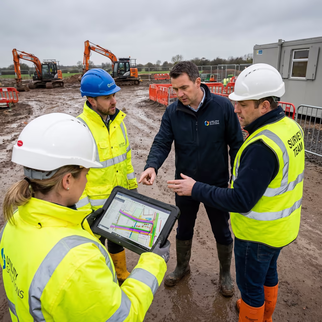
At Hire Drone Pilot, we satisfy every criterion. We are CAA authorised, comprehensively insured, and have delivered corridor mapping projects for utilities, rail, and highway clients throughout the UK.
Prepared to collaborate with a reliable corridor mapping provider?
Is Drone Corridor Mapping More Economical Than Conventional Methods?
Substantially. Conventional corridor surveys require teams of surveyors traversing the entire route, setting up equipment at each station, and often spending weeks in the field. Access issues, health and safety requirements, and challenging terrain all add to costs and delays.
Our UAV corridor mapping captures equivalent or superior data in a fraction of the time. A 20km corridor that might take a ground team three weeks can be flown and processed in under two weeks. The cost savings typically range from 50-70% compared to conventional methods, whilst delivering faster turnaround, higher data density, and often safer operations with minimal ground access required.
Prepared to Discuss Your Corridor Project?
Expert guidance | Tailored pricing | Avg Response within 5 Mins

Peter Leslie
Owner & Drone Pilot
With extensive experience in infrastructure surveying and UAV operations, Peter personally supervises every corridor mapping project to ensure survey-grade accuracy and professional delivery.
Quick Guide: UAV Corridor Mapping Explained
Your Survey Outputs
- Corridor orthomosaic
- Cross-sections at intervals
- Longitudinal profiles
- Clearance analysis
- CAD files (DWG/DXF)
- 3D surface models
Share Your Corridor Requirements
Receive expert guidance and tailored pricing.
Drone Pilot Reviews
Why Drone Pilots Rate HireDronePilot 5 Stars
Don't just take our word for it. Here's what drone pilots in our UK network say about getting work through the platform.
“I get relevant commercial briefs with clear scopes, so quoting is fast and accurate. It has helped me win consistent survey work without chasing low-quality leads.”
Adam Carter
Drone Pilot
“Since joining the platform, I have filled gaps in my schedule with quality roof and inspection jobs. The enquiry details are much better than generic lead forms.”
Sophie Bennett
Drone Pilot
“HireDronePilot makes it easier to focus on delivery. I can review project briefs quickly, submit competitive quotes, and pick up work in new regions.”
Daniel Khan
Drone Pilot
Explore Similar Services
UAV LiDAR Mapping
High-precision LiDAR scanning for detailed terrain models and vegetation analysis through tree canopy.
UAV Topographic Survey
Comprehensive topographic surveys for planning, design and construction projects.
Volumetric Analysis
Precise stockpile measurements and cut/fill calculations from drone data.