Forestry & Woodland
Drone Forestry Survey Service
Detailed UAV assessments for forest management, standing volume inventories, and tree condition evaluation with cutting-edge drone systems.
Avg Response within 5 Mins • Or call +44 1334 804554
Understanding Drone Woodland Assessment
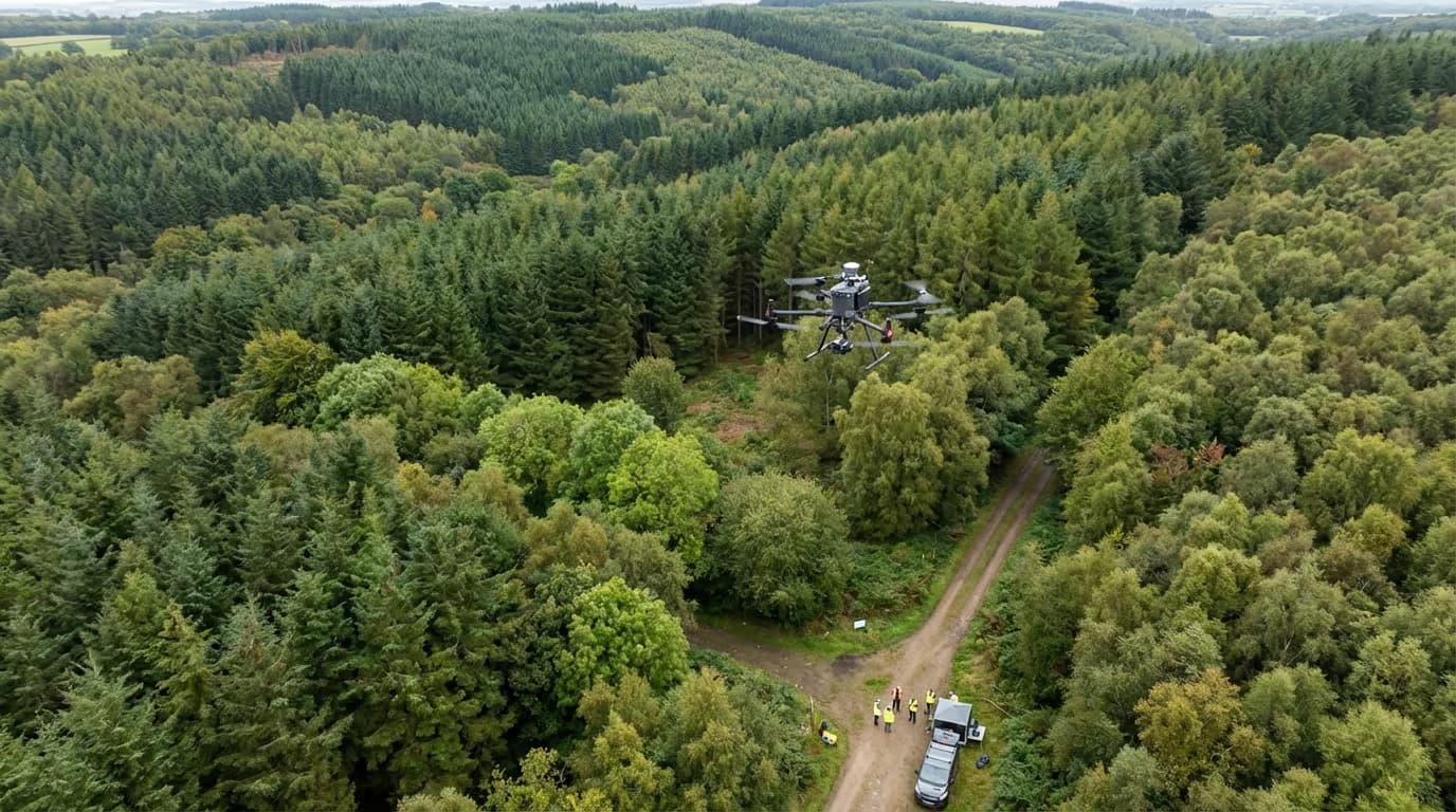
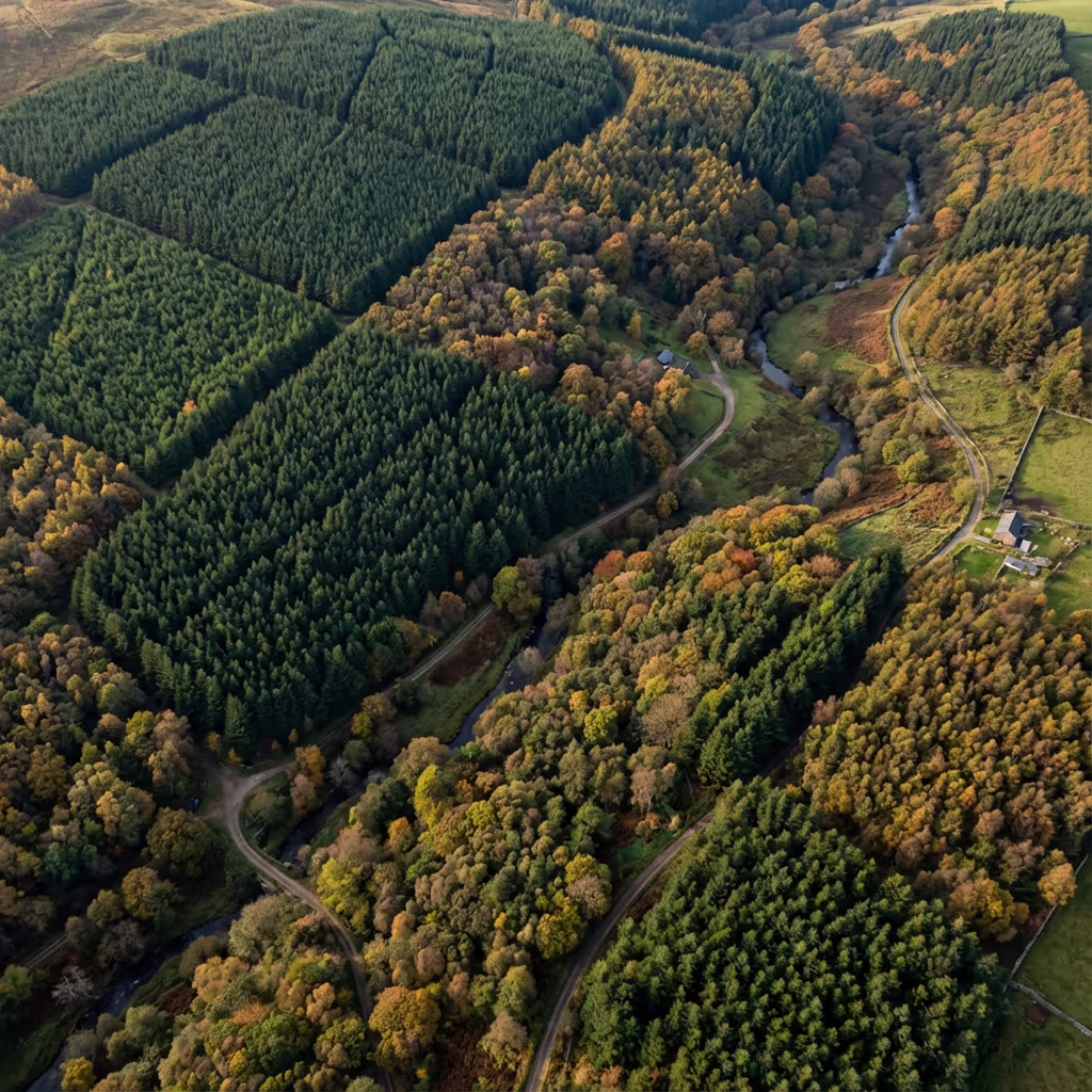
A drone woodland assessment deploys UAV-mounted sensors to gather comprehensive data on forest areas, individual tree structures, and overall woodland condition. In contrast to conventional ground-based approaches, our drones traverse expansive areas rapidly while capturing detailed imagery and accurate elevation measurements.
At Hire Drone Pilot, we integrate photogrammetry with LiDAR technology to produce thorough forest inventories. Our assessments capture tree heights, canopy coverage, species composition, and standing timber volumes—equipping woodland managers with essential data for strategic planning.

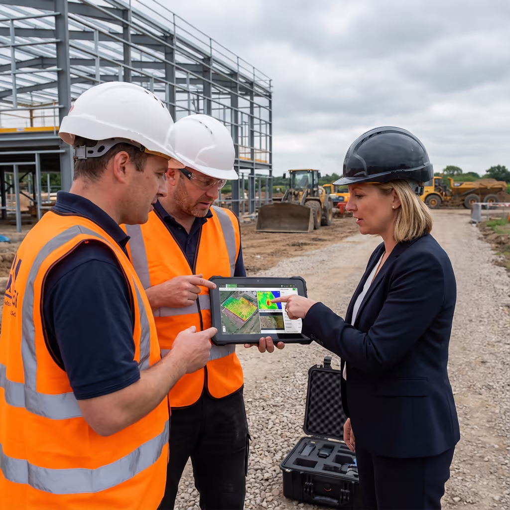
Peter Leslie
Owner & Drone Pilot
"Have questions? Ring me directly - I'm happy to discuss your project requirements."
Call NowExpert Woodland Data,Rapid Turnaround
What You'll Receive
- Comprehensive canopy height models
- Tree inventory with species breakdown
- Standing volume calculations
- Woodland condition reports
Delivered in 5-10 working days
Why Use HireDronePilot
- CAA certified with full insurance
- Woodland survey specialists
- LiDAR & photogrammetry equipped
- Nationwide service delivery
Relied upon by estate owners, timber companies & ecological consultants throughout Britain.
Relied upon by major organisations
Woodland Assessment Pricing Guide
Costs vary based on forest area and the outputs you require. Here's a breakdown to assist your planning:
| Woodland Size | Guide Price |
|---|---|
| Small WoodlandUnder 10 ha | £600+ |
| Medium Woodland10–50 ha | £1,400+ |
| Large Forest50–200 ha | £3,000+ |
| Major Forest200+ ha | POA |
| Annual MonitoringRepeat surveys | POA |
*Indicative prices cover standard outputs. Final quotation depends on site accessibility, terrain challenges, and particular needs.
Factors influencing your quotation
- Forest area & topography
- Specified outputs
- Stand density & composition
- Site access constraints
Our UAV-based methodology typically reduces costs by 50–70% versus conventional ground-based inventory methods. Share your project specifications and we'll deliver a customised quotation within 24 hours.
Prepared for a quotation on your woodland?
Complimentary, no-commitment quotes within 24 hours
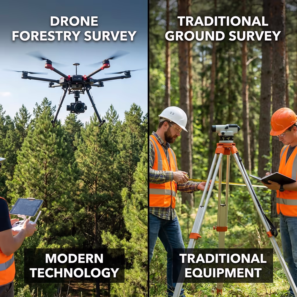
Drone Assessment vs Conventional Ground Methods
Conventional forest inventory depends on sample plots—surveyors traverse the woodland measuring a subset of trees and projecting results. Although this approach has supported forestry for generations, it proves time-intensive, labour-heavy, and restricted in scope.
Drone woodland assessments capture the complete forest from above, measuring each tree rather than merely sample areas. Our UAVs gather thousands of data points per hectare, generating comprehensive canopy height models and facilitating individual tree identification. This delivers superior precision, quicker outcomes, and zero disruption to wildlife or delicate ecosystems.
Selecting the Right Approach
Opt for Drone Assessment
Full forest coverage
Conventional Ground Methods
Sample-based projections
Uncertain which method fits your forest needs?
Precision Standards for Drone Woodland Surveys
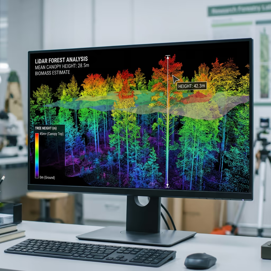
Our drone woodland assessments deliver tree height precision of ±0.5-1.5 metres through photogrammetry, enhanced to ±0.2-0.5 metres with LiDAR technology. For individual tree identification, we consistently detect 85-95% of trees within the upper canopy, with recognition rates varying by species diversity and stand density.
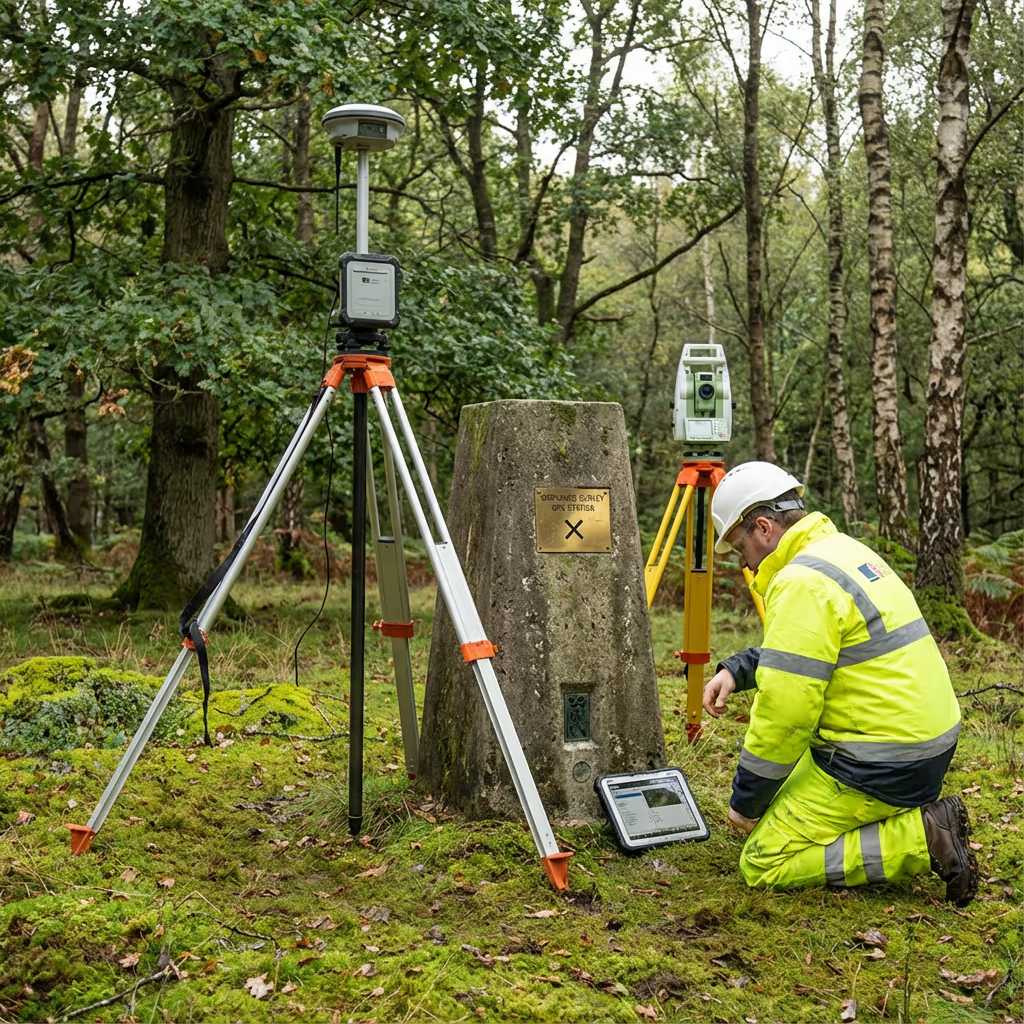
Positional precision relies on ground control placement. Using RTK/PPK positioning combined with surveyed control points, we attain horizontal precision of ±5cm and vertical precision of ±10cm. This accuracy level enables reliable timber volume computations, carbon stock evaluations, and thorough management strategies.
Key Uses for Drone Woodland Surveys
Drone woodland assessments serve every stage of forest management. These are the primary applications where our clients realise the most significant benefits:
Standing Volume Inventory
Comprehensive tree counts, height data, and volume calculations for felling schedules and timber transactions.
Carbon Stock Evaluation
Precise biomass quantification for carbon offset programmes, woodland carbon code initiatives, and sustainability reporting.
Tree Condition Monitoring
Prompt identification of pest infestation, disease progression, storm damage, and water stress via multispectral imaging.
New Planting Schemes
Pre-planting baseline assessments, establishment success monitoring, and funding compliance verification.
Estate Woodland Management
Comprehensive forest mapping for property valuations, management planning, and long-range strategic decisions.
Ecological & Conservation
Habitat evaluation, ancient woodland documentation, and biodiversity tracking for environmental initiatives.
Got a woodland project requiring assessment?
Measuring Tree Heights & Standing Volume
Absolutely—this represents one of our fundamental strengths. Employing photogrammetry and LiDAR, we generate precise Canopy Height Models (CHMs) that record the stature of each tree across your woodland. Paired with species data and diameter approximations, we compute standing timber volume to commercial standards.
Our LiDAR assessments penetrate through the canopy to chart the terrain beneath, providing actual tree heights rather than approximations. For conifer stands, we attain volume precision within 10-15% of conventional ground assessments—whilst covering every tree instead of sample plots alone.
We also monitor changes across time, comparing assessments to gauge growth rates, oversee thinning activities, and evaluate storm impact. This information supports felling timetables, timber appraisals, and extended yield forecasting.
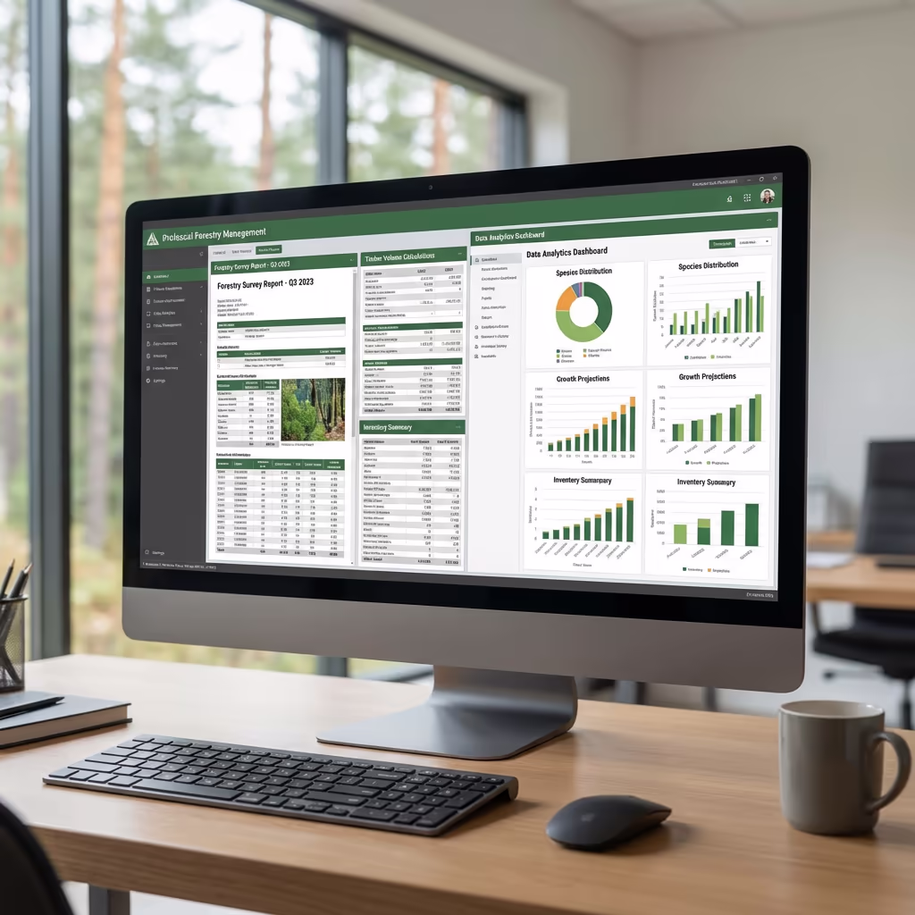
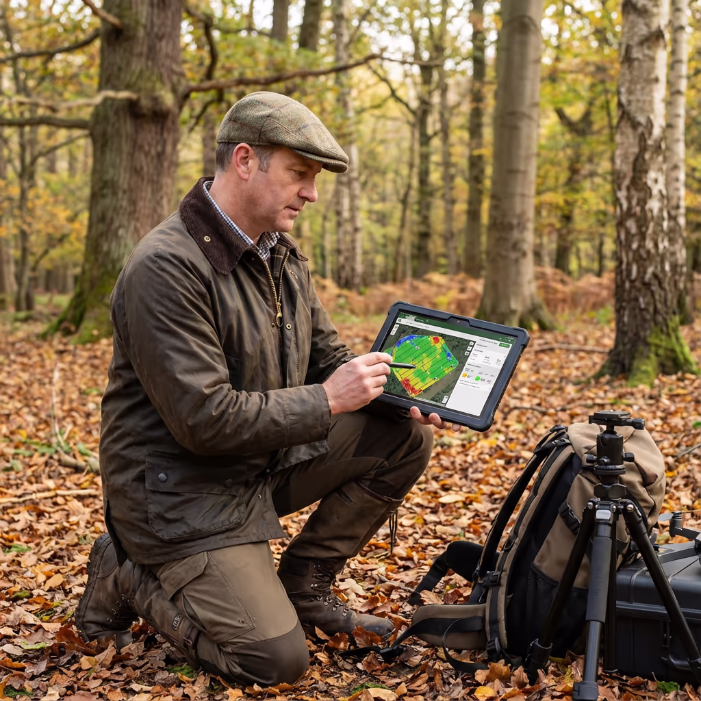
Survey Outputs & Deliverable Packages
We customise outputs to match your project specifications, though our standard woodland assessment packages encompass:
Canopy Height Model (CHM)
Comprehensive height mapping displaying tree statures throughout your forest. Fundamental for volume computations and growth tracking.
Individual Tree Height Data
Per-tree heights derived from CHM data, accompanied by statistical breakdowns covering mean, maximum, and distribution patterns.
Standing Volume Calculations
Timber volume assessments employing allometric formulae calibrated to British forestry benchmarks. Segmented by compartment or bespoke zones.
Condition Assessment Report
Canopy coverage analysis, stress markers, and flagging of areas needing intervention. Multispectral imaging available upon request.
CAD Files & 3D Visualisations
Boundary delineation, access track mapping, and compartment data in AutoCAD formats. Complemented by textured 3D models for presentation and design.
Require particular outputs for your project?
Project Timelines & Delivery Schedules
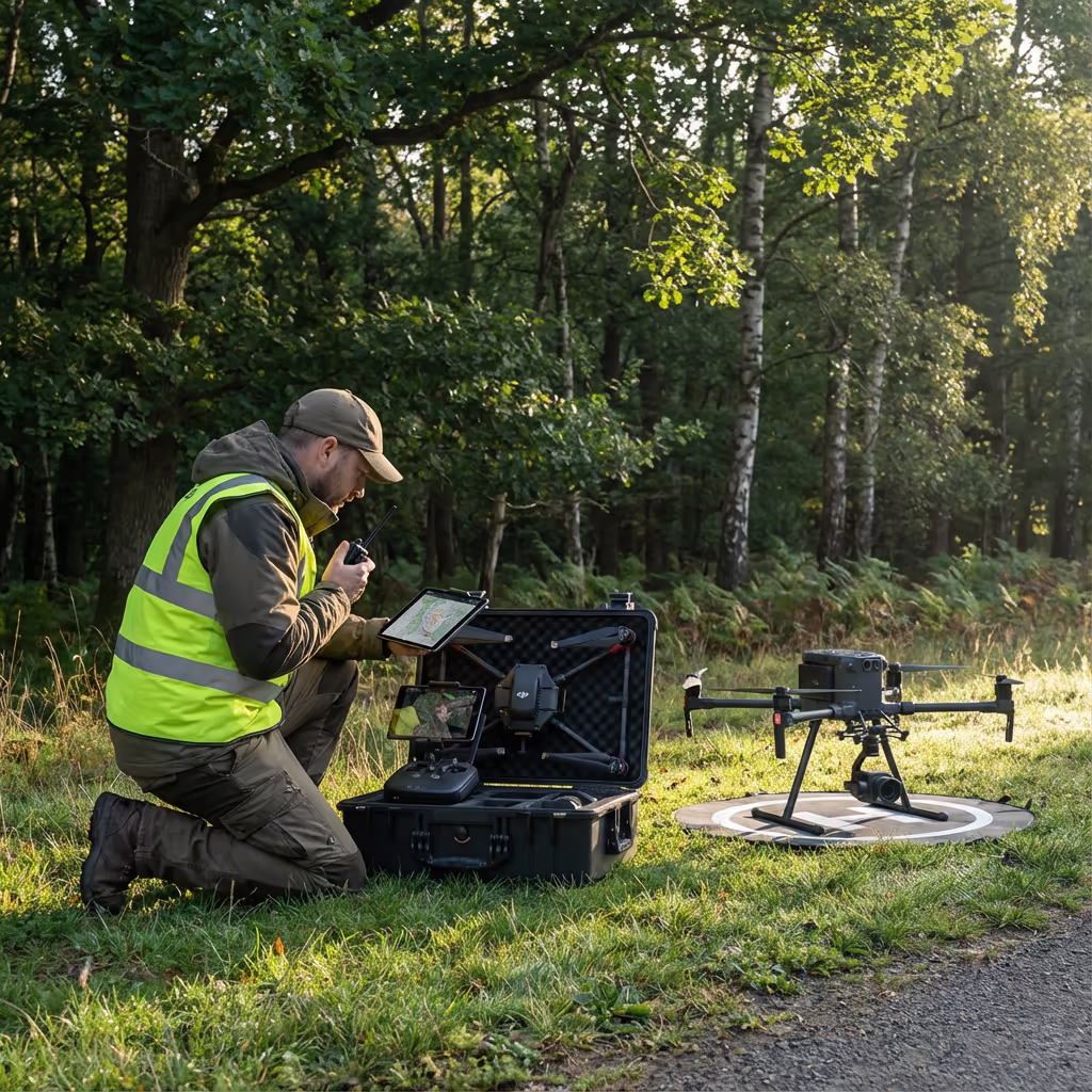
Field data acquisition is impressively efficient. We can assess 30-80 hectares daily depending on landscape and flying conditions. A standard 20-hectare woodland requires approximately half a day of airtime, plus preparation and control point positioning.
Processing and final delivery varies with analytical complexity. Standard canopy mapping and height data is generally complete within 5-7 working days. Comprehensive timber volume analysis with full reporting requires 7-10 working days. We'll establish achievable timeframes when quoting your project.
| Phase | Duration |
|---|---|
| Planning & Permissions | 1-3 days |
| On-Site Data Capture | ½-1 day |
| Data Processing | 2-3 days |
| Analysis & QC | 2-4 days |
| Report Generation | 1-2 days |
| Total (Standard) | 5-10 working days |
Fast-Track Processing Option
Require expedited delivery? Priority processing offered for time-sensitive projects.
Selecting a Woodland Survey Provider
Not every drone operator comprehends forestry requirements. When assessing potential providers, we suggest examining these critical aspects:
- Woodland expertise – Request examples of forest assessments they've undertaken and testimonials from forestry clients
- CAA certification – Verify they possess valid GVC or legacy PfCO authorisation for commercial flight operations
- LiDAR equipment – For precise ground surface mapping beneath the canopy, LiDAR technology is indispensable
- Analysis capability – Tree identification and volume quantification demand specialist software and technical knowledge
- Insurance coverage – Public liability and professional indemnity appropriate to your project scope
At Hire Drone Pilot, we satisfy every criterion. We hold CAA approval, maintain comprehensive insurance, and have conducted woodland surveys for private estates, timber enterprises, and environmental consultancies throughout Britain.
Prepared to collaborate with a dependable woodland survey specialist?
Cost Comparison: Drone vs Ground-Based Methods
In the majority of situations, considerably so. Conventional forest inventory demands teams of surveyors traversing woodland to measure sample plots. For a 50-hectare site, this could occupy a ground crew for 5-7 days of fieldwork, plus additional office hours for processing and documentation.
Our drone assessments gather equivalent or superior data in a fraction of that duration. The same 50-hectare woodland can be captured in a single day, providing complete coverage rather than sample-derived projections. Savings typically span 50-70% versus traditional approaches, whilst delivering swifter results and more thorough datasets.
Prepared to Explore Your Woodland Project?
Specialist guidance • Customised quotations • Avg Response within 5 Mins

Peter Leslie
Owner & Drone Pilot
Drawing on substantial surveying and UAV expertise, Peter personally supervises every woodland project to guarantee precise data and professional results.
Quick Guide: Drone Woodland Assessment
Woodland Survey Outputs
- Canopy height models
- Individual tree data
- Standing volume calculations
- Condition assessment reports
- CAD files & boundary mapping
- 3D visualisations & models
Talk Through Your Project
Receive specialist guidance and customised pricing.
Drone Pilot Reviews
Why Drone Pilots Rate HireDronePilot 5 Stars
Don't just take our word for it. Here's what drone pilots in our UK network say about getting work through the platform.
“I get relevant commercial briefs with clear scopes, so quoting is fast and accurate. It has helped me win consistent survey work without chasing low-quality leads.”
Adam Carter
Drone Pilot
“Since joining the platform, I have filled gaps in my schedule with quality roof and inspection jobs. The enquiry details are much better than generic lead forms.”
Sophie Bennett
Drone Pilot
“HireDronePilot makes it easier to focus on delivery. I can review project briefs quickly, submit competitive quotes, and pick up work in new regions.”
Daniel Khan
Drone Pilot
Complementary Services
LiDAR Mapping
High-precision LiDAR scanning for comprehensive terrain models below vegetation cover.
Drone Topographic Assessment
Thorough topographic assessments for planning, engineering and development schemes.
Volume Measurement
Precise stockpile quantification and earthworks calculations from drone datasets.