Mining & Quarry Surveying
Drone Mining Survey Service
High-precision drone surveys for mining operations, quarries, and aggregate facilities. Reliable stockpile quantification, excavation mapping, and progress tracking delivered safely and effectively.
Avg Response within 5 Mins • Or phone +44 1334 804554
Understanding Drone Mining Surveys
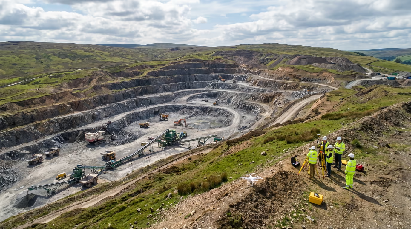
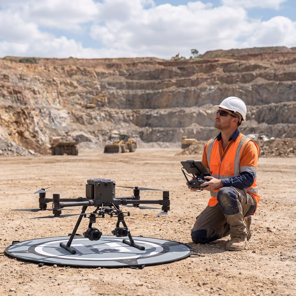
A UAV mining survey employs drone technology to capture comprehensive survey data from mining operations, quarries, and aggregate facilities. Our UAVs fitted with high-resolution cameras and RTK GPS systems traverse your site, acquiring thousands of images which we transform into precise 3D models, orthomosaics, and volume computations.
Hire Drone Pilot specialises in supporting mining and quarrying operations throughout the UK to monitor progress, oversee stockpiles, and maintain precise site documentation. Our surveys deliver the data essential for stock management, compliance documentation, and operational planning—all gathered without interrupting your activities.

Peter Leslie
Owner & Drone Pilot
"Have questions? Ring me directly - I'm happy to discuss your project requirements."
Call NowPrecise Mining Survey Data,Rapid Delivery
What You'll Receive
- Precise stockpile measurements
- Excavation mapping & progress reports
- CAD-compatible survey outputs
- Survey-grade precision (±2-5cm)
Delivered in 5-7 working days
Why Use HireDronePilot
- CAA certified & comprehensively insured
- Mining & quarry sector experts
- Advanced DJI survey equipment
- Nationwide availability
Relied upon by quarry managers and mining firms throughout Britain.
Relied upon by industry leaders
What's the Investment for Drone Mining Surveys?
Costs vary based on site dimensions and survey specifications. Here's a pricing overview to assist your planning:
| Site Dimensions | Starting From |
|---|---|
| Compact SiteUnder 10 ha | £800+ |
| Mid-Size Site10–50 ha | £1,800+ |
| Extensive Site50–100 ha | £3,500+ |
| Large-Scale Operation100+ ha | POA |
| Scheduled MonthlyAny size | POA |
*Indicative prices cover standard outputs. Final quotation reflects site complexity, accessibility, and particular needs.
Factors influencing your quotation?
- Site area & topography
- Stockpile quantity
- Survey regularity
- Specific output needs
Our UAV mining surveys generally achieve 50–70% cost savings versus conventional ground surveying, plus your operations continue without interruption. Get in touch for a customised quotation.
Prepared to receive pricing for your site?
Complimentary, obligation-free quotes within 24 hours
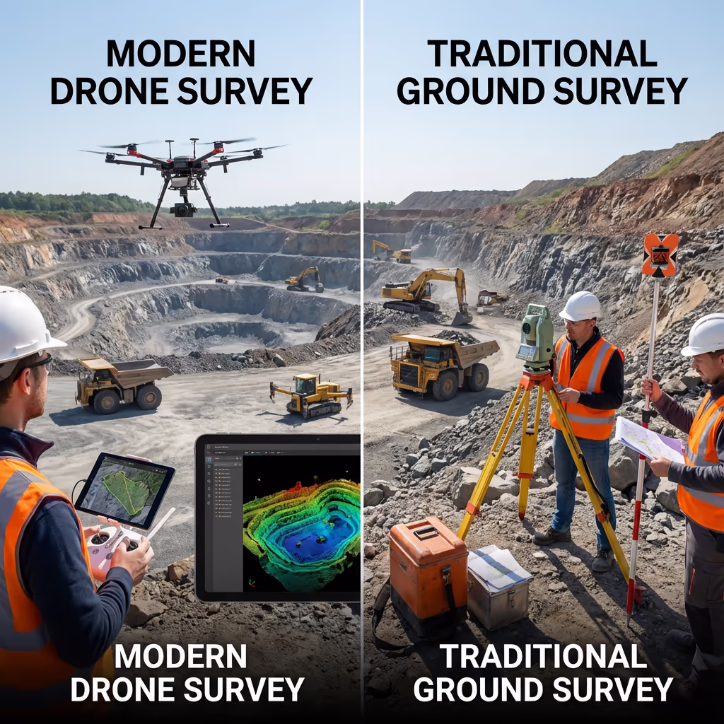
How Do Drone Mining Surveys Compare to Conventional Approaches?
Conventional mining surveys demand that surveyors physically navigate the site carrying total stations or GPS instruments. This necessitates halting operations, securing safe passage to active working faces, and dedicating multiple days on-site to gather thorough data. The outcome is frequently sparse point coverage and considerable operational downtime.
Our UAV mining surveys capture your complete site from above within hours rather than days. We fly securely over active zones, unstable terrain, and unreachable faces without exposing personnel to danger. The outcome is millions of survey points, comprehensive site documentation, and data delivered whilst your operations proceed without pause.
Select the Optimal Method
UAV Mining Survey
Swift, secure & thorough
Conventional Survey
Ground-level techniques
Uncertain which method fits your operation?
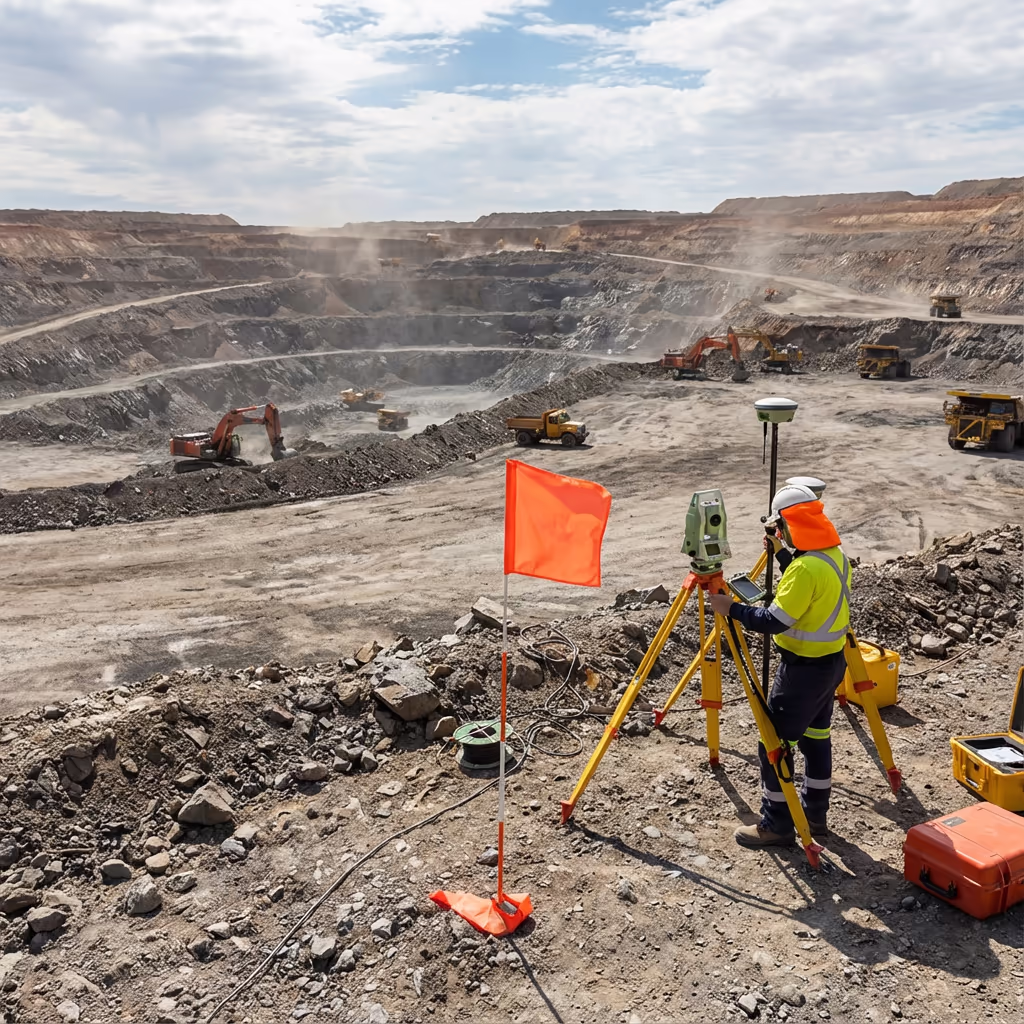
What Precision Levels Do Drone Mining Surveys Attain?
Our UAV mining surveys consistently deliver vertical precision of ±2-5cm and horizontal precision of ±2-3cm when utilising ground control points and RTK positioning. This accuracy standard satisfies requirements for stockpile volume computations, regulatory adherence, and operational planning.
For stockpile volumes, this precision equates to measurement accuracy within 1-2% of true volumes—frequently surpassing conventional methods. We validate every survey against established control points and supply accuracy documentation with all outputs, ensuring you can rely on the data informing your crucial business decisions.
Where Are Drone Mining Surveys Applied?
UAV surveys have revolutionised how mining and quarrying operations manage their facilities. These are the primary applications where our clients experience the most significant benefits:
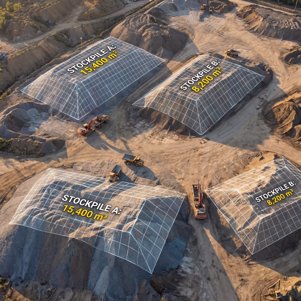
Stockpile Quantification
Precise monthly or quarterly stockpile volumes supporting inventory control, reconciliation, and financial documentation.
Excavation Progress Tracking
Monitor extraction progress, compare against plans, and compute cut/fill volumes for contractor valuations and scheduling.
Regulatory Compliance & Documentation
Evidence supporting planning conditions, environmental assessments, and regulatory requirements with precisely dated records.
Restoration Progress Tracking
Monitor restoration advancement against approved schemes, confirm fill quantities, and document adherence to restoration requirements.
Facility Planning & Design
Precise topographic data supporting expansion proposals, haul route design, and operational enhancement.
Infrastructure Assessment
Examine conveyors, crushers, structures, and infrastructure from above, eliminating scaffolding or rope access requirements.
Got a mining or quarry project requiring survey work?
How Do UAVs Enhance Mining Safety?
Mining and quarrying sites present inherent hazards. Conventional surveys demand that staff work adjacent to active faces, unstable gradients, and operational machinery. Each moment spent on the pit floor represents exposure to potential danger.
Our UAV surveys remove this exposure completely. We acquire comprehensive site data from the safety of altitude, surveying zones that would prove too hazardous or impractical to reach on foot. Precipitous bench faces, unstable stockpiles, operational haul routes—we survey them all without endangering personnel.
Beyond surveying safety, our drone imagery assists in identifying potential hazards: slope instabilities, water accumulation, bench weakness, and access concerns can all be detected from above before they escalate to incidents. Scheduled UAV surveys become integral to your proactive safety management approach.
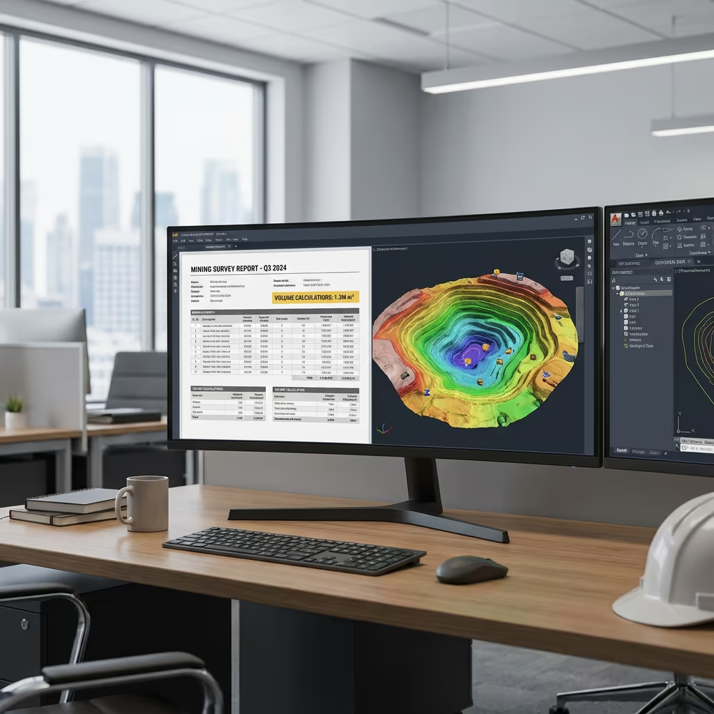
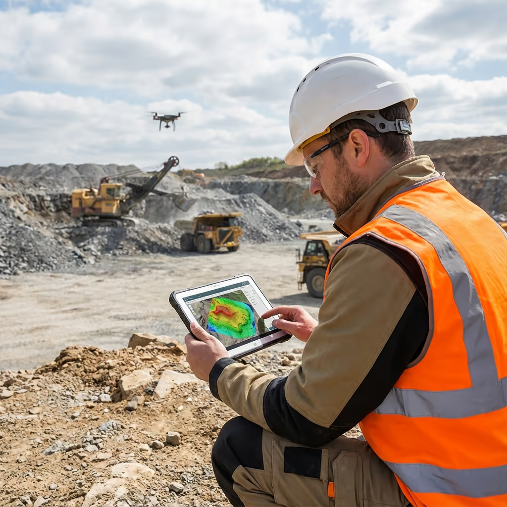
What Outputs Do You Receive From a Drone Mining Survey?
We customise outputs to match your operational needs, though our standard mining survey deliverables encompass:
Excavation Mapping & Surface Models
Comprehensive 3D models of your pit or quarry depicting benches, faces, haul routes, and all surface features at survey-grade precision.
Volume Computations
Precise stockpile volumes with itemised breakdowns. Compare with earlier surveys for stock movement analysis.
Progress Monitoring Reports
Cut/fill analysis displaying extraction advancement, restoration volumes, and comparison against approved schemes.
Safety & Regulatory Documentation
Documentation supporting regulatory adherence, planning conditions, and safety records with time-stamped imagery evidence.
CAD Files & Three-Dimensional Models
Survey data in DWG, DXF, and additional CAD formats. 3D mesh models for visualisation and planning software compatibility.
Require particular outputs for your operation?
What's the Duration of a Drone Mining Survey?
On-site data acquisition is exceptionally rapid compared to conventional approaches. We can survey most quarry sites within a single day, with larger operations requiring 1-2 days. A standard 20-hectare site with multiple stockpiles requires 3-4 hours of flight time.
Processing and delivery varies according to project complexity. Standard outputs are typically prepared within 5-7 working days. For operations needing regular monthly surveys, we can establish streamlined procedures with expedited turnaround. We'll confirm achievable timescales when quoting your project.
| Stage | Timeframe |
|---|---|
| Planning & Organisation | 1-2 days |
| On-Site Data Acquisition | ½-1 day |
| Data Processing | 2-3 days |
| Analysis & Documentation | 2-3 days |
| Overall (Standard) | 5-7 working days |
Scheduled Survey Programmes Offered
Monthly or quarterly surveys featuring streamlined processing and priority booking.
How Should I Select a Drone Mining Survey Provider?
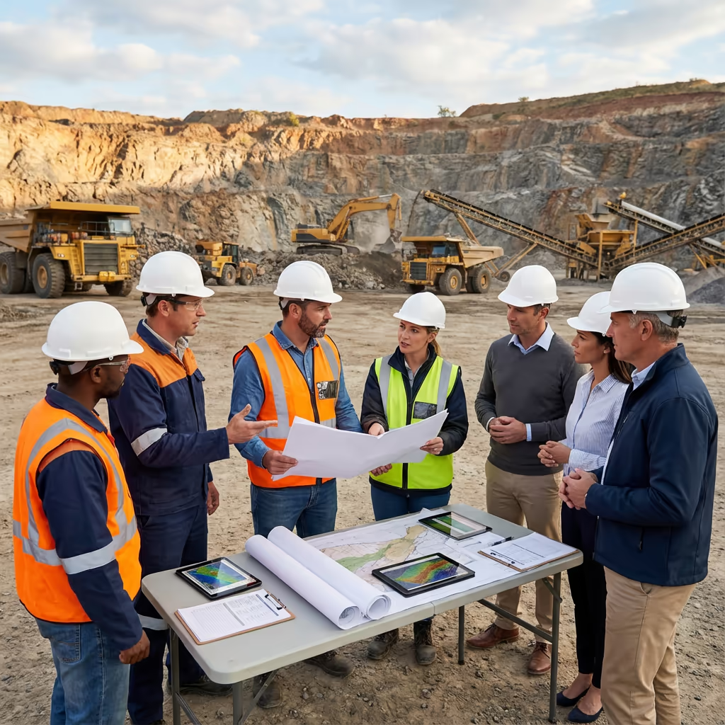
Not every UAV survey provider comprehends the particular demands of mining and quarrying operations. When assessing providers, we suggest verifying these essential factors:
- Mining sector background – Request examples of quarry and mining surveys they've delivered
- CAA certification – Confirm they possess valid GVC permissions for commercial work
- Volume precision history – Enquire about their accuracy record on stockpile quantification
- Site safety knowledge – They must comprehend quarry safety protocols and RAMS documentation
- Adequate insurance – Public liability and professional indemnity suitable for mining environments
At Hire Drone Pilot, we satisfy every criterion. We're CAA certified, comprehensively insured, and have executed surveys for quarries and mining operations throughout the UK. We appreciate your operational demands and accommodate your timetable.
Prepared to collaborate with a dependable mining survey provider?
Are Drone Mining Surveys More Economical Than Conventional Methods?
In nearly every situation, yes—considerably more economical. Conventional ground surveys of operational mining sites demand surveyors spend days on-site, frequently working in demanding conditions whilst operations pause for safe access. The cost of downtime alone regularly surpasses the entire expense of a UAV survey.
Our UAV surveys capture thorough site data within hours rather than days, causing zero operational disruption. Cost savings generally fall between 50-70% compared to conventional approaches. For scheduled monthly surveys, the economics grow even more attractive—we can provide programmed survey packages delivering substantial ongoing savings.
Prepared to Talk About Your Mining Survey?
Professional guidance • Customised pricing • Avg Response within 5 Mins

Peter Leslie
Owner & Drone Pilot
Drawing on comprehensive expertise in surveying and UAV operations, Peter personally manages every mining survey project, guaranteeing precision and professional completion.
Quick Guide: UAV Mining Surveys Overview
Mining Survey Outputs
- Excavation mapping & surface models
- Volume computations
- Progress monitoring reports
- Safety & regulatory documentation
- CAD files (DWG/DXF)
- 3D mesh models
Talk Through Your Project
Receive professional guidance and customised pricing.
Drone Pilot Reviews
Why Drone Pilots Rate HireDronePilot 5 Stars
Don't just take our word for it. Here's what drone pilots in our UK network say about getting work through the platform.
“I get relevant commercial briefs with clear scopes, so quoting is fast and accurate. It has helped me win consistent survey work without chasing low-quality leads.”
Adam Carter
Drone Pilot
“Since joining the platform, I have filled gaps in my schedule with quality roof and inspection jobs. The enquiry details are much better than generic lead forms.”
Sophie Bennett
Drone Pilot
“HireDronePilot makes it easier to focus on delivery. I can review project briefs quickly, submit competitive quotes, and pick up work in new regions.”
Daniel Khan
Drone Pilot
Associated Services
UAV Topographic Survey
Comprehensive topographic surveys supporting planning, design and engineering initiatives.
Volumetric Assessment
Precise stockpile quantification and cut/fill computations derived from drone data.
LiDAR Surveying
High-precision LiDAR scanning producing detailed terrain models penetrating vegetation.