Surveying & Construction
Drone Setting Out Survey Service
Precision setting out with UAV-assisted verification. Transfer design coordinates to site swiftly and accurately with as-built confirmation.
Avg Response within 5 Mins - Or call +44 1334 804554
Understanding Drone Setting Out Surveys
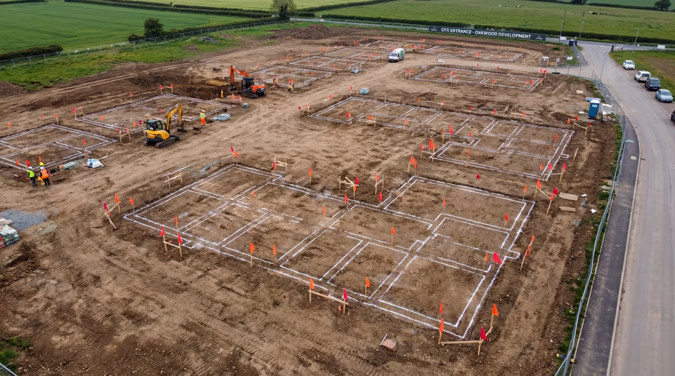
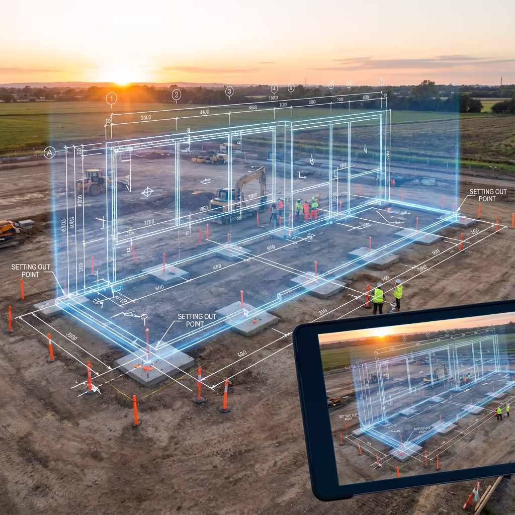
A drone setting out survey combines conventional setting out techniques with UAV technology to transfer design coordinates onto the ground with enhanced speed and verification. We mark the precise positions of building corners, foundation lines, road alignments, and infrastructure elements so construction can proceed accurately from design intent.
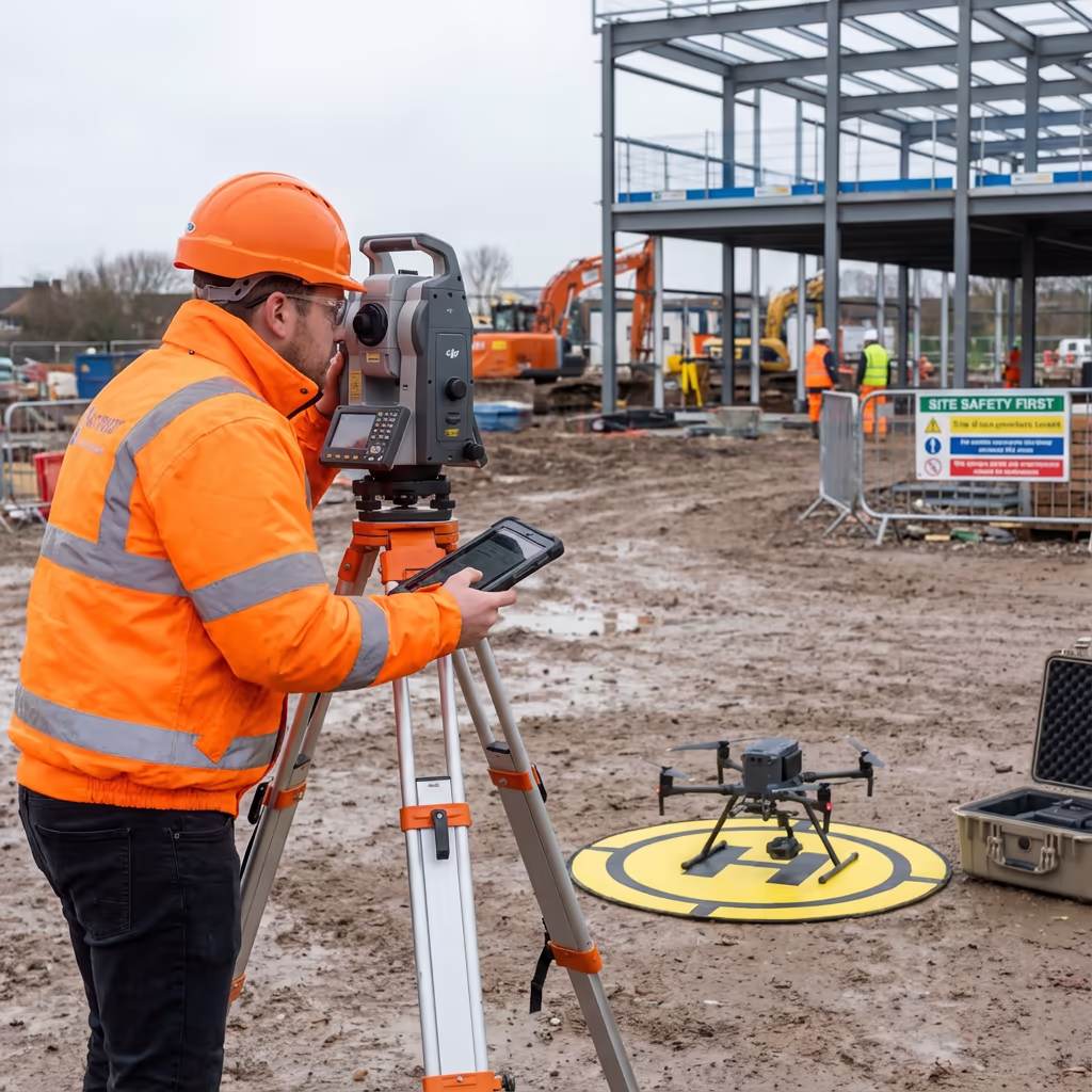
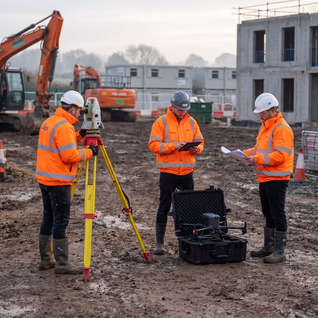
At Hire Drone Pilot, we use RTK-enabled UAVs alongside total stations and GNSS equipment to deliver survey-grade accuracy. The drone component allows instant as-built verification, creating imagery and coordinates that confirm your setting out positions match design specifications before groundworks begin.

Peter Leslie
Owner & Drone Pilot
"Have questions? Ring me directly - I'm happy to discuss your project requirements."
Call NowSurvey-Grade Setting Out,Verified By UAV
What You'll Receive
- Setting out coordinates & schedules
- As-built drone verification
- CAD overlay confirmation
- Survey-grade accuracy (10-20mm)
Delivered same day or next day
Why Use HireDronePilot
- CAA certified & fully insured
- Integrated UAV + total station
- Instant visual verification
- Nationwide coverage
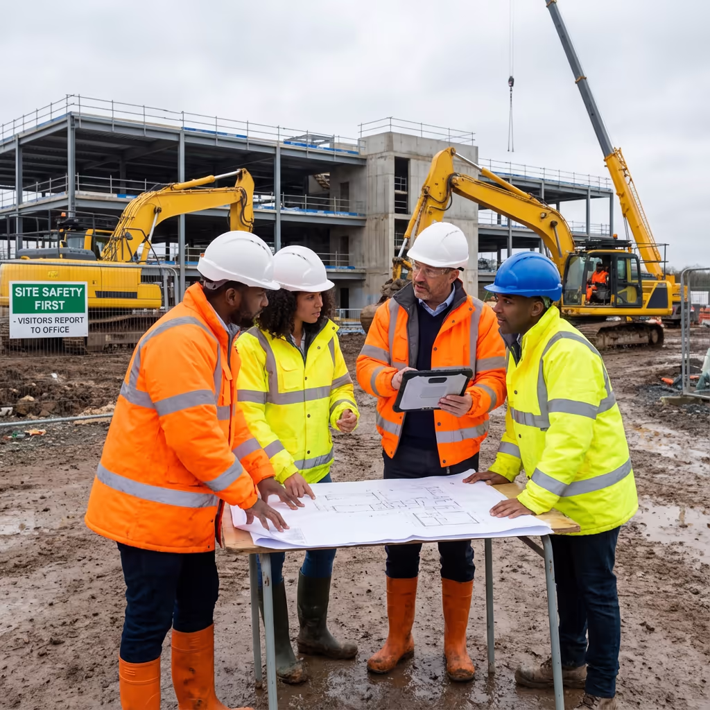
Relied upon by contractors, developers & engineers throughout the UK.
Relied upon by leading organisations
What Does an Drone Setting Out Survey Cost?
Pricing depends on site size, number of points to set out, and required outputs. Here's a guide to help you budget:
| Project Type | Guide Price |
|---|---|
| Small SiteUp to 20 points | £500+ |
| Medium Site20-50 points | £800+ |
| Large Site50-100 points | £1,200+ |
| Complex Project100+ points | £1,800+ |
| Ongoing ContractRegular visits | POA |
*Guide prices include drone verification. Final quote based on point count, site access, and specific requirements.
What influences your quote?
- Number of set-out points
- Site complexity & access
- Verification requirements
- Turnaround urgency
Our UAV-integrated approach reduces revisits and provides instant verification, typically saving 20-30% compared to conventional setting out with separate checking. Contact us with your project details for a tailored quote within 24 hours.
Ready to get a quote for your project?
Free, no-obligation quotes within 24 hours
What Is the Difference Between Drone Setting Out and Conventional Methods?
Conventional setting out relies solely on total stations or GNSS rovers to mark positions on site. The surveyor works point-by-point, marking each location with pegs or spray paint. While accurate, this method provides no immediate visual context and errors may only be discovered during construction.
Drone setting out surveys add a powerful verification layer. After marking positions, we capture imagery from above showing every point in spatial context. We overlay this against CAD designs to confirm alignment before construction begins. This catches errors immediately, reduces costly rework, and provides documented proof of accurate positioning.
When to Choose Each Approach
Select Drone Setting Out
Verified accuracy
Conventional Setting Out
Simple positioning
Not sure which approach suits your project?
What Accuracy Can an Drone Setting Out Survey Achieve?
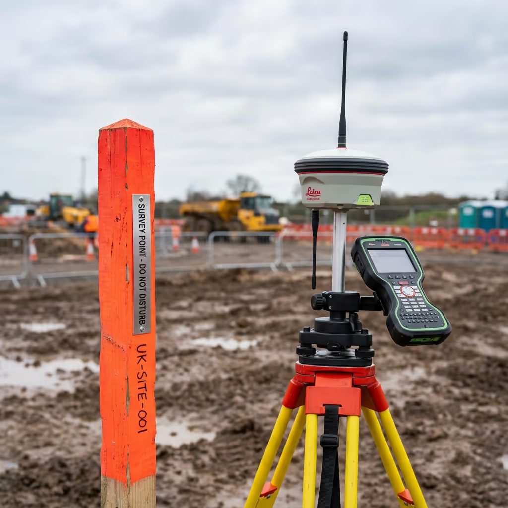
Our drone setting out surveys achieve positional accuracy of 10-20mm when using total station methods, meeting or exceeding construction tolerances for building corners, foundation lines, and infrastructure elements. This is the same accuracy as conventional setting out because we use the same survey-grade equipment.
The UAV verification component adds a visual accuracy check using RTK-enabled positioning. We capture each marked position from the air and confirm coordinates against design data. This dual approach catches any errors in real-time, ensuring what's on the ground matches what's in the CAD drawing before expensive construction begins.
Where Are Drone Setting Out Surveys Used?
Drone setting out surveys serve construction and infrastructure projects where precision positioning and verification matter. Here are the key applications where our clients see the greatest value:
Building Foundations
Marking building corners, pile positions, and foundation outlines with UAV verification against architectural drawings.
Housing Developments
Multi-plot layout with road alignments, service routes, and individual plot boundaries set out and verified from above.
Road & Highway Works
Centreline setting out, kerb lines, junction geometry, and drainage runs with thorough drone documentation.
Utilities & Services
Pipeline routes, cable trenches, and service connection points marked with sub-surface coordination.
Industrial & Commercial
Warehouse footprints, car park layouts, and large-scale commercial building grids with verified accuracy.
Landscaping & Earthworks
Level pegs, cut/fill markers, retention features, and landscaping boundaries with before/after documentation.
Have a project that needs setting out?
How Does Drone Technology Improve Setting Out Accuracy?
UAV technology transforms setting out from a trust-based process into a verified one. Conventional methods rely entirely on the surveyor's field work being correct, with errors only discovered during construction. Our drone integration provides immediate visual confirmation that every point is in the right place.
After completing the ground-based setting out, we fly the site and capture high-resolution imagery with centimetre-accurate positioning. We then overlay your CAD design directly onto this imagery, creating a visual comparison between design intent and actual marker positions. Any discrepancies are immediately visible and can be corrected before work begins.
This verification process also creates permanent documentation. You receive timestamped imagery proving accurate setting out, protecting all parties if disputes arise later. For phased developments, we track progress across multiple visits, building a complete record of setting out accuracy throughout the project lifecycle.
What Outputs Do You Receive From an Drone Setting Out Survey?
We tailor outputs to your project requirements, but our standard drone setting out survey deliverables include:
Setting Out Coordinates
Complete coordinate schedule in your preferred format (CSV, DXF, or project-specific). Grid references, levels, and point descriptions for every marked position.
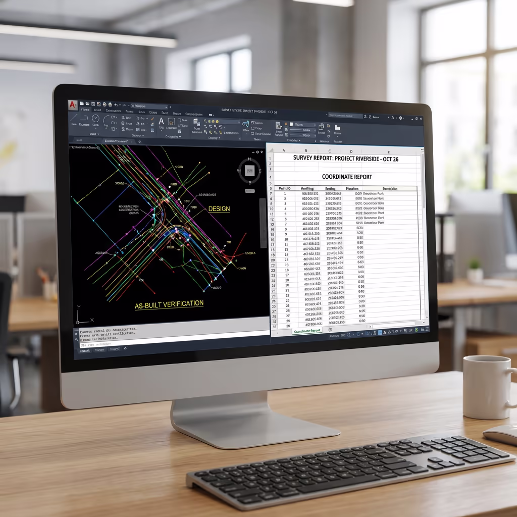
As-Built Verification
Georeferenced drone imagery with marked positions visible. Comparison report showing design vs actual positioning with deviation analysis.
CAD Overlays
Your design drawings overlaid on drone imagery showing alignment of set-out points. Exportable to AutoCAD, Civil 3D, and other CAD platforms.
Progress Reports
For phased projects, comparative imagery and coordinate tracking across multiple setting out visits. Visual progress documentation for project records.
Point Schedules
Detailed point schedule with reference numbers, coordinates, descriptions, and verification status. Formatted for site use and project documentation.
Need specific outputs for your project?
What's the Duration of an Drone Setting Out Survey?
On-site setting out is typically completed in a single day. A straightforward project with 20-30 points takes 3-4 hours including drone verification. Larger sites with 50+ points may require a full day or multiple visits depending on complexity.
Outputs are often available same-day or next working day. Coordinate schedules and verification imagery are processed immediately after field work. For complex multi-phase projects, we agree delivery schedules at the outset to match your construction programme.
| Phase | Duration |
|---|---|
| Pre-Planning | 1-2 days |
| On-Site Setting Out | 3-8 hours |
| UAV Verification | 30-60 mins |
| Processing & QC | 2-4 hours |
| Output Generation | 1-2 hours |
| Total (Standard) | Same day / Next day |
Urgent Response Available
Need setting out urgently? We offer same-day mobilisation for time-critical projects.
How Do I Select an Drone Setting Out Survey Provider?
Not all setting out providers offer drone verification. When evaluating providers, we recommend checking these key factors:
- Survey qualifications - Ensure they have appropriate surveying credentials and construction experience
- CAA certification - Valid GVC or legacy PfCO permissions for commercial UAV operations
- Professional insurance - Public liability and professional indemnity cover appropriate to construction work
- Integrated workflow - Ability to combine conventional survey with drone verification efficiently
- Construction experience - Ask about similar projects they've completed in your sector
At Hire Drone Pilot, we tick every box. We're CAA certified, fully insured, and have delivered drone setting out surveys for housing developments, commercial buildings, and infrastructure projects throughout the UK.
Ready to work with a dependable setting out provider?
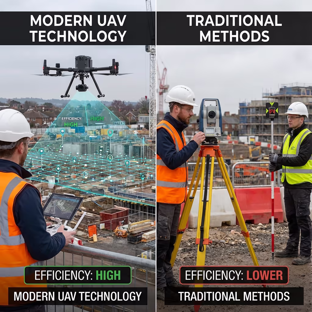
Is Drone Setting Out Survey More Efficient Than Conventional?
The efficiency gains come primarily from reduced errors and instant verification rather than faster marking. Conventional setting out and drone setting out take similar time to mark positions on the ground since both use the same survey-grade equipment.
Where drone integration excels is in eliminating costly revisits and rework. Conventional methods may require separate checking visits and provide no visual documentation. Our UAV verification catches errors immediately, provides permanent proof of accuracy, and enables confident sign-off before construction begins. For projects where accuracy matters, this verification typically pays for itself many times over.
Ready to Talk Through Your Setting Out Project?
Specialist advice - Tailored pricing - Avg Response within 5 Mins

Peter Leslie
Owner & Drone Pilot
With extensive experience in surveying and UAV operations, Peter personally oversees every setting out project to ensure construction-grade accuracy and professional delivery.
TLDR: Drone Setting Out Explained
Setting Out Outputs
- Setting out coordinates
- As-built verification
- CAD overlays
- Progress reports
- Point schedules
Talk Through Your Project
Receive specialist advice and tailored pricing.
Drone Pilot Reviews
Why Drone Pilots Rate HireDronePilot 5 Stars
Don't just take our word for it. Here's what drone pilots in our UK network say about getting work through the platform.
“I get relevant commercial briefs with clear scopes, so quoting is fast and accurate. It has helped me win consistent survey work without chasing low-quality leads.”
Adam Carter
Drone Pilot
“Since joining the platform, I have filled gaps in my schedule with quality roof and inspection jobs. The enquiry details are much better than generic lead forms.”
Sophie Bennett
Drone Pilot
“HireDronePilot makes it easier to focus on delivery. I can review project briefs quickly, submit competitive quotes, and pick up work in new regions.”
Daniel Khan
Drone Pilot
Associated Services
Drone Topographic Survey
Detailed topographic assessments capturing existing site features before construction begins.
UAV Survey
Thorough drone surveys delivering precise data and 3D models for construction projects.
Volumetric Analysis
Accurate stockpile measurements and cut/fill calculations from drone data.