Surveying & Mapping
Drone Survey
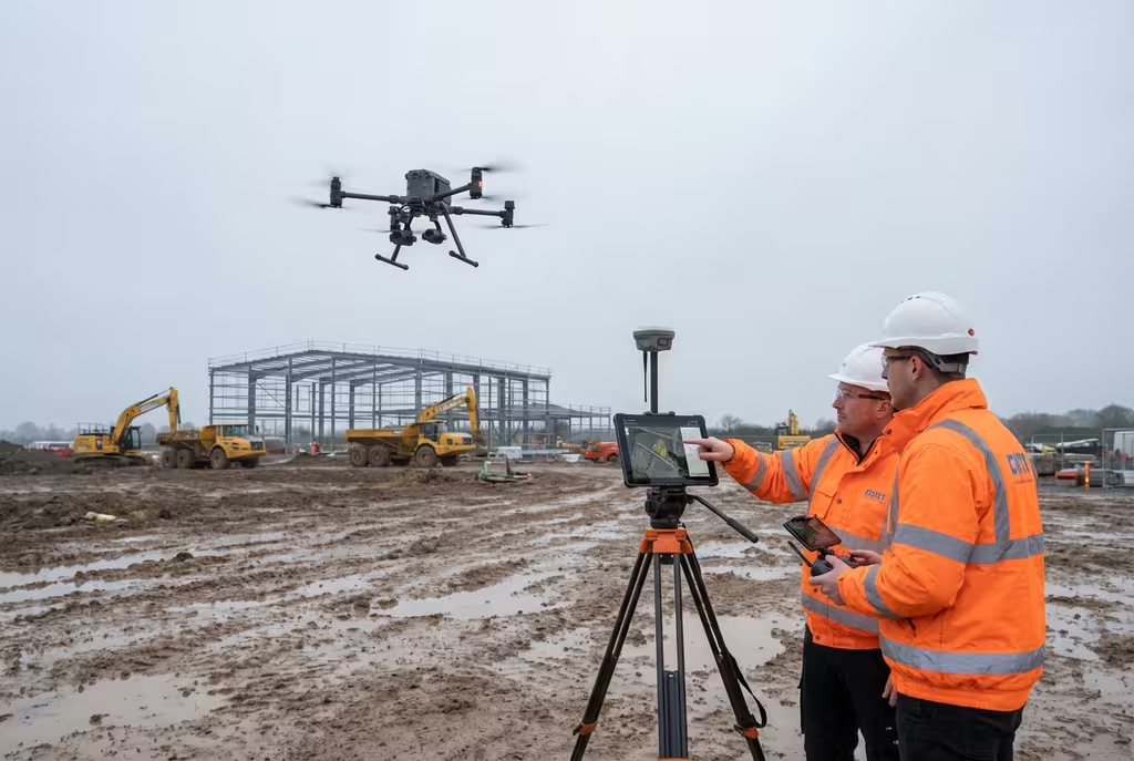
Comprehensive aerial surveys delivering precise topographic data and 3D models.
Overview
Our drone survey services combine cutting-edge UAV technology with professional surveying expertise to deliver accurate, detailed aerial data for your projects. Whether you need topographic surveys, site mapping, or volumetric analysis, our CAA-approved pilots and surveyors work together to provide comprehensive solutions that save time and reduce costs compared to traditional survey methods.
Key Features
- High-accuracy topographic data (±2-5cm)
- Photogrammetric processing
- RTK/PPK enabled drones for precision
- Ground control point surveys
- CAA-approved operations
Applications
- Construction site surveys
- Land development planning
- Volumetric stockpile analysis
- Environmental baseline surveys
- Infrastructure planning
Deliverables
- Orthomosaic maps
- Digital Elevation Models (DEM)
- Digital Surface Models (DSM)
- Contour maps
- 3D point clouds
- CAD-compatible files
Ready to get started?
Contact us for a free consultation and quote for your drone survey project.
Common Questions
Drone Survey FAQs
Our drone surveys typically achieve accuracies of ±2-5cm when using ground control points (GCPs). With RTK-enabled drones, we can achieve even higher precision for projects with stringent accuracy requirements.
On-site data capture typically takes a few hours to a full day depending on the site size. Processing and delivery of final deliverables usually takes 3-7 working days.
Client Feedback
What Our Clients Say
Drone Pilot Reviews
Why Drone Pilots Rate HireDronePilot 5 Stars
Don't just take our word for it. Here's what drone pilots in our UK network say about getting work through the platform.
“I get relevant commercial briefs with clear scopes, so quoting is fast and accurate. It has helped me win consistent survey work without chasing low-quality leads.”
Adam Carter
Drone Pilot
“Since joining the platform, I have filled gaps in my schedule with quality roof and inspection jobs. The enquiry details are much better than generic lead forms.”
Sophie Bennett
Drone Pilot
“HireDronePilot makes it easier to focus on delivery. I can review project briefs quickly, submit competitive quotes, and pick up work in new regions.”
Daniel Khan
Drone Pilot
CAA Approved
Licensed commercial drone operators
Fully Insured
Public liability coverage
Professional Indemnity
PI insurance coverage
Get Started
Compare Quotes for Drone Survey
Complete the form and our team will provide a tailored quote for your drone survey requirements within 24 hours.
Post Once. Compare Independent Drone Pilot Quotes.
Submit once and receive competitive quotes from independent drone pilots.