Infrastructure & Utilities
Drone Utility Survey Service
Thorough drone surveys for power lines, pipelines, and utility infrastructure. Safer, quicker, and more economical than conventional inspection methods.
Avg Response within 5 Mins • Or ring +44 1334 804554
Understanding Drone Utility Surveys
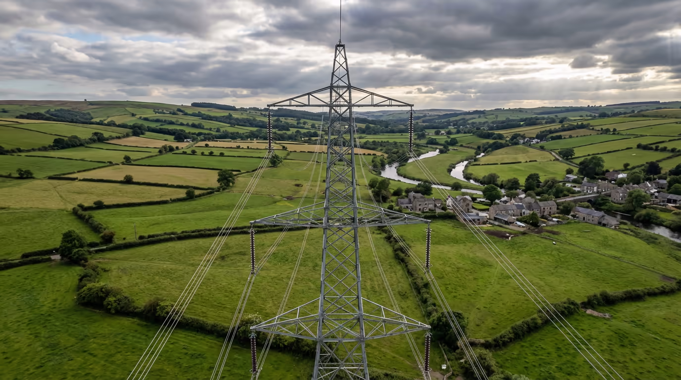
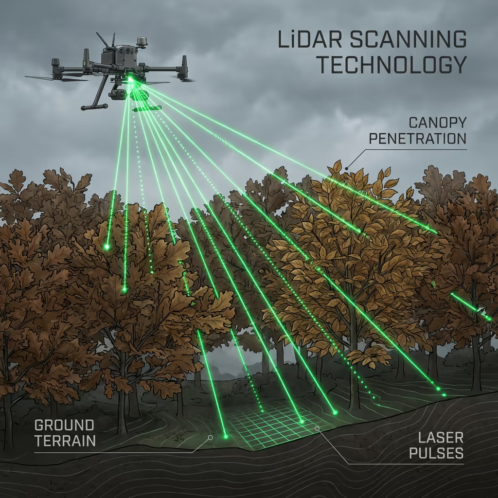
A UAV utility survey employs cutting-edge drone technology to inspect, map, and evaluate utility infrastructure including power lines, transmission towers, pipelines, substations, and telecommunications equipment. Our drones capture high-resolution imagery and LiDAR data that reveals asset condition, clearance distances, and vegetation encroachment risks.
At Hire Drone Pilot, we deploy specialist sensors optimised for utility corridor surveys. Our systems can identify conductor sag, insulator damage, corrosion, and vegetation proximity issues that might go unnoticed during conventional ground inspections—all without the need for costly outages or workers at height.

Peter Leslie
Owner & Drone Pilot
"Have questions? Ring me directly - I'm happy to discuss your project requirements."
Call NowSurvey-Grade UAV Utility Data,Delivered Promptly
What You'll Receive
- Detailed corridor mapping
- Vegetation encroachment analysis
- Asset condition reports
- Clearance measurements
Delivered in 5-7 working days
Why Use HireDronePilot
- CAA certified & fully insured
- Specialist utility sector expertise
- Latest UAV & sensor technology
- Nationwide availability
Relied upon by utility companies, network operators & infrastructure managers throughout the UK.
Relied upon by leading organisations
What's the Investment for a Drone Utility Survey?
Pricing depends on corridor length, asset complexity, and required outputs. Here's a guide to help you budget:
| Project Size | Guide Price |
|---|---|
| Short CorridorUnder 5 km | £1,200+ |
| Medium5–20 km | £2,500+ |
| Long Corridor20–50 km | £5,000+ |
| Major Network50+ km | POA |
| Asset InspectionSingle assets | POA |
*Guide prices include standard deliverables. Final quote based on corridor complexity, access, and specific requirements.
What affects your quote?
- Corridor length & terrain
- Asset types & density
- Turnaround time
- Airspace restrictions
Our UAV-based approach typically saves 50–70% compared to conventional helicopter surveys or manned inspections. Contact us with your project details and we'll provide a tailored quote within 24 hours.
Prepared to receive a quote for your project?
Free, no-obligation quotes within 24 hours
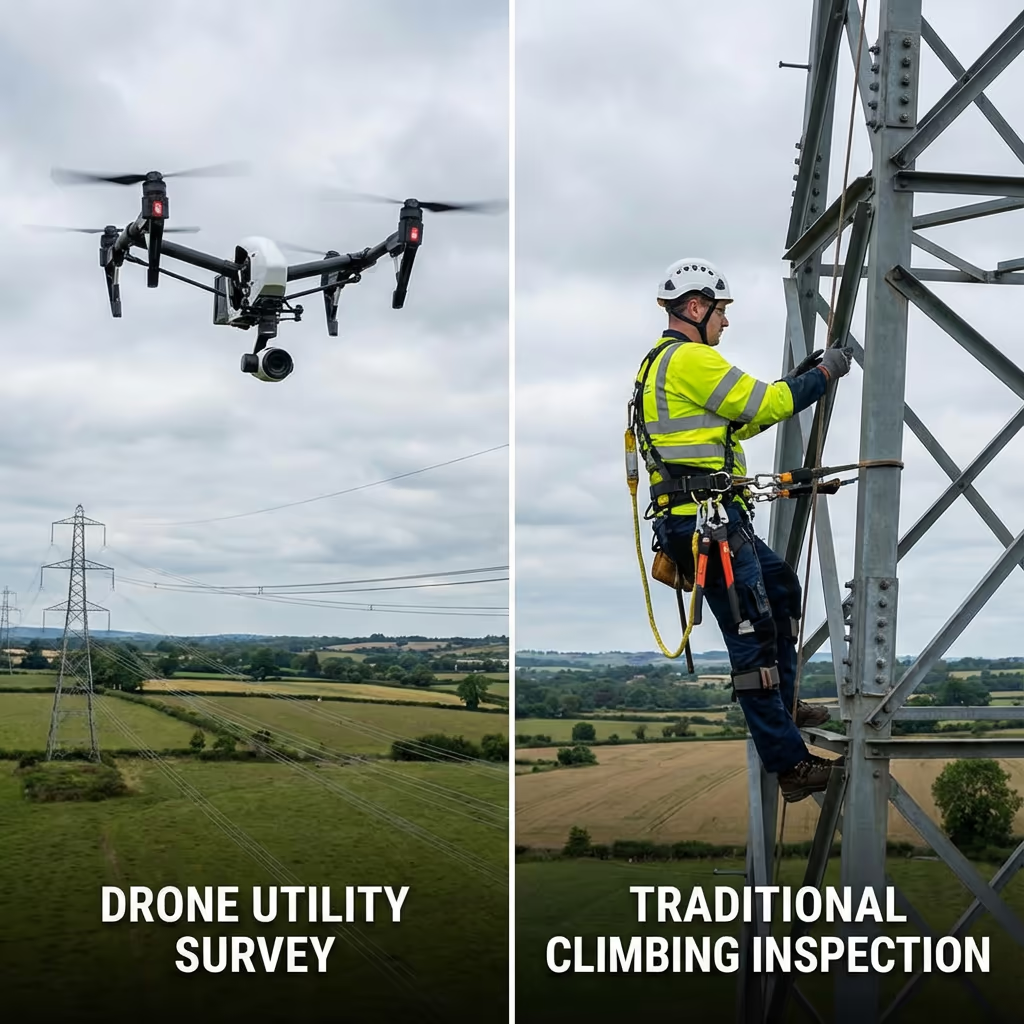
How Do Drone Utility Surveys Compare to Conventional Methods?
Conventional utility inspections typically involve ground patrols, helicopter surveys, or workers climbing structures—all with significant cost, safety, and efficiency limitations. UAVs offer a transformative alternative that addresses all these challenges.
Our UAV utility surveys can cover extensive corridors in a single day, capturing detailed imagery of every asset without requiring shutdowns or putting workers at height. The captured data is more thorough than visual inspections, and can be reviewed, measured, and analysed repeatedly from the office.
When to Select Each Approach
Select UAV Utility Survey
Quicker, safer, more detailed
Conventional Methods
Ground & helicopter surveys
Uncertain which approach suits your infrastructure?
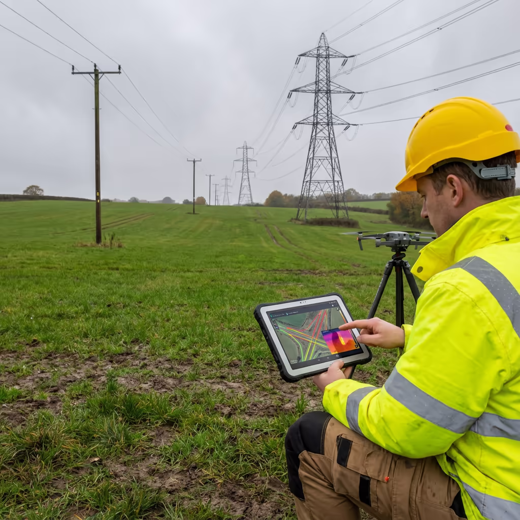
What Precision Levels Do Drone Utility Surveys Attain?
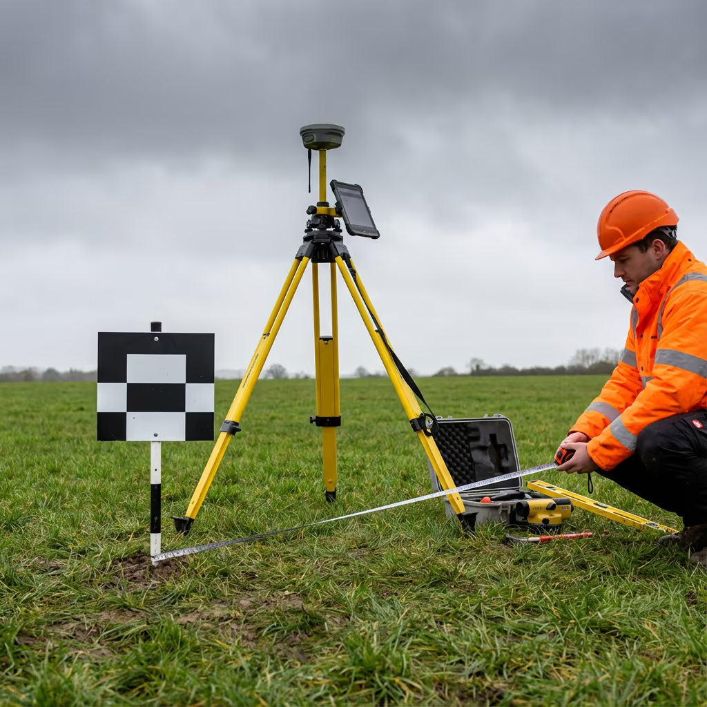
Our UAV utility surveys attain clearance measurement precision of ±5-10cm using combined LiDAR and photogrammetry techniques. This exceeds the requirements for vegetation management planning and regulatory compliance reporting.
For conductor sag analysis and thermal imaging, we deploy specialist sensors calibrated for power line inspection. RTK/PPK positioning ensures every measurement is precisely georeferenced, enabling accurate comparison with design specifications and tracking of changes over time.
Where Are Drone Utility Surveys Applied?
UAV utility surveys have revolutionised how infrastructure operators inspect and manage their assets. Here are the key applications where our clients see the greatest value:
Power Line Inspection
Transmission and distribution line surveys including conductor condition, insulator damage, hardware corrosion, and connection integrity.
Vegetation Management
Identify trees and vegetation that pose encroachment risks, prioritise clearance works, and document compliance with statutory requirements.
Pipeline Corridors
Oil, gas, and water pipeline route surveys for ground movement, third-party encroachment, and easement monitoring.
Substation Surveys
Comprehensive drone inspection of substations, switchyards, and transformer compounds including thermal anomaly detection.
Telecommunication Assets
Mast and tower inspections, antenna alignment verification, and structural condition assessment for mobile and broadcast infrastructure.
Rail Electrification
Overhead line equipment surveys, catenary inspections, and clearance verification for railway electrification projects.
Have utility infrastructure that needs surveying?
Can UAVs Identify Vegetation Encroachment?
Yes—vegetation encroachment identification is one of the most valuable applications of UAV utility surveys. Our LiDAR and photogrammetry systems create precise 3D models of both vegetation canopy and power line conductors, enabling us to measure exact clearance distances at every point along the corridor.
We can identify trees that are currently encroaching, predict which will require attention based on growth rates, and prioritise vegetation management programmes based on risk. The data integrates directly with GIS systems used by utility vegetation management teams, enabling efficient scheduling and compliance documentation.
What Outputs Do You Receive From a Drone Utility Survey?
We tailor outputs to your operational requirements, but our standard UAV utility survey deliverables include:
Corridor Mapping
Complete georeferenced survey of your utility corridor with all assets, structures, and access points documented.
Clearance Analysis
Precise measurements of conductor-to-ground and conductor-to-vegetation clearances with compliance status.
Vegetation Reports
Detailed vegetation encroachment analysis with risk ratings, prioritised work schedules, and GIS-compatible data.
Asset Condition Reports
Visual inspection reports for towers, poles, insulators, and hardware with fault identification and severity ratings.
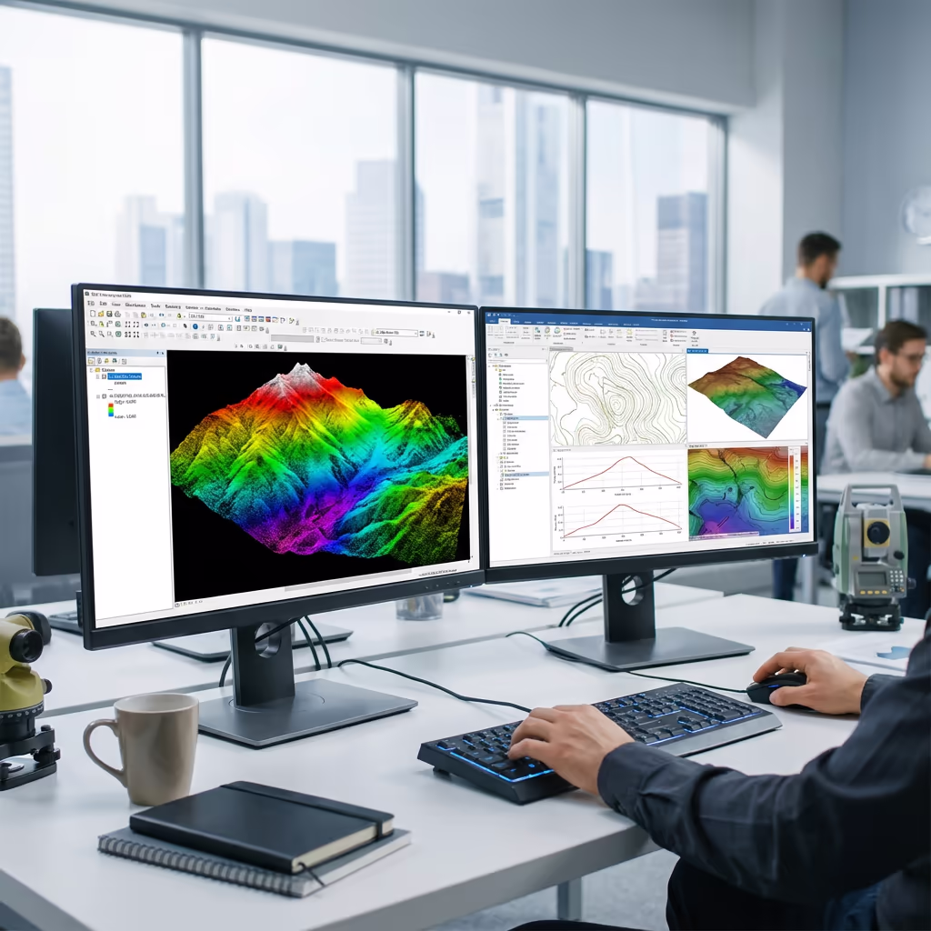
3D Models & CAD Files
Point clouds, 3D mesh models, and CAD-ready drawings for engineering analysis and design work.
Need specific outputs for your project?
What's the Duration of a Drone Utility Survey?
Our UAVs can survey 20-40 km of utility corridor per day depending on terrain and asset density. A typical 15 km distribution line survey can be completed in a single day of flying, with minimal disruption to your operations.
Data processing and report delivery depends on project scope and your required outputs. Standard deliverables are typically ready within 5-7 working days. For urgent projects or time-critical inspections, we offer expedited processing with 48-72 hour turnaround available.
| Phase | Duration |
|---|---|
| Planning & Permissions | 1-3 days |
| On-Site Data Capture | 1-3 days |
| Data Processing | 2-4 days |
| Analysis & QC | 2-3 days |
| Report Generation | 1-2 days |
| Total (Standard) | 5-7 working days |
Express Processing Available
Need it faster? 48-72 hour turnaround available for urgent projects.
How Should I Select a Drone Utility Survey Provider?
Not all UAV operators have the specialist expertise needed for utility sector work. When evaluating providers, we recommend checking these key factors:
- CAA authorisation – Ensure they hold valid GVC permissions for commercial operations near infrastructure
- Utility sector experience – Ask about previous work with power companies and infrastructure operators
- Professional insurance – Public liability and professional indemnity cover appropriate for utility work
- Appropriate equipment – Sensors capable of delivering the accuracy and detail you need
- Data security – Appropriate handling of sensitive infrastructure data
At Hire Drone Pilot, we tick every box. We're CAA certified, fully insured, and have considerable expertise working with utility companies and infrastructure operators throughout the UK.
Prepared to work with a reliable UAV utility survey provider?
Are Drone Utility Surveys More Cost-Effective Than Conventional Methods?
Significantly. Conventional utility inspections carry high costs for good reason—helicopter surveys require expensive aircraft, helicopter flight crews, and extensive safety protocols. Ground-based patrols are slow and labour-intensive. Climbing inspections require specialist crews, equipment, and often service outages.
Our UAV-based approach delivers better data at a fraction of the cost. Typical savings range from 50-70% compared to helicopter surveys, and 40-60% compared to conventional climbing inspections. The speed advantage also means quicker turnaround—critical when you need to respond to faults or plan maintenance programmes.
Prepared to Talk About Your UAV Utility Survey?
Expert guidance • Tailored pricing • Avg Response within 5 Mins

Peter Leslie
Owner & Drone Pilot
With considerable expertise in surveying and UAV operations, Peter personally oversees every utility survey project to ensure professional delivery and precise results.
TLDR: UAV Utility Surveys Explained
UAV Utility Survey Outputs
- Corridor mapping
- Clearance analysis
- Vegetation reports
- Asset condition
- 3D models
- CAD files
Talk About Your Project
Receive expert guidance and tailored pricing.
Drone Pilot Reviews
Why Drone Pilots Rate HireDronePilot 5 Stars
Don't just take our word for it. Here's what drone pilots in our UK network say about getting work through the platform.
“I get relevant commercial briefs with clear scopes, so quoting is fast and accurate. It has helped me win consistent survey work without chasing low-quality leads.”
Adam Carter
Drone Pilot
“Since joining the platform, I have filled gaps in my schedule with quality roof and inspection jobs. The enquiry details are much better than generic lead forms.”
Sophie Bennett
Drone Pilot
“HireDronePilot makes it easier to focus on delivery. I can review project briefs quickly, submit competitive quotes, and pick up work in new regions.”
Daniel Khan
Drone Pilot