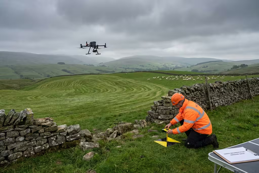
Surveying & Mapping
Topographic Survey
Detailed topographic surveys for planning, design and construction projects.
Overview
Professional topographic surveys combining drone technology with traditional survey methods to deliver comprehensive site data. Our surveys provide the detailed terrain information needed for planning applications, civil engineering design, and construction projects.
Key Features
- Ordnance Survey grid coordinates
- RICS-compliant surveys
- Combined drone and ground survey
- Feature coding to client specifications
- Multiple output formats
Applications
- Planning applications
- Civil engineering design
- Landscape architecture
- Infrastructure projects
- Flood risk assessments
Deliverables
- Topographic survey drawings
- Digital terrain models
- Contour plans
- Feature surveys
- CAD files (DWG/DXF)
Ready to get started?
Contact us for a free consultation and quote for your topographic survey project.
Common Questions
Topographic Survey FAQs
Yes, our topographic surveys are prepared to RICS standards and are suitable for planning applications. We can provide surveys at various scales and levels of detail to meet specific planning requirements.
We work in Ordnance Survey National Grid (OSGB36) as standard, with heights referenced to Ordnance Datum Newlyn. We can also provide data in other coordinate systems including WGS84 if required for your project.
Client Feedback
What Our Clients Say
Drone Pilot Reviews
Why Drone Pilots Rate HireDronePilot 5 Stars
Don't just take our word for it. Here's what drone pilots in our UK network say about getting work through the platform.
“I get relevant commercial briefs with clear scopes, so quoting is fast and accurate. It has helped me win consistent survey work without chasing low-quality leads.”
Adam Carter
Drone Pilot
“Since joining the platform, I have filled gaps in my schedule with quality roof and inspection jobs. The enquiry details are much better than generic lead forms.”
Sophie Bennett
Drone Pilot
“HireDronePilot makes it easier to focus on delivery. I can review project briefs quickly, submit competitive quotes, and pick up work in new regions.”
Daniel Khan
Drone Pilot
CAA Approved
Licensed commercial drone operators
Fully Insured
Public liability coverage
Professional Indemnity
PI insurance coverage
Get Started
Compare Quotes for Topographic Survey
Complete the form and our team will provide a tailored quote for your topographic survey requirements within 24 hours.
Post Once. Compare Independent Drone Pilot Quotes.
Submit once and receive competitive quotes from independent drone pilots.