Stephen Donnelly
Mapping NI
About Stephen
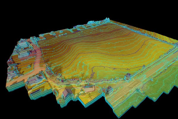
Stephen Donnelly provides drone photogrammetry and aerial survey services across Northern Ireland. Mapping NI delivers topographical CAD, 3D vectors and stockpile survey outputs for clients who need practical site data.
Profile copy, service descriptions and equipment information are supplied by Stephen Donnelly. Confirm current credentials, equipment, permissions and project suitability directly before booking.
Drone Services We Provide
Recent Work
Checks in progress
This profile cannot accept enquiries until HireDronePilot has completed and recorded its credential and insurance checks.
Browse verified pilotsSubmitted credentials — checks in progress
These entries are pilot supplied and have not yet been marked verified.
-
A2 Certificate of Competency
Qualification supplied for this profile; confirm current status where relevant.
-
GVC
Qualification supplied for this profile; confirm current status and project relevance.
Pilot-supplied equipment list
Confirm availability and suitability for your project directly with the pilot.
- DJI Mavic Air 2