Surveying & Mapping
Drone Boundary Survey Service
Precise property boundary mapping, area calculations, and legal plans ready quickly using professional drone survey technology.
Avg Response within 5 Mins • Or phone +44 1334 804554
Understanding Drone Boundary Surveys
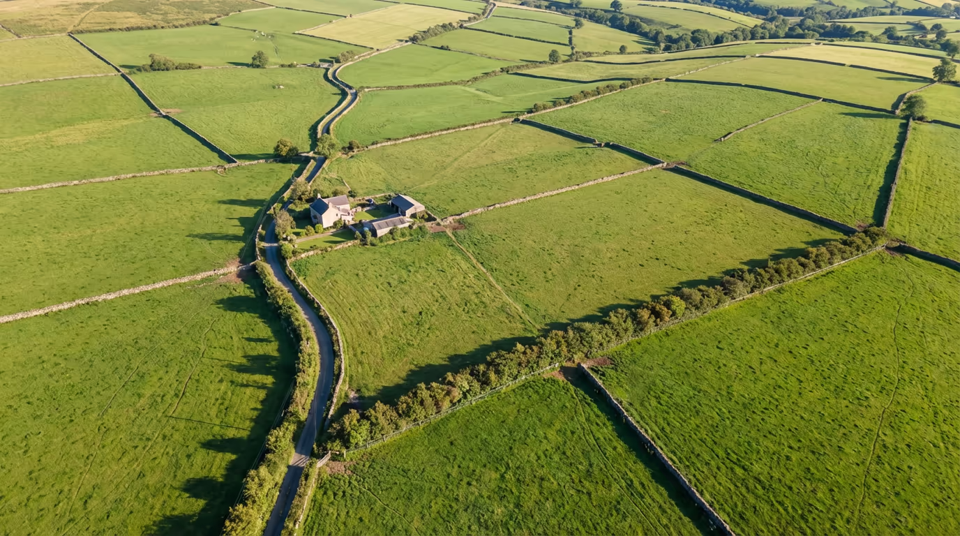
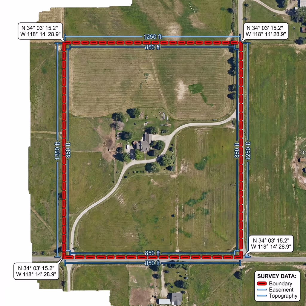
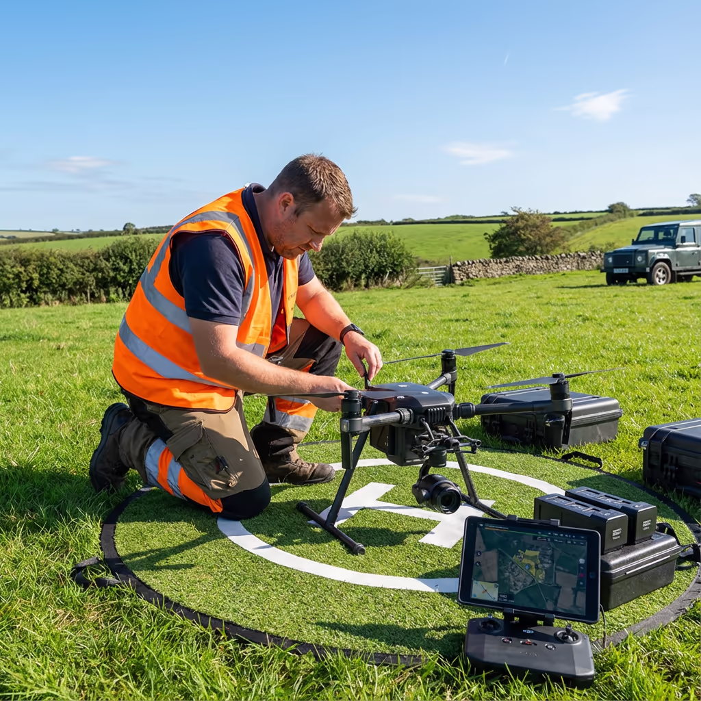
A UAV boundary survey employs drone photography and GPS technology to precisely map the boundaries of land parcels, properties, and estates. Unlike conventional methods that require surveyors to physically walk every boundary line, our aircraft capture high-resolution imagery from above, generating precise orthomosaic maps that show exactly where your boundaries lie.
At Hire Drone Pilot, we combine RTK-GPS positioning with professional photogrammetry to deliver boundary surveys that are accurate to within centimetres. Whether you need to verify your property extent, resolve a boundary dispute, or calculate land areas for legal or planning purposes, our UAV surveys provide the evidence you need.

Peter Leslie
Owner & Drone Pilot
"Have questions? Ring me directly - I'm happy to discuss your project requirements."
Call NowPrecise Boundary Data,Ready Quickly
What You'll Receive
- Detailed boundary mapping
- Precise area calculations
- Coordinate schedules
- Survey-grade accuracy (±2-5cm)
Ready in 3-5 working days
Why Use HireDronePilot
- CAA approved & fully insured
- RTK-GPS precision equipment
- Experience in boundary disputes
- UK-wide coverage
Relied upon by solicitors, landowners & estate agents throughout the UK.
Relied upon by leading organisations
Drone Boundary Survey Pricing Guide
Costs vary based on your site dimensions and specific requirements. Here is a guide to assist your budgeting:
| Project Size | Guide Price |
|---|---|
| Small ParcelUnder 1 ha | £400+ |
| Medium1–5 ha | £600+ |
| Large5–20 ha | £1,000+ |
| Estate20+ ha | £1,800+ |
| Dispute ResolutionAdd-on | +£200 |
*Guide prices include standard deliverables. Final quote based on site complexity, access, and specific requirements.
What influences your quotation?
- Site size & shape
- Boundary complexity
- Required deliverables
- Turnaround time
Our UAV boundary surveys typically save 30-50% compared to conventional ground surveys, while delivering faster results and comprehensive visual evidence. Get in touch with your project details for a tailored quote within 24 hours.
Prepared to receive a quote for your boundary survey?
Complimentary, no-obligation quotes within 24 hours
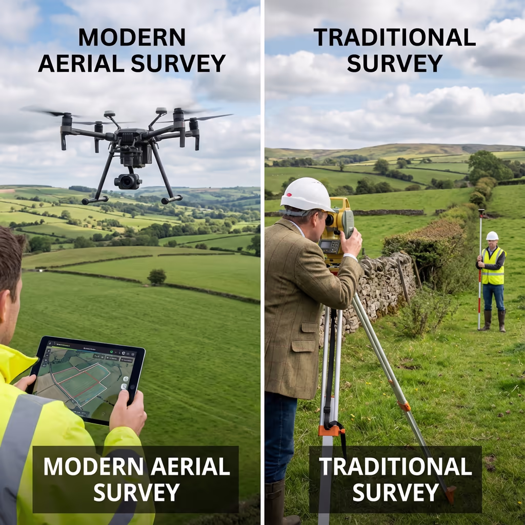
Comparing Drone Boundary Surveys and Conventional Methods
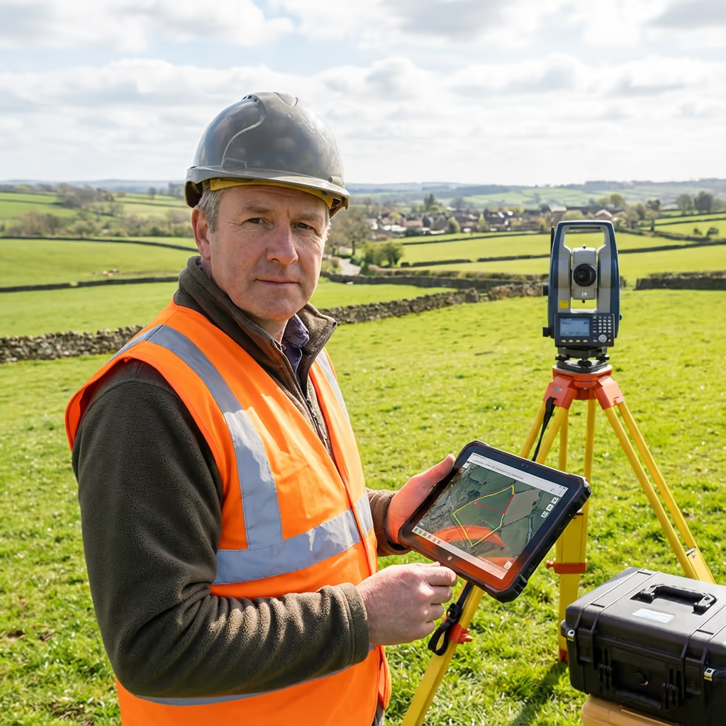
Conventional boundary surveys require surveyors to physically walk the perimeter of your land, taking measurements at regular intervals with theodolites or total stations. While precise, this process is time-consuming and labour-intensive—particularly for larger or difficult-to-access sites.
UAV boundary surveys capture the entire site from above in a single flight, generating a complete photographic record alongside precise positional data. This approach is faster, more comprehensive, and often more cost-effective for medium to large sites. The drone imagery also provides invaluable visual evidence that conventional surveys simply cannot match.
Selecting the Right Approach
Opt for UAV Survey
Rapid & comprehensive
Opt for Conventional
Thorough ground-level
Uncertain which approach fits your project?
Precision Levels for Drone Boundary Surveys
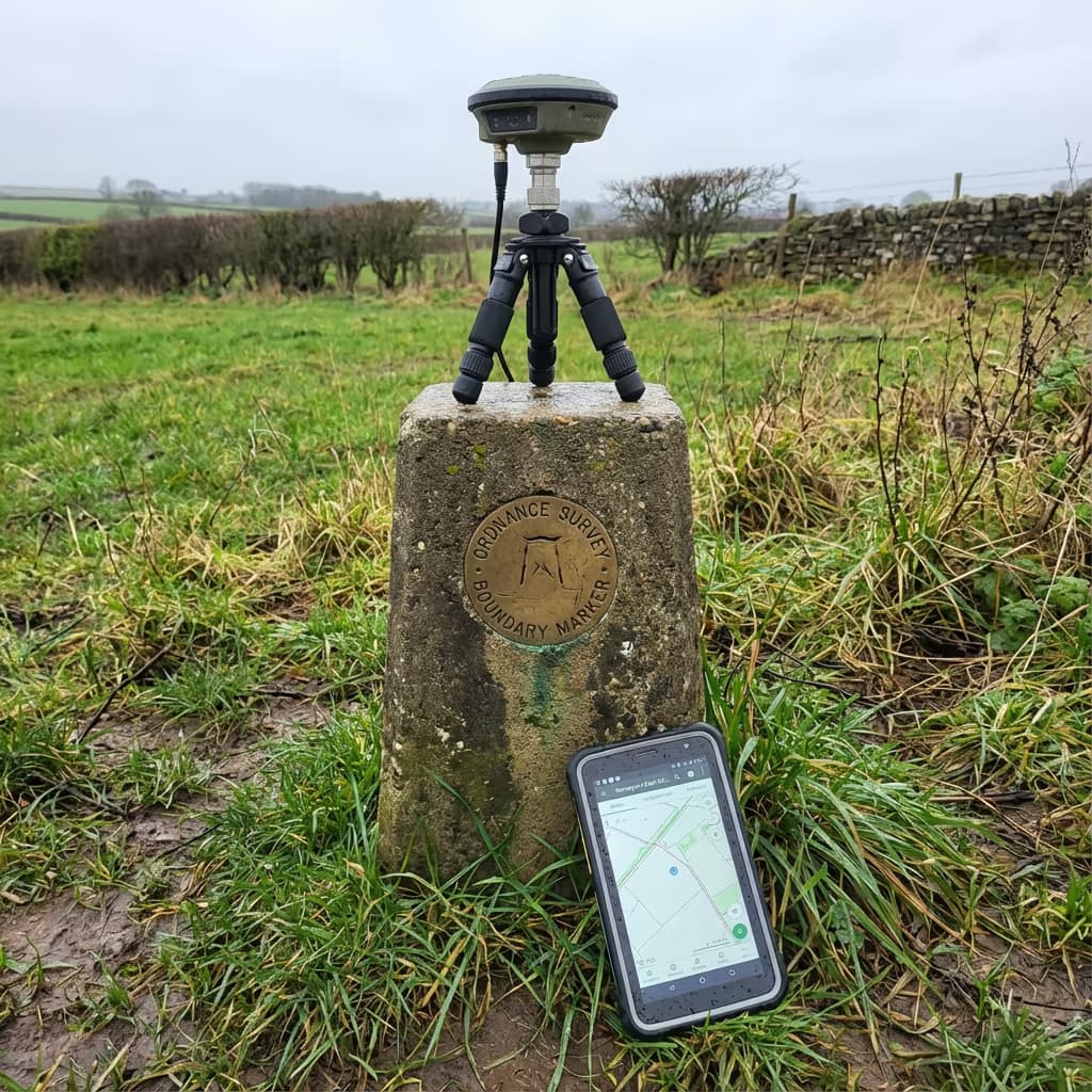
Our UAV boundary surveys consistently achieve positional accuracy of ±2-5cm when employing RTK-GPS and ground control points. This level of precision exceeds the requirements for most boundary verification, land registration, and legal purposes.
We utilise RTK (Real-Time Kinematic) enabled aircraft that receive correction signals from the OS Net network, ensuring centimetre-level positioning during flight. For projects demanding the highest accuracy, we establish ground control points surveyed with dual-frequency GPS receivers. The result is boundary data you can confidently rely on for legal documentation and dispute resolution.
Drone Boundary Survey Applications
UAV boundary surveys serve a wide range of clients and purposes. Here are the key applications where our clients experience the greatest value:
Property Purchase & Sale
Verify land extent before buying or selling, confirm advertised areas, and provide buyers with accurate boundary documentation.
Land Registration
Support first registration or update registered boundaries with HM Land Registry using accurate survey data and plans.
Estate Management
Map entire estates, calculate field areas, and maintain accurate records of land holdings and tenanted boundaries.
Development Sites
Define site boundaries for planning applications, verify site areas, and establish development extents.
Agricultural Schemes
Accurate field measurements for BPS, stewardship schemes, and compliance with agricultural regulations.
Boundary Disputes
Provide impartial evidence and accurate measurements to support dispute resolution between neighbours.
Have a boundary project in mind?
Resolving Boundary Disputes with Drone Surveys
Absolutely—UAV surveys deliver compelling evidence for boundary disputes. The fusion of precise positional data and comprehensive drone photography produces an objective record that can help settle disagreements between neighbours without resorting to expensive legal proceedings.
Our UAV boundary surveys can pinpoint where physical boundaries (fences, hedges, walls) presently exist and compare this against registered title plans or historical records. We supply clear measurements highlighting any discrepancies, accompanied by high-resolution imagery that documents the actual situation on the ground.
For disputes that advance to mediation or litigation, we can furnish expert reports and legal-quality plans suitable for court proceedings. Our surveys have assisted numerous clients in resolving boundary matters efficiently, frequently avoiding the need for costly solicitor involvement.
Drone Boundary Survey Outputs
We customise outputs to your specific requirements, but our standard boundary survey deliverables include:
Boundary Mapping
Comprehensive plan displaying all boundary features including fences, hedges, walls, and ditches with precise positions.
Area Calculations
Exact area measurements in hectares, acres, or square metres. Individual field or parcel areas as required.
Coordinate Schedules
Complete list of boundary point coordinates in OSGB36 (British National Grid) for integration with Land Registry data.
Legal Plans
Plans suitable for HM Land Registry submissions, solicitor requirements, and legal documentation.
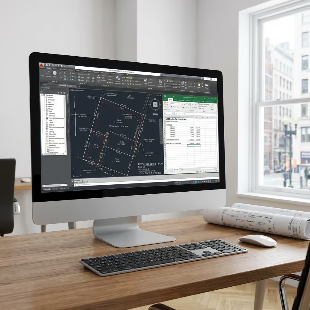
CAD Files & Orthomosaic
DWG/DXF files for use in design software, plus georeferenced drone imagery displaying the entire site.
Require particular outputs for your boundary survey?
Drone Boundary Survey Timeline
On-site data capture is remarkably swift. A typical boundary survey of 5-10 hectares takes merely 1-2 hours of flight time, plus setup and ground control establishment. Larger estates may require a complete day.
Processing and delivery depends on project complexity. Standard deliverables are typically ready within 3-5 working days. For time-sensitive projects, we offer expedited processing with 48-hour turnaround available at additional cost. We will confirm realistic timescales when we quote your project.
| Phase | Duration |
|---|---|
| Planning & Permissions | 1-2 days |
| On-Site Data Capture | 2-4 hours |
| Data Processing | 1-2 days |
| Deliverable Generation | 1-2 days |
| Total (Standard) | 3-5 working days |
Expedited Processing Available
Require faster delivery? 48-hour turnaround available for time-sensitive projects.

Selecting a Drone Boundary Survey Provider
Not all UAV survey providers possess the expertise for boundary work. When assessing providers, we recommend examining these key factors:
- CAA authorisation – Verify they hold valid GVC or legacy PfCO permissions for commercial operations
- Comprehensive insurance – Public liability and professional indemnity cover appropriate to your project
- Survey-grade equipment – RTK-GPS positioning and professional-grade photogrammetry software
- Land Registry experience – Knowledge of legal requirements for boundary documentation
- Dispute experience – Proven track record of providing evidence for boundary disputes
At Hire Drone Pilot, we satisfy every criterion. We are CAA authorised, comprehensively insured, and have delivered boundary surveys for landowners, solicitors, and estate agents throughout the UK.
Prepared to collaborate with a reliable boundary survey provider?
Are Drone Boundary Surveys More Economical Than Conventional Surveying?
For most sites exceeding 1 hectare, yes—substantially more economical. Conventional boundary surveys require surveyors to physically traverse every boundary line, setting up equipment multiple times and spending hours or days on site. Labour costs accumulate rapidly, particularly for larger or irregularly-shaped parcels.
Our UAV approach captures complete site coverage in a fraction of the time. A site that might take a ground surveyor two days can be flown in under two hours. The cost savings typically range from 30-50% compared to conventional methods, while also delivering comprehensive drone photography that conventional surveys cannot provide. For large estates or multiple parcels, the economics become even more favourable.
Prepared to Discuss Your Boundary Survey?
Expert guidance | Tailored pricing | Avg Response within 5 Mins

Peter Leslie
Owner & Drone Pilot
With extensive experience in surveying and UAV operations, Peter personally supervises every boundary project to ensure precise data and professional delivery.
Quick Guide: UAV Boundary Surveys Explained
Your Survey Outputs
- Comprehensive boundary mapping
- Area computations (ha/acres/m²)
- Coordinate schedules (OSGB36)
- Legal plans for Land Registry
- CAD files (DWG/DXF)
- Georeferenced orthomosaic imagery
Share Your Requirements
Receive expert guidance and tailored pricing.
Drone Pilot Reviews
Why Drone Pilots Rate HireDronePilot 5 Stars
Don't just take our word for it. Here's what drone pilots in our UK network say about getting work through the platform.
“I get relevant commercial briefs with clear scopes, so quoting is fast and accurate. It has helped me win consistent survey work without chasing low-quality leads.”
Adam Carter
Drone Pilot
“Since joining the platform, I have filled gaps in my schedule with quality roof and inspection jobs. The enquiry details are much better than generic lead forms.”
Sophie Bennett
Drone Pilot
“HireDronePilot makes it easier to focus on delivery. I can review project briefs quickly, submit competitive quotes, and pick up work in new regions.”
Daniel Khan
Drone Pilot