Land & Property
Drone Land Survey Service
Rapid, precise drone surveys for boundary mapping, area calculations, and comprehensive land assessment throughout the UK.
Avg Response within 5 Mins • Or phone +44 1334 804554
Understanding Drone Land Surveys
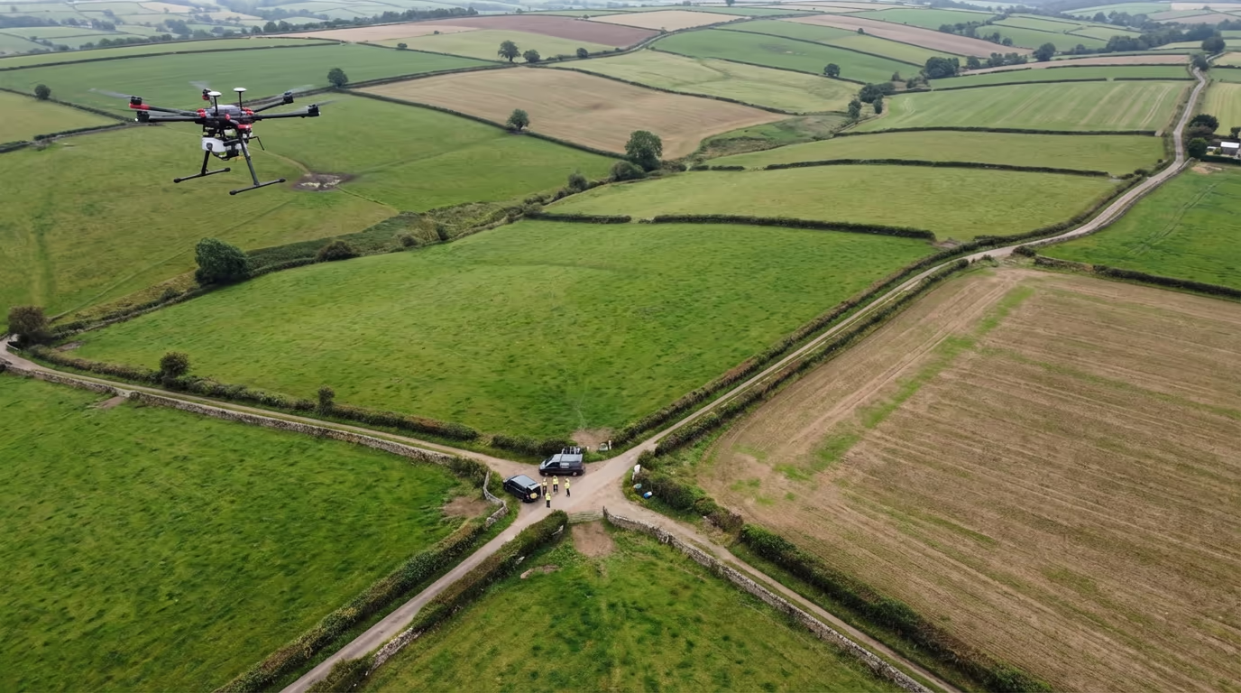
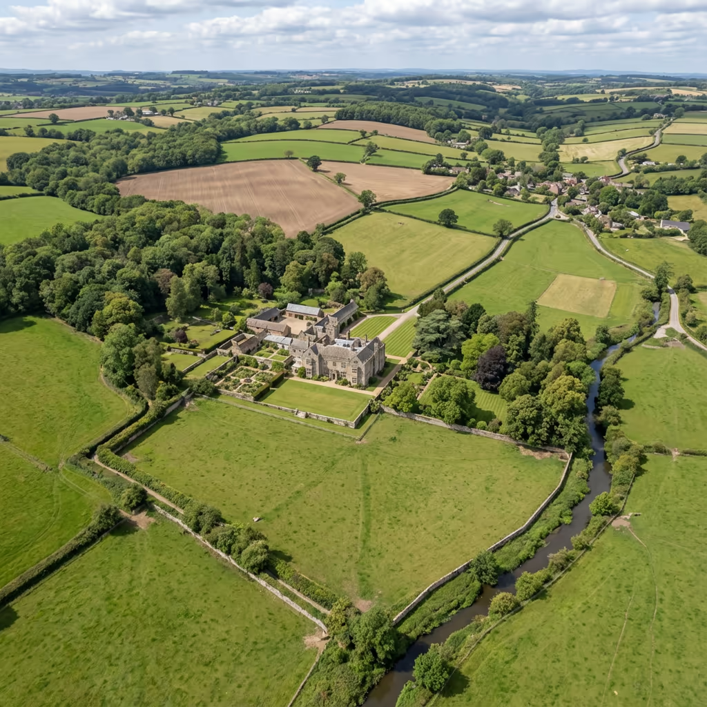
A UAV land survey employs drone photography and photogrammetry to generate precise maps and measurements of land parcels, boundaries, and terrain features. Our aircraft capture thousands of overlapping images which are processed to produce survey-grade orthomosaics, digital elevation models, and precise area calculations.
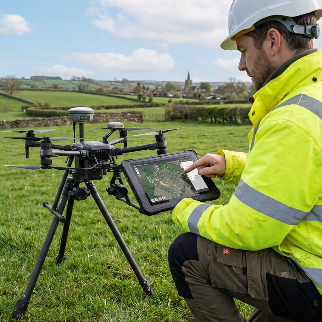
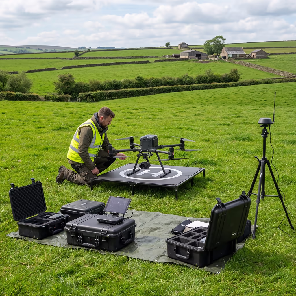
At Hire Drone Pilot, we utilise the latest RTK-enabled aircraft to achieve centimetre-level accuracy across sites of any scale. Whether you require mapping for a single field or surveying an entire estate, our UAV land surveys deliver the detailed, georeferenced data you need for planning, management, and legal purposes.

Peter Leslie
Owner & Drone Pilot
"Have questions? Ring me directly - I'm happy to discuss your project requirements."
Call NowExpert UAV Land Survey Data,Ready Quickly
What You'll Receive
- High-resolution orthomosaic
- Digital Terrain Model (DTM)
- Accurate boundary mapping
- Survey-grade accuracy (±2-5cm)
Ready in 3-5 working days
Why Use HireDronePilot
- CAA approved & fully insured
- RTK precision surveying
- Latest DJI drone technology
- UK-wide coverage
Relied upon by landowners, farmers, and property professionals throughout the UK.
Relied upon by leading organisations
Drone Land Survey Pricing Guide
Costs vary based on your site dimensions and requirements. Here is a guide to assist your budgeting:
| Site Size | Guide Price |
|---|---|
| SmallUnder 5 ha | £600+ |
| Medium5–20 ha | £1,000+ |
| Large20–50 ha | £1,800+ |
| Estate50–100 ha | £3,000+ |
| Major100+ ha | POA |
*Guide prices include standard deliverables. Final quote based on site complexity, access, and specific requirements.
What influences your quotation?
- Site size & complexity
- Required deliverables
- Turnaround time
- Access & location
Our UAV-based approach typically saves 50–70% compared to traditional land surveys. Get in touch with your project details and we will provide a tailored quote within 24 hours.
Prepared to receive a quote for your land survey?
Complimentary, no-obligation quotes within 24 hours
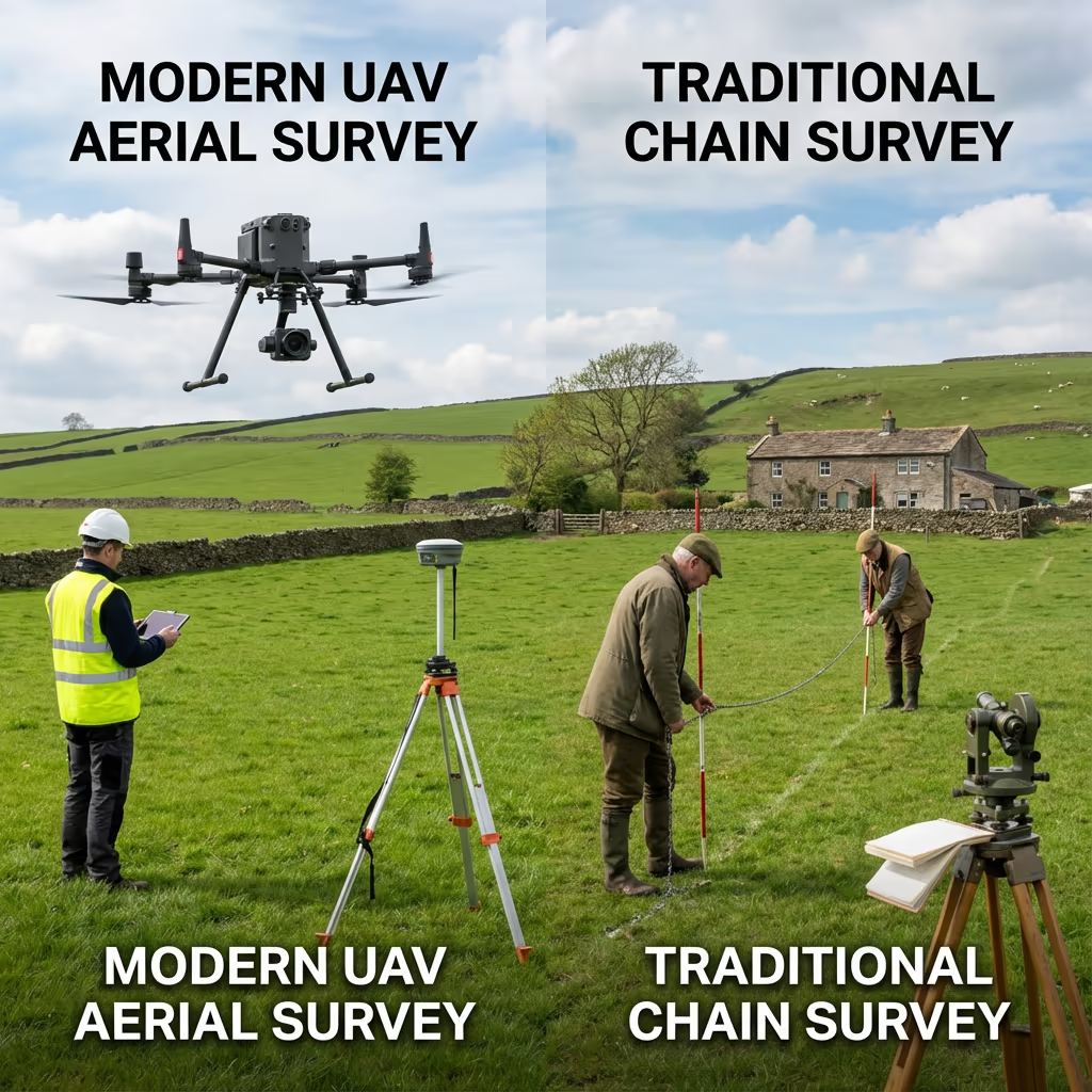
Comparing Drone Land Surveys and Conventional Methods
Conventional land surveys depend on surveyors walking the site with total stations, GPS rovers, or even chain measurements. While precise, these methods are time-consuming—particularly on large sites—and can take days or weeks to complete.
UAV land surveys capture the same data in a fraction of the time. Our aircraft photograph the entire site from above, generating thousands of data points that we process into precise maps and measurements. The result is comprehensive coverage that would be impractical to achieve on foot, ready in days rather than weeks.
Selecting the Right Approach
Opt for UAV Land Survey
Rapid & comprehensive
Opt for Conventional Survey
Thorough & precise
Uncertain which approach fits your project?
Precision Levels for Drone Land Surveys
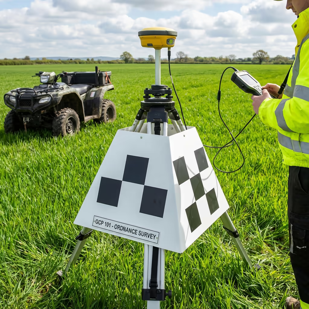
Our UAV land surveys consistently achieve horizontal accuracy of ±2-3cm and vertical accuracy of ±3-5cm when employing RTK positioning and ground control points. This level of precision satisfies the requirements for most planning, agricultural, and property management applications.
We utilise RTK-enabled aircraft that receive real-time corrections from base stations, ensuring every image is precisely georeferenced. For projects demanding the highest accuracy, we establish ground control networks and verify results against known survey points. The result is dependable, survey-grade data you can use with confidence.
Drone Land Survey Applications
UAV land surveys serve a wide range of purposes across agriculture, property, and development sectors. Here are the key applications where our clients experience the greatest value:
Agricultural Land
Farm boundary mapping, field area calculations, crop planning, and agricultural subsidy applications (BPS/SFI).
Property Transactions
Precise land area verification for property sales, estate agent marketing, and due diligence requirements.
Planning Applications
Site surveys for planning submissions, existing site plans, and red line boundary mapping for development proposals.
Estate Management
Comprehensive estate mapping, tenant boundary verification, woodland and amenity area calculations.
Boundary Disputes
Evidence gathering for boundary disagreements, historical feature identification, and comparison with title plans.
Land Registry Updates
Precise surveys for first registration, boundary amendments, and subdivision of land parcels.
Have a land survey project in mind?
Daily Coverage Capacity for Drone Land Surveys
Our aircraft can survey remarkably large areas in a single day. For standard land mapping at 2-3cm resolution, we typically cover 100-200 hectares per day depending on terrain complexity and flight conditions. This represents a significant efficiency gain over conventional methods.
For higher resolution surveys (1cm or better), coverage reduces to around 50-80 hectares per day. Multiple battery sets and efficient flight planning allow us to maximise productive time on site. Even the largest estates can typically be surveyed within 2-3 days, with processed deliverables following within a week.
200ha
Max daily coverage
2-3cm
Standard resolution
45min
Per battery flight
1000+
Images per flight
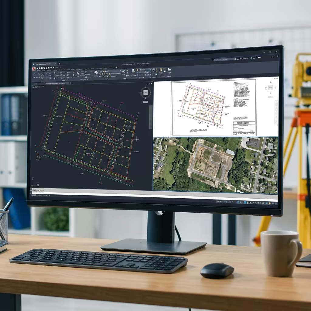
Drone Land Survey Outputs
We tailor deliverables to your project requirements, but our standard UAV land survey outputs include:
High-Resolution Orthomosaic
Georeferenced drone imagery of your entire site, stitched into a single accurate map. Perfect for visual reference and GIS integration.
Digital Terrain Model (DTM)
Bare-earth surface model showing ground elevation. Essential for drainage planning, earthworks, and level analysis.
Digital Surface Model (DSM)
Top surface including vegetation, buildings, and features. Used for visibility analysis and feature mapping.
Boundary Mapping
Clear delineation of land boundaries, hedgerows, fences, and other boundary features with accurate measurements.
Area Calculations & CAD Files
Precise area measurements in hectares/acres, plus DWG/DXF files compatible with AutoCAD and other CAD software.
Require specific deliverables for your project?
Drone Land Survey Timeline
On-site data capture is remarkably swift. A typical 20-hectare site takes just 2-3 hours to survey, including setup and ground control point establishment. Larger sites of 50-100 hectares can usually be completed within a single day.
Processing and delivery depends on site size and your required outputs. Standard deliverables are typically ready within 3-5 working days. For urgent projects, we offer expedited processing with 24-48 hour turnaround available at additional cost.
| Phase | Duration |
|---|---|
| Planning & Permissions | 1-2 days |
| On-Site Data Capture | 2-6 hours |
| Image Processing | 1-2 days |
| Deliverable Production | 1-2 days |
| Total (Standard) | 3-5 working days |
Express Processing Available
Require it sooner? 24-48 hour turnaround available for urgent projects.

Selecting a Drone Land Survey Provider
Not all UAV survey services are equal. When evaluating providers for your land survey, we recommend checking these key factors:
- CAA authorisation – Ensure they hold valid GVC or legacy PfCO permissions for commercial operations
- Professional insurance – Public liability and professional indemnity cover appropriate to your project
- RTK/PPK capability – Essential for survey-grade accuracy on land measurement projects
- Processing expertise – Ask about their photogrammetry software and quality control workflows
- Relevant experience – Request examples of similar land survey projects they've completed
At Hire Drone Pilot, we tick every box. We are CAA authorised, fully insured, and have delivered land surveys for farmers, estates, solicitors, and land agents throughout the UK.
Prepared to work with a reliable land survey provider?
Are Drone Land Surveys More Economical Than Conventional Surveying?
In most scenarios, significantly more economical. Conventional land surveys require surveyors to physically walk every boundary and feature, taking measurements point by point. For a 50-hectare site, this could take a week or more of field work, plus additional office time for drawing production.
Our UAV land surveys capture the same—or more—information in a single day. The cost savings typically range from 50-70% compared to conventional methods, while delivering faster turnaround and comprehensive visual documentation. For large rural sites, the economics become even more favourable, making UAV surveys the obvious choice for cost-conscious landowners and professionals.
Prepared to Talk About Your Land Survey Requirements?
Specialist advice • Competitive pricing • Avg Response within 5 Mins

Peter Leslie
Owner & Drone Pilot
With extensive experience in surveying and UAV operations, Peter personally oversees every land survey project to ensure accuracy and professional delivery.
Quick Guide: UAV Land Surveys
Your Survey Outputs
- High-resolution orthomosaic
- Digital Terrain Model (DTM)
- Digital Surface Model (DSM)
- Boundary mapping
- Area calculations
- CAD files (DWG/DXF)
Share Your Requirements
Receive specialist advice and tailored pricing.
Drone Pilot Reviews
Why Drone Pilots Rate HireDronePilot 5 Stars
Don't just take our word for it. Here's what drone pilots in our UK network say about getting work through the platform.
“I get relevant commercial briefs with clear scopes, so quoting is fast and accurate. It has helped me win consistent survey work without chasing low-quality leads.”
Adam Carter
Drone Pilot
“Since joining the platform, I have filled gaps in my schedule with quality roof and inspection jobs. The enquiry details are much better than generic lead forms.”
Sophie Bennett
Drone Pilot
“HireDronePilot makes it easier to focus on delivery. I can review project briefs quickly, submit competitive quotes, and pick up work in new regions.”
Daniel Khan
Drone Pilot