Smart Farming Technology
Drone Agricultural Survey Service
Advanced field mapping, vegetation health monitoring, and agricultural intelligence gathering to boost productivity and cut expenses.
Quick reply guaranteed • Phone us at +44 1334 804554
Understanding Drone Farm Surveys
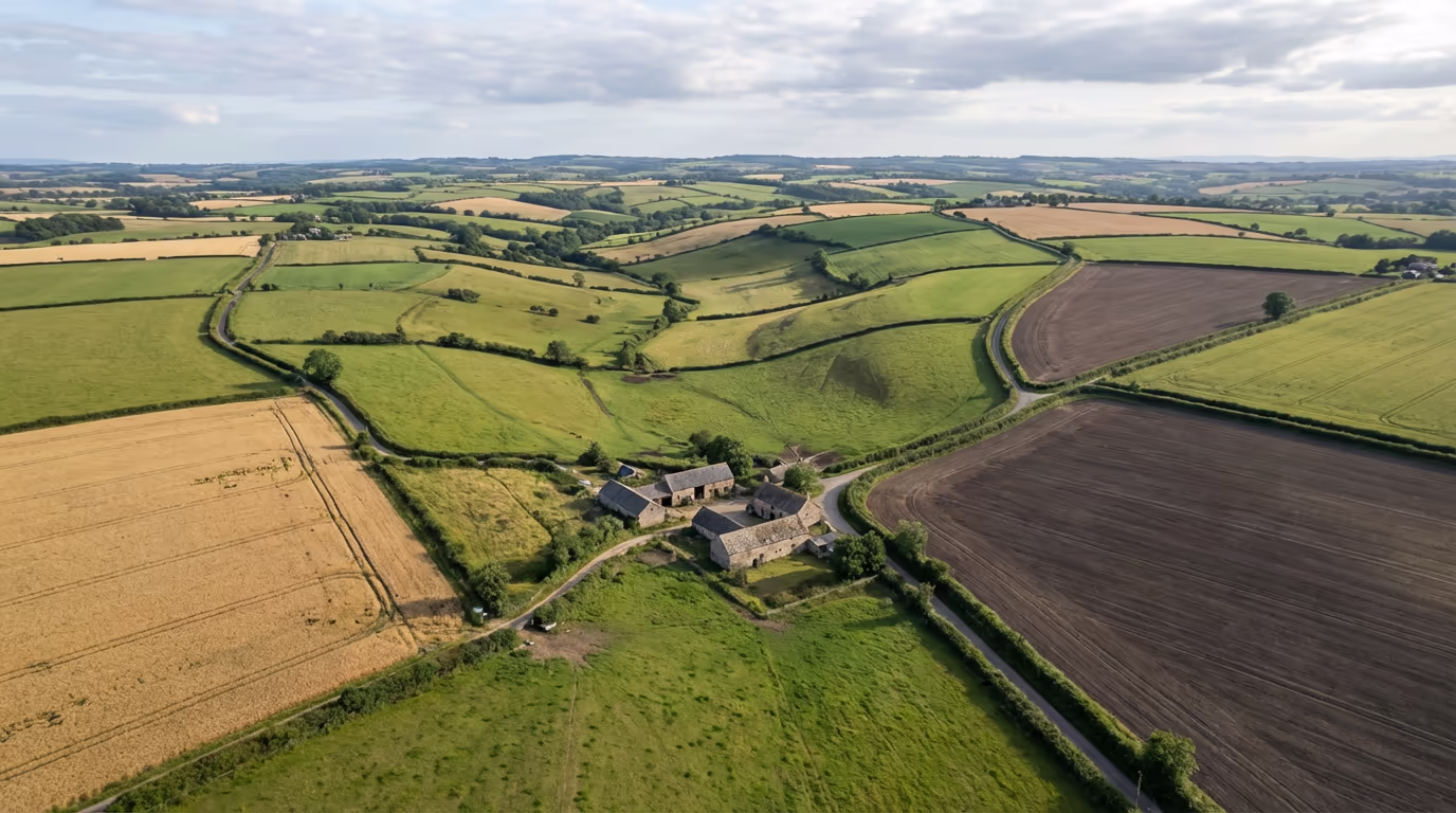
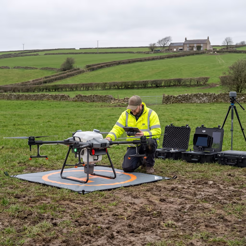
A drone farm survey deploys unmanned aircraft fitted with specialised imaging equipment to gather comprehensive data about your land, crops, and agricultural infrastructure. While conventional ground walks and satellite pictures have limitations, our UAVs operate at low altitudes to achieve centimetre-accurate measurements across your complete property.
Hire Drone Pilot utilises cutting-edge multispectral and standard RGB cameras to produce detailed farm imagery, spot crop issues before they become visible, examine water flow patterns, and create precise perimeter measurements. These insights enable you to take action based on solid evidence, ultimately increasing harvest quality while lowering operational spending.

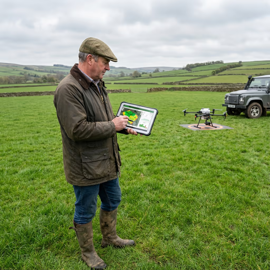
Peter Leslie
Owner & Drone Pilot
"Have questions? Ring me directly - I'm happy to discuss your project requirements."
Call NowAccurate Agricultural Insights,Rapid Turnaround
What You'll Receive
- Detailed farm drone composite
- NDVI vegetation health imagery
- Water flow pattern mapping
- Precise perimeter measurements
Ready within 5-7 business days
Why Use HireDronePilot
- CAA certified & comprehensively insured
- Farming survey experts
- State-of-the-art multispectral sensors
- Service across all UK regions
Relied upon by growers, crop consultants & rural agents throughout Britain.
Chosen by prominent businesses
Pricing for Drone Farm Surveys
Costs vary based on your holding size and the outputs you need. Below is a pricing guide to assist your planning:
| Farm Size | Guide Price |
|---|---|
| Small FarmUnder 20 ha | £500+ |
| Medium Farm20–100 ha | £1,000+ |
| Large Farm100–500 ha | £2,500+ |
| Estate500+ ha | POA |
| Seasonal PackageMultiple visits | POA |
*Indicative rates cover standard outputs. Your final quotation reflects property complexity, site access, and particular needs.
Factors influencing your estimate
- Property size & landscape
- Required outputs
- Deadline urgency
- Frequency of visits
Our drone farm surveys generally run 50-70% below conventional ground-based surveying approaches whilst providing richer, more extensive data. Share your property details and receive a customised quotation within a day.
Interested in pricing for your holding?
Complimentary, obligation-free estimates within 24 hours
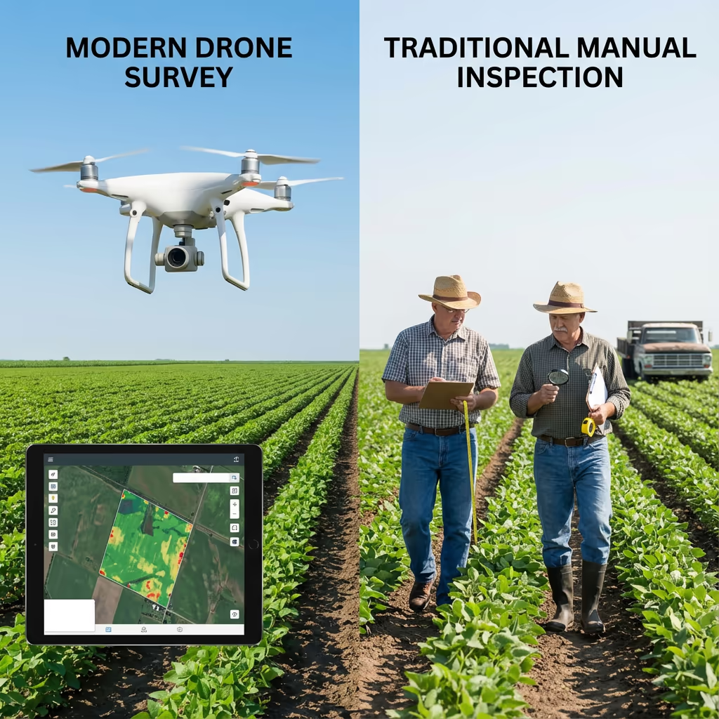
How Do Drone Farm Surveys Compare to Conventional Approaches?
Conventional farm assessment depends on physical field inspection, spot-check evaluations, and periodic satellite photos. Though these techniques have supported agriculture for generations, they demand significant time, offer restricted scope, and frequently fail to identify developing issues until symptoms are plainly visible.
Drone farm surveys capture total coverage of your complete property in one flying session. Our imaging equipment identifies crop stress, nutritional shortfalls, and pest problems days or weeks ahead of visible symptoms appearing—providing vital opportunity to act and safeguard your harvest.
Selecting the Right Method
Select Drone Farm Surveying
Full coverage & advance warning
Conventional Techniques
Physical inspection & spot-checking
Uncertain which method fits your property?
Precision Levels in Drone Farm Surveys
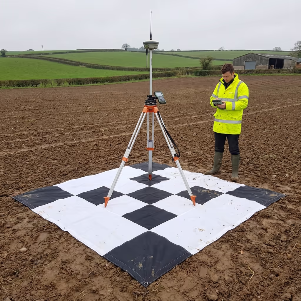
Our drone agricultural surveys deliver ground sample distances (GSD) as detailed as 1-2cm per pixel—sufficient resolution to enumerate individual plants or spot minor weed clusters. For cartography and perimeter documentation, we achieve positional precision of ±2-5cm through RTK/PPK GPS systems and ground reference markers.
Such precision substantially surpasses satellite pictures (usually 30cm-10m resolution) and produces variable rate prescription maps compatible with your spraying or spreading equipment. Our NDVI vegetation health imagery can pinpoint stressed areas as compact as several square metres, enabling genuinely focused treatments.
Uses for Drone Farm Surveys
Drone agricultural surveys enable smart farming throughout every branch of British agriculture. These are the primary uses where our customers achieve maximum value:
Vegetation Health Tracking
NDVI and multispectral evaluation to detect stress, illness, and nutritional gaps before outward signs develop.
Water Flow Evaluation
Pinpoint saturation patterns, clogged channels, and zones needing corrective work to enhance field output.
Perimeter & Field Documentation
Precise field boundaries supporting BPS submissions, lease documentation, and farm software compatibility.
Variable Rate Prescriptions
Create application maps for targeted distribution of nutrients, seed, and plant protection products.
Animals & Structures
Observe livestock, evaluate building status, design new facilities, and map tracks and yards.
Conservation Programmes
Record habitat zones, forest areas, hedges, and streams for Countryside Stewardship and SFI submissions.
Planning a farming project requiring drone assessment?
Are UAVs Capable of Evaluating Vegetation Condition?
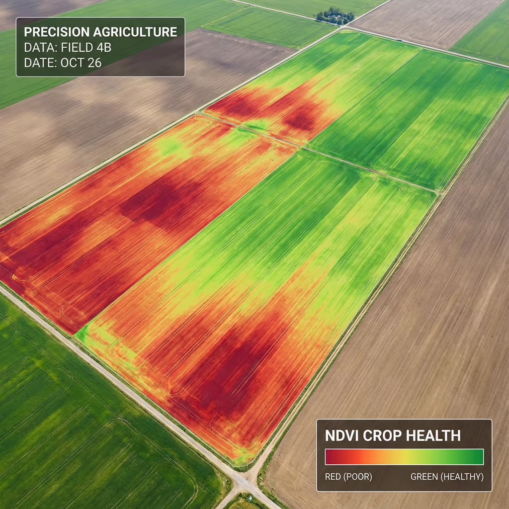
Absolutely—this represents one of the most valuable capabilities of drone agricultural surveys. Our multispectral imaging captures wavelengths beyond what eyes can see to compute the Normalised Difference Vegetation Index (NDVI). This research-backed measurement uncovers plant vitality and chlorophyll levels that remain hidden from human observation.
Vigorous, actively-developing crops bounce back more near-infrared light while absorbing red wavelengths. By analysing this proportion across your full property, we generate precise maps revealing exactly which areas flourish and which struggle. Results appear as colour-graded imagery—green sections signify robust growth, whereas red and amber patches flag stress requiring attention.
Insights From NDVI Analysis
Outputs Provided With Drone Farm Surveys
We customise outputs according to your property needs, though our standard agricultural survey package encompasses:
Property Drone Composite
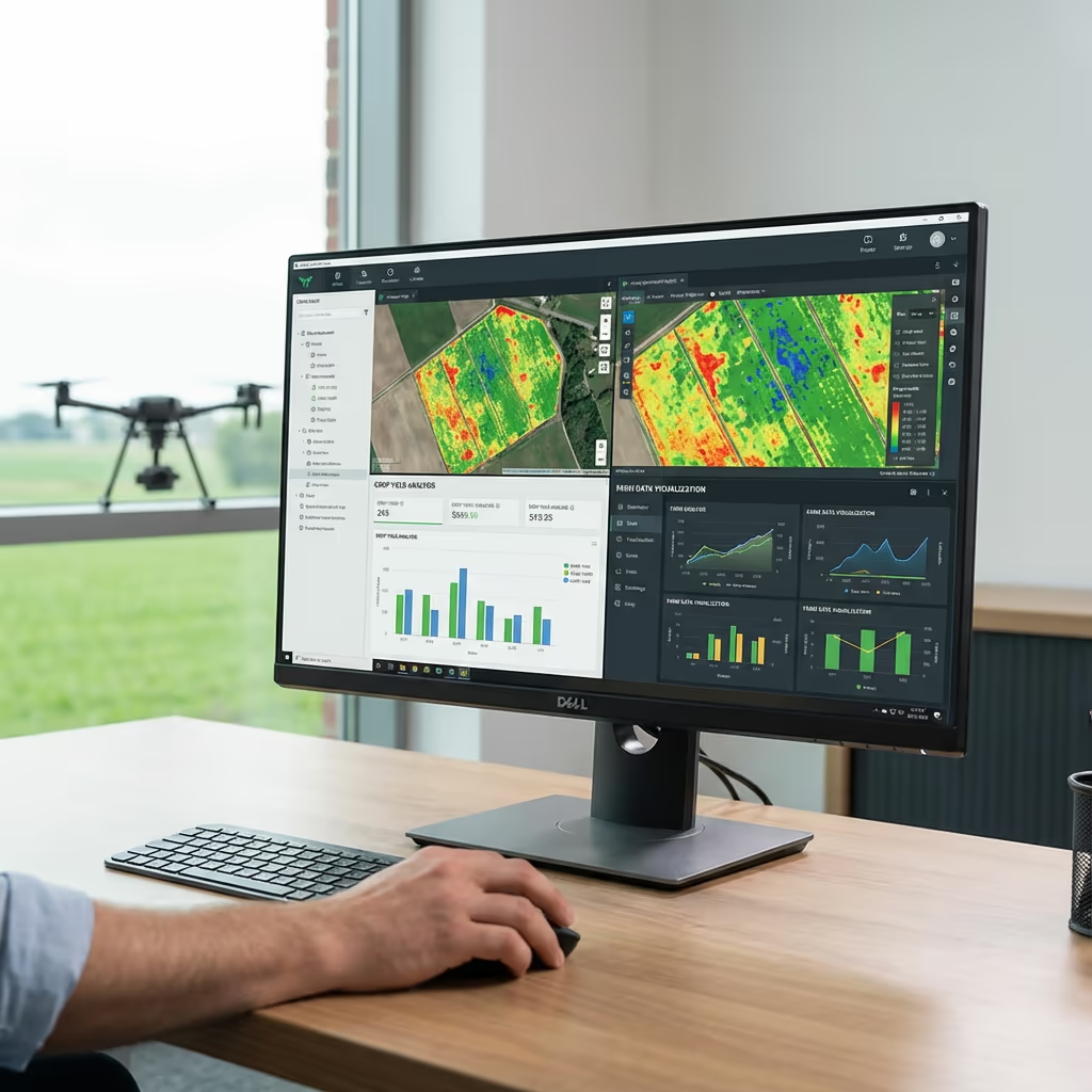
Detailed, location-referenced overhead imagery spanning your complete holding. Ideal for strategy development, documentation, and integration with agricultural management platforms.
NDVI Vegetation Condition Maps
Colour-graded plant index imagery displaying crop vitality throughout all fields. Locate trouble spots and monitor progression across the cultivation period.
Water Flow Assessment
Digital elevation models and surface runoff evaluation to locate drainage concerns, pooling zones, and best positions for additional channels.
Perimeter Documentation & CAD Data
Precise field edges in DXF/DWG format compatible with agricultural software, BPS applications, and business documentation.
Vegetation Evaluation Reports
Documented assessment including suggestions pinpointing zones needing attention and recommended measures to enhance your farming operation.
Require particular outputs for your holding?
Duration of an Drone Farm Survey
Field data collection proceeds surprisingly quickly. We can cover 100-200 hectares daily based on resolution needs and atmospheric conditions. A standard 50-hectare mixed property requires merely 2-3 hours of flying, alongside preparation and ground marker positioning.
Data processing and handover timing depends on your chosen outputs. Standard packages typically arrive within 5-7 business days. For urgent growing-season choices, we provide accelerated 48-72 hour completion for an added fee. We'll establish achievable deadlines when preparing your quotation.
| Phase | Duration |
|---|---|
| Planning & Weather | 1-3 days |
| On-Farm Data Capture | ½-1 day |
| Image Processing | 2-3 days |
| Analysis & QC | 1-2 days |
| Report & Delivery | 1 day |
| Total (Standard) | 5-7 working days |
Rapid Delivery Option
Pressed for time? 48-72 hour completion offered for pressing crop choices.
Selecting an Drone Farm Survey Company
Many UAV survey operators lack agricultural knowledge. During your assessment, we suggest verifying these essential criteria:
- CAA certification – Confirm they possess current GVC or previous PfCO approvals for commercial flying
- Farming knowledge – Enquire about their grasp of agricultural practices and cultivation cycles
- Multispectral sensors – Standard RGB cameras cannot produce NDVI vegetation analysis
- Practical outputs – Information must integrate with your application machinery and management tools
- Agricultural portfolio – Ask for case studies from farming assignments they have accomplished
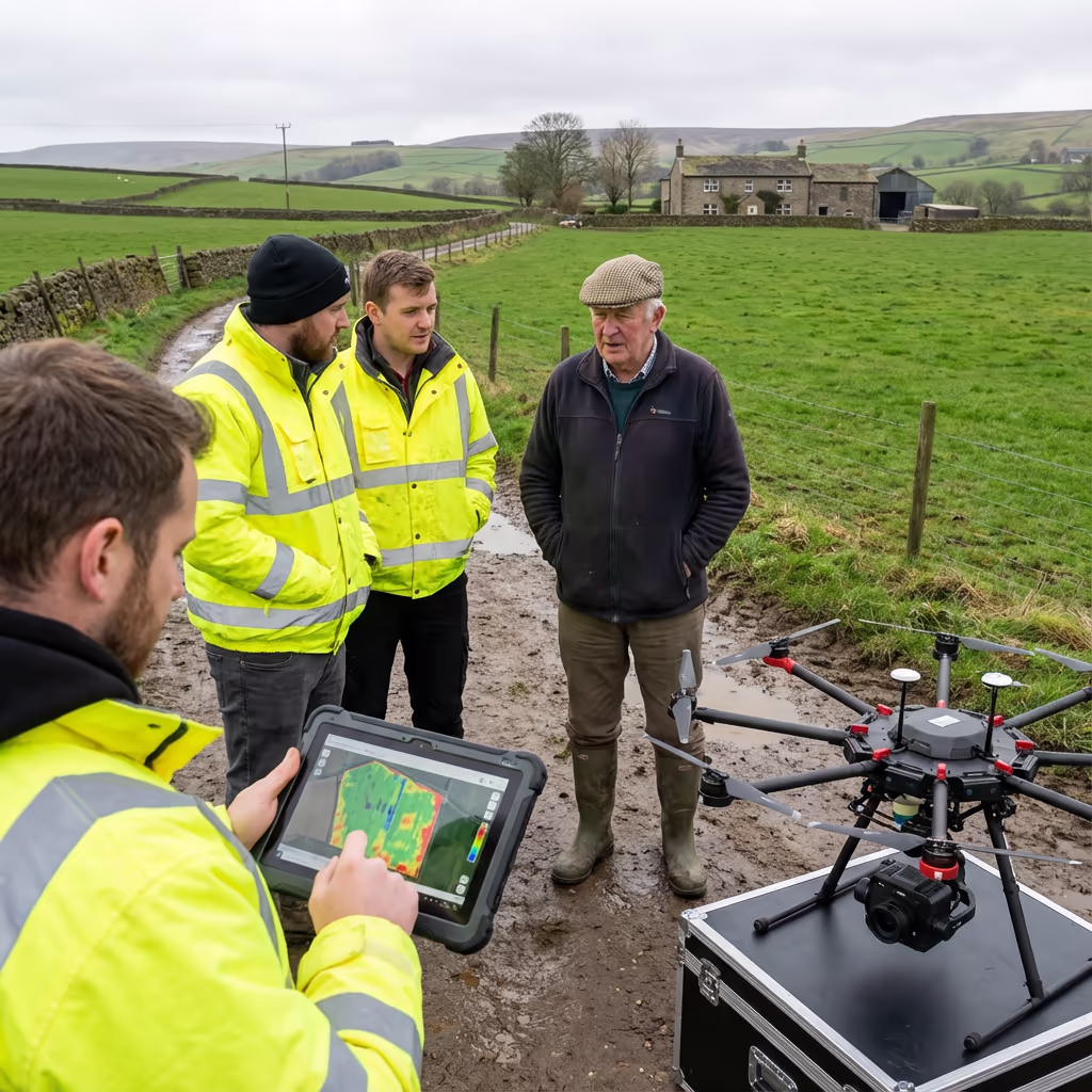
Hire Drone Pilot satisfies all requirements. We hold CAA approval, maintain comprehensive insurance, and have completed agricultural surveys for arable producers, dairy enterprises, mixed farms, and estate managers across Britain.
Keen to partner with a dependable farm survey specialist?
Do Drone Farm Surveys Cost Less Than Conventional Methods?
In the majority of cases, yes—plus you receive substantially more information for your expenditure. Conventional crop inspection and manual sampling can only ever assess a portion of your land. Satellite imagery subscriptions demand hundreds of pounds monthly whilst providing much coarser detail than UAV surveys.
Our drone agricultural surveys achieve total coverage of your complete property in one attendance. Investment returns stem from precise interventions—distributing inputs solely where necessary instead of blanket-treating entire fields. The majority of customers recover costs within their initial season via decreased input expenditure and safeguarded harvests.
Prepared to Explore Your Farm Survey Options?
Specialist guidance • Personalised quotes • Avg Response within 5 Mins

Peter Leslie
Owner & Drone Pilot
Bringing deep expertise in surveying and unmanned aircraft operations, Peter directs every farming assignment personally to guarantee precise, practical information for your property.
Quick Guide: Drone Farm Surveys
Farm Survey Outputs
- Property drone composite
- NDVI vegetation health imagery
- Water flow assessment
- Perimeter documentation
- CAD data (DXF/DWG)
- Vegetation evaluation reports
Talk About Your Agricultural Needs
Receive specialist guidance and customised rates.
Drone Pilot Reviews
Why Drone Pilots Rate HireDronePilot 5 Stars
Don't just take our word for it. Here's what drone pilots in our UK network say about getting work through the platform.
“I get relevant commercial briefs with clear scopes, so quoting is fast and accurate. It has helped me win consistent survey work without chasing low-quality leads.”
Adam Carter
Drone Pilot
“Since joining the platform, I have filled gaps in my schedule with quality roof and inspection jobs. The enquiry details are much better than generic lead forms.”
Sophie Bennett
Drone Pilot
“HireDronePilot makes it easier to focus on delivery. I can review project briefs quickly, submit competitive quotes, and pick up work in new regions.”
Daniel Khan
Drone Pilot
Connected Services
UAV Terrain Surveying
Comprehensive land profiling for water management design, groundworks, and agricultural facility development.
Laser Scanning Services
Accurate elevation models capable of seeing through canopy for forested areas and challenging landscapes.
Drone Survey Solutions
Full-scope overhead surveys supporting land evaluation, development strategy, and archive documentation.