Surveying & Mapping
Drone Site Survey Service
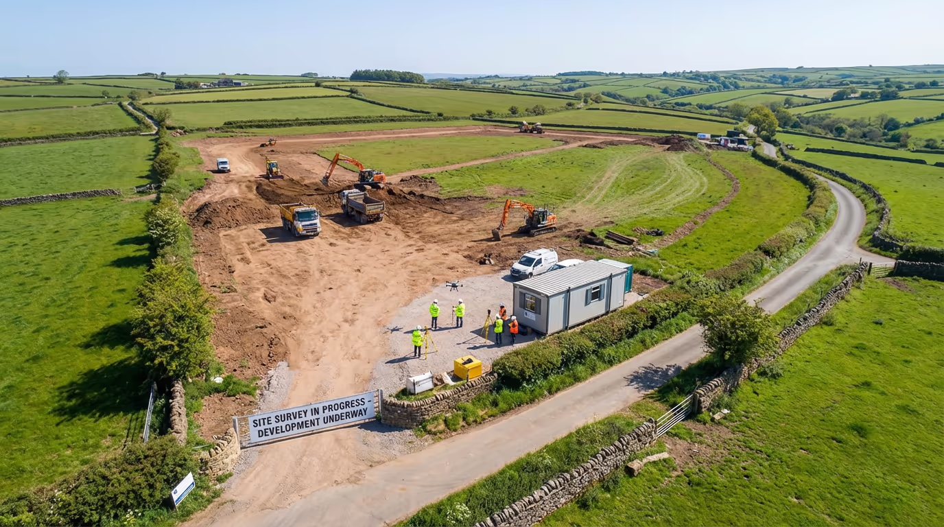
Thorough site documentation from above. Record boundaries, features, access points, and current conditions in one visit.
Avg Response within 5 Mins • Or phone +44 1334 804554
Understanding Drone Site Surveys
A UAV site survey delivers a thorough drone assessment of your development site, documenting everything from perimeters and access routes to existing features and ground conditions. Unlike conventional ground surveys that can require days to finish, our drone approach captures the entire site in hours—providing the complete picture you need for planning, design, and due diligence.
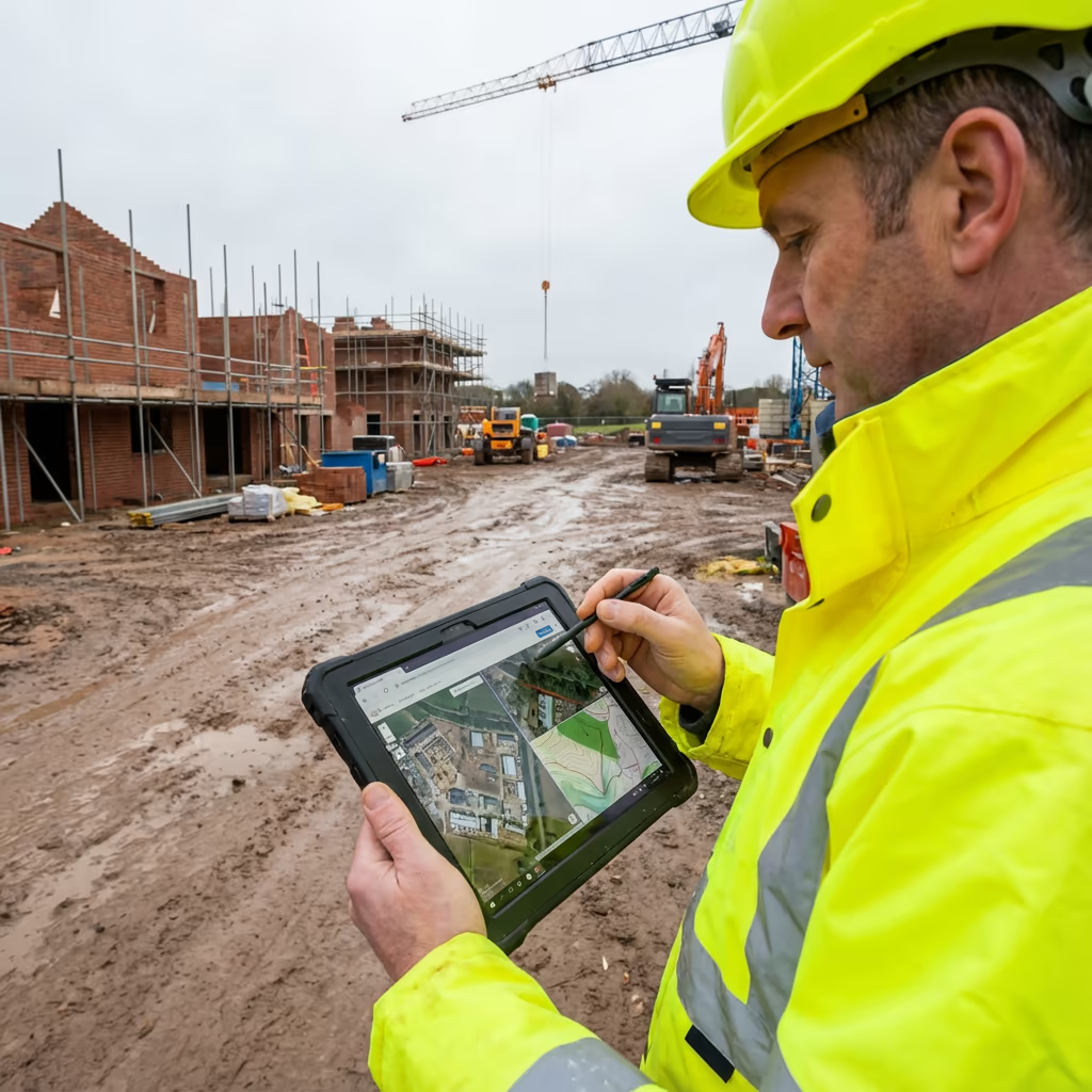
At Hire Drone Pilot, we combine high-resolution drone photography with precision photogrammetry to produce detailed orthomosaic maps, 3D models, and CAD-ready site plans. Whether you're acquiring a site, preparing a planning application, or briefing your design team, our UAV site surveys provide you with accurate, up-to-date information about precisely what exists on the ground.

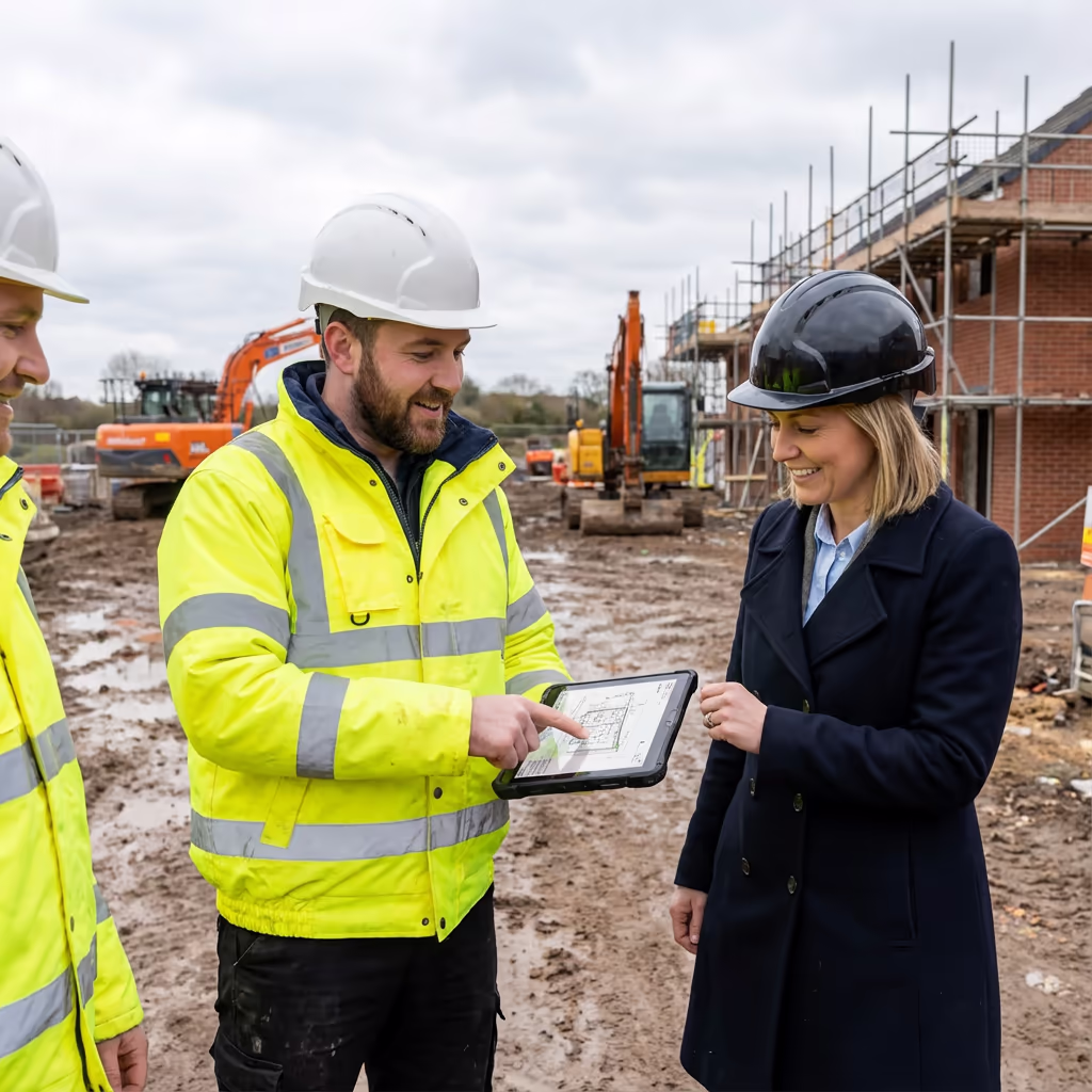
Peter Leslie
Owner & Drone Pilot
"Have questions? Ring me directly - I'm happy to discuss your project requirements."
Call NowComprehensive Site Data,Rapidly Delivered
What You'll Receive
- High-resolution site orthomosaic
- CAD-ready site plans (DWG/DXF)
- Boundary and feature mapping
- Survey-grade accuracy (±2-5cm)
Ready in 3-5 working days
Why Use HireDronePilot
- CAA authorised & fully insured
- Same-week availability
- Latest DJI survey equipment
- UK-wide coverage
Relied upon by developers, architects & planning consultants throughout the UK.
Relied upon by leading organisations
Drone Site Survey Pricing Guide
Pricing varies based on your site dimensions and required outputs. Here's a reference to assist your budgeting:
| Site Size | Guide Price |
|---|---|
| MicroUnder 0.5 ha | £500+ |
| Small0.5–2 ha | £700+ |
| Medium2–5 ha | £1,000+ |
| Large5–10 ha | £1,500+ |
| Enterprise10+ ha | £2,500+ |
| Major ProjectsMulti-site | POA |
*Guide prices include standard deliverables. Final quotation based on site complexity, access, and specific requirements.
What influences your quotation?
- Site size & complexity
- Required deliverables
- Turnaround time
- Access arrangements
Our UAV site surveys typically cost 50-70% less than conventional ground surveys whilst providing more thorough data. Share your site details with us and we'll supply a bespoke quotation within 24 hours.
Prepared to receive a quotation for your site?
Complimentary, no-obligation quotes within 24 hours
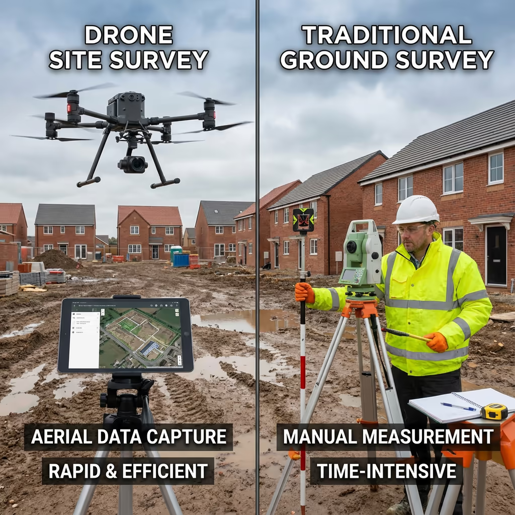
Comparing Drone Site Surveys and Conventional Methods
Conventional site surveys demand teams of surveyors traversing the ground with total stations and GPS equipment, measuring each feature individually. This approach functions well but consumes time—a complex 5-hectare site might require several days to survey thoroughly.
UAV site surveys capture identical information from above in a fraction of the time. We photograph the entire site at high resolution, then process thousands of overlapping images into accurate maps, models, and plans. The outcome is frequently more thorough than traditional methods—we document everything visible from above, not merely the points a ground team elects to measure.
Side-by-Side Comparison
UAV Site Survey
Rapid & thorough
Conventional Survey
Ground-based approach
Uncertain which approach fits your project?
Drone Site Survey Precision Levels
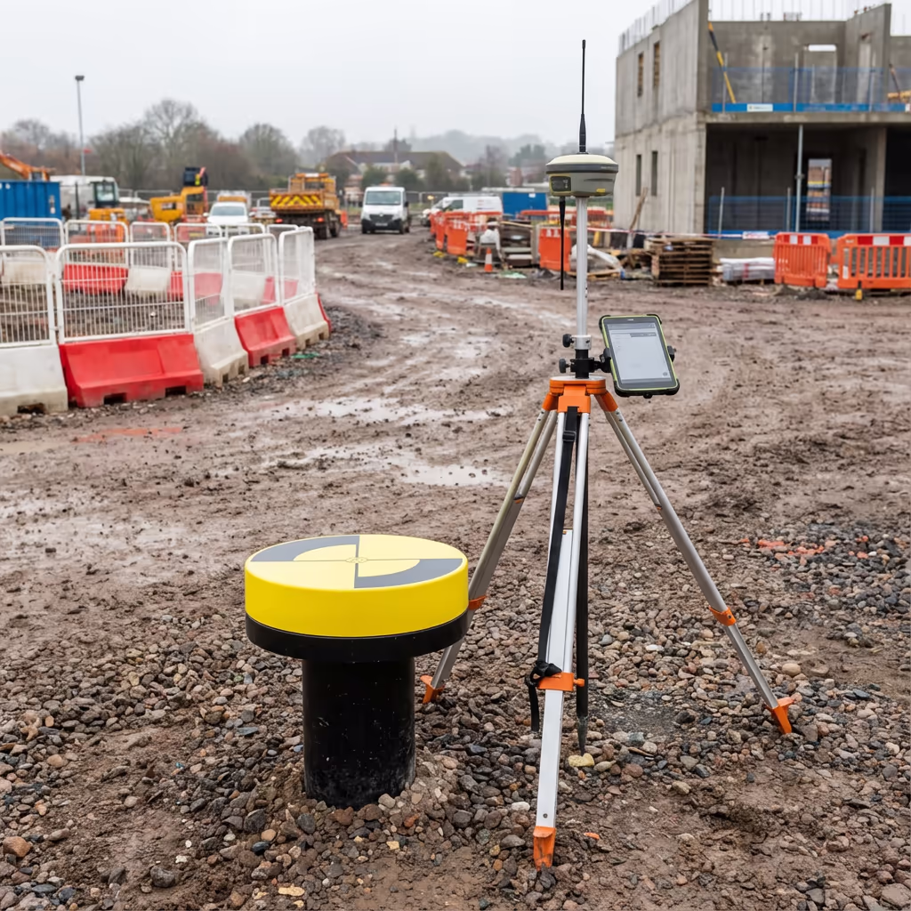
Our UAV site surveys consistently achieve horizontal accuracy of ±2-5cm and vertical accuracy of ±3-5cm when employing ground control points. This level of precision is appropriate for the vast majority of planning, design, and due diligence applications.
We utilise RTK-enabled drones with real-time positioning, combined with strategically placed ground control points surveyed to OSGB36 coordinates. This guarantees your site data integrates accurately with Ordnance Survey mapping and can be used alongside other survey data with assurance. For projects demanding higher accuracy, we can deploy additional ground control and enhanced processing workflows.
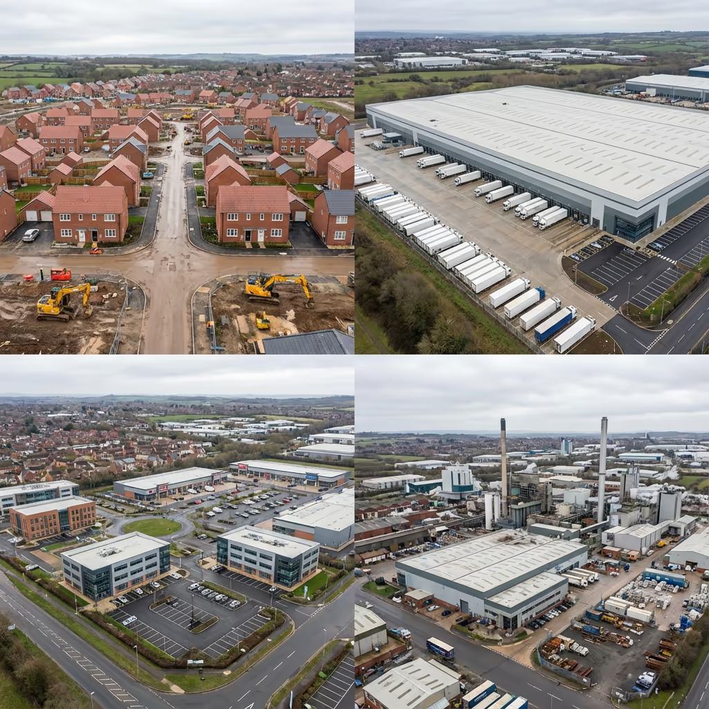
Common Uses for Drone Site Surveys
UAV site surveys inform decisions at every stage of the development lifecycle. Here are the principal applications where our clients experience the greatest benefit:
Residential Development
Site appraisals, capacity assessments, planning submissions, and progress tracking throughout construction.
Commercial Sites
Retail parks, office developments, and mixed-use schemes demanding thorough site documentation.
Industrial Development
Factories, distribution centres, and manufacturing facilities—frequently with intricate existing infrastructure.
Logistics & Warehousing
Large format buildings requiring precise site levels and access route planning.
Land Acquisition
Due diligence surveys for land purchases, revealing existing conditions and potential constraints.
Planning Applications
Accurate site plans and contextual imagery to support planning submissions and consultations.
Have a site requiring surveying?
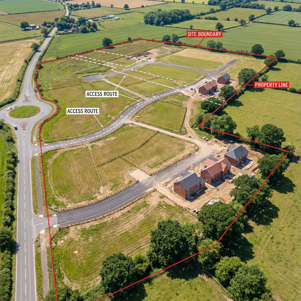
What Elements Can a Drone Site Survey Document?
A thorough UAV site survey documents everything visible from above—and that's typically more than you'd anticipate. Our surveys record the complete picture of your site's existing conditions:
Perimeters & Fencing
Property lines, fence positions, walls, and hedgerows
Buildings & Structures
Existing buildings, outbuildings, ruins, and foundations
Access & Circulation
Roads, paths, tracks, gates, and hardstanding areas
Vegetation
Trees (with heights), woodland, scrub, and hedges
Utilities & Services
Visible manholes, poles, substations, and infrastructure
Water Features
Ponds, streams, ditches, and drainage channels
Levels & Topography
Ground levels, slopes, banks, and elevation changes
Current Uses
Parking areas, storage, waste, and site activities
The orthomosaic imagery we provide serves as a permanent visual record of site conditions at survey date—invaluable for comparison with future surveys or resolving disputes about what existed before development commenced.
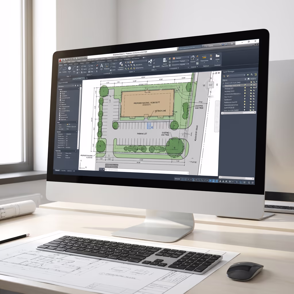
Your Drone Site Survey Outputs
We customise deliverables to your project requirements, but our standard UAV site survey outputs include:
Site Orthomosaic
High-resolution, georeferenced drone imagery displaying every detail of your site. Typically 2-3cm per pixel resolution.
Digital Terrain Model (DTM)
Bare-earth surface model revealing ground levels across the site. Essential for level design and earthworks planning.
Digital Surface Model (DSM)
Top surface encompassing vegetation and structures. Valuable for visibility analysis and comprehending site context.
Perimeter Mapping
Precise mapping of physical boundaries, fence lines, and property extents visible from drone imagery.
CAD Site Plans (DWG/DXF)
Professional CAD drawings prepared for your design team. Layered format compatible with AutoCAD, Revit, and other software.
3D Site Model
Textured 3D mesh model for visualisation, design context, and stakeholder presentations.
Require specific deliverables for your project?
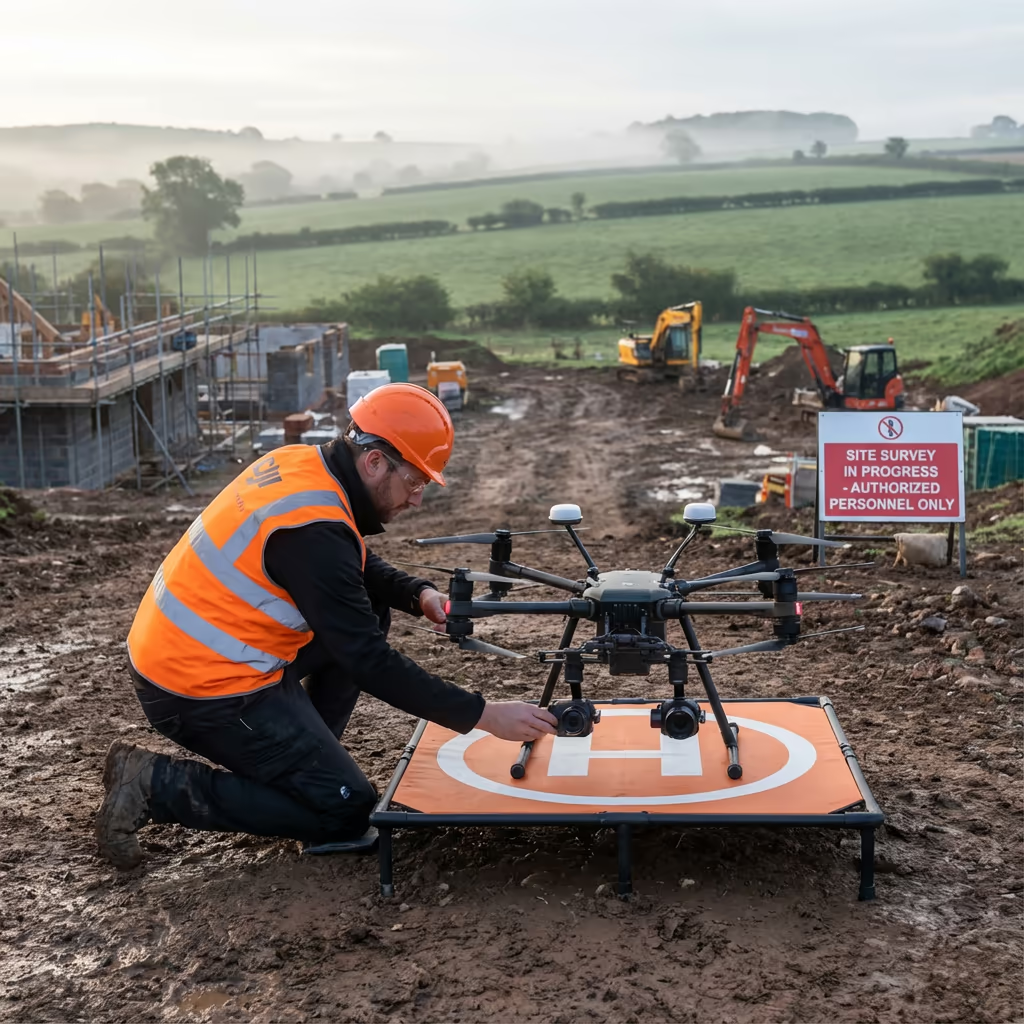
Drone Site Survey Duration
On-site data capture is rapid. Most sites under 10 hectares can be surveyed in a single morning, including ground control setup. Larger sites may require a full day, but we can frequently accomplish what would occupy a ground team for a week in mere hours.
Processing and delivery depends on your required outputs. Standard deliverables are typically prepared within 3-5 working days. For urgent projects, we provide express processing with next-day turnaround available at additional cost.
| Phase | Duration |
|---|---|
| Booking & Planning | 1-2 days |
| On-Site Survey | ½-1 day |
| Data Processing | 1-2 days |
| Feature Extraction | 1-2 days |
| Delivery & Handover | Same day |
| Total (Standard) | 3-5 working days |
Express Processing Available
Require it sooner? Next-day turnaround available for urgent projects.
Selecting a Drone Site Survey Provider
The calibre of drone survey providers differs considerably. When assessing options, we recommend verifying these essential factors:
- CAA authorisation – Confirm they possess valid GVC permissions for commercial UAV operations
- Professional insurance – Public liability and professional indemnity cover suitable for your project value
- Survey expertise – Comprehension of accuracy requirements, coordinate systems, and deliverable formats
- Premium equipment – RTK-enabled drones and professional processing software
- Relevant portfolio – Examples of comparable site survey projects they've completed
At Hire Drone Pilot, we meet every criterion. We're CAA authorised, comprehensively insured, and have delivered site surveys for developers, architects, and planning consultants throughout the UK.
Prepared to partner with a dependable provider?
Are Drone Site Surveys More Economical Than Ground Methods?
In most instances, substantially so. Conventional ground surveys require surveyors to visit every point they need to measure, which consumes time—particularly on larger or more intricate sites. Labour expenses accumulate rapidly when a team spends several days on site.
Our UAV surveys capture everything in hours rather than days, dramatically reducing field time and expenses. Typical savings range from 50-70% compared to equivalent traditional surveys. Beyond cost savings, you also receive comprehensive visual documentation that conventional surveys simply cannot match—high-resolution imagery displaying exactly what was on the ground at survey date.
Prepared to Survey Your Site?
Professional guidance • Same-week availability • Avg Response within 5 Mins

Peter Leslie
Owner & Drone Pilot
With substantial expertise in surveying and UAV operations, Peter personally manages every site survey to guarantee accurate, professional results you can depend on.
Quick Guide: UAV Site Surveys
Your Survey Outputs
- Site orthomosaic imagery
- Digital Terrain Model (DTM)
- Digital Surface Model (DSM)
- Boundary mapping
- Feature survey
- CAD site plans (DWG/DXF)
- 3D site models
Share Your Requirements
Receive professional guidance and bespoke pricing.
Drone Pilot Reviews
Why Drone Pilots Rate HireDronePilot 5 Stars
Don't just take our word for it. Here's what drone pilots in our UK network say about getting work through the platform.
“I get relevant commercial briefs with clear scopes, so quoting is fast and accurate. It has helped me win consistent survey work without chasing low-quality leads.”
Adam Carter
Drone Pilot
“Since joining the platform, I have filled gaps in my schedule with quality roof and inspection jobs. The enquiry details are much better than generic lead forms.”
Sophie Bennett
Drone Pilot
“HireDronePilot makes it easier to focus on delivery. I can review project briefs quickly, submit competitive quotes, and pick up work in new regions.”
Daniel Khan
Drone Pilot
Explore Similar Services
UAV Topographic Survey
Detailed topographic assessments with contours, spot heights, and elevation data for design and planning.
LiDAR Mapping
Precision laser scanning for vegetated sites where photogrammetry cannot penetrate tree cover.
UAV Survey
Thorough drone surveys providing precise data, 3D models, and orthomosaic imagery.