3D Mapping & Modelling
Drone Photogrammetry Survey Service
Ultra-high-resolution drone photography converted into accurate orthomosaics, 3D representations, and comprehensive terrain datasets for construction, planning, and engineering applications.
Avg Response within 5 Mins • Or phone +44 1334 804554
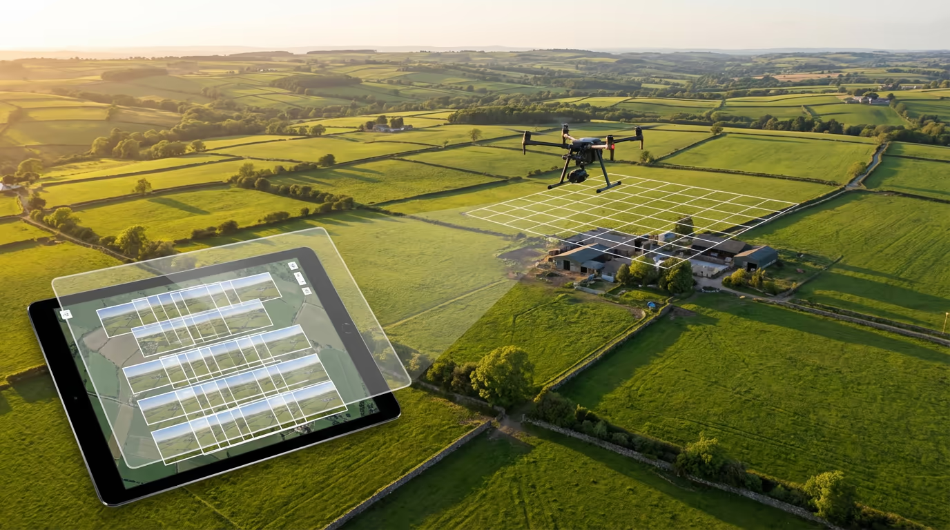
Understanding Drone Photogrammetry Surveys
UAV photogrammetry surveys employ overlapping drone photographs captured by our aircraft to produce highly precise 2D and 3D digital representations of terrain, structures, and infrastructure. Advanced software processes hundreds or thousands of images, recognising common features to reconstruct accurate geometry and surface characteristics.
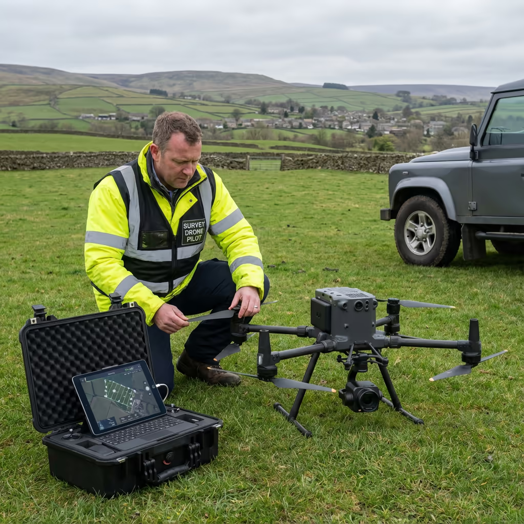
Hire Drone Pilot utilises high-resolution camera systems mounted on professional aircraft capable of recording centimetre-level detail. The outcome is survey-grade orthomosaic imagery, digital elevation products, and textured 3D meshes serving architects, engineers, planners, and construction professionals throughout the UK.
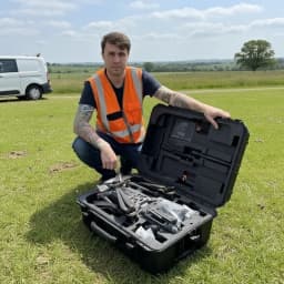
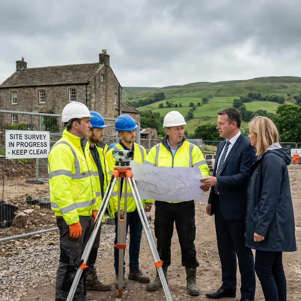
Peter Leslie
Owner & Drone Pilot
"Have questions? Ring me directly - I'm happy to discuss your project requirements."
Call NowPrecision Photogrammetry Data,Rapid Turnaround
What You'll Receive
- High-resolution orthomosaic maps
- 3D point cloud & textured mesh
- Digital Surface & Terrain Models
- Survey-grade accuracy (±2-5cm)
Ready in 3-5 working days
Why Use HireDronePilot
- CAA approved & fully insured
- Professional photogrammetry processing
- Latest DJI camera technology
- UK-wide coverage
Relied upon by architects, property developers & civil engineers throughout the UK.
Relied upon by industry leaders
Drone Photogrammetry Survey Pricing Guide
Costs vary based on project requirements. Use this reference for budget planning:
| Project Size | Guide Price |
|---|---|
| MicroUnder 1 ha | £600+ |
| Small1-5 ha | £900+ |
| Medium5-20 ha | £1,500+ |
| Large20-50 ha | £2,800+ |
| Enterprise50-100 ha | £5,000+ |
| Major Projects100+ ha | POA |
*Indicative rates cover standard outputs. Actual quotations reflect terrain difficulty, accessibility, and particular needs.
Factors Influencing Your Quote
- Site size & terrain
- Required deliverables
- Turnaround time
- Access requirements
Our UAV methodology typically delivers savings of 50-70% versus conventional ground surveys. Share your project specifications and we'll send a bespoke quotation within 24 hours.
Prepared to receive a quotation?
Complimentary, obligation-free quotes within 24 hours
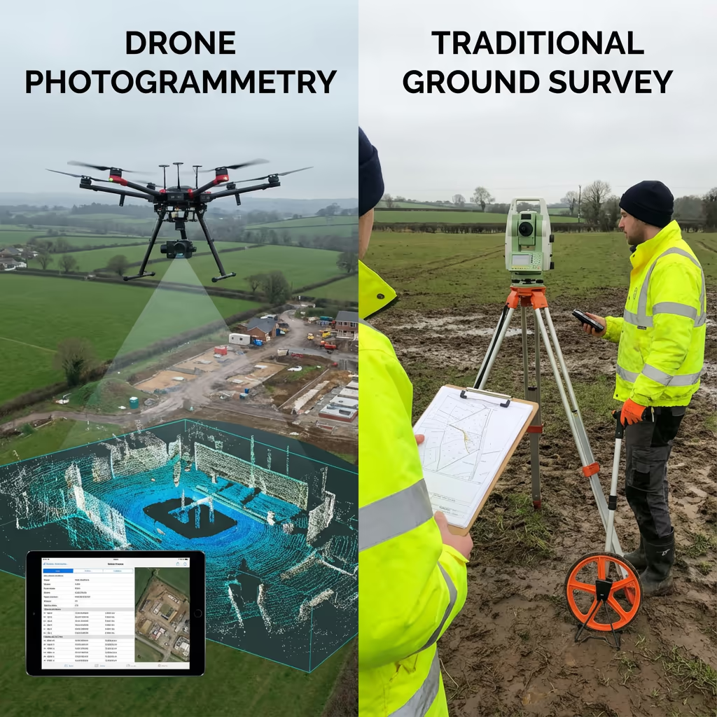
Drone Photogrammetry vs LiDAR Technology
Both technologies generate 3D models, yet they operate through fundamentally distinct methods. UAV photogrammetry employs overlapping photographs to compute surface positions—it excels at recording visual detail, textures, and colours, making it perfect for construction sites, building assessments, and promotional imagery.
LiDAR emits laser pulses capable of penetrating vegetation to reach the terrain beneath. This proves essential for forestry surveys and sites with dense canopy cover. Nevertheless, for most clear sites, construction tracking, and projects demanding visual records, photogrammetry produces outstanding results at reduced cost.
Selecting the Right Technology
Opt for Photogrammetry
Visual clarity & surface detail
Opt for LiDAR
Canopy penetration
Uncertain which technology fits your project?
Precision Levels in Drone Photogrammetry Surveys
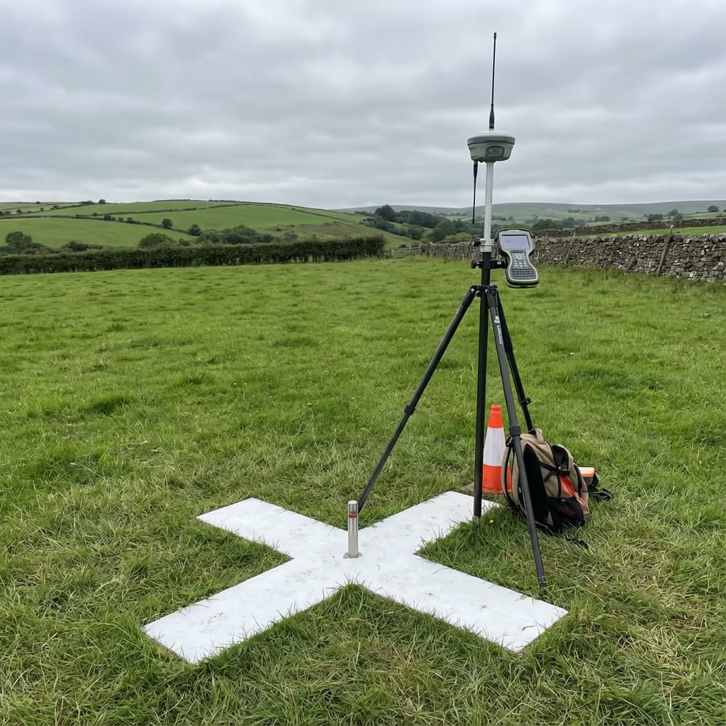
Our UAV photogrammetry surveys consistently attain horizontal accuracy of ±2-3cm and vertical accuracy of ±3-5cm with ground control points in place. This precision standard meets or surpasses the demands of most construction, planning, and engineering applications.
We deploy RTK/PPK-enabled aircraft paired with strategically positioned ground control points (GCPs) to guarantee sub-centimetre precision. The camera records thousands of overlapping images with 75-85% overlap, enabling our photogrammetry software to triangulate each point with exceptional accuracy. For projects demanding maximum precision, we can achieve ±1-2cm with additional GCPs.
Common Uses for Drone Photogrammetry Surveys
UAV photogrammetry has transformed site data capture across numerous sectors. These are the primary applications where our clients gain the most benefit:
Construction Progress Tracking
Periodic site surveys monitoring advancement, confirming earthwork volumes, and generating visual records for stakeholders and project archives.
Planning Submissions
Precise site surveys and visual evidence supporting planning applications, incorporating topographic data and 3D contextual models.
Volume Calculations
Accurate stockpile quantification, cut and fill analysis, and material inventory surveys for quarries, construction, and waste operations.
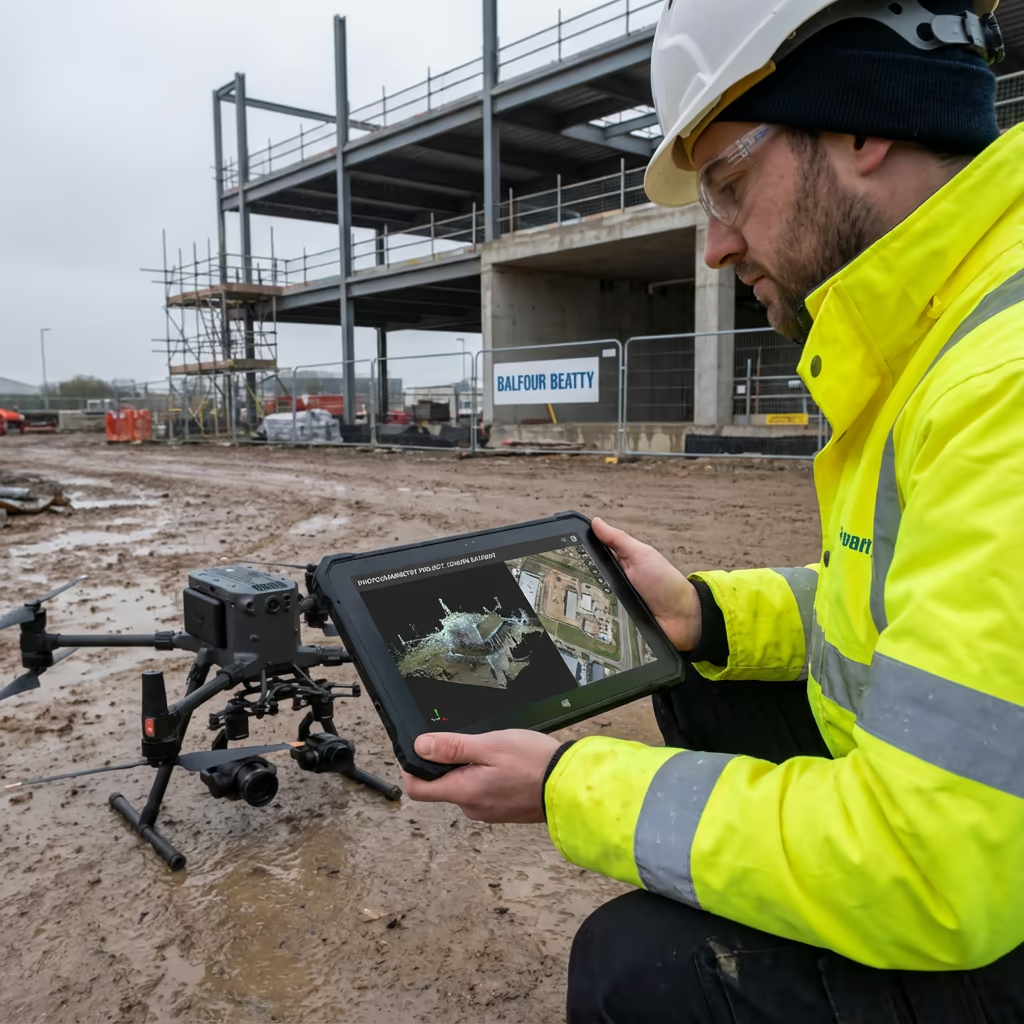
Structure & Roof Assessments
Comprehensive 3D models of buildings for condition evaluations, heritage recording, and BIM workflow integration.
Agricultural Analysis
Crop condition monitoring, drainage design, and land evaluation using high-resolution drone imagery and elevation datasets.
Marketing & Presentation
Impressive drone photography and 3D models for property promotion, development proposals, and stakeholder briefings.
Working on a project requiring photogrammetry?
The Drone Photogrammetry 3D Modelling Process
The power of photogrammetry stems from capturing identical features from multiple viewpoints. Our aircraft follows a pre-programmed grid pattern, typically recording images with 75-85% overlap. This ensures each ground point appears in dozens of photographs shot from varying positions.
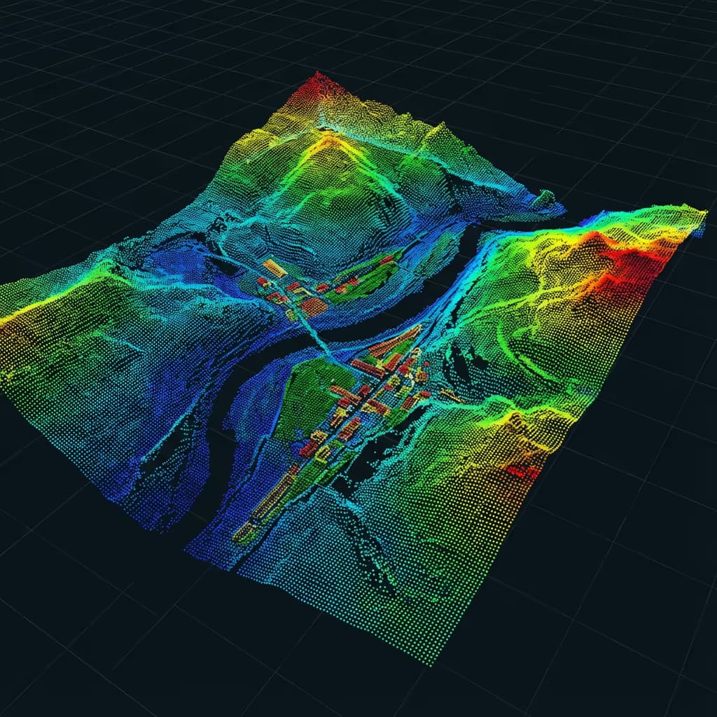
Advanced software examines these images, recognising millions of matching points through sophisticated algorithms. By computing each camera's location when capturing each photograph, the software triangulates the exact 3D coordinates of every matched point—producing a dense point cloud that faithfully represents the terrain and structures.
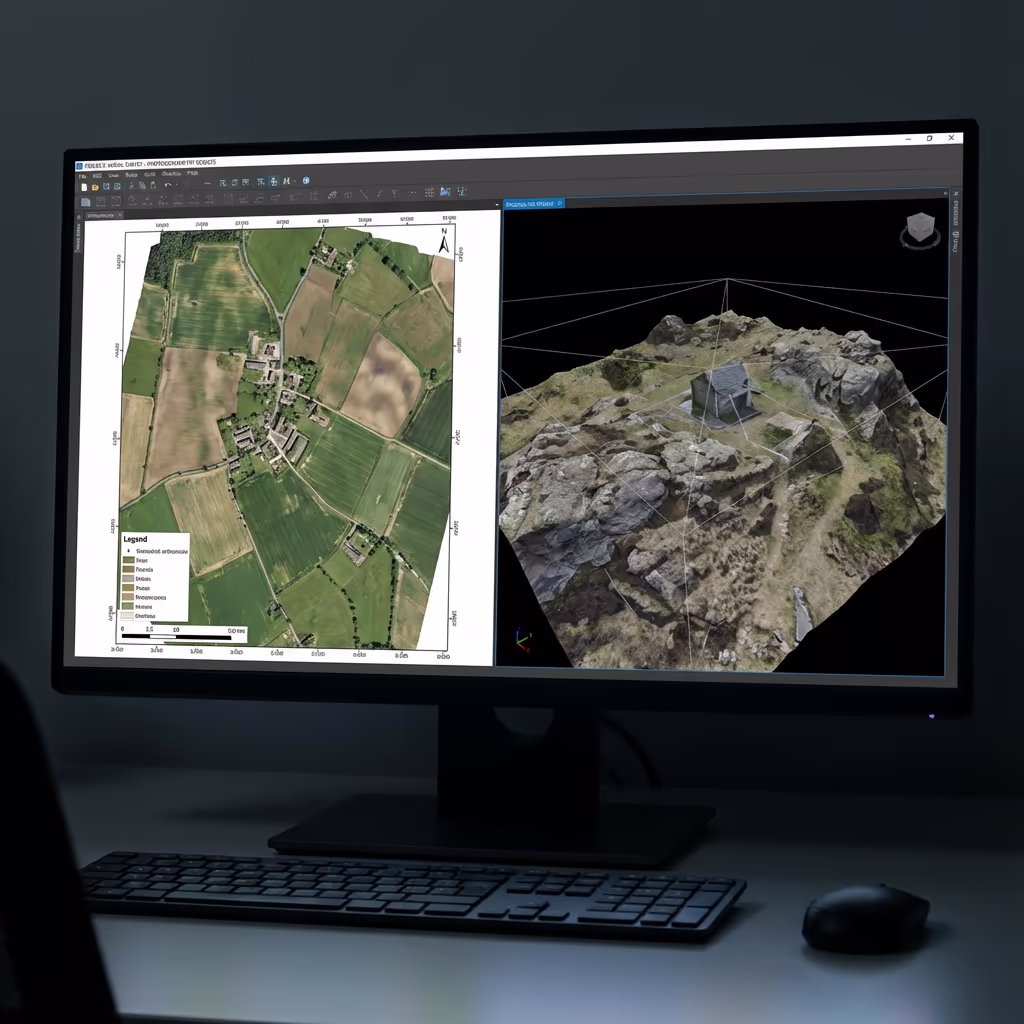
From this point cloud, we derive surface models, contours, and textured 3D meshes. The photographic data also yields geo-referenced orthomosaics—seamless, distortion-free drone maps merging the visual richness of photographs with the geometric precision of conventional survey drawings.
Standard Outputs From Drone Photogrammetry Surveys
We customise outputs to match your project specifications. Our typical photogrammetry survey package includes:
Orthomosaic Imagery
High-resolution, geo-referenced drone photography assembled into a seamless, distortion-free map. Ideal for site drawings, progress documentation, and GIS platforms.
3D Point Cloud
Dense point cloud datasets with RGB colour information. Millions of accurately located points for analysis, measurements, and CAD integration.
Digital Surface Model (DSM)
Elevation model capturing all surface elements including buildings, vegetation, and structures. Vital for viewshed analysis and 3D visualisation.
Digital Terrain Model (DTM)
Bare-earth elevation representation on clear sites. Applied in earthworks design, drainage planning, and volume computations.
Contours & CAD Files
Contour lines at your chosen interval, plus DXF/DWG exports prepared for direct import into AutoCAD, Civil 3D, and other engineering software.
Require particular outputs for your scheme?
Drone Photogrammetry Survey Timeframes
Field data collection is exceptionally quick. We can cover 20-50 hectares daily depending on required resolution and weather conditions. A standard 5-hectare construction site requires just 1-2 hours of flight time, plus equipment setup and control point establishment.
Processing and delivery timelines vary with project complexity and your output requirements. Standard deliverables are typically completed within 3-5 working days. For time-critical schemes, we provide accelerated processing with 24-48 hour delivery available for an additional fee.
| Phase | Duration |
|---|---|
| Planning & Permissions | 1-2 days |
| On-Site Data Capture | 2-4 hours |
| Image Processing | 1-2 days |
| Product Generation | 1-2 days |
| Quality Control & Delivery | 1 day |
| Total (Standard) | 3-5 working days |
Fast-Track Processing Offered
Tight deadline? 24-48 hour turnaround available for priority schemes.
Selecting a Drone Photogrammetry Survey Provider
UAV survey providers vary considerably in quality. When assessing potential partners, we advise examining these essential criteria:
- CAA certification – Verify they possess current GVC or legacy PfCO authorisation for commercial work
- Adequate insurance – Public liability and professional indemnity coverage suited to your project scale
- Surveying expertise – Photogrammetry demands specialist understanding of survey precision and deliverables
- Data processing resources – Enquire about their software platforms and quality assurance procedures
- Portfolio examples – Request demonstrations of comparable projects they have delivered
Hire Drone Pilot meets every criterion. We hold CAA approval, carry comprehensive insurance, and have completed photogrammetry projects across construction, planning, infrastructure, and property sectors throughout the UK.
Prepared to engage a dependable survey partner?
Are Drone Photogrammetry Surveys More Economical Than Ground Methods?
In nearly all cases, yes—substantially. Conventional ground-based surveying demands teams of professionals spending days or weeks traversing sites with total stations and GPS gear. For expansive areas, personnel expenses accumulate rapidly.
Our UAV photogrammetry gathers equivalent or superior data in a fraction of the duration. A site that might occupy a ground crew for a week can be captured aerially in hours. The typical cost reduction ranges from 50-70% versus traditional approaches, whilst providing quicker delivery and more thorough visual records. For extensive or intricate sites, the financial advantages become even more pronounced.
Prepared to Talk About Your Photogrammetry Requirements?
Professional guidance • Bespoke pricing • Avg Response within 5 Mins

Peter Leslie
Owner & Drone Pilot
With substantial expertise in surveying and drone operations, Peter personally manages every photogrammetry assignment to guarantee survey-grade precision and professional results.
Quick Guide: UAV Photogrammetry Surveys
Your Survey Outputs
- High-resolution orthomosaic maps
- 3D point cloud (LAS/LAZ)
- Digital Surface Model (DSM)
- Digital Terrain Model (DTM)
- Contours at specified intervals
- CAD files (DXF/DWG)
Share Your Requirements
Receive professional guidance and bespoke pricing.
Drone Pilot Reviews
Why Drone Pilots Rate HireDronePilot 5 Stars
Don't just take our word for it. Here's what drone pilots in our UK network say about getting work through the platform.
“I get relevant commercial briefs with clear scopes, so quoting is fast and accurate. It has helped me win consistent survey work without chasing low-quality leads.”
Adam Carter
Drone Pilot
“Since joining the platform, I have filled gaps in my schedule with quality roof and inspection jobs. The enquiry details are much better than generic lead forms.”
Sophie Bennett
Drone Pilot
“HireDronePilot makes it easier to focus on delivery. I can review project briefs quickly, submit competitive quotes, and pick up work in new regions.”
Daniel Khan
Drone Pilot