Ecology & Habitat Mapping
Drone Environmental Survey Service
Thorough drone assessments for habitat classification, plant community mapping, and ecology baseline studies across environmentally sensitive locations.
Avg Response within 5 Mins • Or call +44 1334 804554
Understanding Drone Ecological Surveys
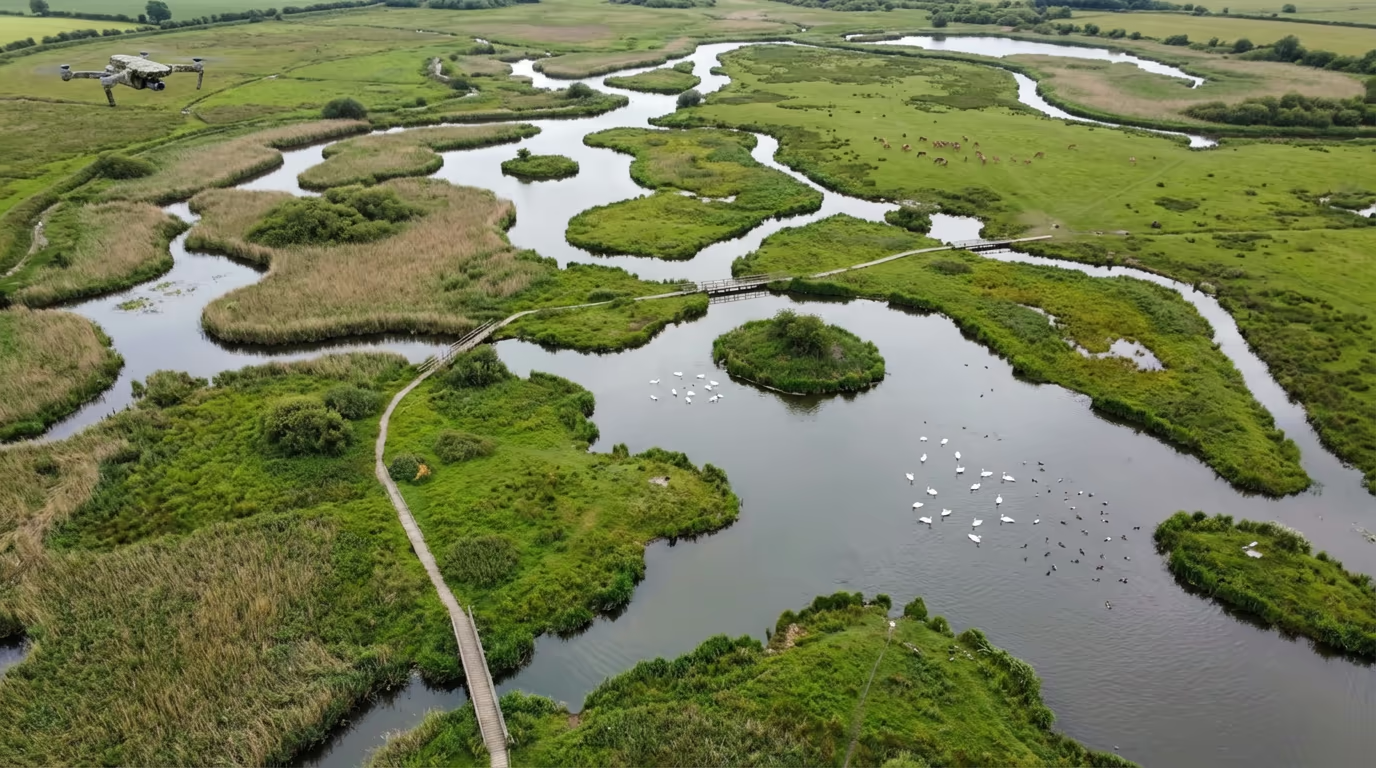
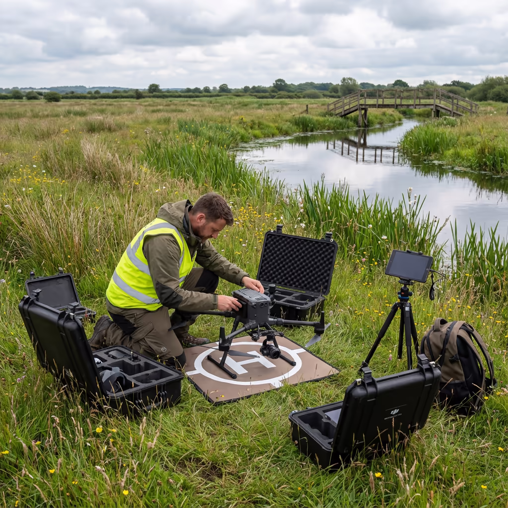
A drone ecological survey employs drone technology to gather detailed imagery and data for habitat assessments, vegetation classification, and environmental monitoring. Our UAVs fitted with high-resolution cameras and multispectral sensors deliver thorough coverage of sensitive locations without the disruption associated with conventional ground-based methods.
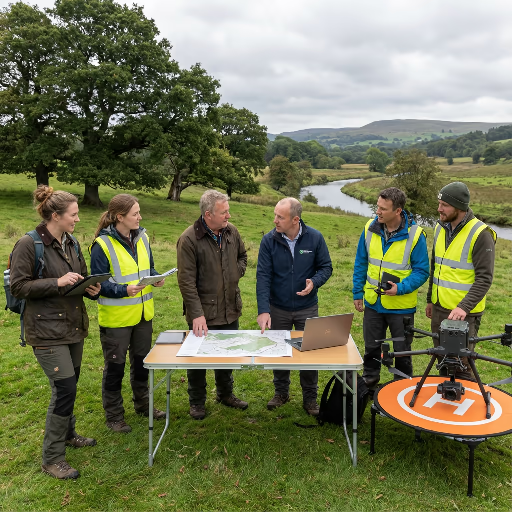
At Hire Drone Pilot, we assist ecologists, environmental consultants, and conservation bodies with accurate drone data that identifies habitat boundaries, vegetation condition, and ecological features across sites of any scale. From SSSI assessments to biodiversity net gain calculations, our drone ecological surveys provide the spatial information your project demands.

Peter Leslie
Owner & Drone Pilot
"Have questions? Ring me directly - I'm happy to discuss your project requirements."
Call NowHabitat Data Collection,Without Disturbance
What You'll Receive
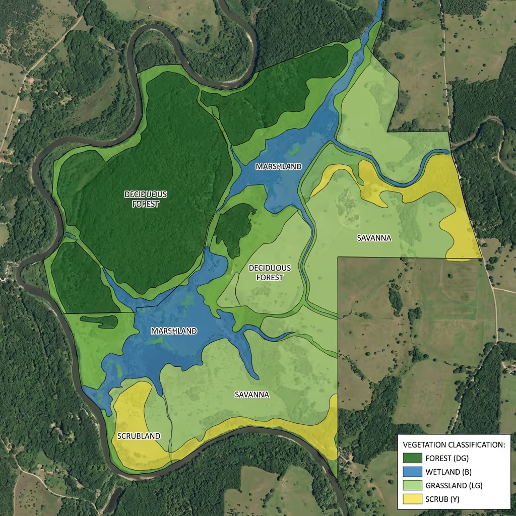
- Habitat classification maps (Phase 1/UKHab)
- Vegetation health indices (NDVI)
- High-resolution orthomosaics
- Environmental baseline data
Delivered in 5-7 working days
Why Use HireDronePilot
- CAA approved & fully insured
- Minimal site disturbance
- Multispectral sensor capability
- Nationwide service delivery
Relied upon by ecologists, conservation organisations & environmental consultants throughout Britain.
Relied upon by leading organisations
What Does an Drone Ecological Survey Cost?
Investment varies based on project scale and required outputs. Here is a guide to assist with budgeting:
| Project Size | Guide Price |
|---|---|
| SmallUnder 5 ha | £600+ |
| Medium5-20 ha | £1,200+ |
| Large20-50 ha | £2,200+ |
| Major50+ ha | POA |
| Seasonal MonitoringRepeat surveys | POA |
*Guide prices include standard deliverables. Final quotation based on site complexity, access, and specific requirements.
Factors influencing your quotation
- Site size & habitat complexity
- Required classification level
- Sensor requirements
- Seasonal timing constraints
Our UAV-based approach typically delivers savings of 40-60% compared to conventional ground-based habitat assessments whilst minimising disturbance to sensitive wildlife. Share your project details and we will provide a bespoke quotation within 24 hours.
Prepared to receive a quotation for your project?
Complimentary, obligation-free quotes within 24 hours
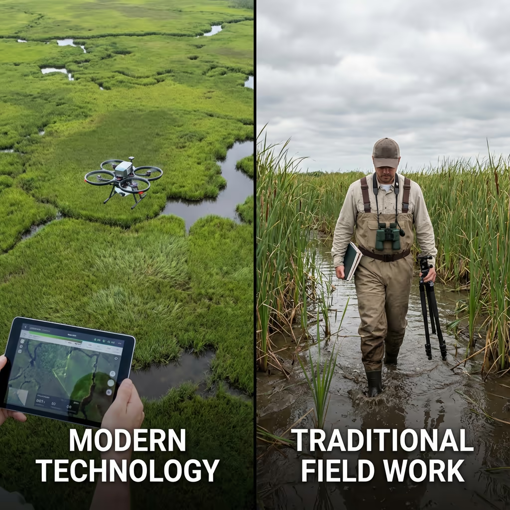
How Do Drone Ecological Surveys Compare to Traditional Methods?
Conventional habitat assessments require ecologists to walk transects across sites, manually documenting habitat types and features. Whilst this ground-truthing remains valuable, it proves time-consuming, costly for large sites, and can cause considerable disturbance—particularly during sensitive nesting or breeding periods.
Drone ecological surveys capture the entire site in a fraction of the time with zero ground disturbance. Our drone imagery delivers complete coverage that is unachievable on foot, whilst multispectral sensors reveal vegetation health patterns invisible to the human eye. The outcome is faster, more thorough data that complements traditional ecological expertise.
Selecting the Right Approach
Select Drone Ecological Survey
Minimal impact coverage
Select Conventional Survey
In-depth ground verification
Uncertain which approach fits your project?
What Precision Can an Drone Ecological Survey Deliver?
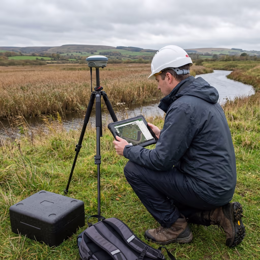
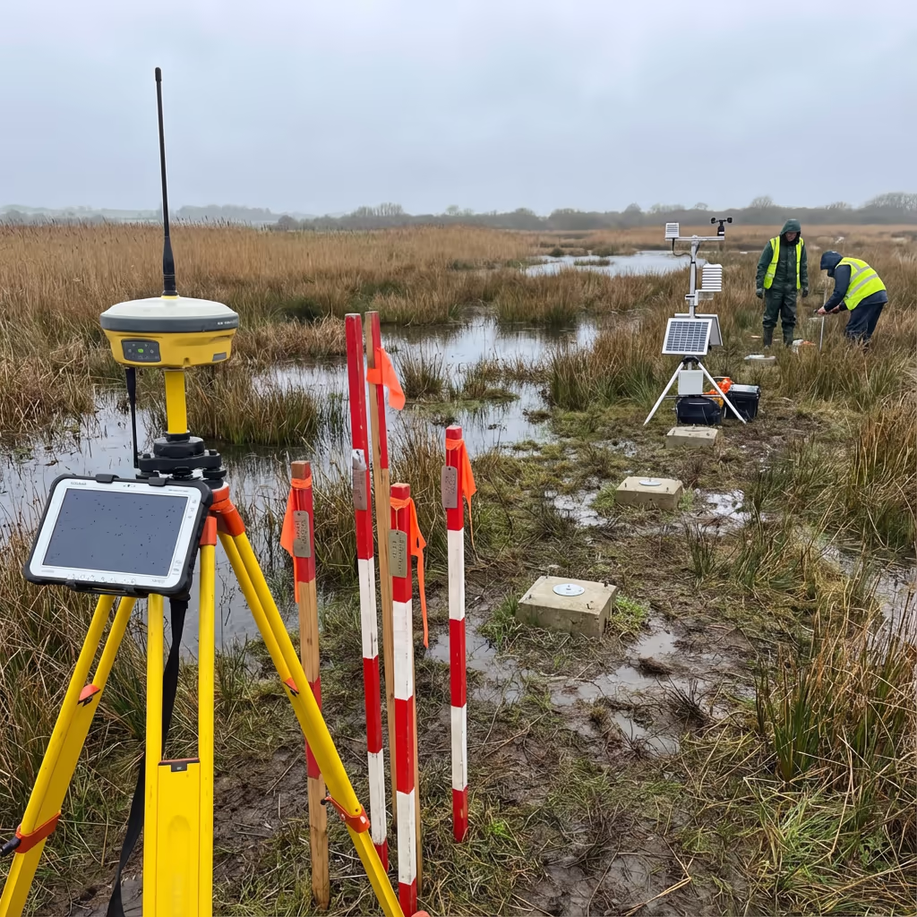
Our drone ecological surveys deliver ground sampling distances (GSD) as fine as 1-2cm per pixel, enabling identification of individual plants and precise habitat boundary delineation. Utilising RTK/PPK positioning, we achieve horizontal accuracy of ±2-5cm—essential for repeatable monitoring and change detection over time.
For vegetation classification, our multispectral sensors capture spectral signatures that distinguish between habitat types with high confidence. When combined with strategic ground-truthing points, our habitat maps meet or exceed the accuracy requirements for Phase 1 habitat surveys, UKHab classification, and biodiversity net gain assessments.
Where Are Drone Ecological Surveys Applied?
Drone ecological surveys support a broad spectrum of conservation and environmental applications. Here are the principal use cases where our clients realise the greatest value:
Biodiversity Net Gain (BNG)
Precise habitat baseline mapping for metric calculations, pre- and post-development monitoring, and ongoing stewardship documentation.
SSSI & Protected Site Monitoring
Condition assessments for Sites of Special Scientific Interest, SACs, SPAs, and local wildlife sites without causing disturbance.
Habitat Restoration Projects
Monitor vegetation establishment, invasive species spread, and restoration progress over seasonal and annual cycles.
Environmental Impact Assessment
Swift baseline surveys for EIA, identifying ecological constraints and opportunities for development projects.
Wetland & Coastal Surveys
Chart fragile wetland habitats, saltmarsh extent, and coastal vegetation without disturbing sensitive areas.
Agricultural & Estate Management
Identify field margins, hedgerow condition, and habitat features for environmental stewardship schemes.
Have an ecological project requiring drone assessment?
Can UAVs Map Habitats and Vegetation?
Absolutely—this is where drone ecological surveys truly shine. Utilising high-resolution RGB imagery combined with multispectral sensors, we capture detailed spectral signatures that distinguish between grassland types, scrub, woodland, wetland, and other habitat categories with remarkable precision.
Our vegetation classification workflows produce habitat maps aligned with Phase 1, UKHab, or NVC classification systems as required. We calculate vegetation indices like NDVI to reveal plant health patterns invisible to standard photography—essential for identifying stressed vegetation, invasive species spread, or areas of poor establishment in restoration projects.
For long-term monitoring, our georeferenced datasets enable precise change detection between survey dates. You can monitor habitat loss or gain, vegetation succession, and the effectiveness of management interventions with quantified metrics rather than subjective observation.
What Outputs Do You Receive From an Drone Ecological Survey?
We customise deliverables to your project requirements and the ecological frameworks you are working within. Our standard environmental survey outputs include:
Habitat Classification Maps
Georeferenced habitat maps aligned with Phase 1, UKHab, or NVC classification systems with habitat areas precisely calculated.
Vegetation Health Indices (NDVI)
Normalised Difference Vegetation Index maps revealing plant vigour, stress patterns, and biomass distribution throughout your site.
High-Resolution Orthomosaic
Georeferenced drone imagery at 1-2cm per pixel resolution, suitable for detailed ecological interpretation and documentation.
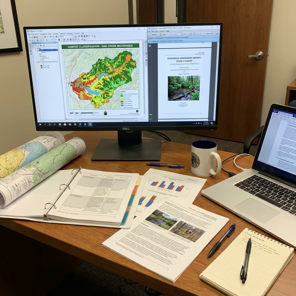
Environmental Baseline Report
Comprehensive report with habitat areas, key ecological features, and recommendations for additional survey or management.
CAD & GIS Files
Habitat polygons and survey data in DWG, DXF, Shapefile, and GeoPackage formats for seamless integration with your CAD and GIS systems.
3D Site Models
Digital Surface Models and terrain data for visualisation, drainage analysis, and landscape planning purposes.
Require specific deliverables for your project?
What Is the Duration of an Drone Ecological Survey?
On-site data capture is remarkably efficient. We can survey 20-50 hectares per day depending on habitat complexity and weather conditions. A typical 10-hectare nature reserve takes just 1-2 hours of flight time, causing minimal disturbance to wildlife compared to days of ground-based assessment.
Processing and analysis depends on your required outputs. Standard habitat maps and orthomosaics are typically delivered within 5-7 working days. For urgent projects, we offer expedited processing with 48-72 hour turnaround available at additional cost. Seasonal timing may affect scheduling—we will discuss optimal survey windows when quoting your project.
| Phase | Duration |
|---|---|
| Planning & Permissions | 1-3 days |
| On-Site Data Capture | ½-1 day |
| Image Processing | 1-2 days |
| Habitat Classification | 2-3 days |
| Deliverable Generation | 1-2 days |
| Total (Standard) | 5-7 working days |
Priority Processing Available
Need it sooner? 48-72 hour turnaround available for time-sensitive projects.
Selecting an Drone Ecological Survey Provider
Not all drone survey providers grasp the specific requirements of ecological work. When evaluating providers, we recommend checking these key factors:
- CAA authorisation – Verify they hold valid GVC or legacy PfCO permissions for commercial operations
- Ecological awareness – Experience working on sensitive sites with wildlife disturbance protocols
- Appropriate sensors – Multispectral capability for vegetation analysis, not just standard cameras
- Classification expertise – Understanding of Phase 1, UKHab, and ecological frameworks
- Relevant case studies – Request examples of similar ecological projects they've completed
At Hire Drone Pilot, we tick every box. We're CAA approved, fully insured, and have delivered environmental surveys for nature reserves, rewilding projects, BNG assessments, and conservation organisations throughout the UK.
Ready to work with a trusted environmental survey provider?
Is Drone Environmental Survey Cheaper Than Traditional Methods?
In most scenarios, yes—significantly. Traditional habitat surveys require teams of ecologists walking transects for days, which quickly becomes expensive for large or complex sites. Access difficulties in wetlands, dense vegetation, or steep terrain add further time and cost.
Our drone environmental surveys capture equivalent or better spatial data in a fraction of the time. A site that might take a ground team a week to survey can be flown in hours. The cost savings typically range from 40-60% compared to traditional methods, while providing more complete coverage and consistent documentation. For repeat monitoring surveys, the economics become even more favourable—your baseline data enables rapid comparison without starting from scratch.
Ready to Discuss Your Environmental Project?
Expert advice • Tailored pricing • Avg Response within 5 Mins

Peter Leslie
Owner & Drone Pilot
With extensive experience in surveying and UAV operations, Peter personally oversees every environmental survey project to ensure accurate data capture with minimal ecological disturbance.
TLDR: Drone Ecological Surveys Explained
Ecological Survey Outputs
- Habitat classification maps
- Vegetation indices (NDVI)
- Species identification data
- Environmental baseline report
- CAD & GIS files
- 3D site models
Talk Through Your Project
Receive specialist guidance and bespoke pricing.
Drone Pilot Reviews
Why Drone Pilots Rate HireDronePilot 5 Stars
Don't just take our word for it. Here's what drone pilots in our UK network say about getting work through the platform.
“I get relevant commercial briefs with clear scopes, so quoting is fast and accurate. It has helped me win consistent survey work without chasing low-quality leads.”
Adam Carter
Drone Pilot
“Since joining the platform, I have filled gaps in my schedule with quality roof and inspection jobs. The enquiry details are much better than generic lead forms.”
Sophie Bennett
Drone Pilot
“HireDronePilot makes it easier to focus on delivery. I can review project briefs quickly, submit competitive quotes, and pick up work in new regions.”
Daniel Khan
Drone Pilot
Complementary Survey Services
LiDAR Mapping
Penetrate vegetation canopy to map ground terrain for ecological baseline and habitat assessment.
Topographic Survey
Detailed terrain mapping for environmental planning, flood modelling, and site assessment.
Drone Survey
Comprehensive drone surveys delivering precise data and 3D models for any application.