Terrain Mapping Solutions
Drone Topographic Survey Service
Survey-grade terrain mapping through advanced UAV photogrammetry. Precise contour data, digital terrain models, and CAD-compatible outputs for development, planning, and civil engineering.
Avg Response within 5 Mins • Or phone +44 1334 804554
Understanding Drone Topographic Surveys
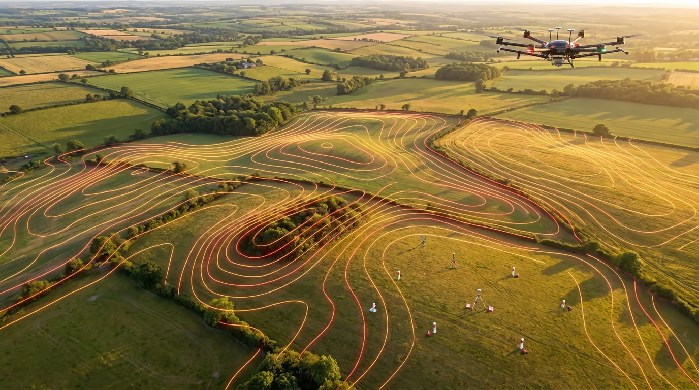
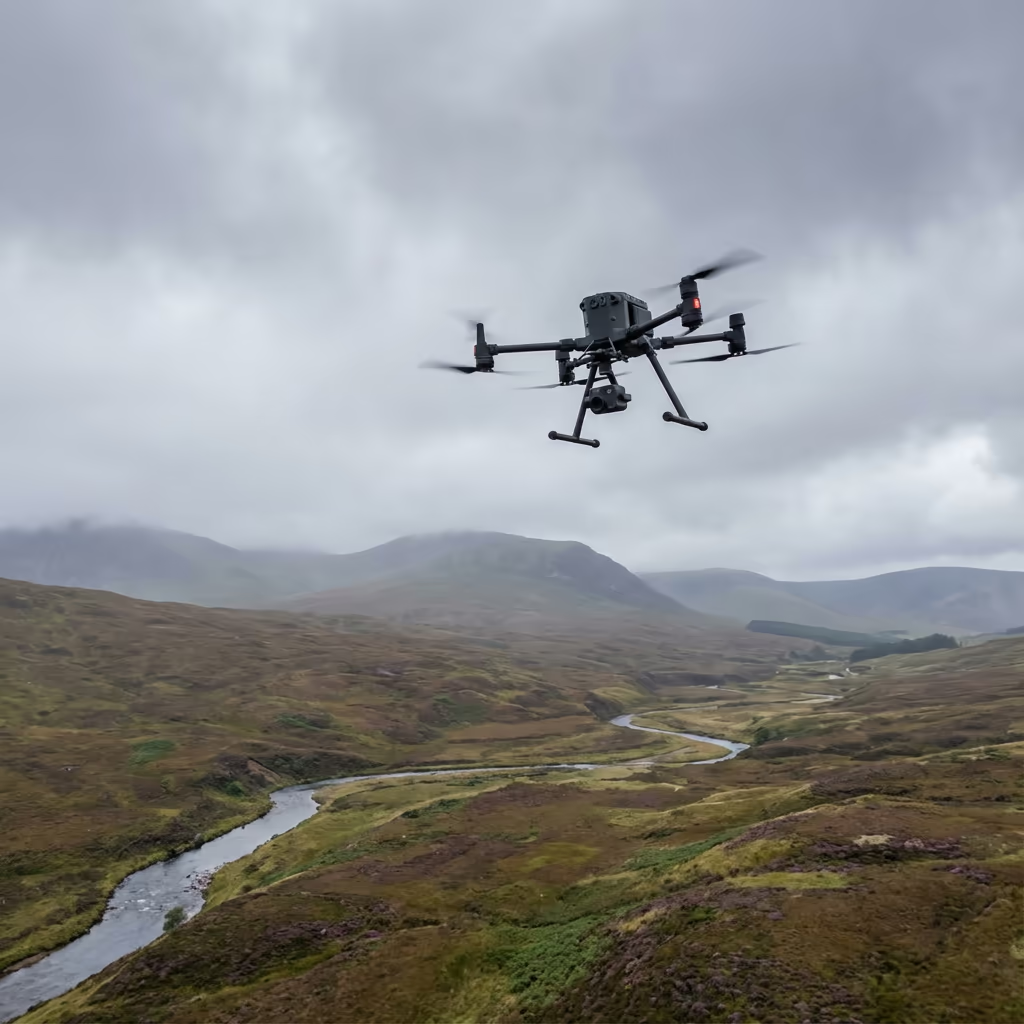
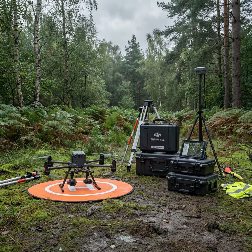
UAV topographic surveys harness high-resolution drone imagery and photogrammetric processing to generate comprehensive terrain maps, feature records, and elevation data. Our aircraft capture thousands of overlapping photographs that transform into precise 3D models, contour drawings, and CAD-ready files for planning submissions and engineering projects.
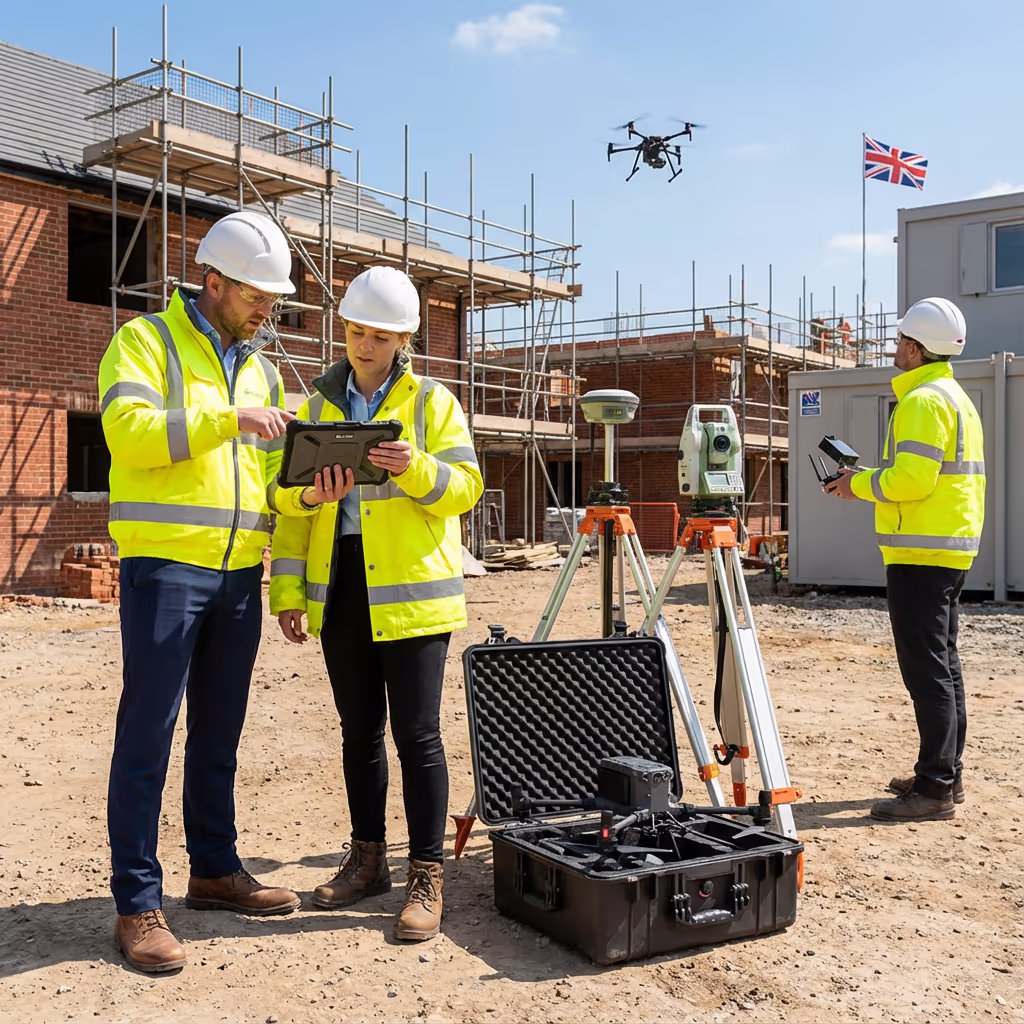
Hire Drone Pilot produces RICS-compliant topographic data that satisfies the demands of planning departments, architectural practices, and civil engineering firms. Our photogrammetry methodology suits open land, active construction zones, and development plots requiring accurate ground elevations, boundary delineation, and feature mapping.
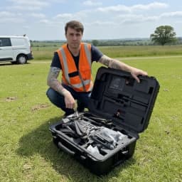
Peter Leslie
Owner & Drone Pilot
"Have questions? Ring me directly - I'm happy to discuss your project requirements."
Call NowSurvey-Grade Terrain Data,Rapid Turnaround
What You'll Receive
- Orthomosaic map (GeoTIFF)
- Digital Terrain Model (DTM)
- Contours at your specified interval
- CAD files (DWG/DXF)
Ready in 5-7 working days
Why Use HireDronePilot
- CAA approved & fully insured
- RICS-compliant deliverables
- Latest DJI drone technology
- UK-wide coverage
Relied upon by architects, property developers & councils throughout the UK.
Relied upon by industry leaders
Drone Topographic Survey Pricing Guide
Costs vary based on project requirements. Use this reference for budget planning:
| Project Size | Guide Price |
|---|---|
| MicroUnder 1 ha | £800+ |
| Small1–5 ha | £1,200+ |
| Medium5–20 ha | £2,000+ |
| Large20–50 ha | £3,500+ |
| Enterprise50–100 ha | £6,000+ |
| Major Projects100+ ha | POA |
*Indicative rates cover standard outputs. Actual quotations reflect terrain difficulty, accessibility, and particular needs.
Factors Influencing Your Quote
- Site size & terrain
- Required deliverables
- Turnaround time
- Access requirements
Our UAV methodology typically delivers savings of 40–60% versus conventional ground surveys. Share your project specifications and we'll send a bespoke quotation within 24 hours.
Prepared to receive a quotation?
Complimentary, obligation-free quotes within 24 hours
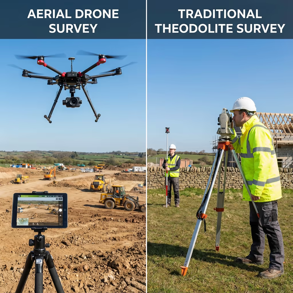
Drone vs Conventional Topographic Survey Methods
Conventional topographic surveys rely on total stations and GPS instruments, requiring surveyors to traverse the site collecting individual point measurements. While highly precise, this approach demands considerable time, particularly across larger areas. Each measurement point needs separate recording, potentially taking days or weeks on complex schemes.
UAV topographic surveys gather thousands of data points during a single flight, producing a complete digital representation of your site. We attain comparable precision in a fraction of the time, making drone surveys perfect for expansive areas, challenging terrain, or deadline-driven projects where ground-based methods prove impractical or costly.
Selecting the Right Approach
Opt for UAV Survey
Efficiency & reach
Opt for Ground Survey
Granular detail
Uncertain which approach fits your project?
Precision Levels in Drone Topographic Surveys
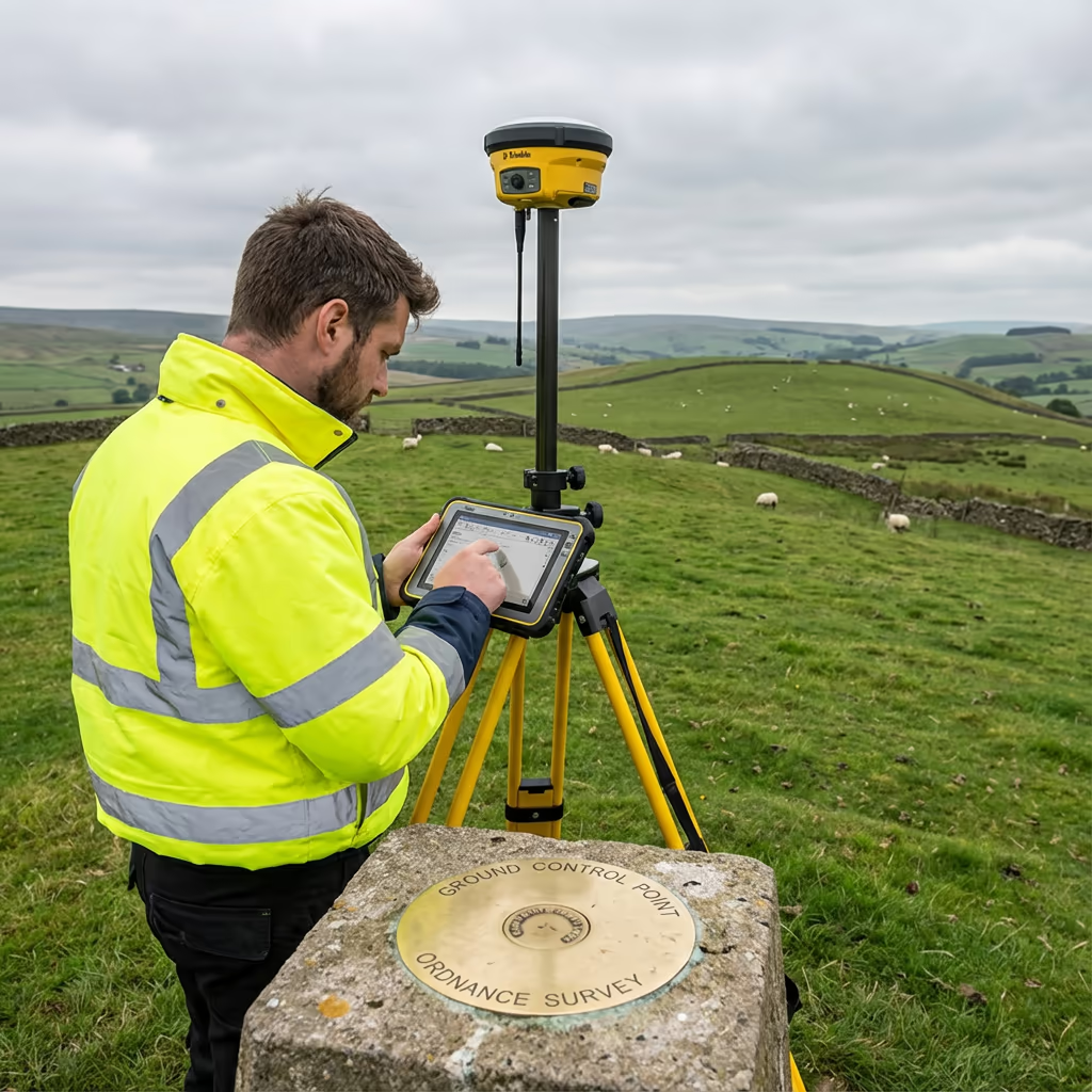
Our UAV topographic surveys consistently attain vertical accuracy of ±3-5cm and horizontal accuracy of ±2-5cm with ground control points in place. This precision standard satisfies the demands of planning submissions, engineering design work, and construction schemes throughout the UK.
We deploy RTK-enabled aircraft equipped with survey-grade GNSS receivers for exact positioning of each captured image. Paired with precisely established ground control points and meticulous photogrammetric workflows, we produce data that architects, engineers, and planning officials can depend upon for critical design choices.
Common Uses for Drone Topographic Surveys
UAV topographic surveys serve numerous planning, engineering, and development purposes. These are the primary applications where our clients gain the most benefit:
Planning Submissions
Precise site drawings depicting current levels, features, and perimeters for outline and detailed planning applications to councils.
Civil Engineering Projects
Comprehensive terrain information for road design, drainage analysis, earthwork scheduling, and infrastructure viability assessments.
Construction Monitoring
As-built documentation, progress tracking, and cut/fill volume analysis for housing, commercial, and industrial builds.
Property Registration
Perimeter surveys and area measurements for land registry filings, property transactions, and legal records.
Flood Risk Analysis
Precise elevation records for flood simulation, drainage planning, and Environment Agency risk evaluations.
Linear Infrastructure
Corridor surveys for highways, rail lines, pipelines, and utility routes demanding thorough terrain data.
Working on a project requiring topographic data?
Site Elements Captured by Drone Topographic Surveys
Our drone surveys record an extensive array of site elements visible from above. High-resolution photography and 3D point clouds enable precise mapping and measurement of everything across your property, delivering the detail required for planning and design purposes.
The following features can be identified and recorded from our drone datasets:
For elements not visible from above—including underground utilities, vegetation-obscured manholes, or exact boundary markers—we suggest pairing drone survey with focused ground measurements to guarantee comprehensive coverage.
Standard Outputs From Drone Topographic Surveys
We customise outputs to match your project specifications. Our typical topographic survey package includes:
Orthomosaic Imagery
High-resolution georeferenced drone photography covering your complete site. Ideal for planning drawings and visual records.
Digital Terrain Model (DTM)
Bare-earth representation displaying ground elevations. Vital for drainage planning, earthwork volumes, and flood analysis.
Digital Surface Model (DSM)
Upper surface encompassing buildings, vegetation, and structures. Applied in viewshed studies and 3D rendering.
Contour Drawings
Contour lines at your chosen interval (typically 0.25m, 0.5m, or 1m) illustrating site terrain clearly.
CAD Files (DWG/DXF)
Industry-standard drawings compatible with AutoCAD, Civil 3D, and other engineering software platforms.
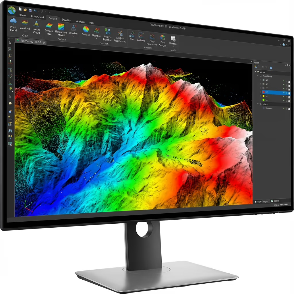
3D Point Clouds
Dense point cloud datasets for thorough analysis, measurements, and BIM workflow integration.
Require particular outputs for your scheme?
Drone Topographic Survey Timeframes
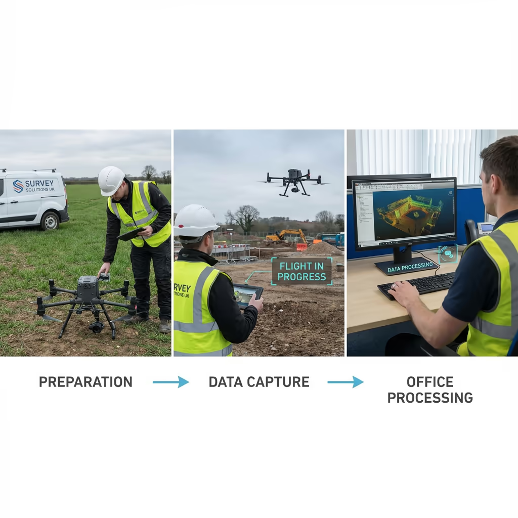
Field data collection is exceptionally quick. We can cover 20-50 hectares daily depending on terrain and weather conditions. A standard 5-hectare development plot requires just 1-2 hours of flight time, plus equipment setup and control point establishment.
Processing and delivery timelines vary with project complexity and your output requirements. Standard deliverables are typically completed within 5-7 working days. For time-critical schemes, we provide accelerated processing with 48-72 hour delivery available for an additional fee. We'll outline realistic schedules when quoting your project.
| Phase | Duration |
|---|---|
| Planning & Permissions | 1-3 days |
| On-Site Data Capture | ½-1 day |
| Photogrammetric Processing | 2-3 days |
| Surface Generation & QC | 1-2 days |
| Deliverable Generation | 1-2 days |
| Total (Standard) | 5-7 working days |
Fast-Track Processing Offered
Tight deadline? 48-72 hour turnaround available for priority schemes.
Selecting a Drone Topographic Survey Provider
UAV survey providers vary considerably in quality. When assessing potential partners, we advise examining these essential criteria:
- CAA certification – Verify they possess current GVC or legacy PfCO authorisation for commercial work
- Adequate insurance – Public liability and professional indemnity coverage suited to your project scale
- Surveying expertise – Topographic work demands specialist knowledge beyond piloting skills
- Data processing resources – Enquire about their software platforms and quality assurance procedures
- RICS adherence – For planning submissions, confirm outputs satisfy RICS specifications
Hire Drone Pilot meets every criterion. We hold CAA approval, carry comprehensive insurance, and have completed topographic surveys for planning submissions, engineering works, and developments throughout the UK.
Prepared to engage a dependable survey partner?
Are Drone Topographic Surveys More Economical Than Ground Methods?
In the majority of cases, substantially so. Ground-based surveys necessitate surveyors recording each point separately, traversing the whole site carrying GPS or total station instruments. For sizeable areas, this process can span days and demands multiple personnel on location.
Our drone surveys gather equivalent information in a fraction of the time. A 10-hectare site that might occupy a ground crew for 3-4 days can be captured in 2-3 hours by drone. Cost reductions typically fall between 40-60% versus traditional techniques, whilst providing quicker delivery and complete site coverage instead of spot measurements. For extensive or intricate sites, the financial advantage grows even greater.
Prepared to Explore Your Topographic Requirements?
Professional guidance • Bespoke quotations • Avg Response within 5 Mins

Peter Leslie
Owner & Drone Pilot
Drawing on substantial surveying and UAV expertise, Peter directly supervises each topographic project to guarantee survey-grade precision and professional results.
Quick Guide: Topographic Survey Overview
Survey Outputs Included
- Orthomosaic maps (GeoTIFF)
- Digital Terrain Model (DTM)
- Digital Surface Model (DSM)
- Contour plans
- CAD files (DWG/DXF)
- 3D point clouds
Share Your Requirements
Receive specialist guidance and bespoke pricing.
Drone Pilot Reviews
Why Drone Pilots Rate HireDronePilot 5 Stars
Don't just take our word for it. Here's what drone pilots in our UK network say about getting work through the platform.
“I get relevant commercial briefs with clear scopes, so quoting is fast and accurate. It has helped me win consistent survey work without chasing low-quality leads.”
Adam Carter
Drone Pilot
“Since joining the platform, I have filled gaps in my schedule with quality roof and inspection jobs. The enquiry details are much better than generic lead forms.”
Sophie Bennett
Drone Pilot
“HireDronePilot makes it easier to focus on delivery. I can review project briefs quickly, submit competitive quotes, and pick up work in new regions.”
Daniel Khan
Drone Pilot
Complementary Solutions
Drone Survey
Full-coverage drone surveys producing accurate mapping datasets and 3D representations.
LiDAR Mapping
Advanced laser scanning penetrating vegetation canopy for comprehensive terrain modelling.
Volume Calculations
Precise stockpile quantification and earthwork cut/fill analysis from drone datasets.