Building Inspection
Drone Facade Survey Service
Secure, economical building exterior inspections without scaffolding, abseil access, or elevated platforms. Thorough defect detection for structures of any height.
Avg Response within 5 Mins • Or call +44 1334 804554
Understanding Drone Facade Assessments
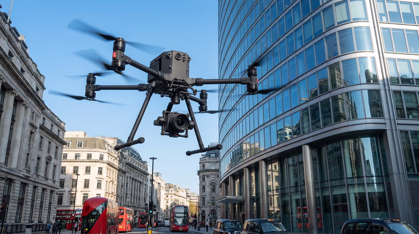
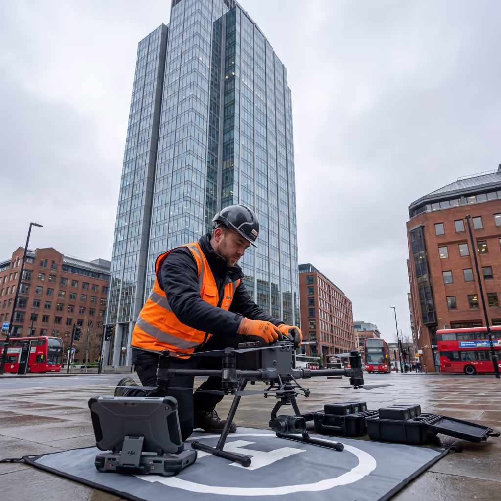
A drone facade assessment employs high-resolution cameras and thermal detection sensors fitted to our UAVs to gather comprehensive imagery of building exteriors. This enables us to spot defects, damage, and degradation across the complete facade without requiring scaffolding, boom lifts, or abseil crews.
At Hire Drone Pilot, we operate cutting-edge drone technology capable of capturing sub-millimetre precision from secure operating distances. Our assessments uncover cracks, water penetration, deteriorated sealants, unstable cladding, and structural concerns that would otherwise demand costly access equipment to examine.

Peter Leslie
Owner & Drone Pilot
"Have questions? Ring me directly - I'm happy to discuss your project requirements."
Call NowThorough Exterior Assessments,Zero Scaffolding Needed
What You'll Receive
- Ultra-sharp facade photography
- Comprehensive defect documentation
- Condition mapping & classification
- Thermal irregularity detection
Delivered in 5-7 working days
Why Use HireDronePilot
- CAA certified & comprehensively insured
- No elevated work hazards
- State-of-the-art drone & camera systems
- Nationwide coverage
Relied upon by facilities managers, chartered surveyors & property owners throughout the UK.
Relied upon by major organisations
What Does an Drone Facade Assessment Cost?
Pricing varies based on building height, facade intricacy, and required outputs. Below is a reference to assist with budgeting:
| Building Type | Guide Price |
|---|---|
| Low-rise1-3 storeys | £400+ |
| Medium-rise4-8 storeys | £700+ |
| High-rise9-15 storeys | £1,200+ |
| Tall Building15+ storeys | £2,000+ |
| Multi-buildingCampus | POA |
*Reference prices encompass standard outputs. Final quotation depends on building intricacy, access needs, and particular requirements.
Factors Influencing Your Quote
- Structure height & intricacy
- Number of elevations
- Required outputs
- Thermal scanning needs
Our UAV-based approach typically delivers savings of 60-80% compared to scaffolding or abseil inspections. Send us your building particulars and we'll furnish a customised quotation within 24 hours.
Prepared to receive a quotation for your structure?
Complimentary, no-commitment quotes within 24 hours
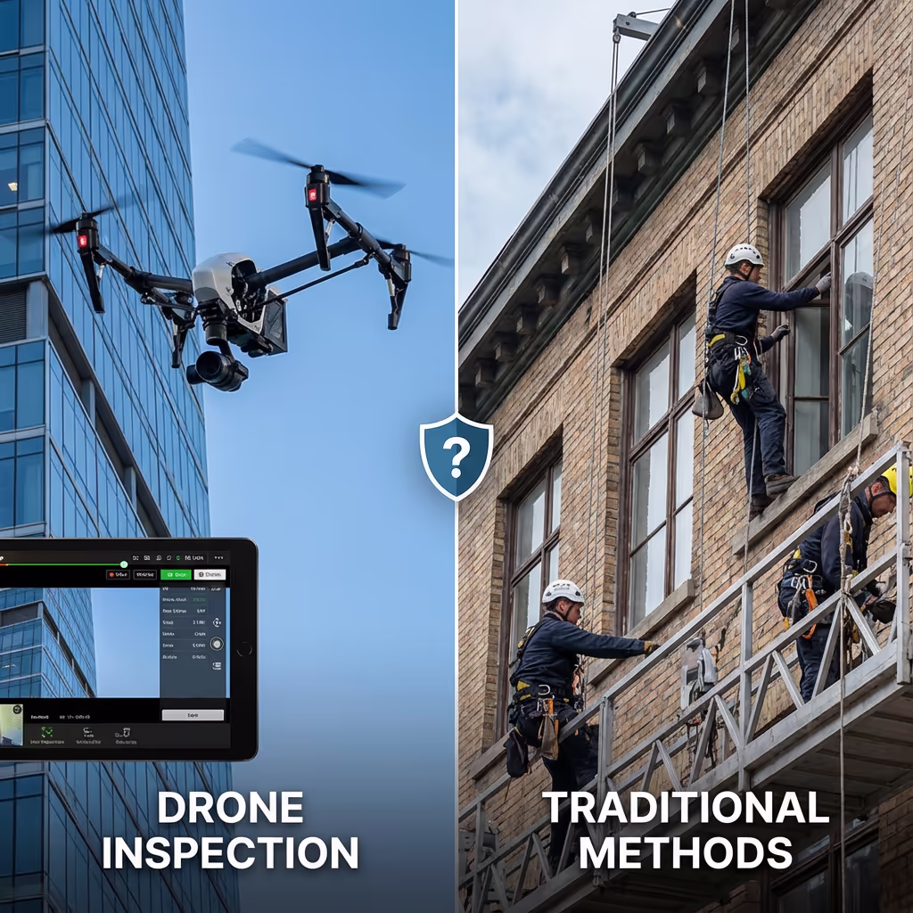
How Does Drone Facade Assessment Compare to Abseil Access?
Conventional facade inspections demand either scaffolding, boom lifts, or abseil teams. These approaches are costly, time-intensive, and present considerable health and safety hazards. Elevated work remains among the primary causes of workplace fatalities within the UK construction sector.
Drone facade assessments remove all elevated work hazards by maintaining personnel securely at ground level. Our drones gather imagery that's frequently more comprehensive than visual inspection, and can reach zones that would be challenging or unfeasible to access via traditional methods—such as balcony undersides or areas adjacent to obstacles.
Selecting the Right Approach
Select Drone Facade Assessment
Secure & budget-friendly
Consider Abseil Access
Physical intervention required
Uncertain which approach fits your project?
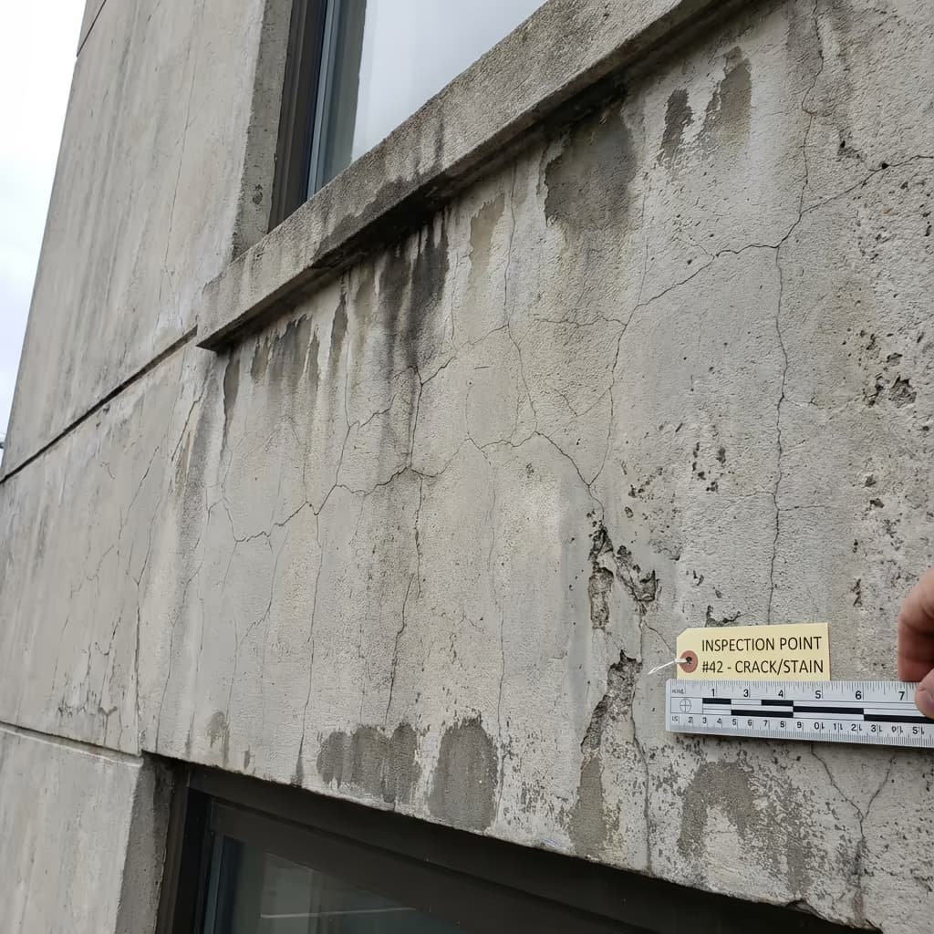
What Precision Can an Drone Facade Assessment Deliver?
Our drone facade assessments gather imagery at resolutions of 2-5mm per pixel, enabling us to spot hairline cracks, minor degradation, and early-stage defects that might escape notice during conventional visual inspections. This degree of clarity surpasses what's attainable by the human eye from scaffolding or abseil access.
For thermal scanning surveys, we employ radiometric cameras detecting temperature differences as minimal as 0.05 degrees Celsius. This enables us to pinpoint moisture penetration, insulation failures, and thermal bridging with exact precision. All imagery is geotagged and can be superimposed onto building elevations for accurate defect position mapping.
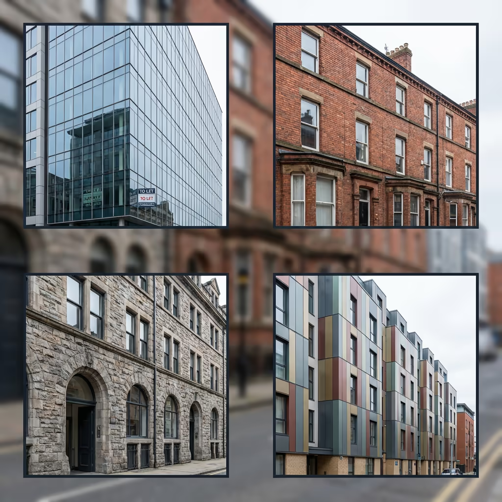
Where Are Drone Facade Assessments Used?
Drone facade assessments address a broad spectrum of building inspection and asset management requirements. Below are the principal applications where our clients realise the most value:
Cladding Examinations
Post-Grenfell compliance verification, ACM detection, cladding condition reviews for building safety cases and EWS1 documentation.
Scheduled Maintenance
Programmed facade condition reviews for upkeep planning, budgeting, and lifecycle expense analysis.
Pre-Purchase Assessments
Due diligence examinations for property acquisitions, spotting potential remediation expenses before purchase.
Insurance Documentation
Recording storm damage, impact damage, or defects for insurance claims with timestamped evidence.
Historic Structures
Non-intrusive inspection of protected buildings, churches, and heritage structures where access faces restrictions.
Defect Examination
Investigating reported defects, water penetration, cracking, or structural issues without access equipment.
Have a structure requiring inspection?
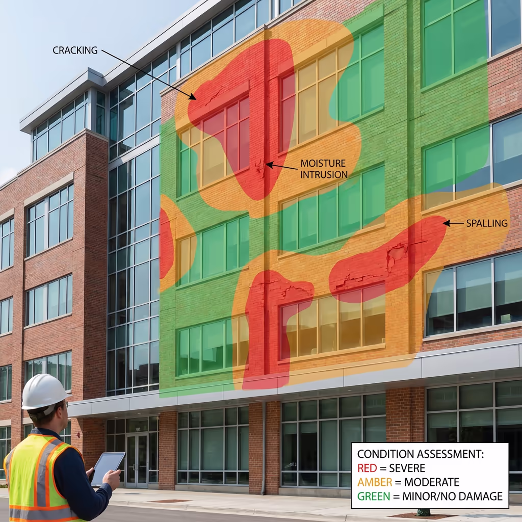
What Issues Can Drone Facade Assessments Detect?
Our high-resolution cameras and thermal sensors can detect an extensive array of facade defects and degradation:
Visible Defects
- Fine and structural fracturing
- Spalling and surface degradation
- Deteriorated or absent sealants
- Unstable or compromised cladding panels
- Oxidation and rust marking
- Plant growth and organic staining
- Impact damage and vandalism
- Absent or damaged fixings
Thermal Anomalies
- Moisture penetration and dampness
- Insulation failures and gaps
- Thermal bridging
- Air leakage routes
- Concealed water damage
- Delamination under render
- Failed cavity barriers
- HVAC efficiency problems
Every defect is recorded with high-resolution imagery, exact position mapping, and severity classification to support upkeep planning and remediation prioritisation.
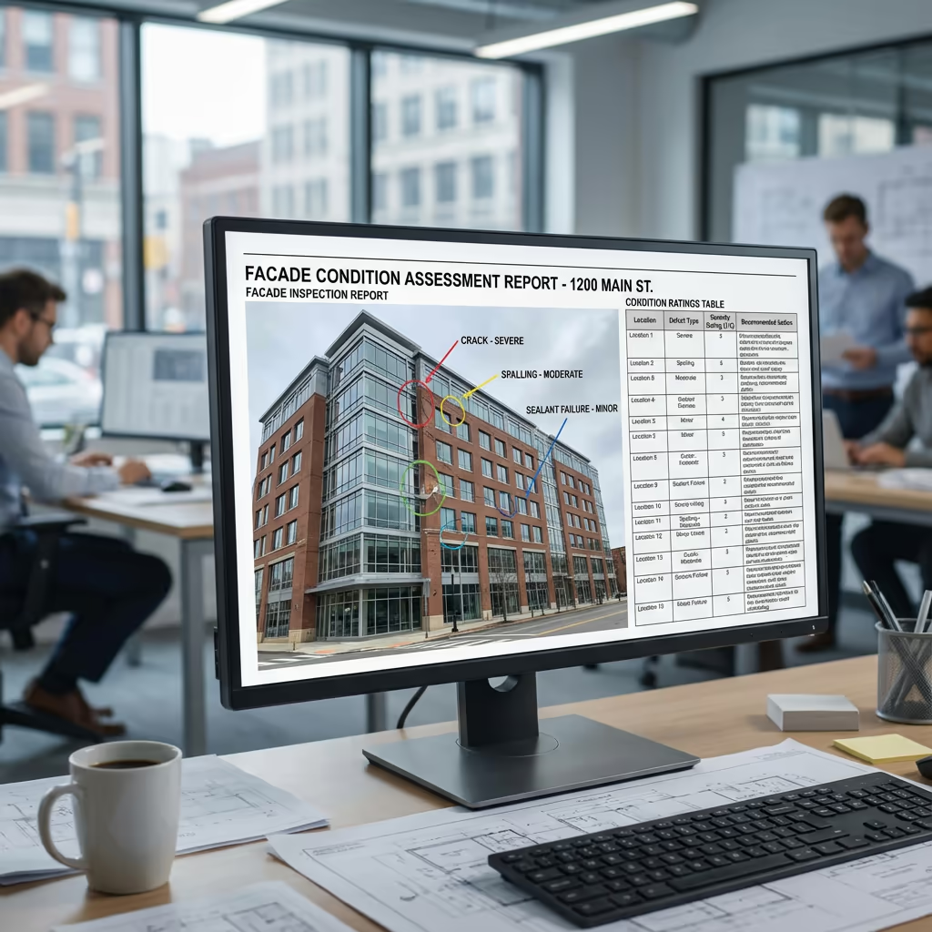
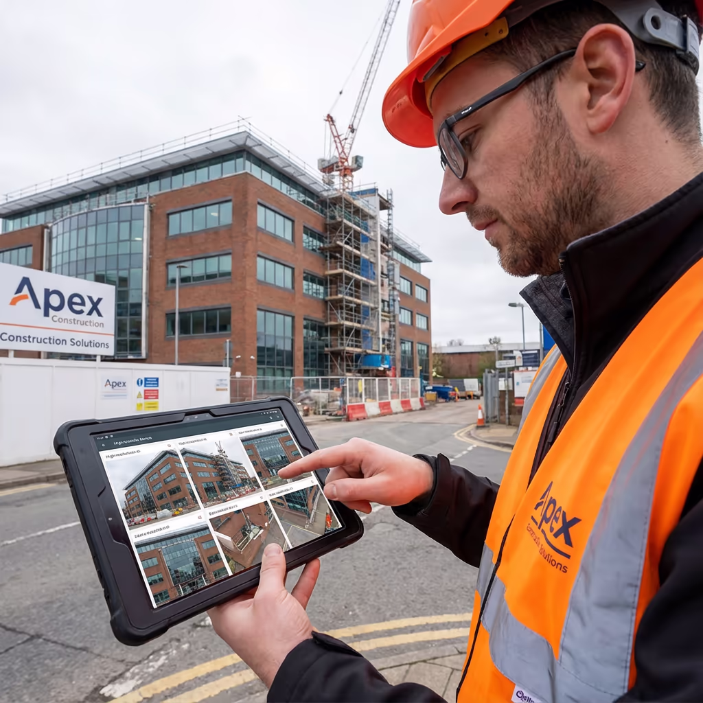
What Outputs Do You Receive From an Drone Facade Assessment?
We customise outputs to match your project needs, but our standard drone facade assessment package comprises:
Ultra-Sharp Facade Photography
Complete photographic archive of all elevations at 2-5mm resolution, organised by facade with metadata.
Defect Documentation
Thorough report cataloguing all discovered defects with severity classifications, positions, and suggested actions.
Condition Charts
Elevation drawings with defects plotted and colour-graded by severity (red/amber/green) for visual evaluation.
3D Representations (Optional)
Photogrammetric 3D model of building exteriors for measurement, visualisation, and BIM compatibility.
CAD Drawings (Optional)
Scaled elevation drawings in DWG/DXF format with defect annotations for remediation scheduling.
Require particular outputs for your project?
What's the Duration of an Drone Facade Assessment?
On-site data gathering is exceptionally swift compared to conventional approaches. A standard medium-rise structure (4-8 storeys) can be assessed in 2-4 hours, covering all four elevations. High-rise buildings require additional time but typically complete within a single day.
Processing and report delivery hinges on building intricacy and required outputs. Standard deliverables are generally complete within 5-7 working days. For time-sensitive projects, we provide accelerated processing with 48-72 hour turnaround obtainable at supplementary cost.
| Phase | Duration |
|---|---|
| Planning & Permissions | 1-3 days |
| On-Site Data Capture | 2-6 hours |
| Image Processing | 1-2 days |
| Defect Analysis | 2-3 days |
| Report & Deliverables | 1-2 days |
| Total (Standard) | 5-7 working days |
Express Processing Available
Need it faster? 48-72 hour turnaround available for urgent projects.

How Do I Select an Drone Facade Assessment Provider?
Not all drone facade assessment providers deliver the same quality. When appraising providers, we suggest verifying these essential criteria:
- CAA certification – Confirm they possess valid GVC permissions for commercial operations near structures
- Comprehensive insurance – Public liability and professional indemnity coverage suitable for building assessments
- Building assessment expertise – Facade assessments demand specialised knowledge beyond standard drone photography
- Thermal detection capability – Enquire about their thermal cameras and analysis proficiency
- Documentation quality – Request sample reports to evaluate their analysis and presentation calibre
At Hire Drone Pilot, we meet every criterion. We're CAA certified, comprehensively insured, and have completed facade assessments for residential blocks, commercial offices, heritage structures, and industrial premises throughout the UK.
Prepared to engage a dependable facade assessment provider?
Is Drone Facade Assessment More Economical Than Conventional Approaches?
In nearly every case, yes—substantially. Conventional facade inspections demand either scaffolding (costly to construct and remove), cherry pickers (restricted reach, necessitates road closures), or abseil crews (skilled personnel, safety gear, permits). These approaches readily accumulate tens of thousands of pounds for high-rise structures.
Our drone facade assessments gather equivalent or superior data at a fraction of the expense. A structure that might cost £15,000-£20,000 to scaffold for inspection can be assessed by drone for £1,500-£3,000. The cost reductions typically span 60-80% compared to conventional approaches, whilst providing quicker turnaround and frequently more thorough coverage.
Scaffolding
£15,000+
2-3 weeks installation
Abseil Access
£5,000+
3-5 days on-site
Drone Facade Assessment
£1,200+
Same day data gathering
Prepared to Talk Through Your Facade Assessment?
Specialist guidance • Bespoke pricing • Avg Response within 5 Mins

Peter Leslie
Owner & Drone Pilot
With substantial expertise in building assessments and UAV operations, Peter personally supervises every facade inspection to guarantee thorough coverage and professional delivery.
Quick Guide: Drone Facade Assessments Explained
Facade Assessment Outputs
- Ultra-sharp facade photography
- Defect documentation with severity classifications
- Condition charts (RAG)
- 3D representations & measurements
- CAD drawings (DWG/DXF)
- Thermal irregularity analysis
Talk Through Your Project
Receive specialist guidance and bespoke pricing.
Drone Pilot Reviews
Why Drone Pilots Rate HireDronePilot 5 Stars
Don't just take our word for it. Here's what drone pilots in our UK network say about getting work through the platform.
“I get relevant commercial briefs with clear scopes, so quoting is fast and accurate. It has helped me win consistent survey work without chasing low-quality leads.”
Adam Carter
Drone Pilot
“Since joining the platform, I have filled gaps in my schedule with quality roof and inspection jobs. The enquiry details are much better than generic lead forms.”
Sophie Bennett
Drone Pilot
“HireDronePilot makes it easier to focus on delivery. I can review project briefs quickly, submit competitive quotes, and pick up work in new regions.”
Daniel Khan
Drone Pilot
Associated Services
Drone Roof Inspection
Secure, comprehensive roof assessments without requiring scaffolding or access equipment.
Thermal Detection
Pinpoint heat loss, moisture penetration, and insulation failures with drone thermal assessments.
Drone Survey
Thorough drone assessments for land, construction sites, and infrastructure projects.