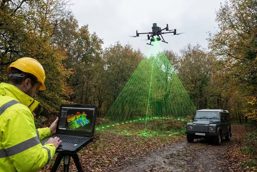
Drone LiDAR Mapping
Precision LiDAR scanning for detailed terrain models and vegetation analysis.
Drone Drone LiDAR Mapping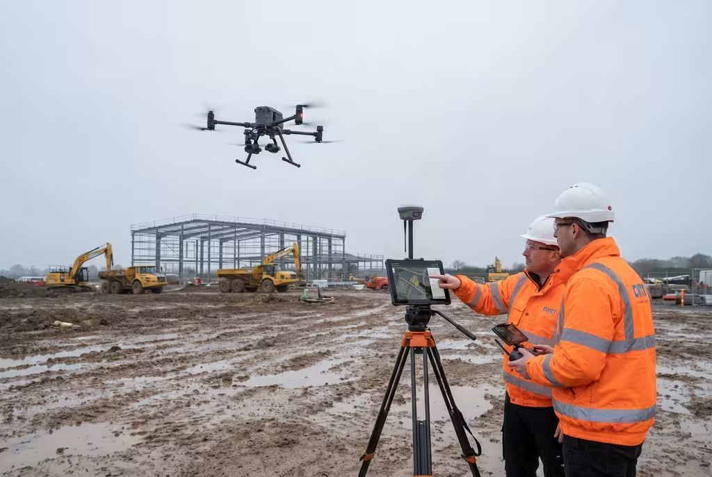
Our Services
Comprehensive drone survey solutions for construction, infrastructure, and land management projects across the UK.
Avg Response within 5 Mins • Or call +44 1334 804554
Precision LiDAR scanning for detailed terrain models and vegetation analysis.
Drone Drone LiDAR Mapping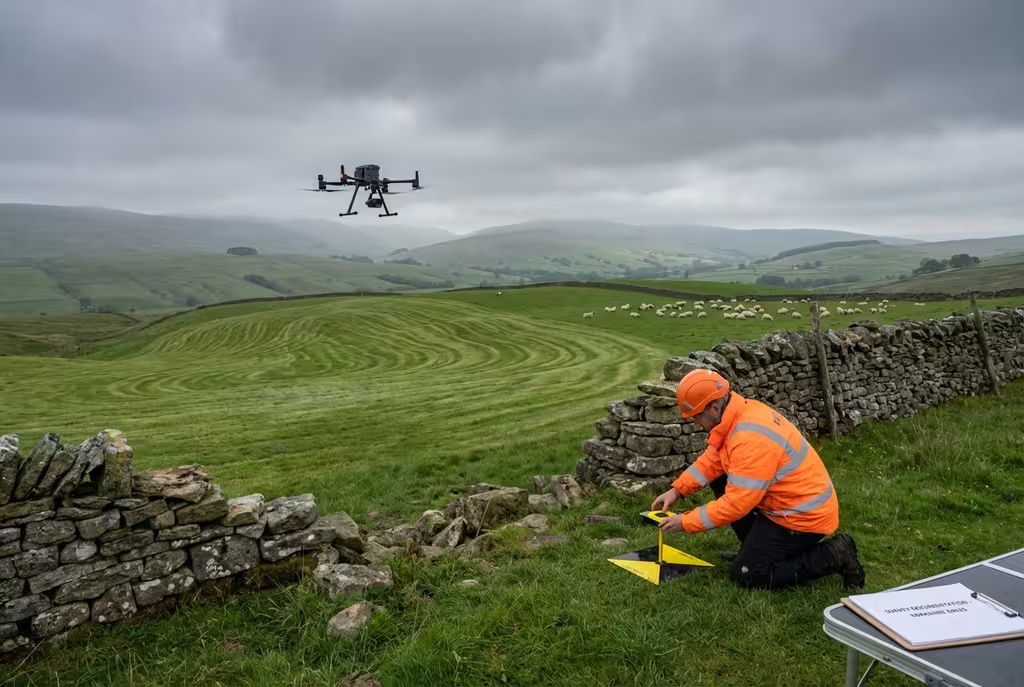
Precise aerial topographic surveys delivering detailed terrain models, contour maps, and elevation data for planning and design.
Drone Drone Topographical Survey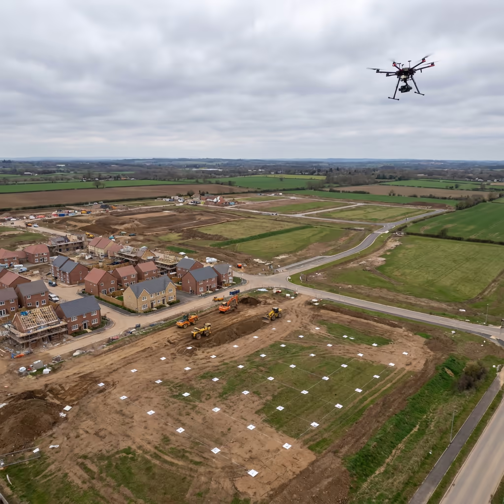
High-accuracy photogrammetric surveys creating detailed 3D models, orthomosaics, and point clouds from aerial imagery.
Drone Drone Photogrammetry Survey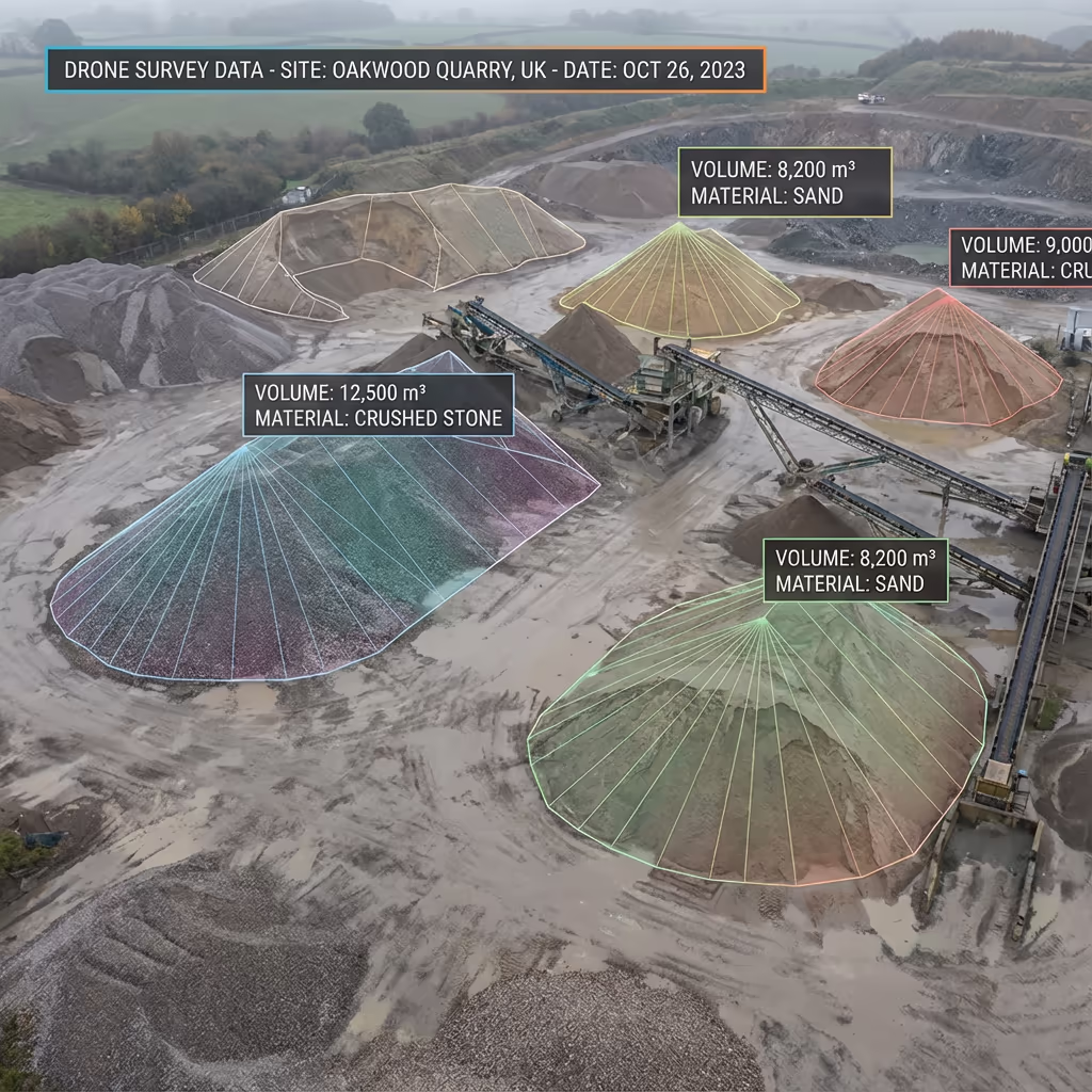
Accurate stockpile measurements and volume calculations for quarries, construction sites, and waste management facilities.
Drone Drone Volumetric Survey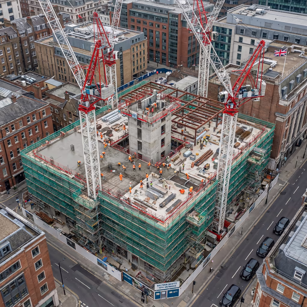
Regular aerial surveys tracking construction progress, documenting site changes, and supporting project management.
Drone Drone Construction Monitoring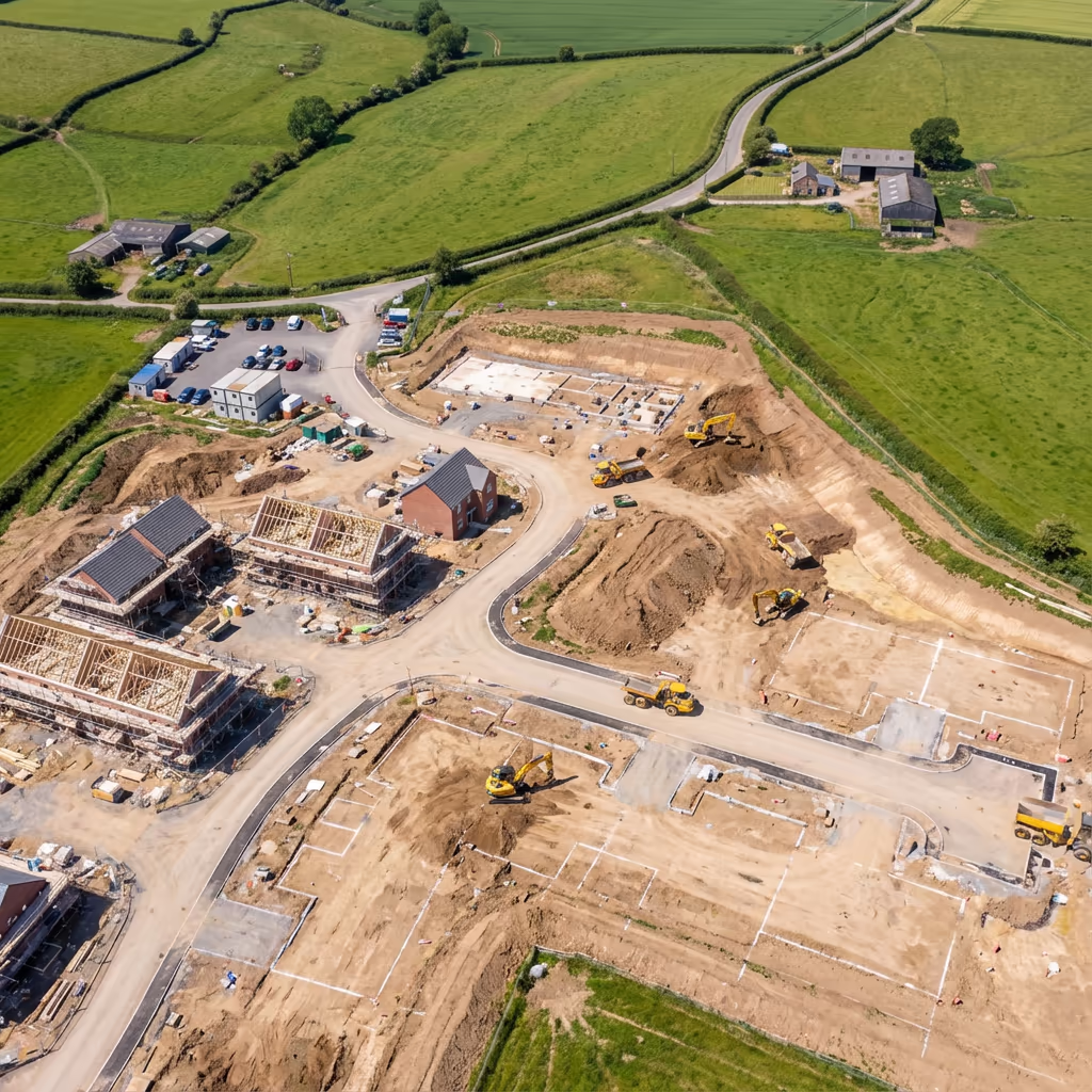
Comprehensive site surveys providing detailed aerial imagery and mapping data for planning and development projects.
Drone Drone Site Survey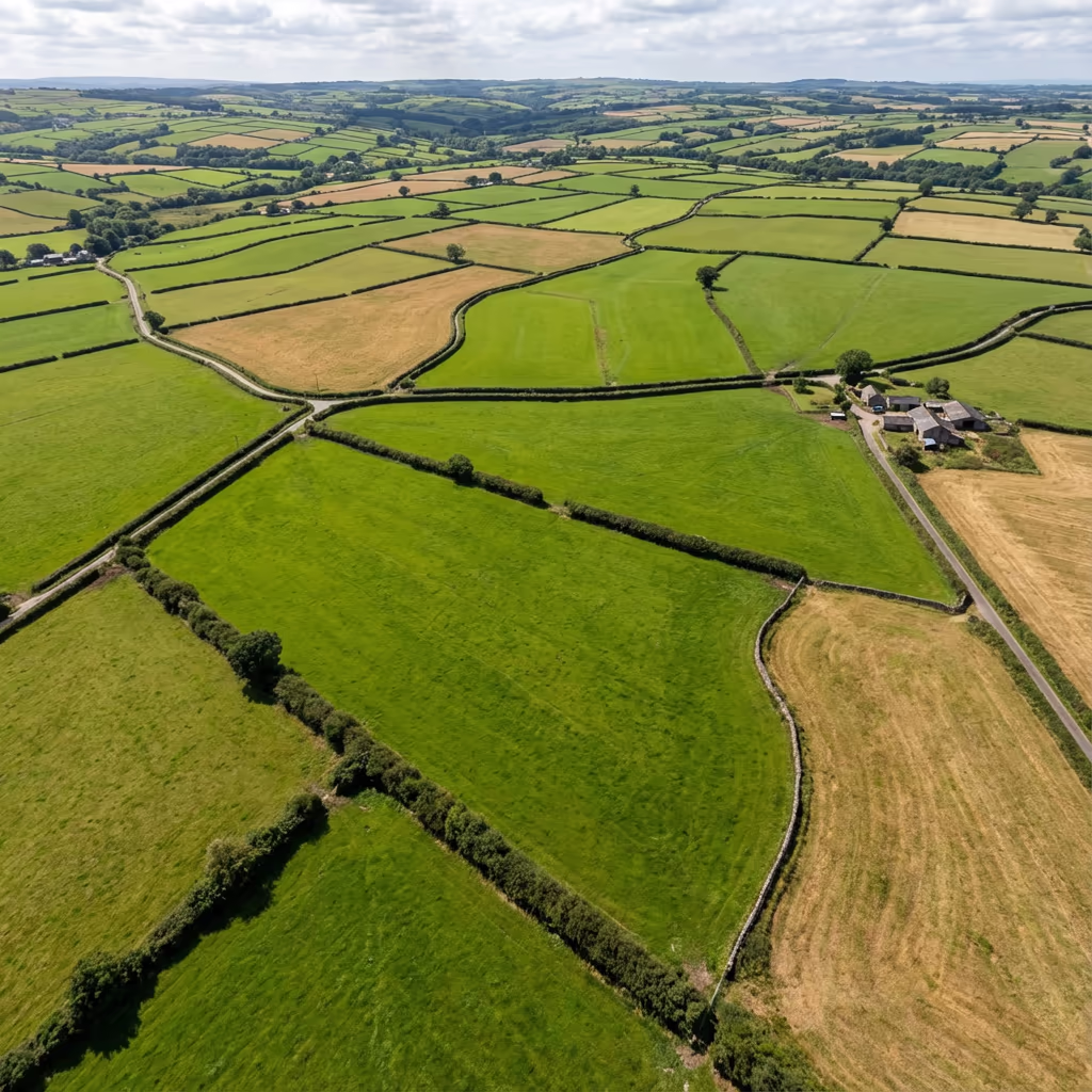
Professional land surveys capturing terrain data, boundary information, and detailed site documentation.
Drone Drone Land Survey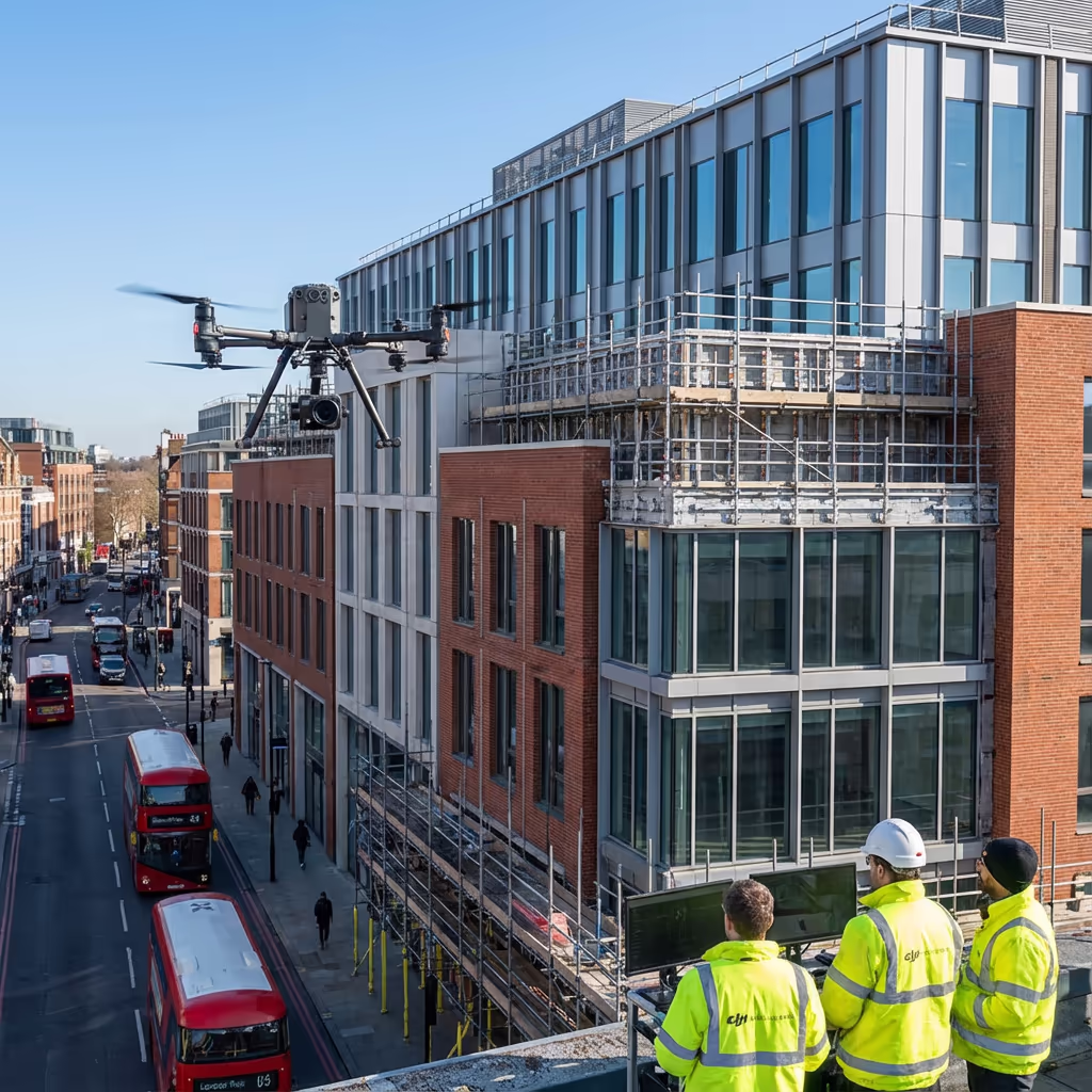
High-precision elevation surveys producing accurate height data, DEMs, and contour mapping for engineering projects.
Drone Drone Elevation Survey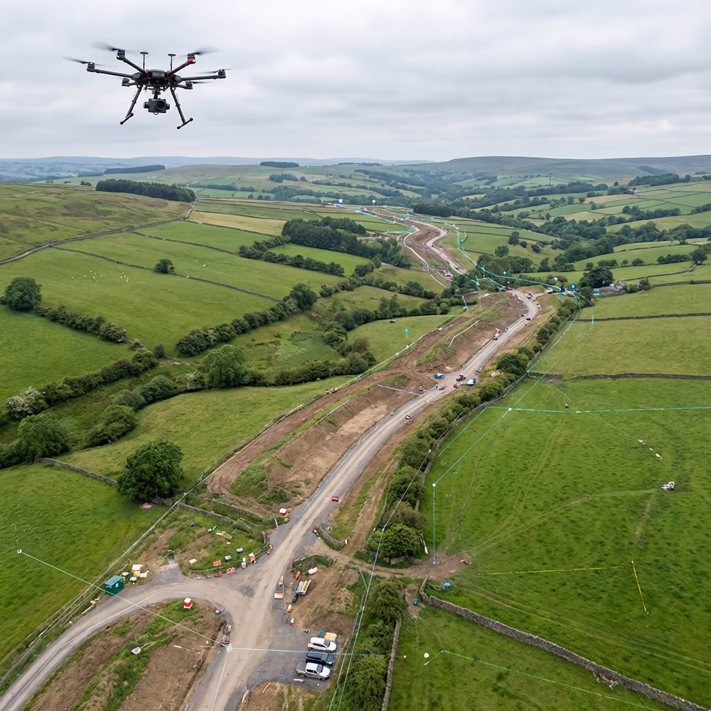
Efficient linear corridor surveys for pipelines, power lines, roads, and railway infrastructure projects.
Drone Drone Corridor Mapping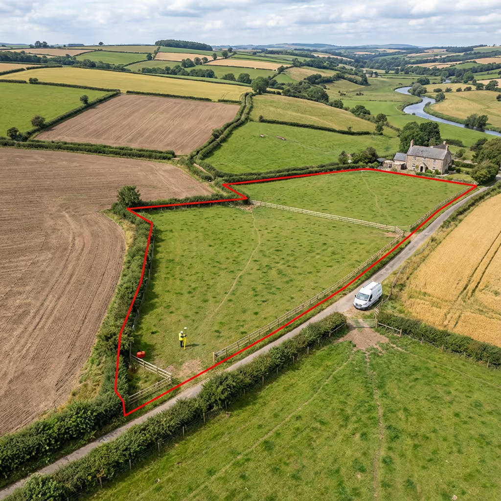
Accurate boundary surveys providing precise property line data and demarcation for legal and planning purposes.
Drone Drone Boundary Survey
Comprehensive estate surveys capturing detailed aerial imagery and mapping for property management and valuation.
Drone Drone Estate SurveyComprehensive drone survey services across the UK, delivering precision aerial data for construction, land, and infrastructure projects.
Drone Drone SurveysHigh-density 3D point cloud generation from drone photogrammetry and LiDAR for detailed spatial modelling.
Drone Drone Point Cloud Mapping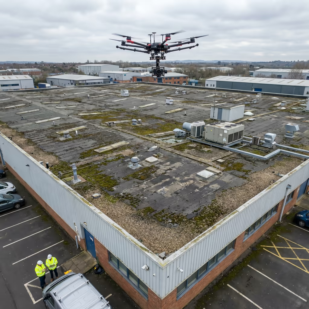
Safe, detailed aerial roof inspections without scaffolding. High-resolution imagery and thermal analysis for condition assessments.
Drone Drone Roof Inspection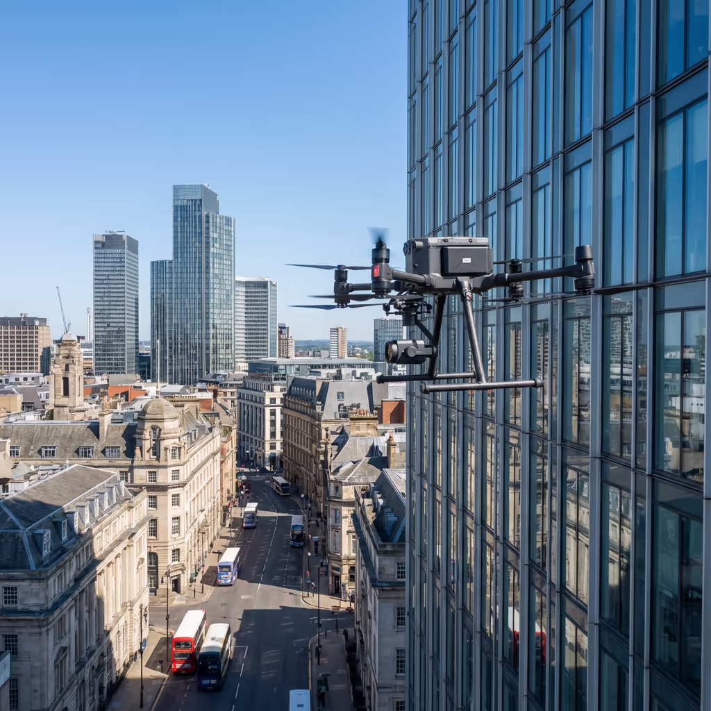
Detailed building facade inspections capturing high-resolution imagery for condition assessment and maintenance planning.
Drone Drone Facade Survey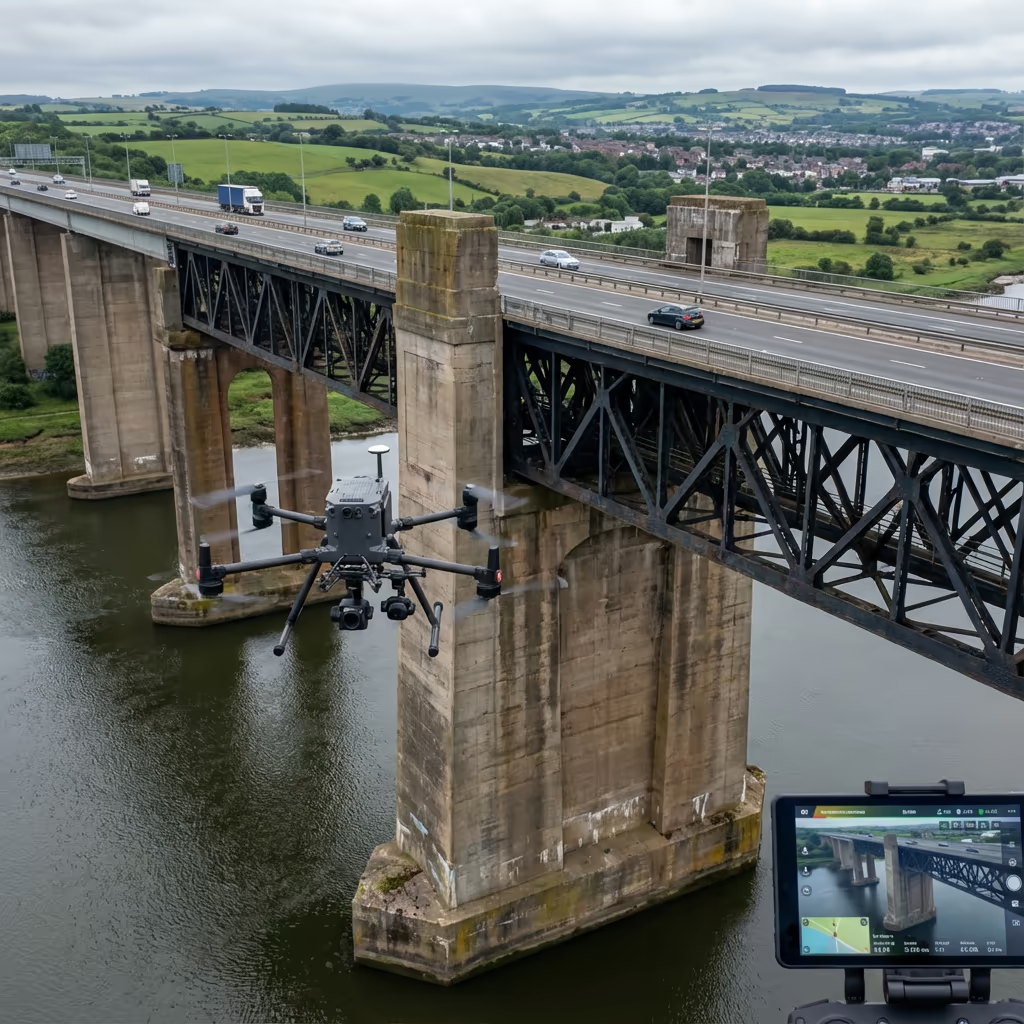
Safe and efficient bridge inspections using drones, eliminating traffic closures and providing detailed structural imagery.
Drone Drone Bridge Inspection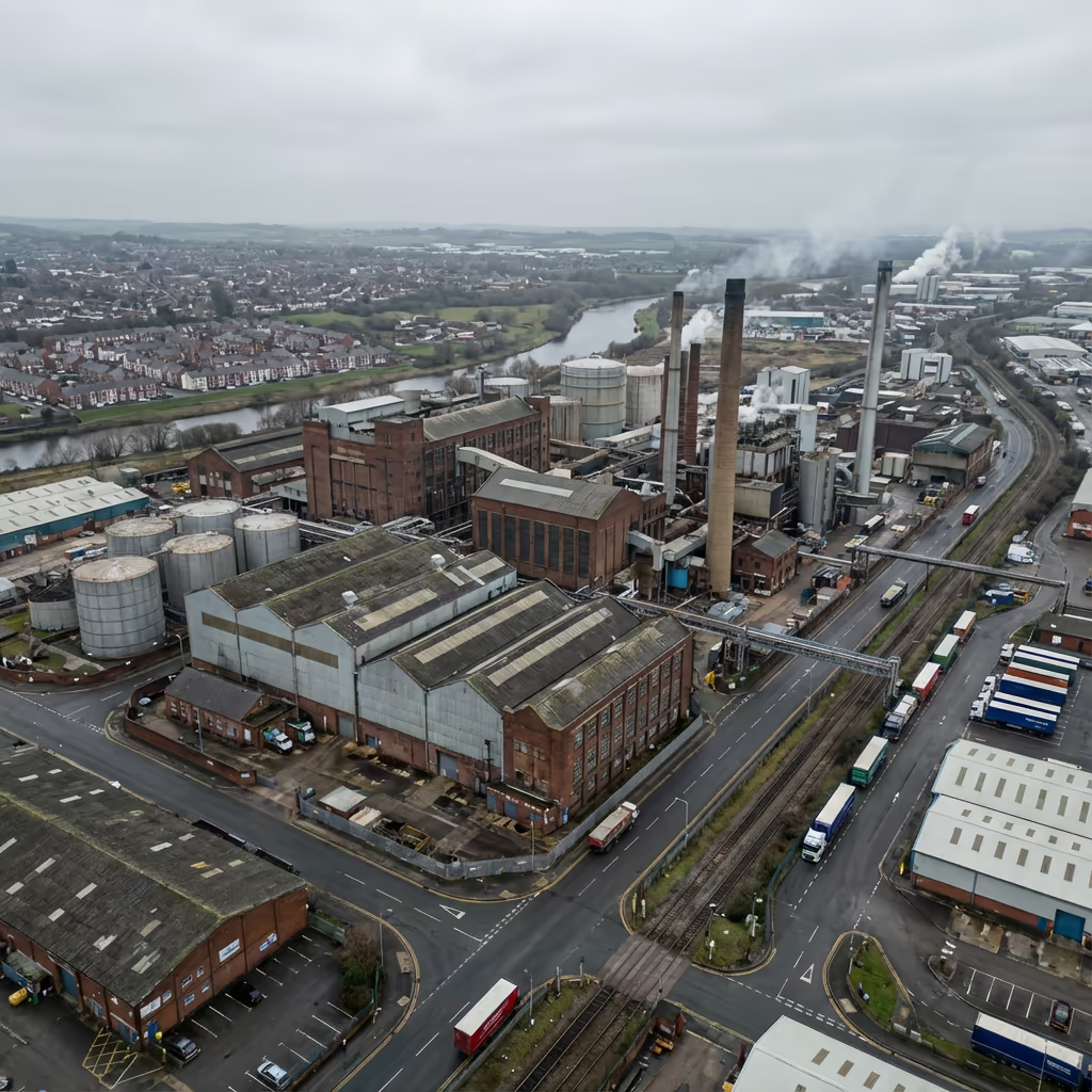
Industrial facility inspections and surveys covering manufacturing plants, refineries, and processing facilities.
Drone Drone Industrial Survey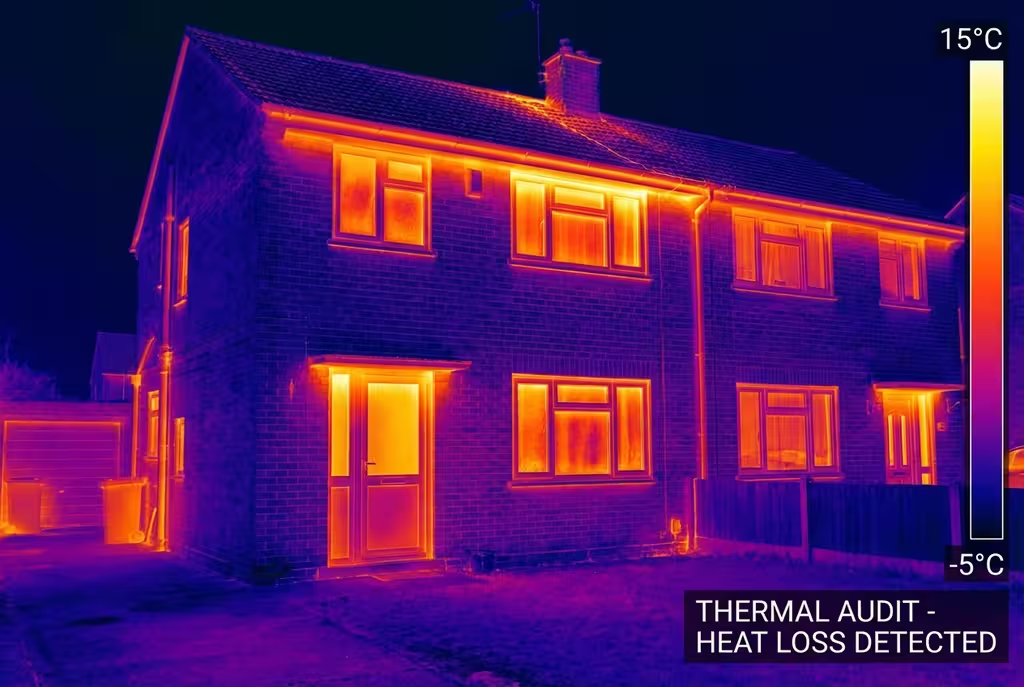
Aerial thermal imaging services for building diagnostics, energy audits, solar panel inspection, and industrial monitoring.
Drone Drone Thermal ImagingSafe drone inspections of confined spaces including tanks, silos, tunnels, and industrial vessels without human entry.
Drone Drone Confined Space Inspection
Highway and road corridor surveys providing detailed mapping, condition assessment, and planning data.
Drone Drone Road Survey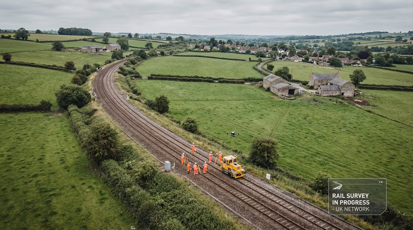
Rail corridor surveys for infrastructure assessment, vegetation management, and network planning.
Drone Drone Railway Survey
Utility infrastructure surveys covering power lines, substations, and distribution networks.
Drone Drone Utility Survey
Solar farm inspections using thermal and visual imagery to identify faulty panels and optimise performance.
Drone Drone Solar Survey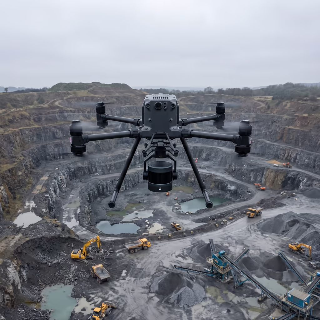
Wind turbine inspections providing detailed blade and tower assessments without costly downtime.
Drone Drone Wind Farm Survey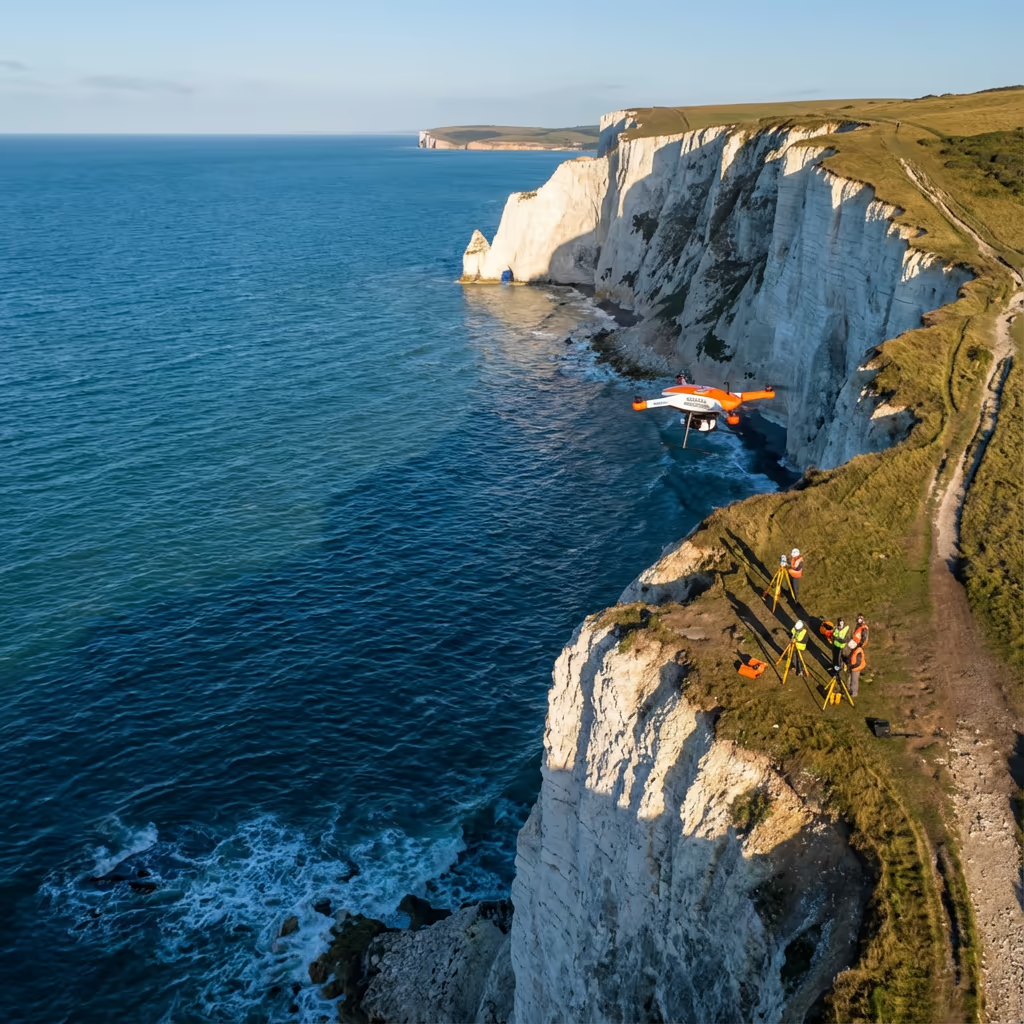
Coastal monitoring and erosion surveys providing accurate data for coastal management and environmental assessment.
Drone Drone Coastal Survey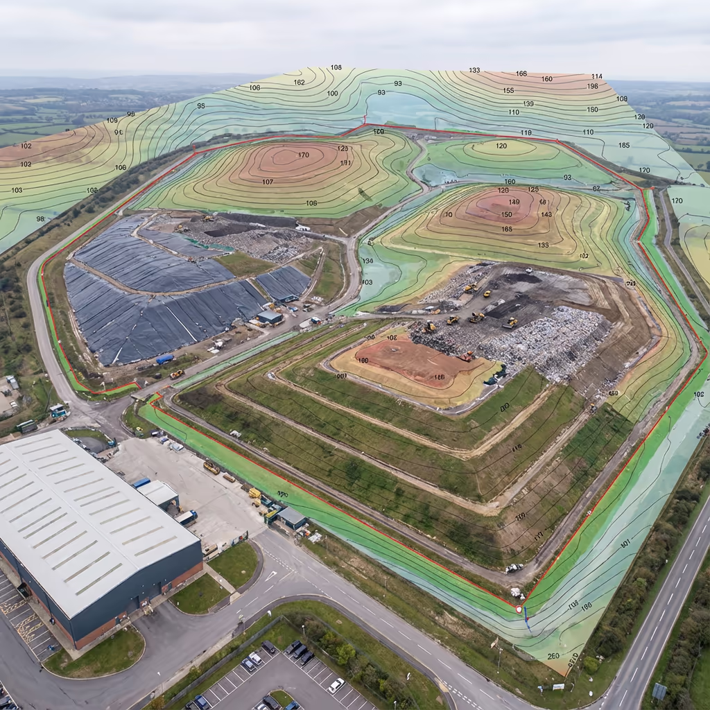
Landfill site surveys for volumetric analysis, cell planning, and environmental compliance monitoring.
Drone Drone Landfill Survey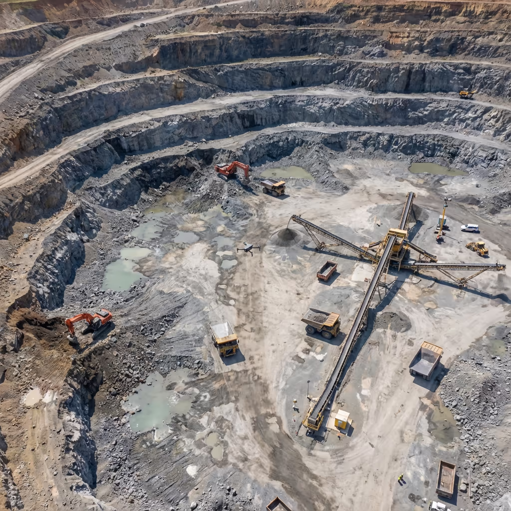
Mining and quarry surveys providing stockpile measurements, pit mapping, and progress monitoring.
Drone Drone Mining Survey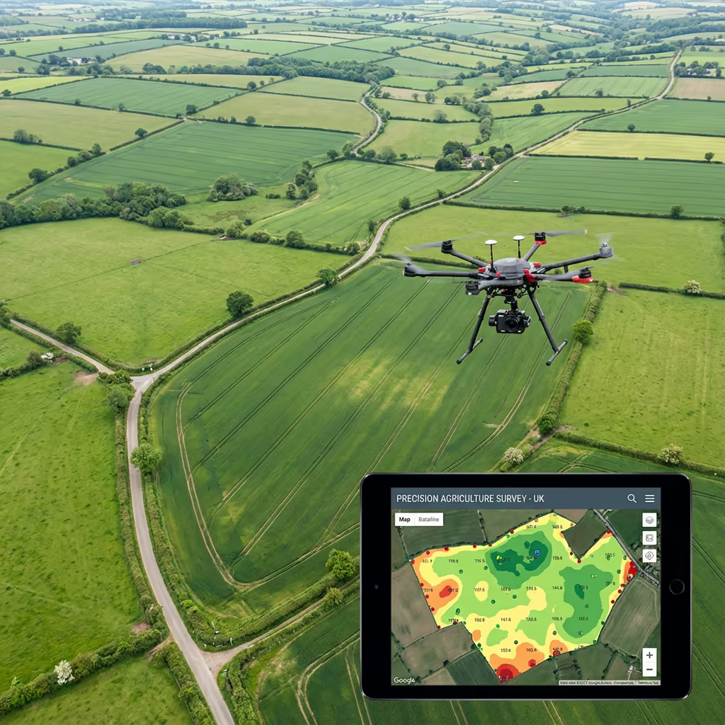
Agricultural surveys using multispectral imaging for crop health monitoring, field mapping, and precision farming.
Drone Drone Agricultural Survey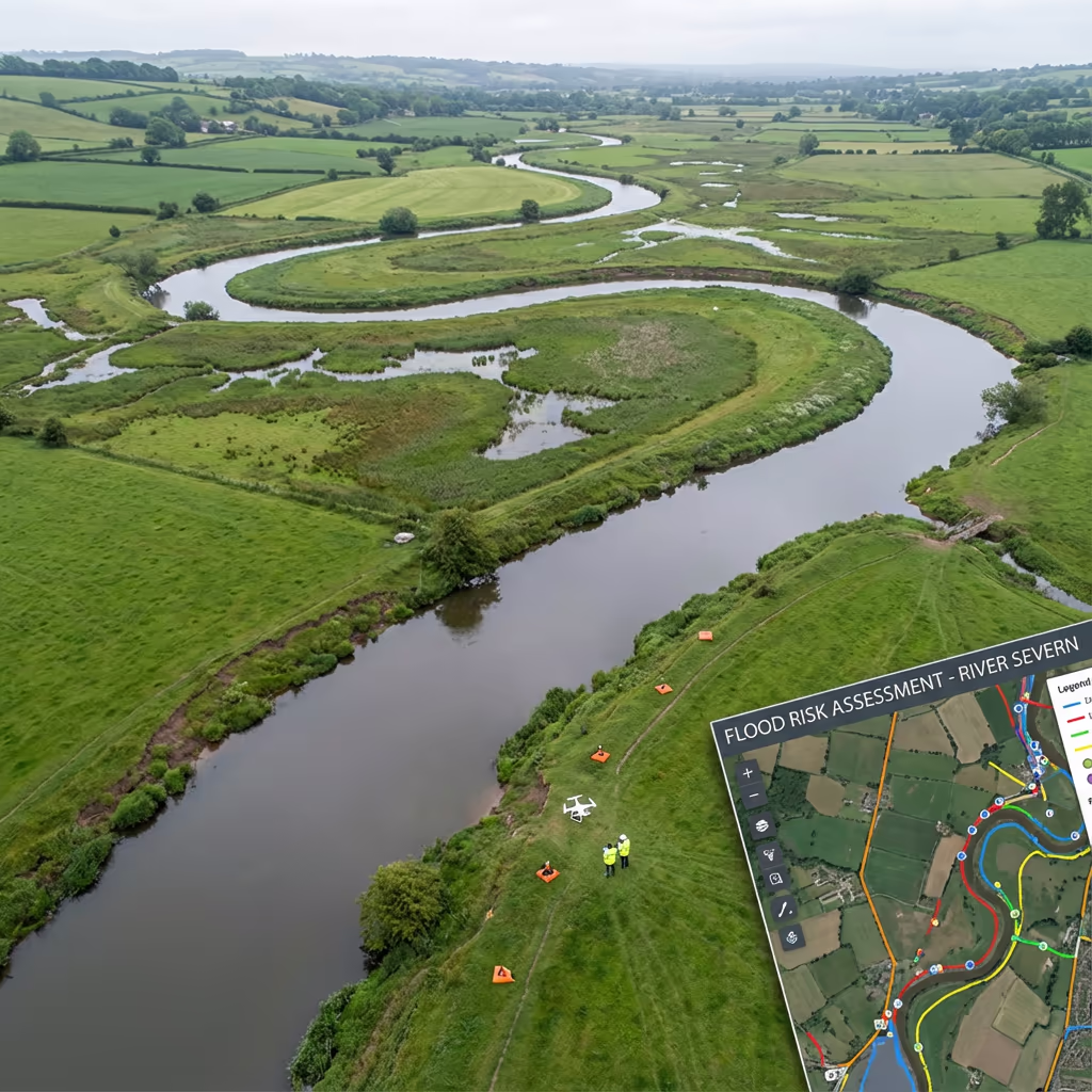
Flood risk assessment surveys providing terrain data for flood modelling and drainage planning.
Drone Drone Flood Risk Survey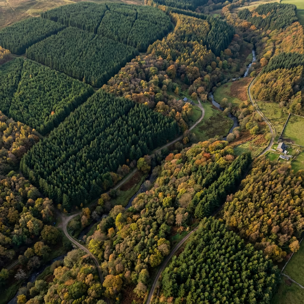
Forestry surveys for woodland mapping, tree counts, canopy analysis, and timber volume estimation.
Drone Drone Forestry SurveyComprehensive drone surveys for quarry operations including stockpile volumes, pit mapping, and progress monitoring.
Drone Drone Quarry SurveyProfessional drone photography services capturing stunning aerial images for marketing, documentation, and analysis across the UK.
Drone Drone PhotographyProfessional aerial photography for property marketing, estate agents, and property developers across the UK.
Drone Drone Real Estate PhotographyStunning aerial wedding photography and videography capturing your special day from breathtaking perspectives.
Drone Drone Wedding PhotographyProfessional aerial videography services delivering cinematic drone footage for marketing, events, and documentation.
Drone Drone Videographer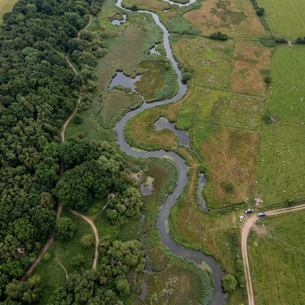
Comprehensive aerial surveys for habitat mapping, vegetation classification, and ecological baseline assessments.
Drone Drone Environmental Survey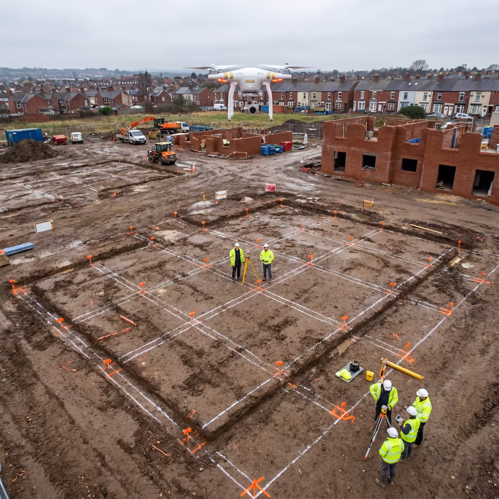
Precision setting out surveys for construction projects, ensuring accurate positioning of buildings and infrastructure.
Drone Drone Setting Out Survey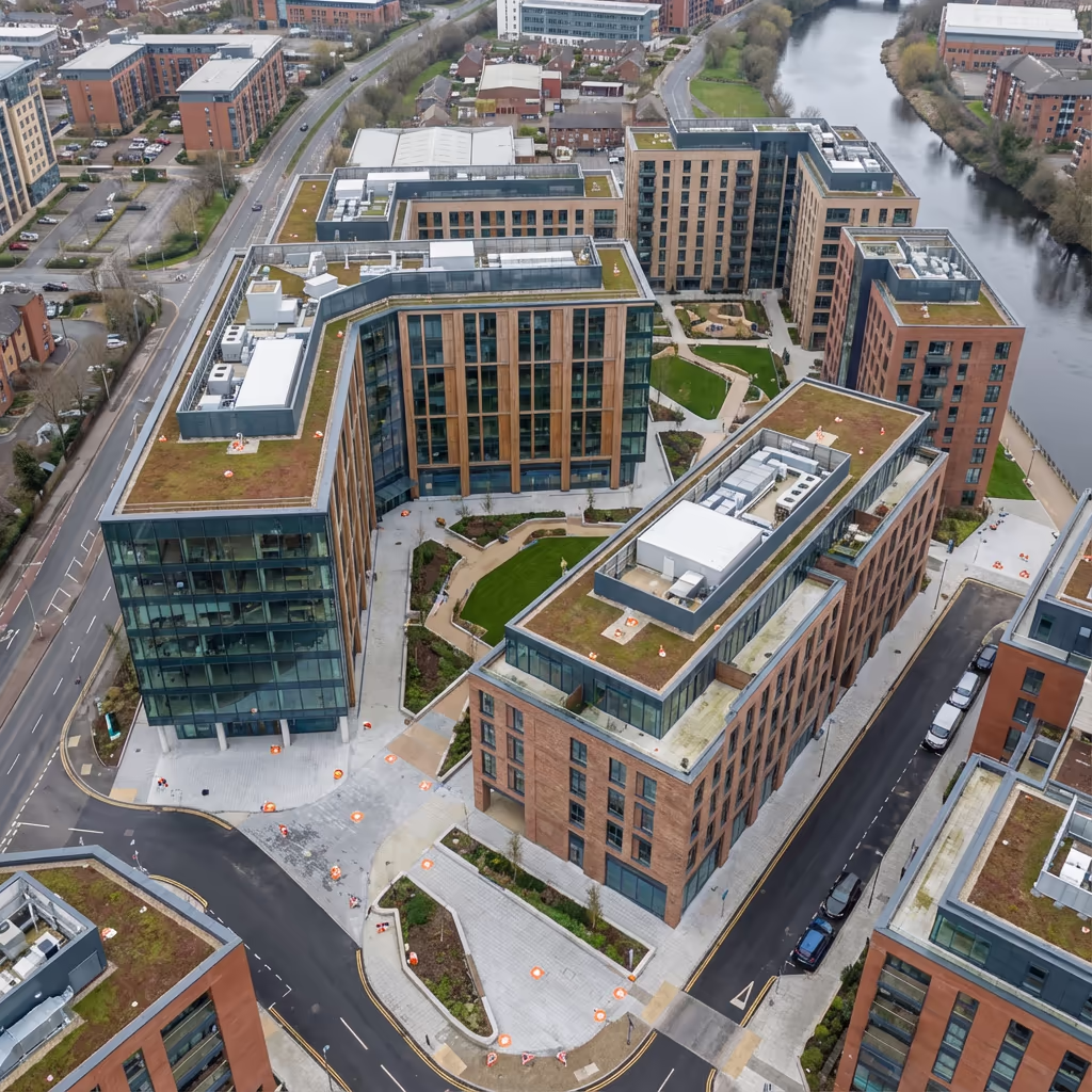
As-built surveys documenting completed construction for verification against design specifications.
Drone Drone As-Built Survey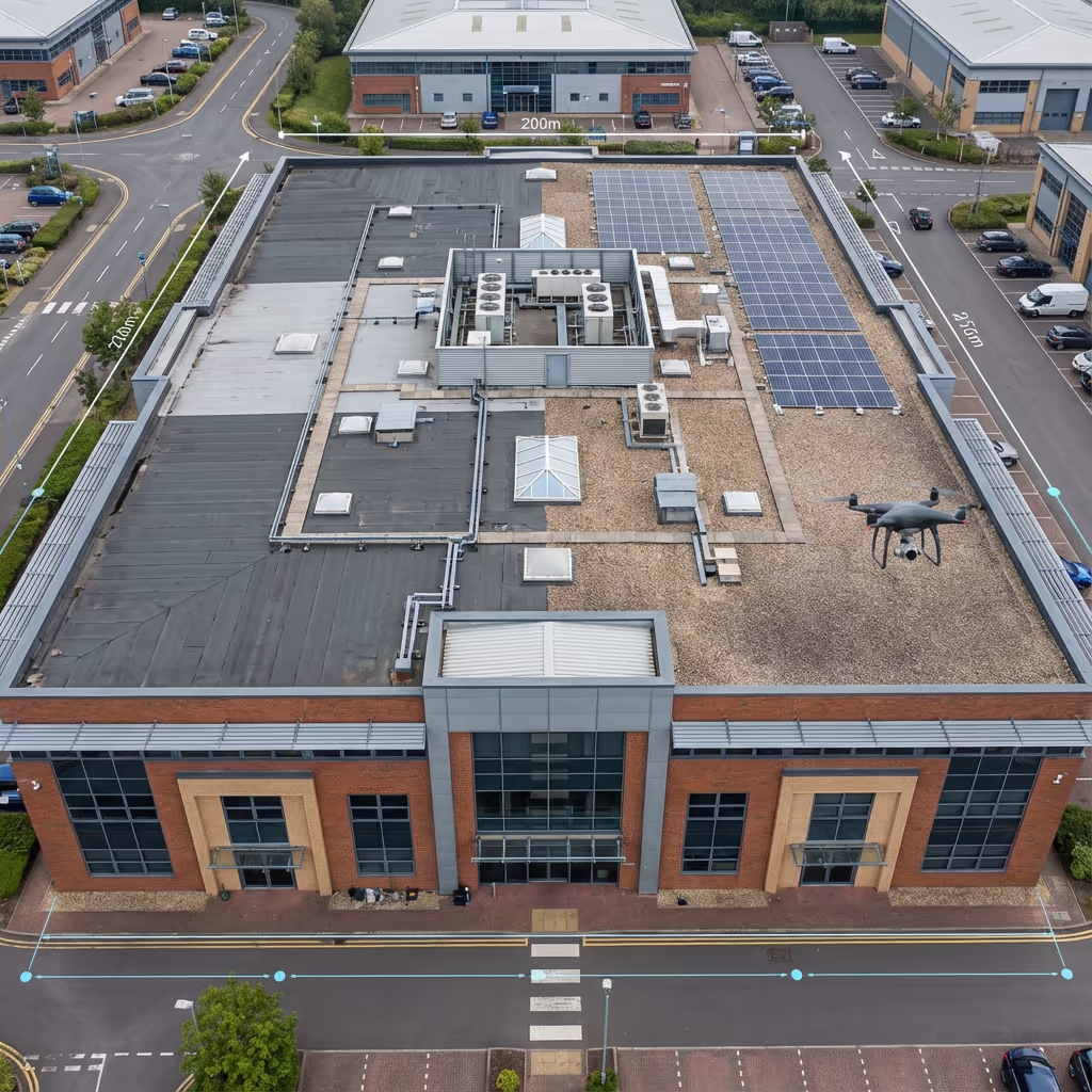
Detailed measured building surveys combining aerial and ground data for accurate floor plans and elevations.
Drone Drone Measured Building Survey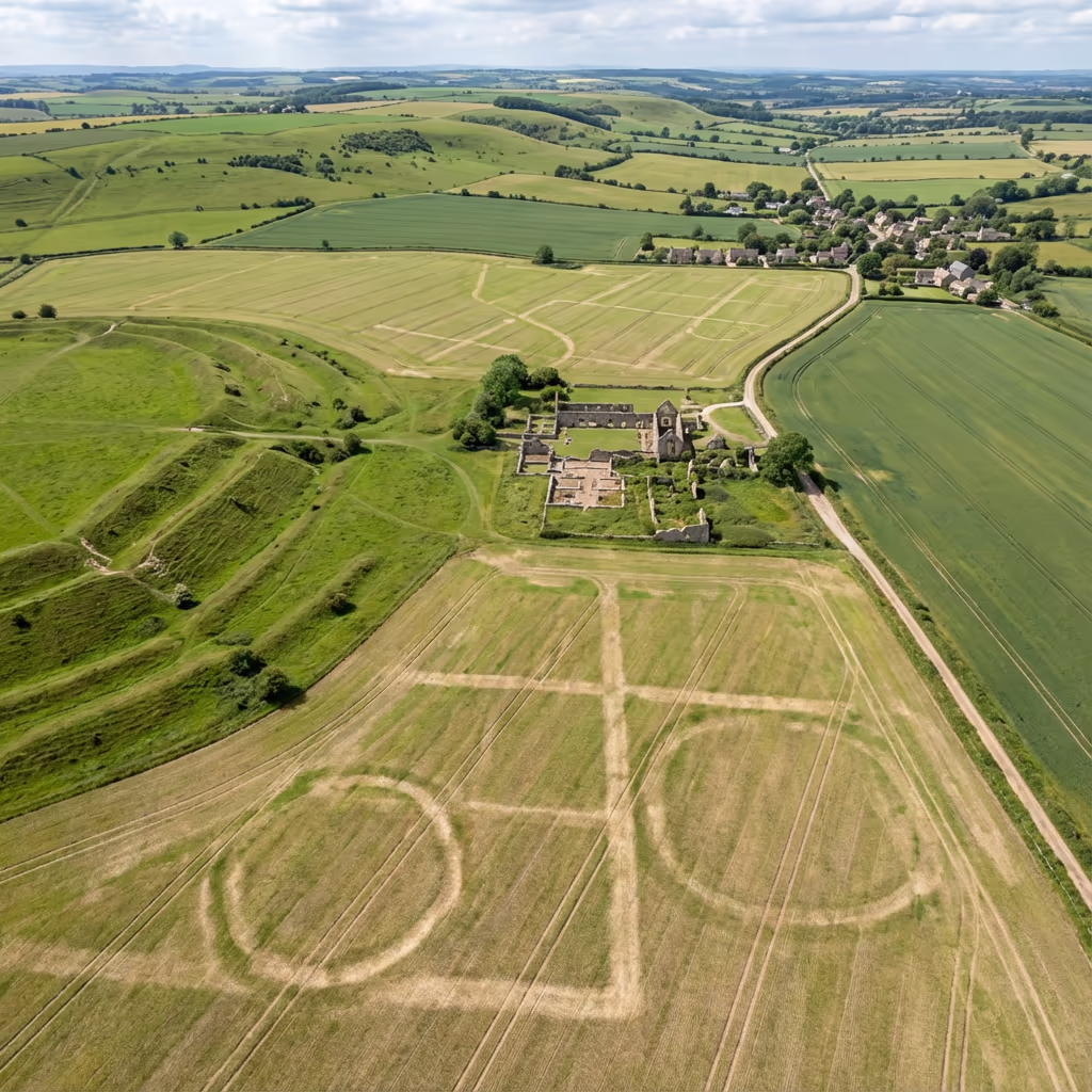
Archaeological site surveys using photogrammetry and multispectral imaging to reveal hidden features and document sites.
Drone Drone Archaeological Survey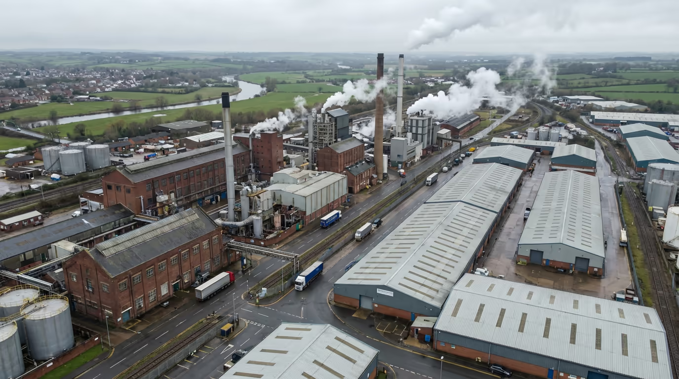
Industrial drone gas detection and leak inspection for UK facilities with rapid deployment and compliance-focused reporting.
Drone Drone Gas Detection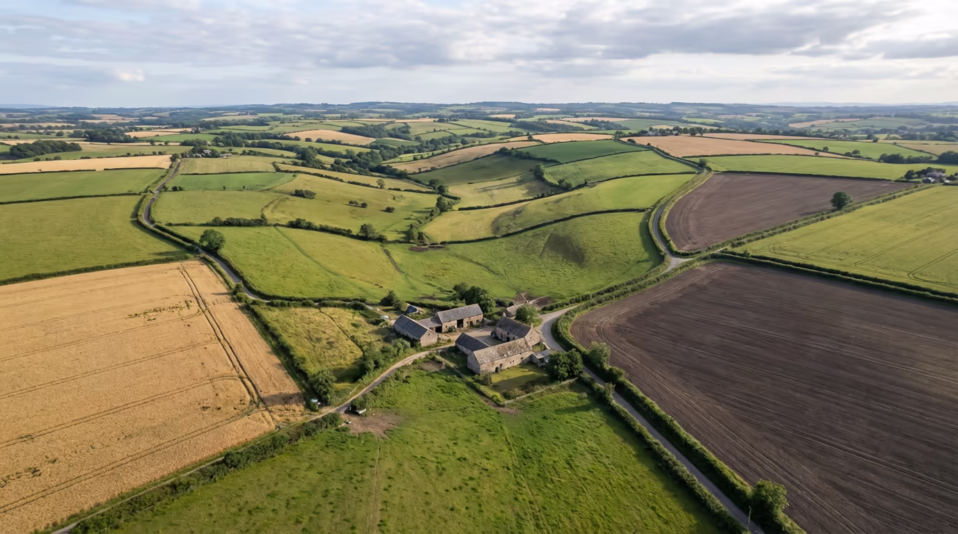
Targeted drone crop spraying for UK farms with precision application, faster deployment, and reduced chemical waste.
Drone Drone Crop SprayingAerial bathymetric surveys mapping underwater terrain and water body depths using drone-mounted sensors.
Drone Drone Bathymetric SurveyDrone-deployed sonar surveys for underwater mapping, object detection, and aquatic environment assessment.
Drone Drone Sonar SurveyAerial water quality monitoring using multispectral sensors to assess turbidity, algal blooms, and contamination.
Drone Drone Water Quality AssessmentDrone-mounted GPR surveys detecting subsurface features, utilities, voids, and geological structures.
Drone Drone Ground Penetrating RadarHigh-accuracy data capture with ±2-5cm precision using RTK/PPK technology.
Complete surveys in a fraction of the time compared to traditional methods.
Eliminate working-at-height risks with CAA-approved drone operations.
Cost-effective solutions delivering 40-60% savings on typical survey projects.
Tell us about your project and we'll provide a tailored quote within 24 hours.
Submit once and receive competitive quotes from independent drone pilots.