Compare Quotes
Drone Survey Service
Professional aerial surveying from certified drone pilots. Compare topographical mapping, volumetric calculations, and site analysis services with RTK accuracy.


.webp&w=3840&q=75&dpl=dpl_26REbpitH5FtBnFHJkWoYMTvr5F2)
High Accuracy Surveys
RTK/PPK precision
Large Area Coverage
Professional surveying
What Is Drone Surveying?
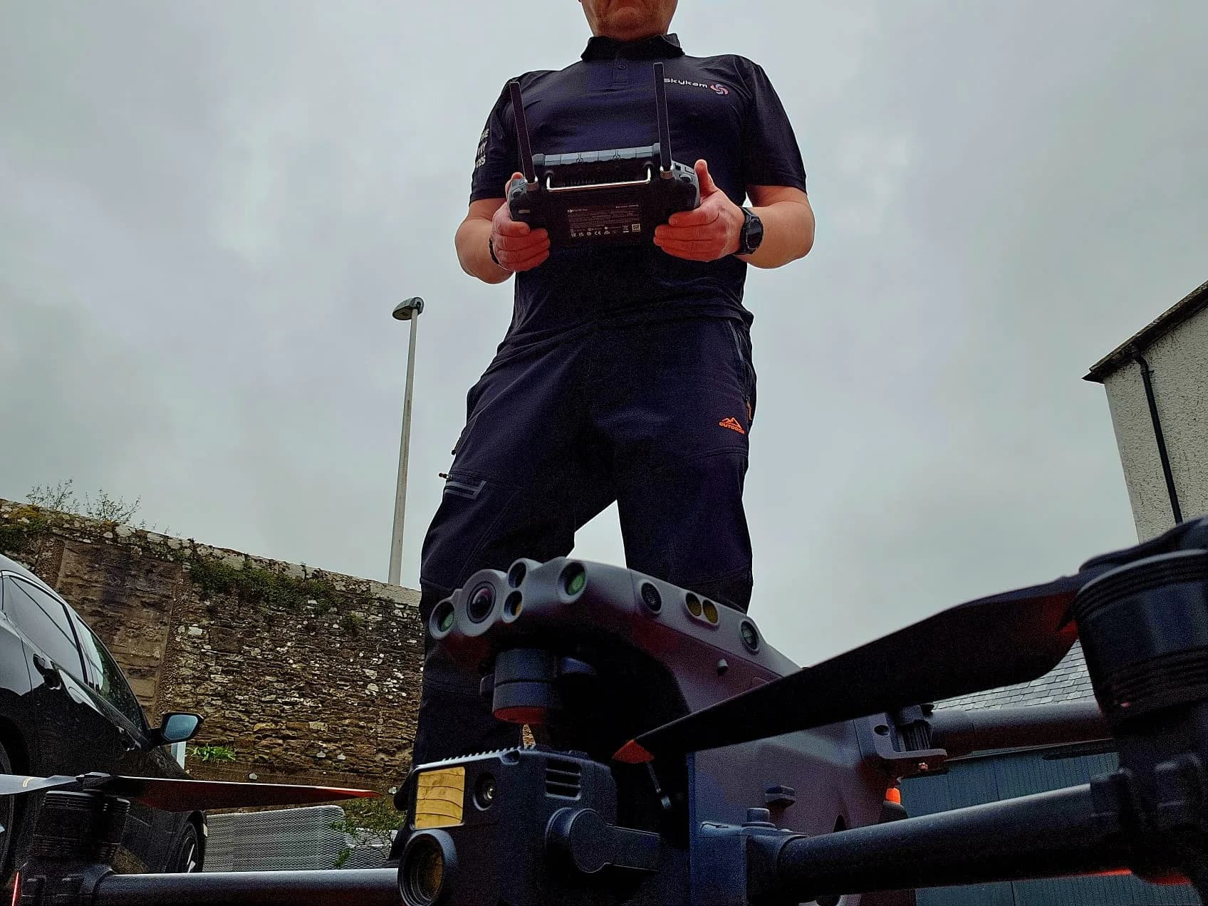
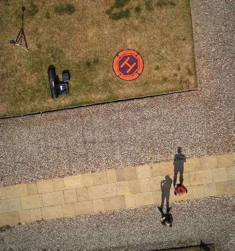
Drone surveying uses advanced UAVs with precision GPS to capture thousands of data points, creating accurate 3D models and topographical maps. From construction sites to quarries, it delivers survey-grade data faster and safer than traditional methods.
Centimeter-Level Accuracy
RTK/PPK technology delivers survey-grade precision for critical measurements
10x Faster Data Collection
Survey large sites in hours, not days. Data typically processed in 48-72 hours
Complete Digital Deliverables
3D models, point clouds, orthomosaics, and CAD files ready for your workflow
Professional aerial surveying transforms data collection for construction and land development
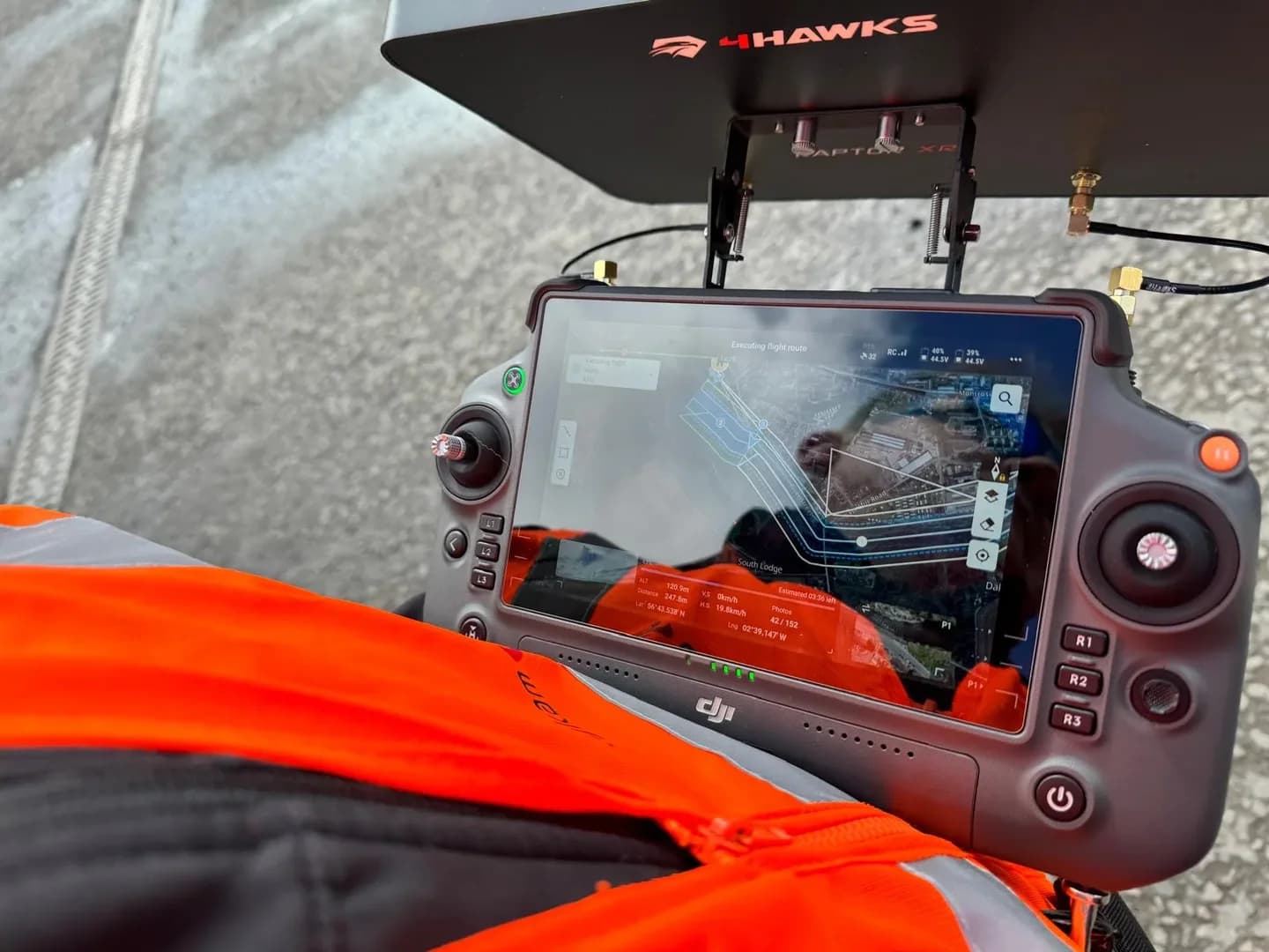
How It Works
Get Drone Survey Quotes in 3 Simple Steps
Professional project management from start to finish. We handle permissions, equipment, and data processing while you focus on your project.
Define Survey Scope
Site location, area size, required accuracy, deliverables needed. Share existing site plans if available.
Compare Drone Survey Quotes
Review equipment specs, accuracy levels, turnaround times. Certified surveyors submit competitive quotes within hours.
We Handle Everything
From CAA permissions to data processing, we coordinate everything. Receive deliverables via secure cloud link.
Why Hire Drone Surveyors Through Us
Every Surveyor is Qualification-Verified
We verify surveying qualifications, equipment specifications, and accuracy capabilities before approval.
Professional Accuracy Standards
Surveys are conducted to meet industry standards. RTK/PPK equipment verified. GCP options are available.
Compare Equipment & Expertise
View equipment specs side-by-side. Choose based on accuracy needs, not just price. Find specialists for your sector.
Industry-Standard Deliverables
CAD files, point clouds, orthomosaics. All formats compatible with AutoCAD, Civil 3D, and other professional software.
Specialist Services
Professional Drone Services
From topographical mapping to volumetric analysis, our certified surveyors deliver accurate data for every industry
Topographical Surveys
Detailed terrain mapping for planning applications, design work, and site analysis. Delivering survey-grade accuracy.
- Contour maps at any interval
- DTM/DSM generation
- CAD-ready deliverables
- OS grid integration

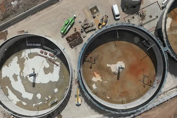
Mining & Quarry Surveys
Accurate stockpile measurements, blast planning, and site safety monitoring. Regular volume reporting available.
- High-accuracy stockpile volumes
- Blast design support
- Haul road analysis
- Safety compliance reports
Survey Success Metrics
When You Hire Drone Surveyors Through Our Platform:
Survey Deliverables from Our Network
Every drone surveyor in our network delivers professional-grade outputs. See the range of deliverables available for your project.
Orthomosaic Maps
Georeferenced aerial imagery stitched into measurable 2D maps. Perfect for site planning and analysis.
.webp&w=3840&q=75&dpl=dpl_26REbpitH5FtBnFHJkWoYMTvr5F2)
3D Point Clouds
Millions of data points creating accurate 3D representations. Compatible with all major CAD software.
Contour Maps
Elevation contours at any interval. Essential for drainage design and earthworks planning.
.webp&w=3840&q=75&dpl=dpl_26REbpitH5FtBnFHJkWoYMTvr5F2)
Volume Calculations
Accurate stockpile and cut/fill volumes with detailed reports. Essential for quarries and earthworks.
DTM & DSM Models
Digital terrain and surface models for design integration. Remove vegetation to see true ground levels.
CAD Drawings
Survey data converted to DWG/DXF format. Ready for immediate use in AutoCAD and Civil 3D.
What's Included in Your Drone Survey Package
Ground Control (Available)
GCP establishment and survey for maximum accuracy when required
Quality Assurance
Accuracy reports and metadata included with all deliverables
Cloud Delivery
Secure download links with organized folders for all outputs
Post-Delivery Support
Support for data access and initial queries
Coordinate Systems
OSGB36, WGS84, or any required projection system
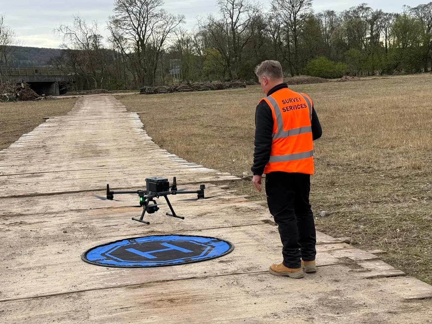
CAA Permissions
All necessary flight permissions handled by surveyors
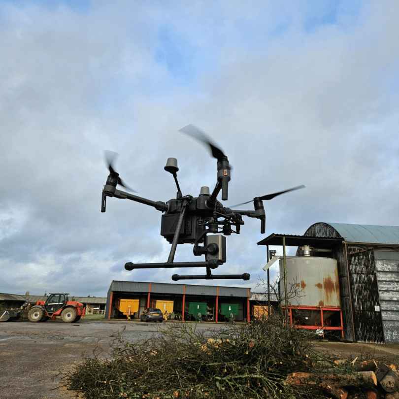
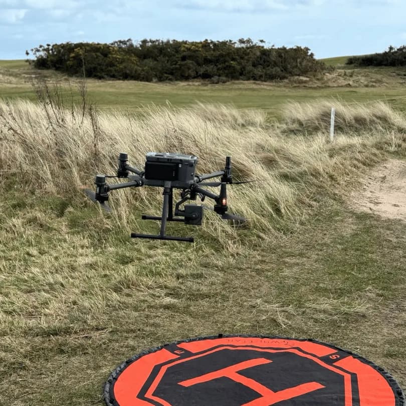
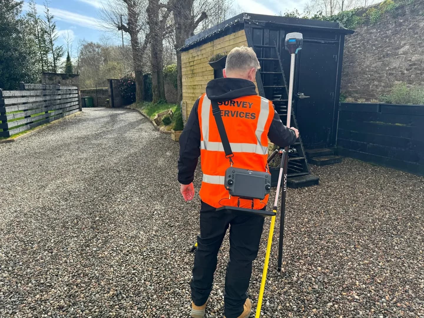
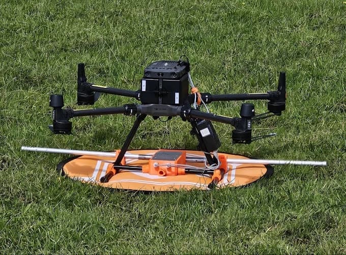
Professional-grade survey equipment ensures accuracy and reliability
Professional Survey Equipment
RTK/PPK GPS Systems
Real-time kinematic and post-processed kinematic GPS for centimeter-level positioning accuracy. Essential for survey-grade results.
LiDAR Capabilities
Select pilots offer LiDAR scanning for vegetation penetration and enhanced accuracy in challenging environments.
Professional Processing Software
Industry-standard software including Pix4D, Agisoft Metashape, and DJI Terra for accurate data processing and analysis.
Reliable Professional Systems
Professional-grade systems ensure data integrity and mission success even in challenging conditions.
Common Questions About Drone Surveying
Everything you need to know about our managed drone survey service
With RTK/PPK GPS, expect 2-5cm horizontal and vertical accuracy. Standard GPS provides 1-3m accuracy. Ground Control Points (GCPs) further improve precision.
Standard deliverables include orthomosaic maps, 3D point clouds, contour maps, DTM/DSM, volumetric reports, and CAD files. All formats compatible with industry software.
Single flight covers 20-100 hectares depending on resolution needed. Larger sites use multiple flights. Most pilots can survey 500+ hectares per day.
Yes, pilots can establish and survey GCPs for maximum accuracy, or work with your existing control network. RTK drones may not require GCPs.
Absolutely. All surveys can be delivered in OSGB36 National Grid coordinates or any required coordinate system. Integration with existing site data guaranteed.
Light rain and overcast conditions are fine for surveying. Strong winds or heavy rain require rescheduling. Free weather delays included in all quotes.