Heritage & Archaeology
Drone Archaeological Survey Service
Uncover concealed archaeological features with precision UAV surveys. From crop mark detection to thermal analysis, our drone technology discovers what ground-based methods overlook.
Avg Response within 5 Mins • Or call +44 1334 804554
Understanding Drone Archaeological Assessment
A drone archaeological assessment employs sophisticated UAV technology to identify, document, and chart archaeological features that remain hidden or challenging to observe from ground level. Our unmanned aircraft gather high-resolution imagery and data that expose crop marks, earthworks, and subsurface structures throughout the terrain.
At HireDronePilot, we integrate photogrammetry, multispectral sensing, and thermal detection to produce thorough archaeological documentation. This non-destructive methodology safeguards site integrity whilst furnishing archaeologists with precise survey information for research, planning submissions, and heritage stewardship.

Peter Leslie
Owner & Drone Pilot
"Have questions? Ring me directly - I'm happy to discuss your project requirements."
Call NowDiscover Buried Heritage,Without Disturbance
What You'll Receive
- High-resolution site orthomosaic
- 3D terrain and feature models
- Crop mark analysis report
- CAD-ready survey drawings
Delivered in 5-7 working days
Why Use HireDronePilot
- CAA approved & fully insured
- Experience with heritage projects
- Latest drone & sensor technology
- Nationwide service delivery
Relied upon by archaeology units, heritage bodies and consultancies throughout the UK.
Relied upon by leading organisations
Archaeological Assessment Pricing Guide
Investment varies based on your project scope and specifications. Here is a reference to assist with budgeting:
| Project Size | Guide Price |
|---|---|
| Small SiteUnder 1 ha | £500+ |
| Medium Site1–5 ha | £900+ |
| Large Site5–20 ha | £1,800+ |
| Major Site20+ ha | POA |
| Research ProjectsAcademic/heritage | POA |
*Guide prices include standard deliverables. Final quote based on site complexity, access, and specific requirements.
Factors influencing your estimate
- Site size & terrain
- Required deliverables
- Turnaround time
- Sensor requirements
Our UAV-based approach typically delivers 40-60% savings compared to conventional ground survey techniques whilst covering sites considerably faster. Reach out with your project specifications and we will furnish a bespoke estimate within 24 hours.
Prepared to receive an estimate for your project?
Complimentary, obligation-free quotes within 24 hours
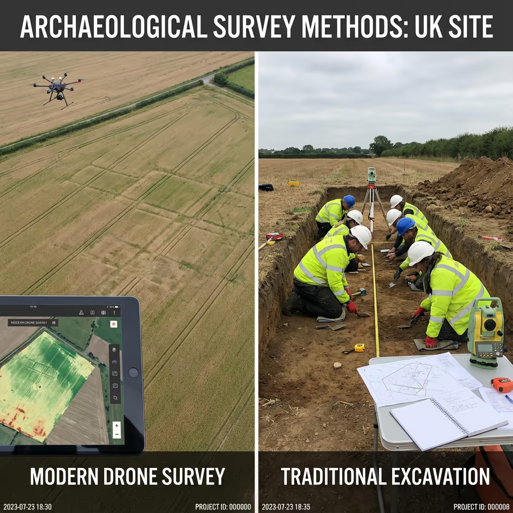
Drone Assessment vs Conventional Methods
Conventional archaeological survey depends on ground-based techniques such as total station recording, GPS plotting, and manual photography. Though accurate, these methods prove time-intensive, weather-sensitive, and restricted in the viewpoint they provide.
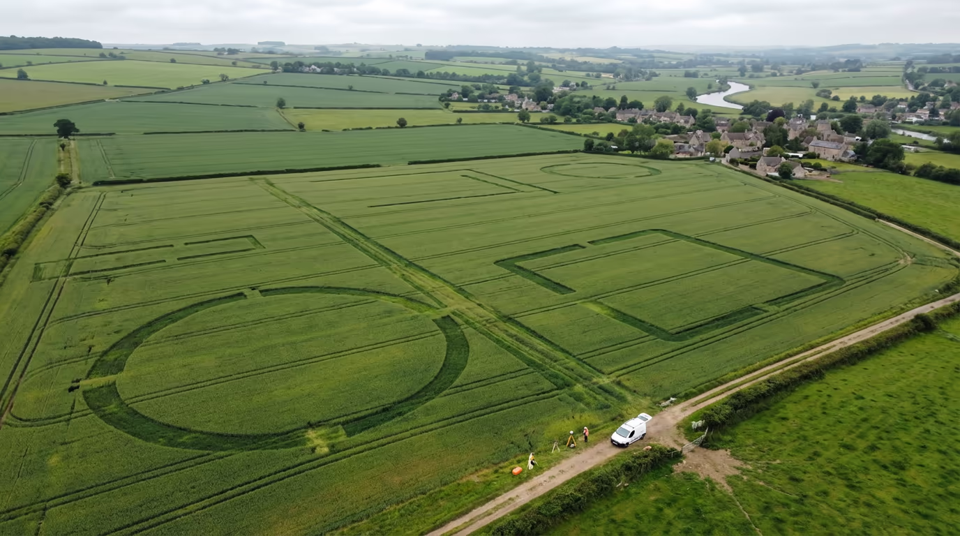
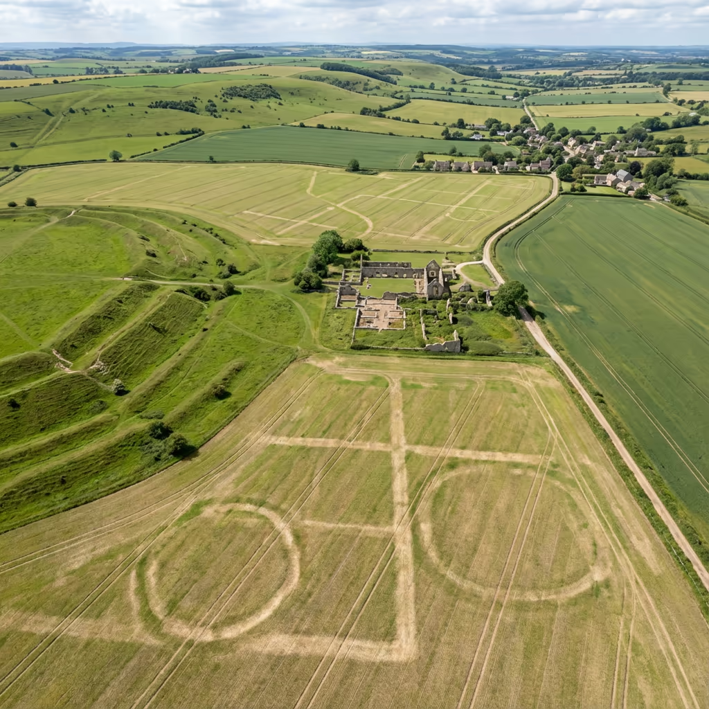
Drone archaeological assessment captures complete sites from above in a fraction of the duration, exposing patterns and features that remain entirely hidden from ground level. Crop marks, subtle earthworks, and landscape relationships become instantly evident when observed from altitude.
Selecting the Right Methodology
Select Drone Archaeological Assessment
Landscape-scale perspective
Select Conventional Methods
Exact detail documentation
Uncertain which methodology fits your project?
Precision Standards for Archaeological Assessment
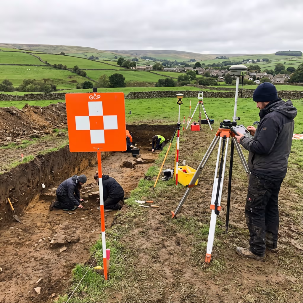
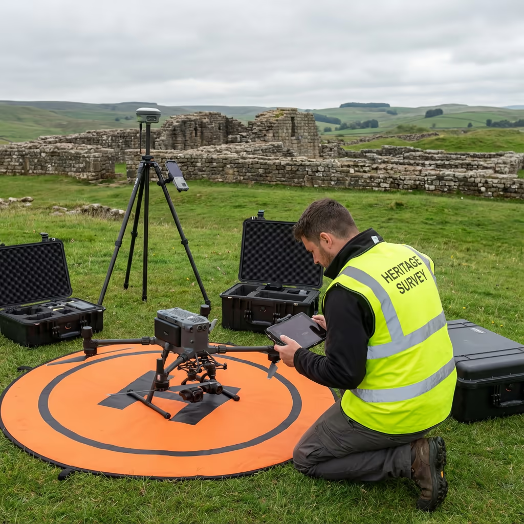
Our drone archaeological assessments attain positional accuracy of plus or minus 2-3cm when employing ground control points, meeting or surpassing the specifications demanded for most archaeological documentation. Ground sample distances of 1-2cm per pixel guarantee individual features remain clearly discernible and measurable.
We deploy RTK-enabled aircraft with survey-grade GNSS positioning, complemented by strategically placed ground control points measured using our own GPS equipment. This workflow generates georeferenced outputs that merge seamlessly with your existing site documentation and national grid references.
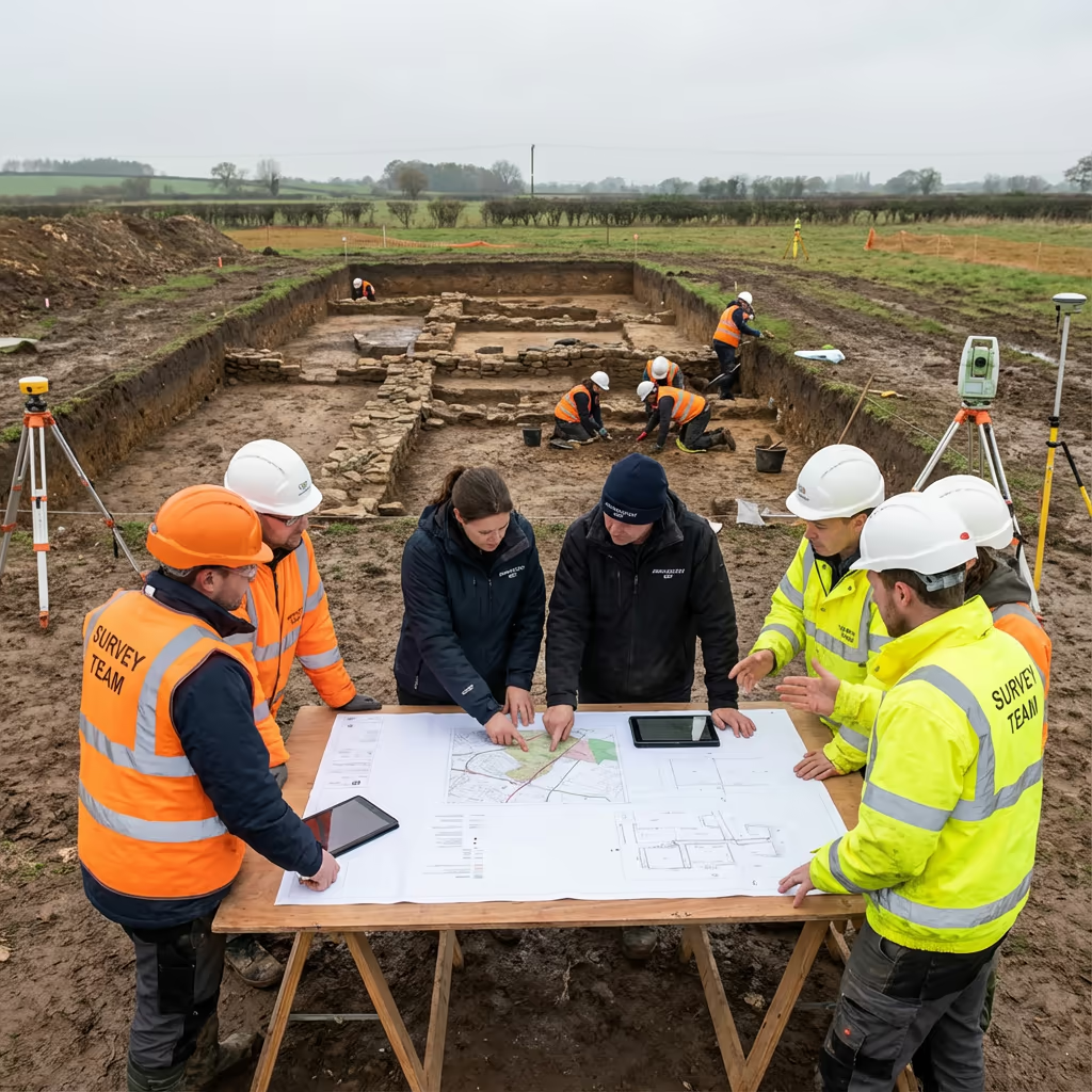
Key Uses for Archaeological Assessment
Drone archaeological assessment has revolutionised heritage documentation across numerous domains. These are the principal areas where our clients experience the most significant value:
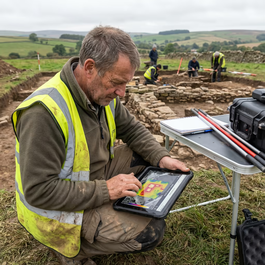
Excavation Documentation
Thorough photographic records of trenches and open-area excavations, accompanied by precise 3D models for post-excavation analysis.
Desk-Based Evaluations
High-resolution drone imagery supporting heritage impact evaluations and planning submissions.
Crop Mark Detection
Targeted surveys during optimal conditions to identify and document buried archaeological features manifesting as crop marks.
Monument Documentation
Comprehensive recording of scheduled monuments, hillforts, barrows, and other protected sites for condition assessment.
Landscape Assessments
Wide-area surveys examining settlement patterns, field systems, and relationships between features.
Community Initiatives
Supporting HLF-funded projects, research excavations, and community archaeology programmes with professional survey data.
Have an archaeological project requiring assessment?
Exposing Concealed Archaeological Features
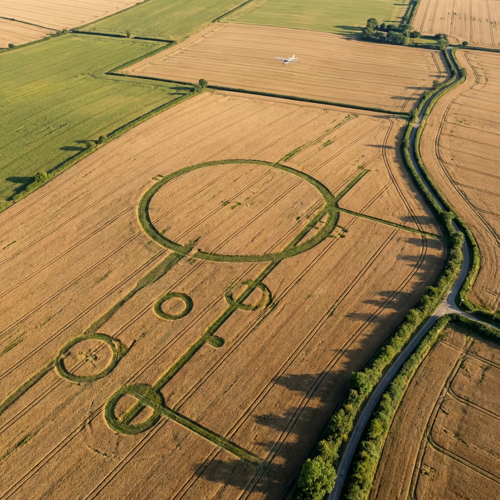
Certainly - this represents one of the most compelling applications of drone archaeological assessment. Features concealed beneath the surface become discernible through several phenomena best observed from above.
Crop marks develop when buried ditches retain additional moisture, causing vegetation above to grow taller and stay green longer. Conversely, buried walls and floors constrain root development, producing stunted or stressed vegetation. Our aircraft capture these subtle variations during optimal conditions - typically early summer mornings following dry periods.
Our Feature Detection Techniques
Crop Mark Evaluation
Standard RGB imagery during optimal growing conditions exposes differential crop growth patterns above buried features.
Thermal Detection
Buried structures retain heat differently from surrounding soil, generating thermal signatures discernible in early morning or evening surveys.
Micro-Topography Mapping
High-resolution elevation models expose subtle earthworks, platforms, and hollows imperceptible to the naked eye at ground level.
We can counsel you on optimal timing for your survey based on the features you seek to identify, the crops cultivated on site, and prevailing weather conditions. Many of our most noteworthy discoveries have resulted from flying at precisely the right moment.
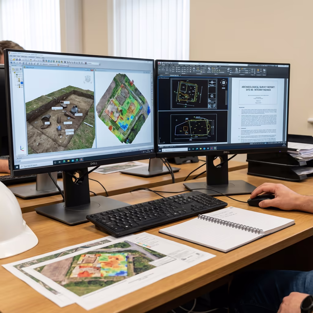
Survey Outputs & Deliverable Packages
We customise deliverables to match your project specifications, though our standard archaeological survey outputs comprise:
Site Orthomosaic Imagery
High-resolution, georeferenced drone photograph encompassing the complete site, typically at 1-2cm ground sample distance. Ideal for interpretation and as a foundation for GIS work.
Three-Dimensional Models
Detailed 3D mesh and point cloud of excavations, structures, and terrain. Export for analysis, archiving, or public engagement initiatives.
Feature Interpretation Mapping
Interpretive mapping of visible archaeological features, crop marks, and earthworks superimposed on the orthomosaic.
CAD Drawing Files
Survey-accurate CAD files compatible with your established workflows. DXF, DWG, and Shapefile formats available.
Excavation Assistance
Real-time orthophotos and progress models during excavation, facilitating rapid decision-making and thorough documentation.
Require particular deliverables for your project?
Project Timelines & Delivery Schedules
On-site data capture proves remarkably efficient. A typical excavation site can be surveyed in 30-60 minutes of flight time, whilst larger landscape surveys spanning several hectares require just a few hours. We can survey sites during excavation breaks with minimal disruption to the dig team.
Processing and delivery hinges on project complexity and your specified outputs. Standard deliverables are typically prepared within 5-7 working days. For urgent projects - such as fast-track excavations or planning deadlines - we provide expedited processing with 48-72 hour turnaround.
| Phase | Duration |
|---|---|
| Planning & Permissions | 1-2 days |
| On-Site Data Capture | 1-4 hours |
| Processing | 2-3 days |
| Quality Control | 1-2 days |
| Deliverable Generation | 1-2 days |
| Total (Standard) | 5-7 working days |
Accelerated Processing Offered
Require faster delivery? 48-72 hour turnaround available for pressing excavation or planning deadlines.
Selecting an Archaeological Survey Provider
Not all drone survey providers grasp the particular requirements of archaeological projects. When assessing providers, we recommend examining these essential factors:
- CAA certification - Verify they possess valid GVC or legacy PfCO permissions for commercial operations
- Archaeological comprehension - Do they appreciate archaeological recording standards and your project specifications?
- Comprehensive insurance - Public liability and professional indemnity coverage suitable for heritage sites
- Survey-grade precision - Can they furnish the accuracy demanded for archaeological documentation?
- Heritage sector track record - Request examples of archaeological projects they have executed
At HireDronePilot, we satisfy every criterion. We are CAA certified, comprehensively insured, and have executed archaeological survey projects for commercial archaeology units, heritage bodies, and research initiatives throughout the UK.
Prepared to collaborate with a provider who comprehends archaeology?
Drone Assessment vs Conventional Method Costs
In the majority of scenarios, yes - frequently by a considerable margin. Conventional photographic recording of excavations demands scaffold towers, multiple camera positions, and substantial time. Ground-based surveying of complex sites entails establishing stations and manually documenting thousands of points.
Our drone surveys capture equivalent or superior data in a fraction of the duration. An excavation that might consume half a day to photograph conventionally can be captured in minutes from above, with vastly greater coverage and consistency. Cost reductions typically span 40-60% compared to conventional methods, whilst providing swifter turnaround and more thorough records.
Prepared to Explore Your Archaeological Project?
Specialist guidance - Bespoke pricing - Avg Response within 5 Mins

Peter Leslie
Owner & Drone Pilot
With extensive experience in surveying and UAV operations, Peter personally oversees every archaeological project to ensure professional delivery and accurate recording.
Quick Guide: Drone Archaeological Assessments
Archaeological Survey Outputs
- Site orthomosaic (1-2cm GSD)
- 3D models & point clouds
- Feature mapping & interpretation
- Crop mark analysis
- CAD files (DXF/DWG)
- Excavation support services
Talk Through Your Project
Receive specialist guidance and bespoke pricing.
Drone Pilot Reviews
Why Drone Pilots Rate HireDronePilot 5 Stars
Don't just take our word for it. Here's what drone pilots in our UK network say about getting work through the platform.
“I get relevant commercial briefs with clear scopes, so quoting is fast and accurate. It has helped me win consistent survey work without chasing low-quality leads.”
Adam Carter
Drone Pilot
“Since joining the platform, I have filled gaps in my schedule with quality roof and inspection jobs. The enquiry details are much better than generic lead forms.”
Sophie Bennett
Drone Pilot
“HireDronePilot makes it easier to focus on delivery. I can review project briefs quickly, submit competitive quotes, and pick up work in new regions.”
Daniel Khan
Drone Pilot
Complementary Survey Services
Drone Topographic Survey
Comprehensive topographic surveys for planning, design and heritage stewardship projects.
LiDAR Terrain Mapping
Penetrate vegetation to expose concealed earthworks and features beneath canopy cover.
Three-Dimensional Modelling
Comprehensive 3D models of excavations, structures, and monuments for archival and analysis purposes.