Surveying & Mapping
Drone Measured Building Survey Service
Accurate external building measurements from drone data. Elevation drawings, 3D representations, and thorough dimensional data for architects and property professionals.
Avg Response within 5 Mins • Or call +44 1334 804554
Understanding Drone Measured Building Survey
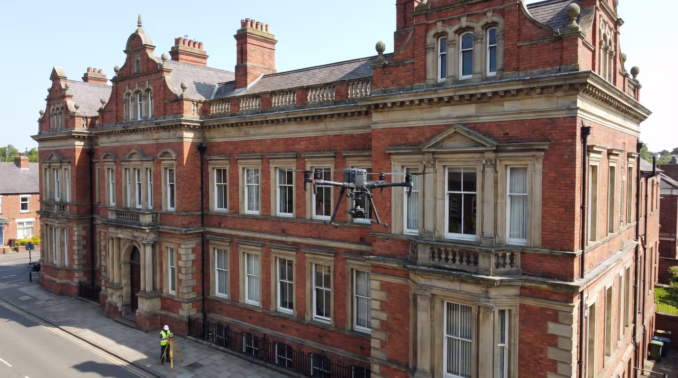
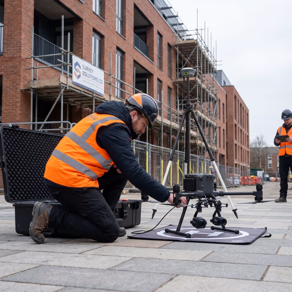
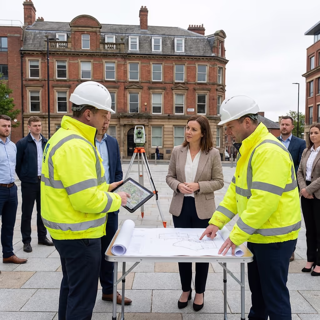
A drone measured building survey captures accurate external dimensions of buildings utilising photogrammetry. Our UAVs photograph every facade, roof plane, and architectural feature, generating precise 3D models from which we extract thorough measurement data.
At Hire Drone Pilot, we merge high-resolution drone imagery with sophisticated processing to produce elevation drawings, facade measurements, and 3D building models. This methodology is especially beneficial for buildings where conventional access is challenging, hazardous, or would necessitate costly scaffolding.

Peter Leslie
Owner & Drone Pilot
"Have questions? Ring me directly - I'm happy to discuss your project requirements."
Call NowPrecise Building Dimensions,No Access Equipment Needed
What You'll Receive
- Scaled elevation drawings
- 3D building representation
- Facade measurements
- CAD-ready files (DXF/DWG)
Delivered in 3-5 working days
Why Use HireDronePilot
- CAA certified & comprehensively insured
- No scaffolding or access equipment
- Architect-ready outputs
- Nationwide coverage
Relied upon by architects, surveyors & property developers throughout the UK.
Relied upon by major organisations
What Does an Drone Measured Building Survey Cost?
Pricing varies based on building dimensions, intricacy, and required outputs. Below is a reference to assist with budgeting:
| Building Type | Guide Price |
|---|---|
| Small BuildingUnder 200m² footprint | £400+ |
| Medium Building200-500m² footprint | £700+ |
| Large Building500-1000m² footprint | £1,200+ |
| Complex BuildingIntricate architecture | £2,000+ |
| Multi-BuildingEstate or campus | POA |
*Reference prices encompass standard outputs. Final quotation depends on building intricacy, access, and particular requirements.
Factors Influencing Your Quote
- Building dimensions & elevation
- Architectural intricacy
- Required outputs
- Access & location
Our UAV-based approach removes scaffolding and cherry picker hire, frequently saving 30-50% compared to conventional measured building surveys. Send us your project particulars for a customised quotation within 24 hours.
Prepared to receive a quotation for your building?
Complimentary, no-commitment quotes within 24 hours
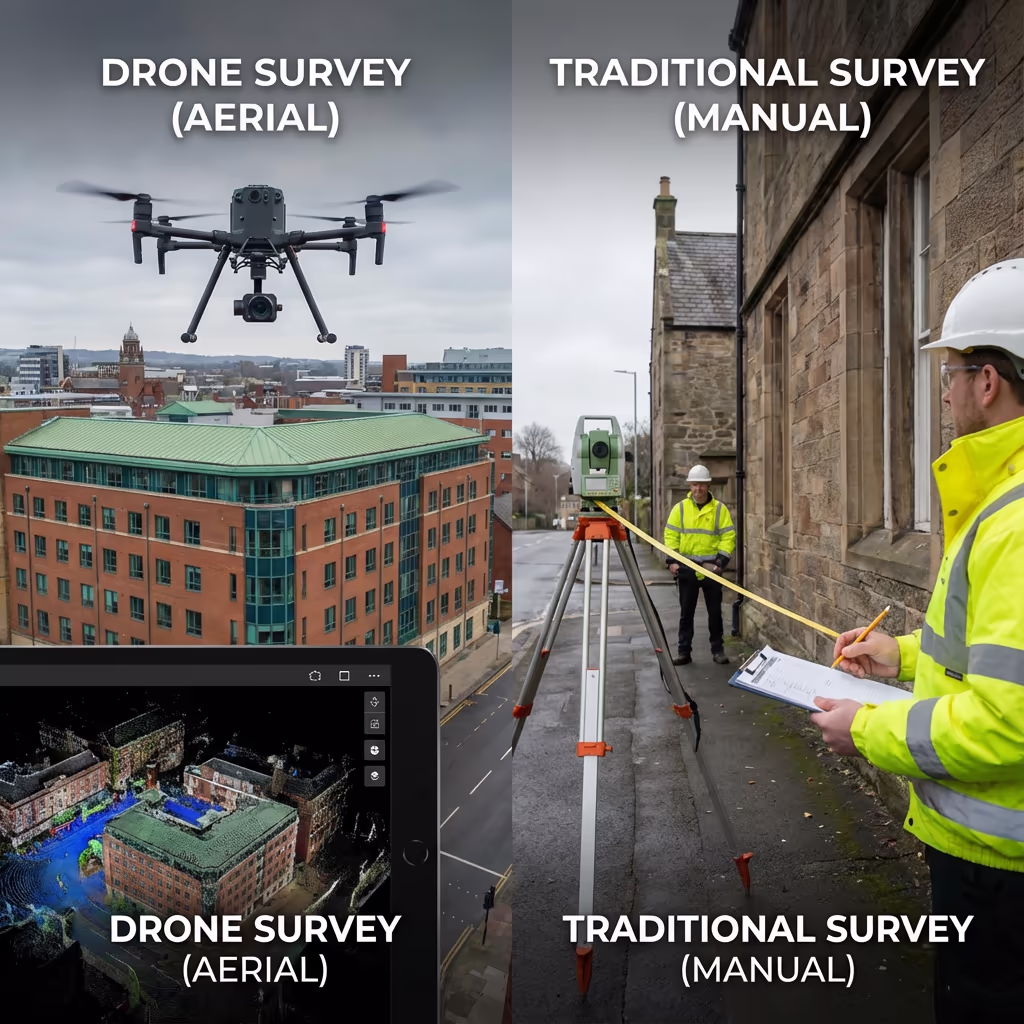
How Does Drone Measured Building Survey Compare to Conventional Approaches?
Conventional measured building surveys demand surveyors to physically access every portion of a building—frequently utilising scaffolding, cherry pickers, or abseil access for upper storeys and roofs. This is time-intensive, costly, and occasionally impossible for certain structures.
Drone measured building surveys capture the complete exterior from above in a fraction of the time. Our UAVs photograph all facades, roof zones, and architectural features without scaffolding or working at height. The outcome is thorough coverage that frequently surpasses what conventional approaches can accomplish—especially for complex rooflines and inaccessible zones.
Selecting the Right Approach
Drone Measured Building Survey
Contemporary approach
Conventional Approaches
Manual measurement
Uncertain which approach fits your project?
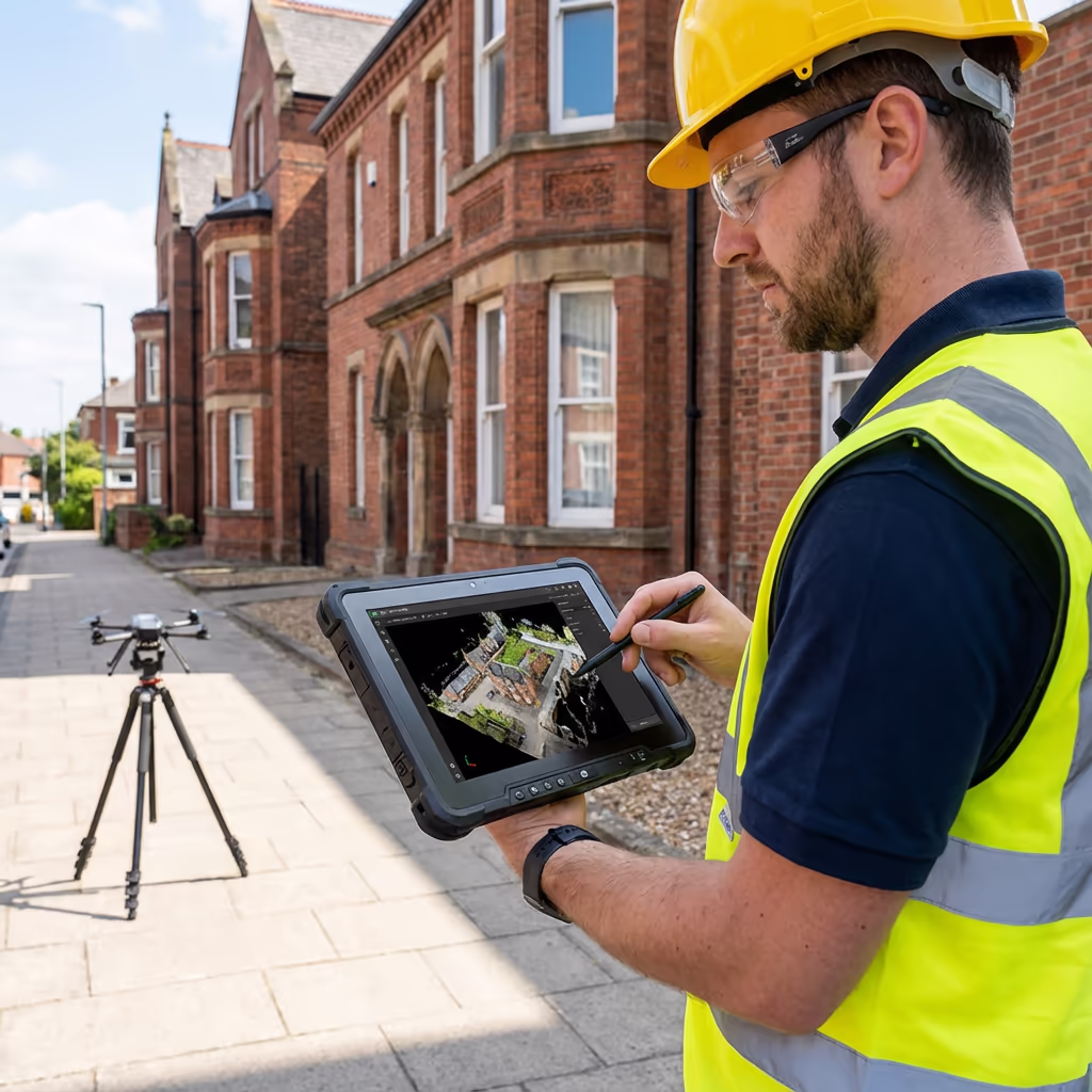
What Precision Can an Drone Measured Building Survey Deliver?
Our drone measured building surveys consistently attain precision of ±10-20mm on facade dimensions when employing ground control points. For most architectural and planning purposes, this surpasses the tolerances stipulated by RICS guidelines.
We establish survey control utilising RTK GPS and position coded targets on the building where accessible. Our processing workflow employs photogrammetric adjustment to guarantee consistent precision across all facades. For projects demanding higher accuracy, we can merge drone capture with terrestrial survey checks to attain ±5mm or superior.
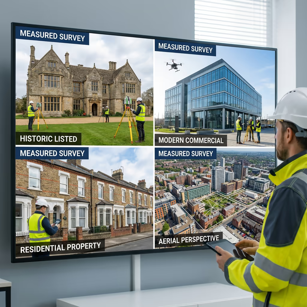
Where Are Drone Measured Building Surveys Used?
Drone measured building surveys serve a broad spectrum of property and construction professionals. Below are the principal applications where our clients realise the most value:
Architectural Design
Precise as-built drawings for extensions, modifications, and refurbishment projects where original drawings are absent or unreliable.
Planning Applications
Accurate elevation drawings and site context for planning submissions, change of use applications, and conservation area proposals.
Heritage & Conservation
Comprehensive recording of listed buildings, historic structures, and conservation assets for heritage statements and repair specifications.
Property Transactions
Due diligence assessments for acquisitions, lease negotiations, and portfolio management demanding accurate floor areas and dimensions.
Facade Restoration
Comprehensive facade assessments for window replacement, cladding projects, and restoration schemes necessitating precise opening dimensions.
BIM & Digital Twins
Generating precise 3D models as the groundwork for BIM workflows and digital twin applications in facilities management.
Have a building requiring measurement?
Can UAVs Capture Building Interiors?
Standard outdoor UAVs are engineered for exterior assessments only. Flying inside buildings presents considerable challenges—GPS doesn't function indoors, there's insufficient space for safe manoeuvring, and collision risk is elevated. Our drone measured building surveys concentrate on external facades, roofs, and building envelopes.
For interior assessments, we provide complementary terrestrial laser scanning and handheld SLAM scanning services. These can be integrated with drone exterior surveys to produce thorough whole-building models. If you require internal floor plans alongside external elevations, we can furnish an integrated package.
Require Interior + Exterior?
We provide combined packages merging drone exterior surveys with terrestrial interior scanning for complete building documentation.
What Outputs Do You Receive From an Drone Measured Building Survey?
We customise outputs to match your project requirements, but our standard measured building survey deliverables comprise:
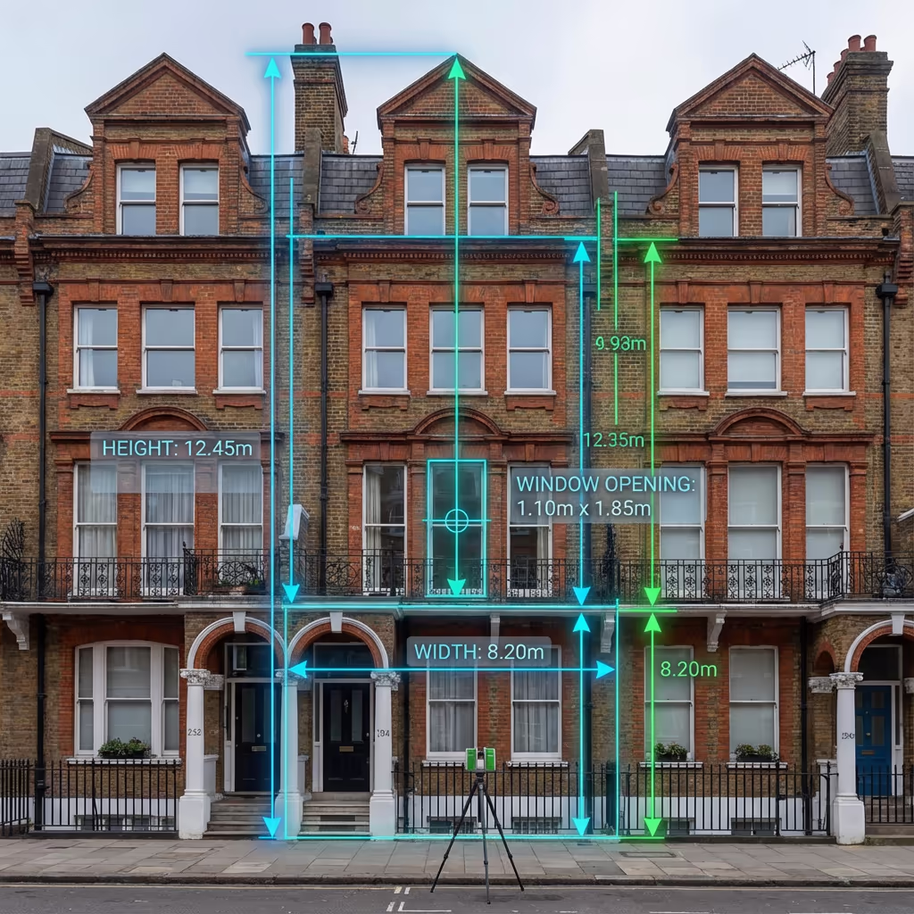
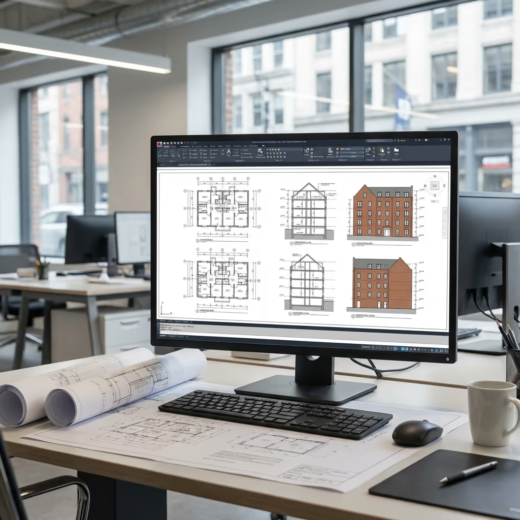
Elevation Drawings
Scaled elevation drawings of all facades with principal dimensions annotated. Supplied as PDF and DWG/DXF files.
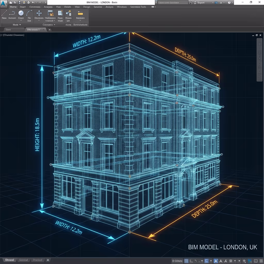
3D Building Representation
Textured 3D mesh model of the complete building exterior. Available in OBJ, FBX, or other common formats.
Orthomosaic Facades
True-to-scale photographic images of each facade, corrected for perspective distortion and suitable for condition documentation.
Roof Plan
Plan view of the roof displaying all planes, features, and principal dimensions. Essential for roofing specifications and drainage design.
CAD Files
All drawings furnished in DWG and DXF formats, prepared for import into AutoCAD, Revit, or other design software.
Ultra-Sharp Imagery
Complete collection of drone photographs capturing all building details. Invaluable for condition evaluation and defect identification.
Require particular outputs for your project?
What's the Duration of an Drone Measured Building Survey?
On-site data gathering is exceptionally swift. A typical residential or small commercial building takes 1-2 hours to survey completely—encompassing all facades and roof zones. Larger or more complex buildings may necessitate half a day.
Processing and output production typically requires 3-5 working days for standard projects. Intricate buildings with detailed architectural features may demand additional processing time. For pressing requirements, we provide accelerated turnaround options.
| Phase | Duration |
|---|---|
| Booking & Planning | 1-2 days |
| On-Site Survey | 1-4 hours |
| 3D Model Creation | 1-2 days |
| Drawing Production | 1-2 days |
| Total (Standard) | 3-5 working days |
Express Processing Ready
Require it sooner? 24-48 hour turnaround obtainable for pressing projects.
How Do I Select an Drone Measured Building Survey Provider?
Not all drone survey providers deliver the same calibre of measured building work. When appraising providers, we suggest verifying these essential criteria:
- CAA certification – Confirm they possess valid GVC or legacy PfCO permissions for commercial operations
- Comprehensive insurance – Public liability and professional indemnity coverage appropriate to your project
- Survey expertise – Drone photography differs from measured surveys—verify they comprehend dimensional precision
- CAD competency – Enquire about their drawing production workflow and output formats
- Pertinent examples – Request case studies of comparable building surveys they've accomplished
At Hire Drone Pilot, we meet every criterion. We're CAA certified, comprehensively insured, and have delivered measured building surveys for architects, heritage consultants, and property professionals throughout the UK.
Prepared to engage a dependable survey provider?
Is Drone Measured Building Survey More Economical Than Conventional Approaches?
In most instances, yes—frequently considerably so. Conventional measured building surveys of multi-storey structures typically demand scaffolding hire, cherry picker rental, or specialist abseil access. These access expenses alone can surpass the complete price of a drone survey.
Our UAV-based approach captures all exterior surfaces in hours rather than days, with no access equipment necessary. Typical savings span 30-50% compared to conventional approaches, whilst frequently delivering more thorough data—especially for roof zones that would otherwise demand costly access solutions.
Typical Cost Comparison (3-Storey Building)
Prepared to Discuss Your Building Survey?
Specialist guidance - Customised pricing - Avg Response within 5 Mins

Peter Leslie
Owner & Drone Pilot
With substantial expertise in surveying and UAV operations, Peter personally supervises every measured building project to guarantee precise dimensions and professional delivery.
TLDR: Drone Measured Building Surveys Explained
Survey Outputs
- Elevation drawings (PDF/DWG)
- 3D building representation
- Orthomosaic facades
- Roof plan
- CAD files (DXF/DWG)
- Ultra-sharp imagery
Talk Through Your Project
Obtain specialist guidance and customised pricing.
Drone Pilot Reviews
Why Drone Pilots Rate HireDronePilot 5 Stars
Don't just take our word for it. Here's what drone pilots in our UK network say about getting work through the platform.
“I get relevant commercial briefs with clear scopes, so quoting is fast and accurate. It has helped me win consistent survey work without chasing low-quality leads.”
Adam Carter
Drone Pilot
“Since joining the platform, I have filled gaps in my schedule with quality roof and inspection jobs. The enquiry details are much better than generic lead forms.”
Sophie Bennett
Drone Pilot
“HireDronePilot makes it easier to focus on delivery. I can review project briefs quickly, submit competitive quotes, and pick up work in new regions.”
Daniel Khan
Drone Pilot
Associated Services
Drone Topographic Survey
Thorough site assessments providing accurate topographic data and 3D terrain models.
LiDAR Mapping
High-precision laser scanning for comprehensive terrain models and vegetation penetration assessments.
Drone Roof Inspection
Comprehensive roof assessments and condition evaluations without scaffolding or access equipment.