Surveying & Mapping
Drone Road Survey Service
Precision drone surveys for roads, highways, and transport infrastructure. Precise cross-sections, surface condition mapping, and CAD-ready outputs.
Avg Response within 5 Mins • Or ring +44 1334 804554
Understanding Drone Road Surveys
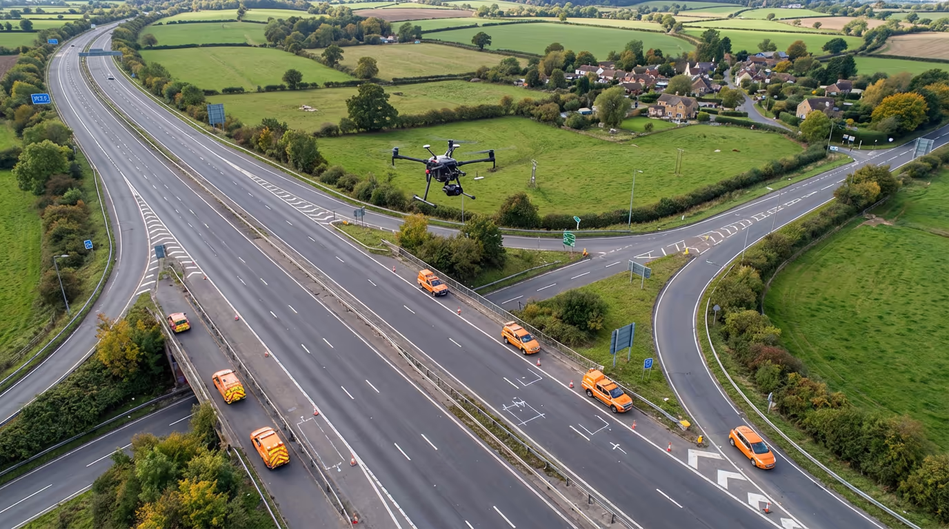
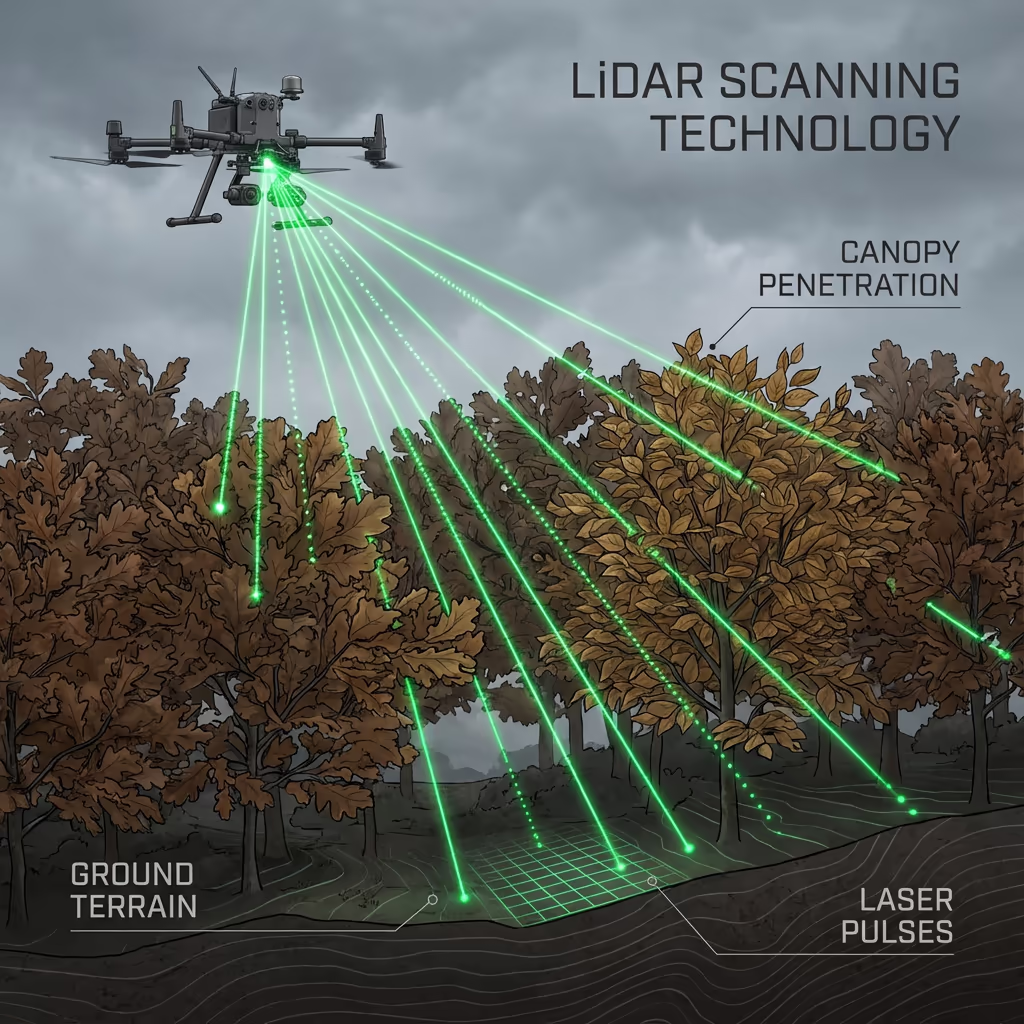
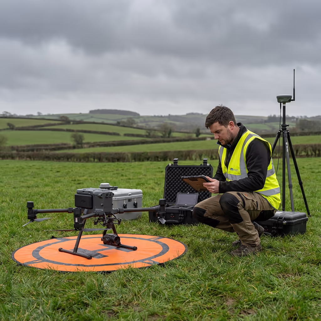
A UAV road survey employs drone-mounted cameras and sensors to capture highly precise data of road corridors, highways, and transport infrastructure. Our drones fly systematic grid patterns along roads, capturing thousands of overlapping images that are processed into precise 3D models, orthomosaics, and cross-sections.
At Hire Drone Pilot, we deliver survey-grade road data for highway authorities, civil engineers, and transport planners. Whether you need cross-sections for resurfacing projects, surface condition assessments, or complete corridor mapping for new road schemes, our UAV road surveys provide the precise data you need—quicker and more economically than conventional methods.

Peter Leslie
Owner & Drone Pilot
"Have questions? Ring me directly - I'm happy to discuss your project requirements."
Call NowSurvey-Grade Road Data,Delivered Promptly
What You'll Receive
- High-resolution orthomosaic
- Cross-sections at any interval
- Longitudinal profiles
- Survey-grade accuracy (±2-5cm)
Delivered in 5-7 working days
Why Use HireDronePilot
- CAA certified & fully insured
- Specialist road survey expertise
- Latest UAV & sensor technology
- Nationwide availability
Relied upon by highway authorities, engineers & transport planners throughout the UK.
Relied upon by leading organisations

What's the Investment for a Drone Road Survey?
Pricing depends on the length of road and complexity of your requirements. Here's a guide to help you budget:
| Road Length | Guide Price |
|---|---|
| Short StretchUnder 1km | £600+ |
| Medium1-5km | £1,200+ |
| Long5-10km | £2,000+ |
| Major Route10+ km | £3,500+ |
| Network SurveyMultiple routes | POA |
*Guide prices include standard deliverables. Final quote based on road width, traffic management requirements, and specific outputs needed.
What affects your quote?
- Road length & width
- Traffic management needs
- Required deliverables
- Turnaround time
Our UAV-based approach typically saves 50-70% compared to conventional road survey methods—and dramatically reduces traffic disruption. Contact us with your project details and we'll provide a tailored quote within 24 hours.
Prepared to receive a quote for your road project?
Free, no-obligation quotes within 24 hours
How Do Drone Road Surveys Compare to Conventional Methods?
Conventional road surveys require teams of surveyors working on or beside live carriageways. This means traffic management, lane closures, and significant health and safety considerations. It's slow, expensive, and disruptive to road users.
UAV road surveys capture the same data—often more—from the air. Our drones fly above the road corridor, capturing thousands of images in a fraction of the time. We can survey 10km of road in a single day that might take a ground team weeks. Traffic disruption is minimal or eliminated entirely for many projects.
When to Select Each Approach
Select UAV Road Survey
Quick & minimal disruption
Select Conventional Methods
When ground access is essential
Uncertain which approach suits your project?
What Precision Levels Do Drone Road Surveys Attain?
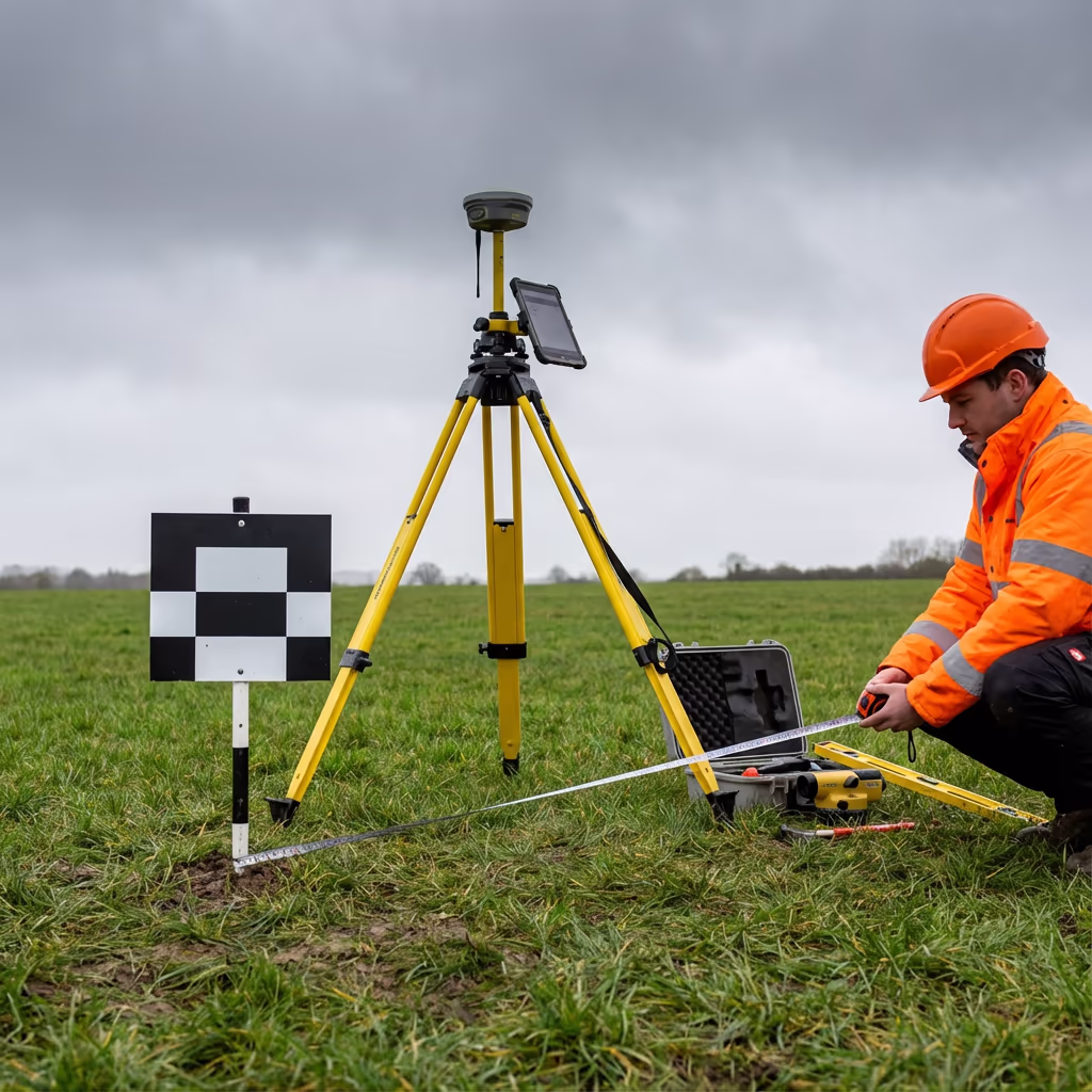
Our UAV road surveys routinely attain vertical precision of ±2-5cm and horizontal precision of ±3-5cm when using ground control points. This level of accuracy meets the requirements for highway design, resurfacing projects, and engineering applications.
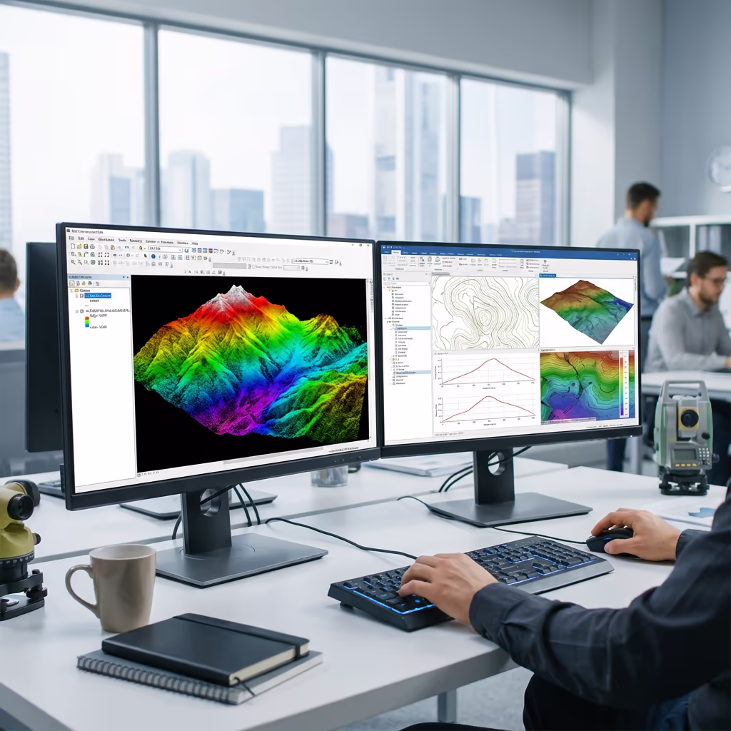
We use RTK/PPK-enabled drones with high-resolution cameras to ensure precise positioning. For projects requiring the highest accuracy, we establish ground control networks along the road corridor and process data using rigorous photogrammetric workflows. Cross-sections and profiles are extracted to engineering-grade standards suitable for CAD integration.
Where Are Drone Road Surveys Applied?
UAV road surveys serve a wide range of highway and transport infrastructure projects. Here are the key applications where our clients see the greatest value:
Road Design & Planning
Accurate terrain models and existing conditions surveys for new road schemes, junction improvements, and road widening projects.
Resurfacing Projects
Precise cross-sections and longitudinal profiles for surfacing quantity calculations and material specification.
Highway Asset Management
Network-wide condition surveys, asset inventories, and baseline data for highway authorities and maintenance contractors.
Drainage & Flooding
Accurate elevation data for drainage design, flood risk assessment, and surface water management along road corridors.
Active Travel Routes
Cycle paths, pedestrian routes, and multi-use trails—capturing existing conditions for upgrade and improvement schemes.
Construction Monitoring
Progress surveys during road construction, volume calculations for earthworks, and as-built verification.
Have a road project that needs surveying?
Can Drone Road Surveys Capture Road Surface Condition?
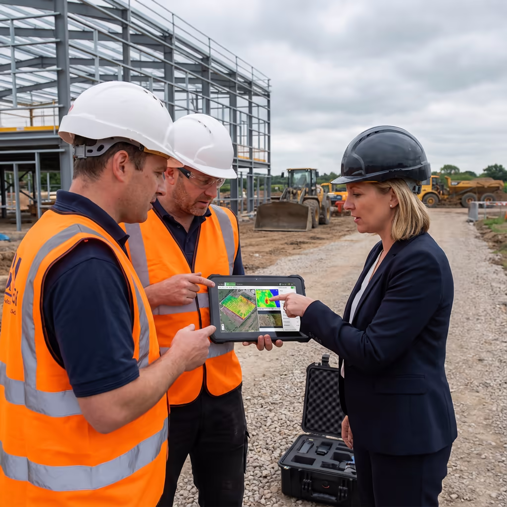
Yes—our high-resolution UAV imagery captures detailed road surface condition data. From centimetre-resolution orthomosaics, we can identify and map surface faults including cracking patterns, potholes, patching, rutting evidence, and deterioration of road markings.
For highway authorities and maintenance contractors, this provides a powerful tool for condition assessment and planned maintenance prioritisation. Combined with our 3D surface models, we can quantify rutting depth, identify drainage issues, and support asset management decisions. This visual condition data complements conventional machine-based surveys and provides context that automated systems often miss.
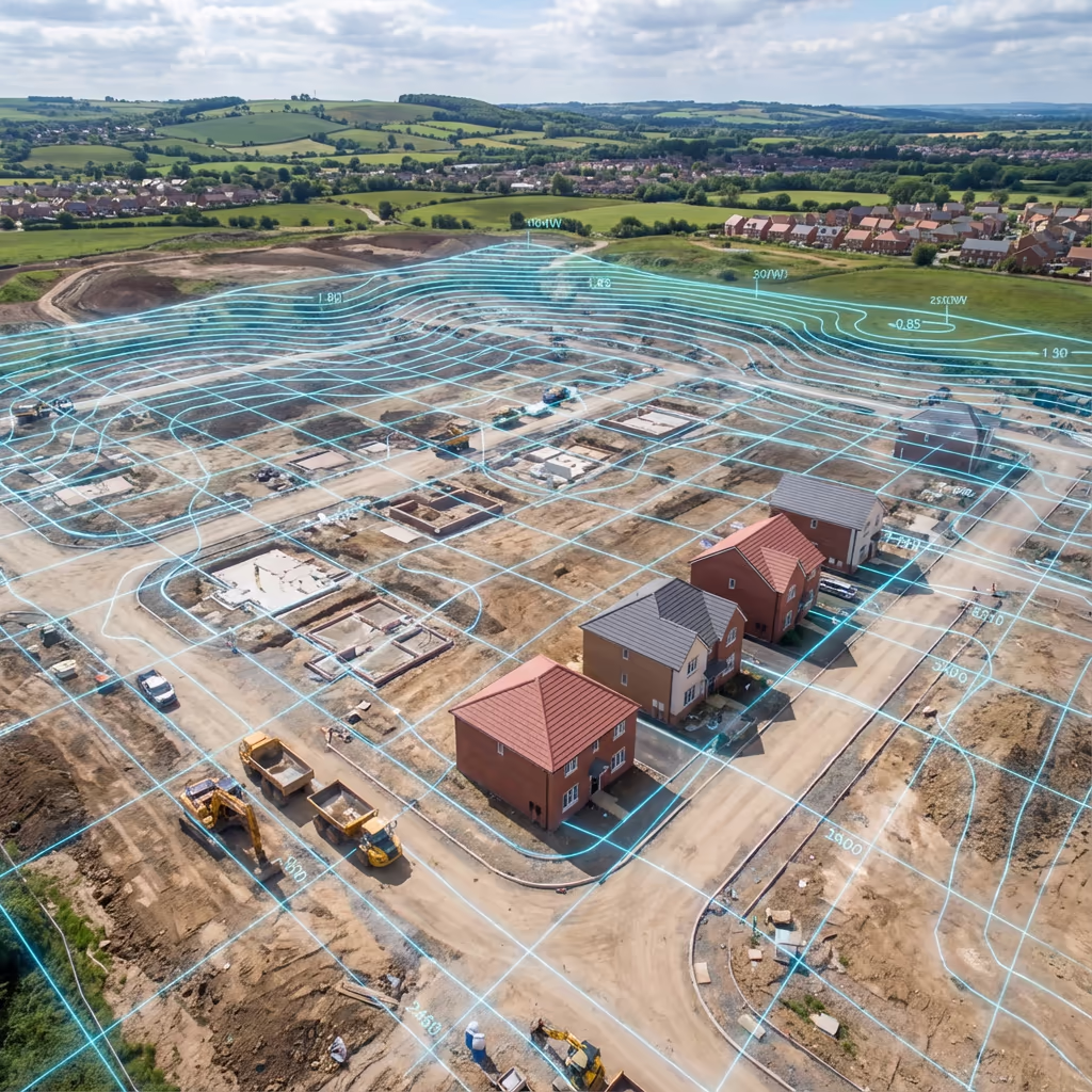
What Outputs Do You Receive From a Drone Road Survey?
We tailor outputs to your project requirements. Our standard UAV road survey deliverables include:
High-Resolution Orthomosaic
Georeferenced drone imagery of the entire road corridor at 1-2cm per pixel resolution. Perfect for condition assessment and visual documentation.
Cross-Sections
Accurate cross-sections at any interval you specify—typically 10m, 20m, or 50m depending on project requirements.
Longitudinal Profiles
Road centreline profiles showing vertical alignment, gradients, and level changes along the route.
Surface Condition Reports
Visual assessment of road surface condition with defect mapping and photographic evidence.
CAD Drawings
AutoCAD-compatible DWG files with road edge, kerb lines, markings, and survey data ready for design integration.
Digital Terrain Model (DTM)
Bare-earth surface model of the road corridor for drainage analysis, earthworks calculations, and design development.
Need specific outputs for your road project?
What's the Duration of a Drone Road Survey?
On-site data capture is remarkably quick compared to conventional methods. We can survey 5-10km of road corridor per day depending on width, traffic conditions, and complexity. A typical 2km road scheme takes just 2-3 hours of flight time, plus setup and ground control establishment.
Processing and delivery depends on project complexity and your required outputs. Standard deliverables are typically ready within 5-7 working days. For urgent projects, we offer expedited processing with 48-72 hour turnaround available at additional cost.
| Phase | Duration |
|---|---|
| Planning & Permissions | 1-3 days |
| On-Site Data Capture | ½-1 day |
| Photogrammetric Processing | 2-3 days |
| Cross-Section Extraction | 1-2 days |
| QC & Delivery | 1 day |
| Total (Standard) | 5-7 working days |
Express Processing Available
Need it faster? 48-72 hour turnaround available for urgent road projects.
How Should I Select a Drone Road Survey Provider?
Not all UAV survey providers have expertise with road and highway projects. When evaluating providers, we recommend checking these key factors:
- CAA authorisation – Ensure they hold valid GVC or legacy PfCO permissions for commercial operations
- Professional insurance – Public liability and professional indemnity cover appropriate to highway projects
- Road survey experience – Ask about their experience with linear corridor surveys and cross-section extraction
- CAD capability – Ensure they can deliver in your required formats (DWG, DXF, etc.)
- Relevant case studies – Request examples of similar road and highway projects they've completed
At Hire Drone Pilot, we tick every box. We're CAA certified, fully insured, and have delivered road survey projects for highway authorities, civil engineering consultants, and transport planners throughout the UK.
Prepared to work with a reliable road survey provider?
Are Drone Road Surveys More Cost-Effective Than Conventional Methods?
In most scenarios, yes—often dramatically so. Conventional road surveys require teams of surveyors working on or beside live carriageways, with all the traffic management, health and safety, and time costs that entails. A ground survey of a 5km road corridor might take a team a week or more.
Our UAV approach captures equivalent data in hours, not days. We fly above the road corridor, eliminating most traffic management requirements and dramatically reducing on-site time. The cost savings typically range from 50-70% compared to conventional methods—and you get quicker turnaround with less disruption to road users. For busy roads and motorways, the indirect savings from reduced traffic disruption can be even greater.
Prepared to Talk About Your Road Survey Project?
Expert guidance • Tailored pricing • Avg Response within 5 Mins

Peter Leslie
Owner & Drone Pilot
With considerable expertise in surveying and UAV operations, Peter personally oversees every road survey project to ensure survey-grade precision and professional delivery.
TLDR: UAV Road Surveys Explained
Road Survey Outputs
- High-resolution orthomosaic
- Cross-sections at any interval
- Longitudinal profiles
- Surface condition reports
- CAD drawings (DWG/DXF)
- Digital Terrain Model (DTM)
Talk About Your Project
Receive expert guidance and tailored pricing.
Drone Pilot Reviews
Why Drone Pilots Rate HireDronePilot 5 Stars
Don't just take our word for it. Here's what drone pilots in our UK network say about getting work through the platform.
“I get relevant commercial briefs with clear scopes, so quoting is fast and accurate. It has helped me win consistent survey work without chasing low-quality leads.”
Adam Carter
Drone Pilot
“Since joining the platform, I have filled gaps in my schedule with quality roof and inspection jobs. The enquiry details are much better than generic lead forms.”
Sophie Bennett
Drone Pilot
“HireDronePilot makes it easier to focus on delivery. I can review project briefs quickly, submit competitive quotes, and pick up work in new regions.”
Daniel Khan
Drone Pilot