Solar Asset Management
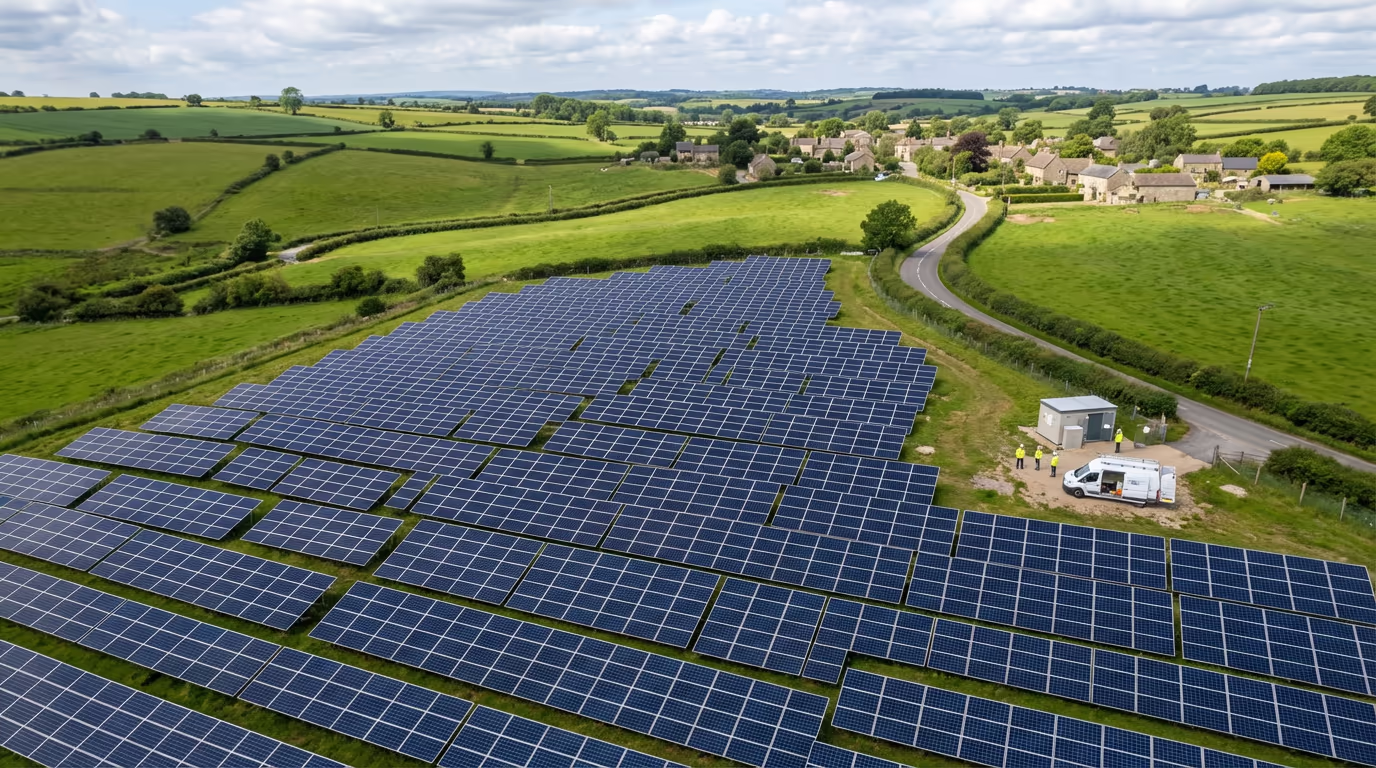
Drone Solar Farm Survey Service
High-precision thermal imaging and inspection services for solar installations. Identify faulty panels, enhance performance, and maximise your energy output.
Avg Response within 5 Mins • Or phone +44 1334 804554
Understanding Drone Solar Farm Surveys
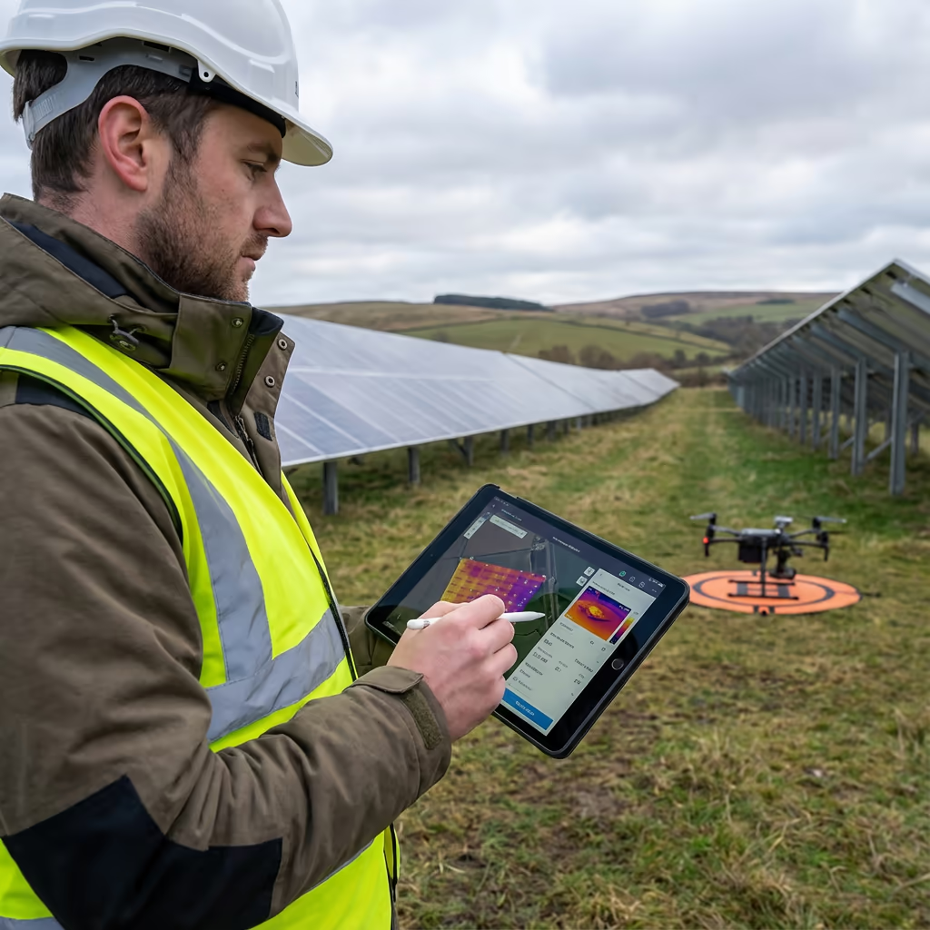
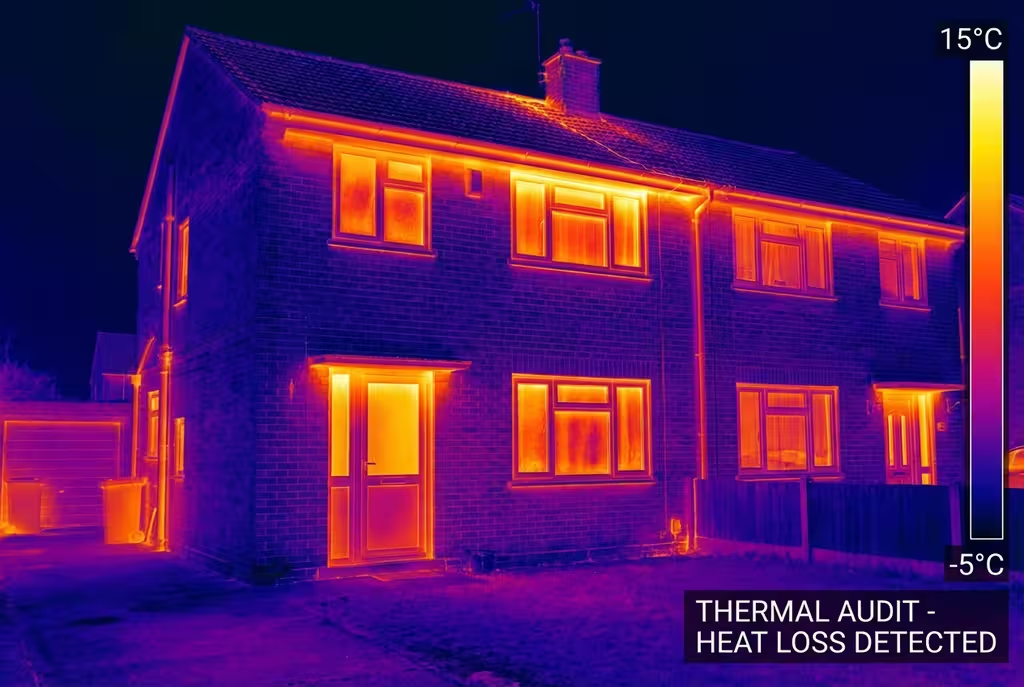
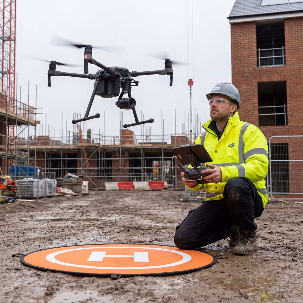
A UAV solar farm survey employs thermal imaging cameras fitted to our aircraft to inspect solar panel installations swiftly and precisely. Unlike conventional ground-based inspections, our drones can survey complete solar farms in hours instead of days, gathering detailed thermal data that uncovers panel faults invisible to the unaided eye.
At Hire Drone Pilot, we merge high-resolution RGB imagery with radiometric thermal sensors capable of detecting temperature variations as minute as 0.05 degrees Celsius. This precision enables us to pinpoint hotspots, bypass diode failures, cell fractures, and soiling problems that diminish your energy output and can cause expensive damage if left unaddressed.
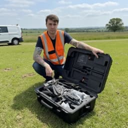
Peter Leslie
Owner & Drone Pilot
"Have questions? Ring me directly - I'm happy to discuss your project requirements."
Call NowThorough Solar Farm Inspection,Rapid Delivery
What You'll Receive
- Thermal imagery of each panel
- Panel fault report with coordinates
- High-resolution orthomosaic
- Maintenance priority schedule
Delivered in 5-7 working days
Why Use HireDronePilot
- CAA certified & comprehensively insured
- Radiometric thermal cameras
- Advanced DJI & sensor technology
- Nationwide availability
Relied upon by solar farm operators, asset managers & O&M providers throughout Britain.
Relied upon by industry leaders
What's the Investment for Drone Solar Farm Surveys?
Costs vary based on your site capacity and inspection specifications. Here's a pricing overview to assist your planning:
| Site Capacity | Starting From |
|---|---|
| CompactUnder 5MW | £800+ |
| Mid-Size5-20MW | £1,500+ |
| Extensive20-50MW | £2,500+ |
| Utility Scale50+ MW | POA |
| Scheduled InspectionAnnual agreement | POA |
*Indicative prices cover standard outputs. Final quotation reflects site layout, accessibility, and particular needs.
Factors influencing your quotation?
- Site capacity (MW)
- Panel arrangement
- Turnaround timeframe
- Report comprehensiveness
Our UAV-based approach generally achieves 60-80% cost savings versus manual panel-by-panel inspection. Get in touch with your site specifics and we'll supply a customised quotation within 24 hours.
Prepared to receive pricing for your solar farm?
Complimentary, obligation-free quotes within 24 hours

How Do Drone Solar Farm Surveys Compare to Manual Inspection?
Conventional manual inspection demands that technicians physically access each panel, examining for visible damage and utilising handheld thermal cameras. This method proves slow, labour-intensive, and can overlook faults that aren't apparent at panel level.
Our UAV solar farm survey captures thermal and visual data from an optimal drone vantage point, examining thousands of panels per hour. The uniform viewing angle and automated flight paths guarantee no panel is missed, whilst our calibrated thermal sensors detect anomalies that handheld devices simply cannot match regarding coverage and consistency.
Selecting the Optimal Method
UAV Solar Farm Survey
Swift & thorough
Manual Inspection
Conventional approach
Uncertain which method fits your site?

What Precision Levels Do Drone Solar Farm Surveys Attain?
Our radiometric thermal cameras achieve temperature measurement precision surpassing ±2 degrees Celsius, with thermal sensitivity detecting variations as minute as 0.05 degrees. This accuracy enables us to pinpoint hotspots and anomalies that signal cell damage, bypass diode failures, or connection problems.
Geospatial precision proves equally vital for positioning faults. Utilising RTK-enabled drones, we locate each thermal anomaly to within centimetres, allowing your maintenance team to find faulty panels rapidly. Every fault is mapped with precise GPS coordinates and cross-referenced to your panel layout, guaranteeing efficient remediation.
Where Are Drone Solar Farm Surveys Applied?
UAV solar farm surveys support the complete lifecycle of solar assets, from pre-acquisition due diligence to continuing O&M programmes. These are the principal applications:
Asset Acquisition
Independent condition evaluation for investors and purchasers. Pinpoint faults and warranty claims prior to transaction completion.
Performance Enhancement
Identify underperforming panels reducing string or inverter output. Prioritise maintenance for optimal yield improvement.
Warranty Adherence
Document panel faults for manufacturer warranty submissions. Our reports supply the evidence required for successful claims.
O&M Contract Transition
Baseline condition surveys when switching O&M providers. Clear documentation of existing faults and maintenance requirements.
Insurance Documentation
Post-event damage evaluation following storms, hail, or vandalism. Evidence for insurance claims with georeferenced fault mapping.
Regulatory Adherence
Support for periodic inspection requirements under subsidy programmes. Documented evidence of ongoing asset maintenance.
Prepared to inspect your solar farm?
Can UAVs Identify Defective Solar Panels?
Yes - thermal imaging proves exceptionally effective at detecting a broad spectrum of solar panel faults. When panels have problems, they produce excess heat that appears distinctly on thermal imagery. Our radiometric cameras can pinpoint:
- Hotspots - Concentrated heating signalling cell damage, faulty connections, or shading impacts
- Bypass diode failures - Overheating bypass diodes visible as heated thirds of panels
- Cell fractures - Cracked cells appearing as linear or irregular heated zones
- PID (Potential Induced Degradation) - Patterns of diminished output across modules
- Contamination & vegetation - Bird droppings, debris, and vegetation shadows impacting performance
- String failures - Complete strings displaying as uniformly cold versus neighbouring strings
Early identification of these problems prevents energy loss and circumvents the safety hazards linked to severely overheating panels. Our comprehensive fault reports categorise each anomaly by severity, enabling you to prioritise maintenance strategically.
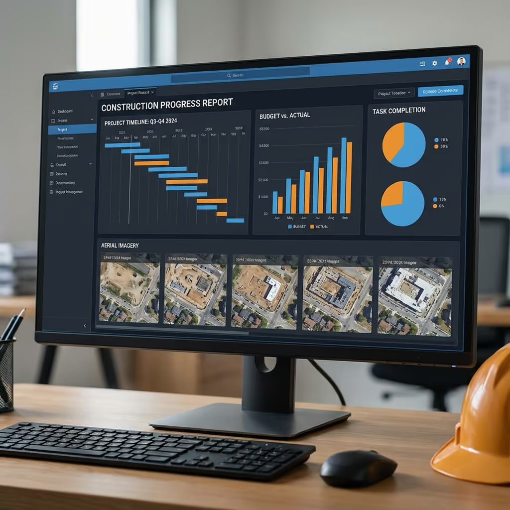
What Outputs Do You Receive From a Drone Solar Farm Survey?
We customise outputs to match your particular requirements, though our standard UAV solar farm survey deliverables encompass:
Thermal Imagery
High-resolution radiometric thermal images of each panel. Calibrated temperature data for precise fault classification.
Panel Fault Reports
Thorough fault register with GPS coordinates, fault type classification, severity ratings, and recommended remedial actions.
Site Orthomosaic
High-resolution drone imagery spanning your complete site. Ideal for site management, vegetation monitoring, and visual condition evaluation.
Site Mapping
GIS-compatible mapping featuring panel locations. Integration with your asset management system for streamlined maintenance planning.
Performance Assessment
Statistical summary of faults by type and severity. Projected energy loss computations and comparison with prior inspections.
Maintenance Prioritisation
Ranked action list based on fault severity and potential energy impact. Clear direction for your maintenance team or O&M provider.
Require particular outputs for your project?
What's the Duration of a Drone Solar Farm Survey?
On-site data acquisition is remarkably efficient. We can survey 50-100MW daily depending on site layout and weather conditions. A typical 20MW solar farm requires just 3-4 hours of flight time, capturing both thermal and RGB imagery of each panel.
Processing and report generation varies with site size and your specified outputs. Standard deliverables are typically prepared within 5-7 working days. For pressing projects requiring rapid turnaround, we provide expedited processing with 48-72 hour delivery available at supplementary cost.
| Stage | Timeframe |
|---|---|
| Planning & Organisation | 1-2 days |
| On-Site Data Acquisition | ½-1 day |
| Image Processing | 1-2 days |
| Fault Assessment | 2-3 days |
| Report Compilation | 1 day |
| Overall (Standard) | 5-7 working days |
Expedited Processing Offered
Require faster delivery? 48-72 hour turnaround accessible for pressing projects and acquisitions.
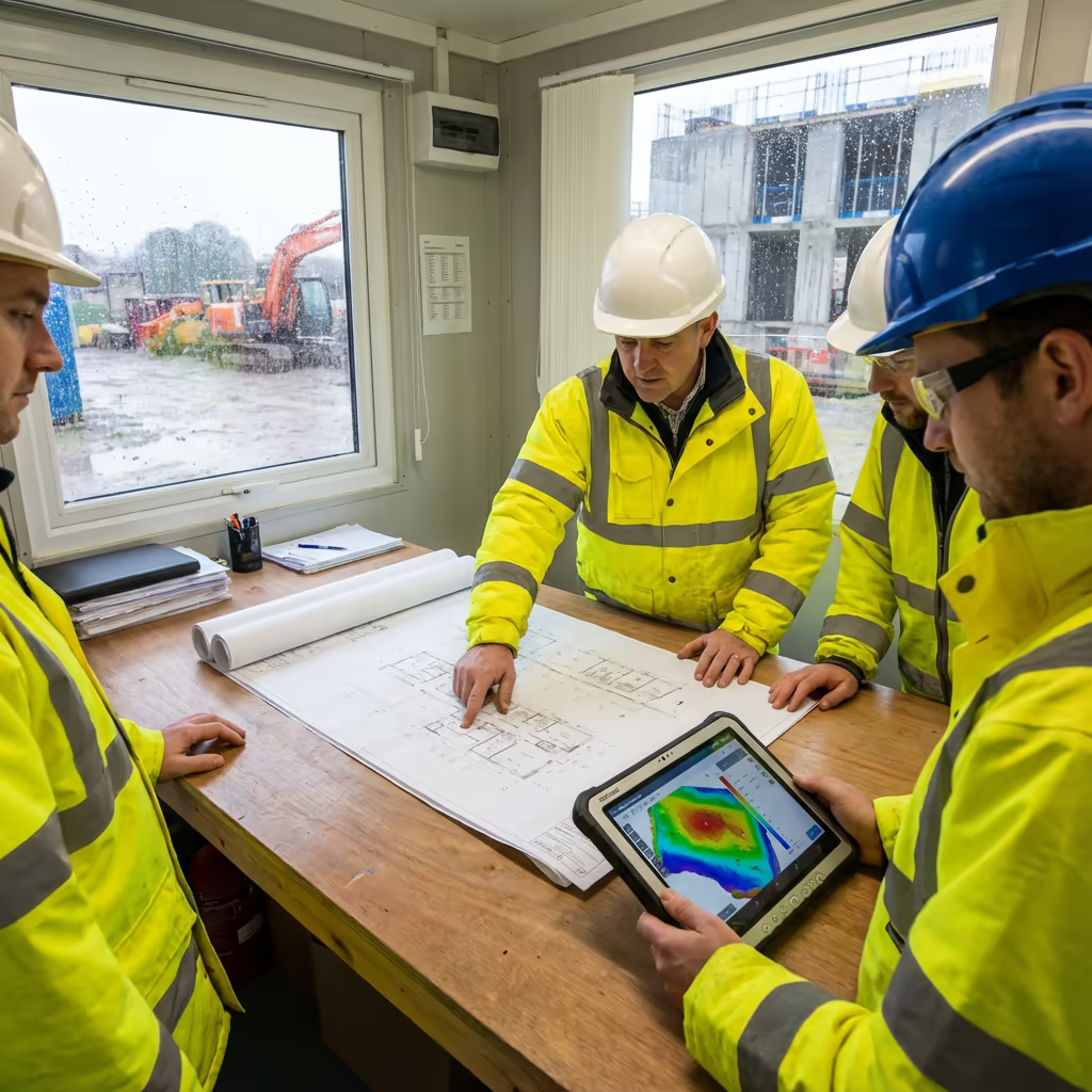
How Should I Select a Drone Solar Farm Survey Provider?
Not every UAV solar inspection service is equivalent. When assessing providers, we suggest verifying these essential criteria:
- CAA certification - Confirm they possess valid GVC or legacy PfCO authorisations for commercial work
- Radiometric thermal cameras - Not all thermal cameras supply calibrated temperature data essential for precise analysis
- Solar sector expertise - Comprehension of PV fault types and their operational consequences
- Comprehensive insurance - Public liability and professional indemnity coverage suited to solar asset work
- Transparent reporting - Reports that integrate with your asset management systems and O&M workflows
At Hire Drone Pilot, we satisfy every criterion. We're CAA certified, comprehensively insured, and have completed solar farm inspections for asset owners, investors, and O&M providers throughout Britain.
Prepared to partner with a dependable solar inspection provider?
Are Drone Solar Farm Surveys More Cost-Effective Than Manual Inspection?
Considerably more economical in nearly every scenario. Conventional manual inspection of a 20MW solar farm might require a team of technicians an entire week, with associated labour, equipment hire, and health & safety expenditure. Our UAV survey captures the same site in hours.
The cost savings typically range from 60-80% compared to conventional panel-by-panel inspection, while producing more thorough data. Every panel is inspected from a consistent angle with calibrated thermal sensors - something manual inspection simply cannot replicate. For portfolio owners with multiple sites, the economics become even more attractive with multi-site contracts.
Ready to Talk About Your Solar Farm Inspection?
Professional guidance - Bespoke pricing - Avg Response within 5 Mins

Peter Leslie
Owner & Drone Pilot
With considerable expertise in surveying and UAV operations, Peter personally manages every solar farm inspection to ensure precise fault identification and professional delivery.
TLDR: UAV Solar Farm Survey Explained
Solar Survey Outputs
- Thermal imaging data
- Panel fault reports
- Orthomosaic mapping
- Site documentation
- Performance assessment
- Maintenance scheduling
Talk About Your Project
Receive professional guidance and bespoke pricing.
Drone Pilot Reviews
Why Drone Pilots Rate HireDronePilot 5 Stars
Don't just take our word for it. Here's what drone pilots in our UK network say about getting work through the platform.
“I get relevant commercial briefs with clear scopes, so quoting is fast and accurate. It has helped me win consistent survey work without chasing low-quality leads.”
Adam Carter
Drone Pilot
“Since joining the platform, I have filled gaps in my schedule with quality roof and inspection jobs. The enquiry details are much better than generic lead forms.”
Sophie Bennett
Drone Pilot
“HireDronePilot makes it easier to focus on delivery. I can review project briefs quickly, submit competitive quotes, and pick up work in new regions.”
Daniel Khan
Drone Pilot