Surveying & Mapping
Drone Coastal Survey Service
High-precision UAV assessments for erosion tracking, cliff face mapping, and coastal change monitoring throughout Britain.
Avg Response within 5 Mins • Or call +44 1334 804554
Understanding Drone Shoreline Assessment
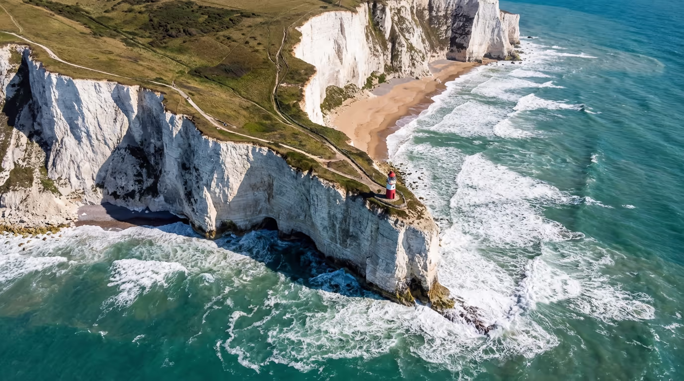
A drone shoreline assessment employs UAV-mounted cameras and sensors to gather high-resolution data from coastlines, cliffs, beaches, and coastal defence structures. This technology enables us to produce detailed mapping, 3D reconstructions, and change analysis that uncovers erosion patterns, structural integrity, and environmental shifts along Britain's shores.
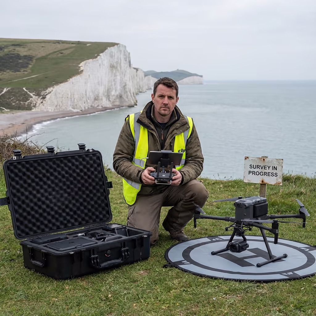
At Hire Drone Pilot, we utilise specialist coastal assessment equipment capable of recording centimetre-precise data across demanding shoreline environments. Our assessments furnish coastal authorities, engineers, and environmental specialists with the accurate information required to track erosion, design interventions, and safeguard critical coastal infrastructure.

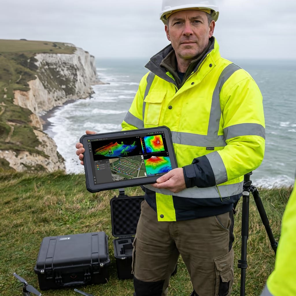
Peter Leslie
Owner & Drone Pilot
"Have questions? Ring me directly - I'm happy to discuss your project requirements."
Call NowPrecision Shoreline Data,Swift Delivery
What You'll Receive
- Detailed coastal orthomosaic imagery
- Erosion tracking & change analysis
- Cliff profiles & section drawings
- Survey-grade precision (±2-5cm)
Delivered in 5-7 working days
Why Use HireDronePilot
- CAA certified with full insurance
- Dedicated coastal assessment expertise
- Current DJI & sensor platforms
- Nationwide service delivery
Relied upon by coastal authorities, engineers & environmental specialists throughout Britain.
Relied upon by major organisations
Shoreline Assessment Pricing Guide
Costs vary based on coastline length and project complexity. Here's a breakdown to assist your planning:
| Coastal Length | Guide Price |
|---|---|
| Short SectionUnder 1km | £600+ |
| Medium1–5km | £1,200+ |
| Long5–10km | £2,000+ |
| Major Stretch10+ km | POA |
| Recurring MonitoringAnnual/Bi-annual | POA |
*Indicative prices cover standard outputs. Final quotation depends on site demands, accessibility, and particular needs.
Factors influencing your quotation
- Shoreline extent & topography
- Specified outputs
- Delivery timeframe
- Site access & approvals
Our UAV-based methodology typically reduces costs by 50–70% versus conventional coastal survey approaches. Share your project specifications and we'll deliver a customised quotation within 24 hours.
Prepared for a quotation on your coastal project?
Complimentary, no-commitment quotes within 24 hours
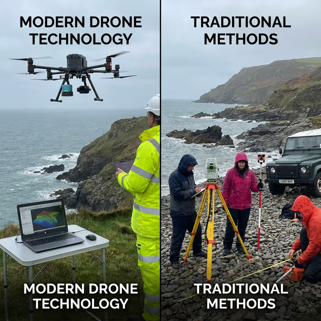
Drone Assessment vs Conventional Monitoring Methods
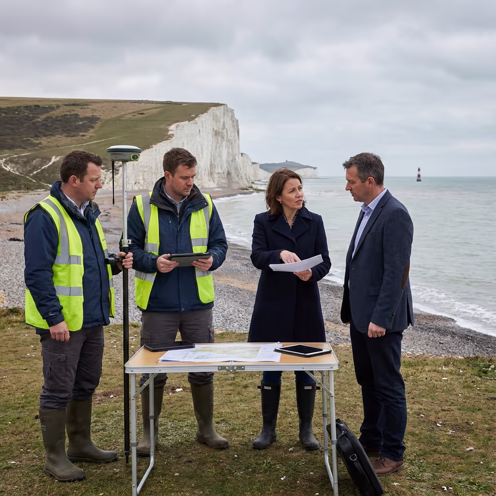
Conventional coastal surveys generally depend on ground-based GPS measurements, theodolite stations, or manned aircraft. Although effective, these approaches are frequently time-intensive, costly, and constrained in the data they can gather—especially on dangerous cliff faces or dynamic beach settings.
Drone shoreline assessments fundamentally transform this methodology. Our UAVs safely reach cliff tops, vertical faces, and isolated coastline sections that would be hazardous or inaccessible for ground crews. We capture thousands of high-resolution images yielding detailed orthomosaics and 3D models, enabling precise volumetric analysis of erosion and sediment accretion.
Selecting the Right Approach
Opt for Drone Assessment
Rapid, secure & thorough
Conventional Ground Survey
Targeted point measurements
Uncertain which method fits your shoreline needs?
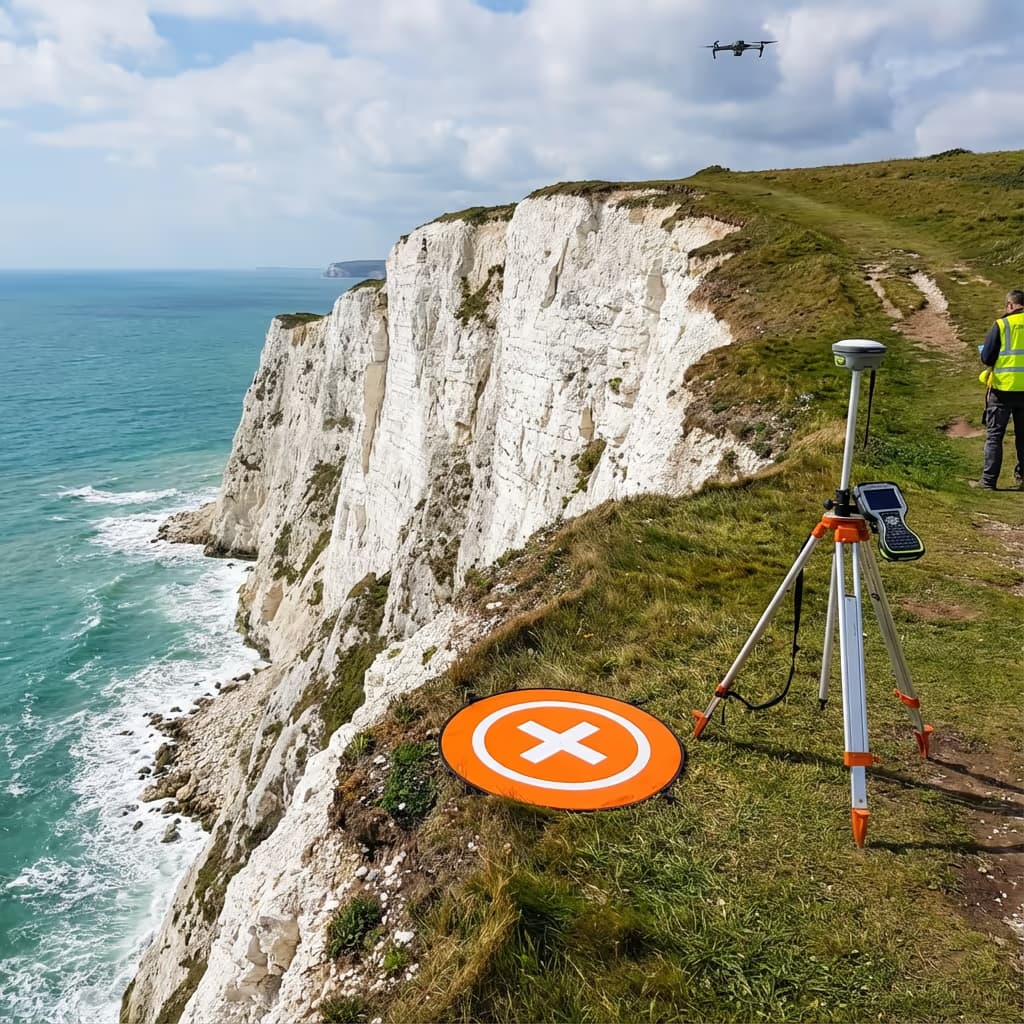
Precision Standards for Drone Shoreline Surveys
Our drone shoreline assessments consistently attain vertical precision of ±2-5cm and horizontal precision of ±3-5cm when employing ground control points. This accuracy level is vital for identifying subtle erosion patterns, quantifying cliff recession rates, and measuring sediment shifts along beaches.
We utilise RTK/PPK-enabled drones paired with strategically positioned control points to guarantee every measurement satisfies survey-grade requirements. For recurring monitoring assessments, we preserve consistent control networks ensuring reliable change detection between survey epochs. The outcome is data you can depend upon for engineering judgements, planning submissions, and scientific studies.
Key Uses for Drone Shoreline Surveys
Drone shoreline assessments support numerous industries and uses throughout Britain. These are the primary applications where our clients realise the most significant benefits:
Erosion Tracking Programmes
Monitor cliff recession rates, beach profiles, and sediment movement across time with precise change detection analysis.
Defence Structure Inspection
Evaluate the condition of groynes, sea walls, revetments, and breakwaters without hazardous manual access.
Cliff Stability Evaluation
Generate detailed 3D models of cliff faces to identify fractures, overhangs, and sections at risk of failure.
Beach Replenishment Schemes
Pre and post-nourishment assessments to compute volumes and monitor sediment distribution effectiveness.
Environmental Impact Analysis
Baseline assessments and ongoing monitoring for coastal developments, habitat evaluations, and marine conservation zones.
Flood Risk Evaluation
Comprehensive elevation data for coastal flood modelling, drainage engineering, and sea level rise impact studies.
Got a coastal project requiring assessment?
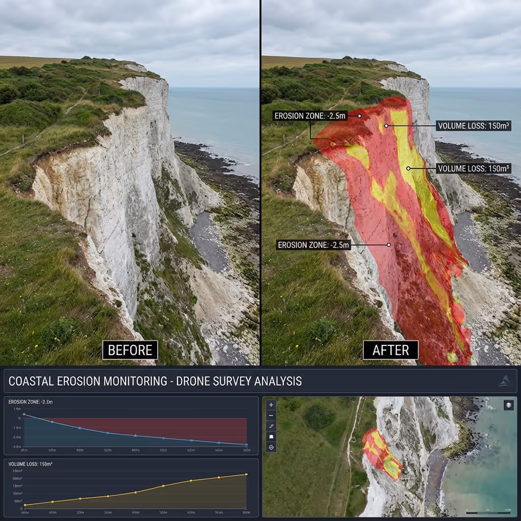
Tracking Coastal Erosion Patterns
Absolutely—this represents one of the most impactful applications of drone shoreline assessment technology. By undertaking repeat assessments at regular intervals, we can precisely quantify how coastlines transform over time. Our change detection analysis uncovers erosion rates, pinpoints vulnerable sections, and measures sediment loss or accumulation with centimetre precision.
We superimpose survey data from different epochs to generate visual change maps that distinctly illustrate where erosion is progressing and at what pace. This intelligence proves invaluable for coastal authorities planning protective interventions, property owners comprehending cliff recession risks, and engineers designing sea defence structures.
Our monitoring schemes can be arranged annually, bi-annually, or following significant storm events to track both gradual erosion and sudden cliff collapses. Each assessment contributes to a comprehensive time-series dataset that exposes trends and assists in forecasting future coastal transformation.
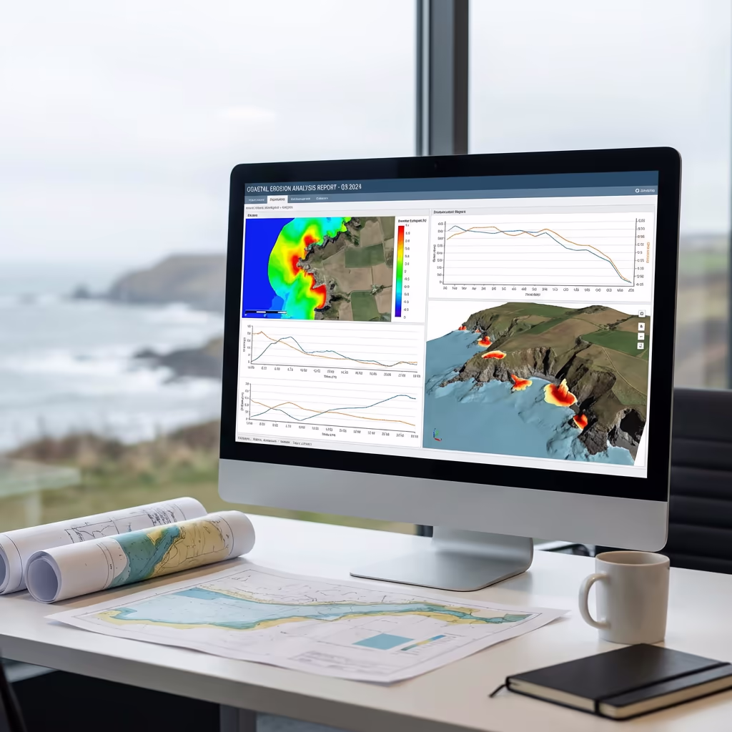
Survey Outputs & Deliverable Packages
We customise outputs to match your project specifications, though our standard drone shoreline assessment packages encompass:
High-Resolution Coastal Orthomosaic
Georeferenced drone imagery of your coastline at 2-3cm/pixel resolution. Perfect for visual documentation and GIS analysis.
Erosion Analysis & Change Detection
Quantified volumetric changes, recession rates, and visual comparison maps when comparing to previous surveys.
Cliff Profiles & Cross-Sections
Detailed elevation profiles at specified intervals along cliff faces, showing geometry and highlighting instability risks.
CAD Files & 3D Models
DWG/DXF files for engineering use, plus detailed 3D mesh models for visualisation and analysis.
Digital Surface Model (DSM)
Elevation model of the coastal surface for contour generation, slope analysis, and flood risk assessment.
Require particular outputs for your coastal project?
Project Timelines & Delivery Schedules
Field data acquisition is remarkably rapid versus traditional approaches. We can assess 5-10km of coastline daily depending on conditions and site complexity. A typical 1-2km cliff section requires just 2-3 hours of airtime, including preparation and control point positioning.
Processing and final delivery varies with project complexity and your specified outputs. Standard deliverables are generally complete within 5-7 working days. For time-critical projects, we provide expedited processing with 48-72 hour turnaround offered at supplementary cost. We'll establish achievable timeframes when quoting your project.
| Phase | Duration |
|---|---|
| Planning & Permissions | 1-3 days |
| On-Site Data Capture | ½-1 day |
| Data Processing | 2-3 days |
| Analysis & QC | 1-2 days |
| Deliverable Generation | 1-2 days |
| Total (Standard) | 5-7 working days |
Fast-Track Processing Option
Require expedited delivery? 48-72 hour turnaround offered for time-sensitive shoreline projects.
Selecting a Shoreline Survey Provider
Not every drone operator has familiarity with the distinctive challenges of coastal environments. When assessing potential providers, we suggest examining these critical aspects:
- CAA certification – Verify they possess valid GVC or legacy PfCO authorisation for commercial flight operations
- Shoreline survey expertise – Coastal settings demand understanding of tidal patterns, wind conditions, and salt exposure
- Insurance coverage – Public liability and professional indemnity appropriate to your project scope
- Change analysis capability – Enquire about their software and processes for erosion tracking
- Portfolio examples – Request demonstrations of comparable shoreline projects they've undertaken
At Hire Drone Pilot, we satisfy every criterion. We hold CAA approval, maintain comprehensive insurance, and have conducted shoreline assessment projects for councils, engineering practices, and environmental bodies throughout Britain.
Prepared to collaborate with a dependable shoreline survey specialist?
Drone Assessment Cost Advantages
In the majority of situations, substantially so. Conventional coastal assessments frequently necessitate costly vessel-based access, rope teams for cliff faces, or piloted aircraft sorties. These approaches are not only expensive but also time-intensive and weather-dependent.
Our drone shoreline assessments gather equivalent or superior information in a fraction of the time and expenditure. A cliff section that might occupy a rope access crew for several days can be surveyed by UAV in hours. The savings typically span 50-70% compared with traditional approaches, whilst delivering quicker turnaround, higher resolution data, and safer operations. For extended monitoring programmes, the economics become even more advantageous with recurring surveys.
Prepared to Talk Through Your Shoreline Project?
Specialist guidance • Customised pricing • Avg Response within 5 Mins

Peter Leslie
Owner & Drone Pilot
With extensive experience in surveying and UAV operations, Peter personally oversees every coastal project to ensure survey-grade accuracy and professional delivery.
Quick Guide: Drone Shoreline Assessments
Shoreline Assessment Outputs
- Shoreline orthomosaic
- Erosion analysis
- Cliff profiles
- Change detection
- CAD drawings
- 3D reconstructions
Talk Through Your Project
Obtain specialist guidance and customised pricing.
Drone Pilot Reviews
Why Drone Pilots Rate HireDronePilot 5 Stars
Don't just take our word for it. Here's what drone pilots in our UK network say about getting work through the platform.
“I get relevant commercial briefs with clear scopes, so quoting is fast and accurate. It has helped me win consistent survey work without chasing low-quality leads.”
Adam Carter
Drone Pilot
“Since joining the platform, I have filled gaps in my schedule with quality roof and inspection jobs. The enquiry details are much better than generic lead forms.”
Sophie Bennett
Drone Pilot
“HireDronePilot makes it easier to focus on delivery. I can review project briefs quickly, submit competitive quotes, and pick up work in new regions.”
Daniel Khan
Drone Pilot
Complementary Survey Services
Drone Topographic Mapping
Comprehensive terrain surveys for planning, design and construction undertakings.
UAV LiDAR Scanning
High-precision laser scanning for terrain mapping through vegetation and demanding environments.
Drone Survey Solutions
Full-scope drone assessments delivering accurate data and 3D reconstructions.