Flood Risk & Environmental
Drone Flood Risk Survey Service
Precise elevation data for flood risk assessments, catchment analysis, and Environment Agency submissions. Survey-grade terrain models with swift delivery.
Avg Response within 5 Mins • Or call +44 1334 804554
Understanding Drone Flood Risk Assessment
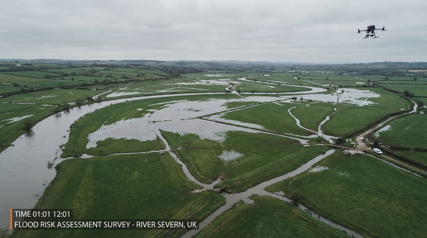
A drone flood risk assessment employs UAV technology to gather highly precise elevation data from land, watercourses, and floodplains. This information underpins Flood Risk Assessments (FRAs) necessary for planning applications, insurance evaluations, and environmental impact studies throughout Britain.
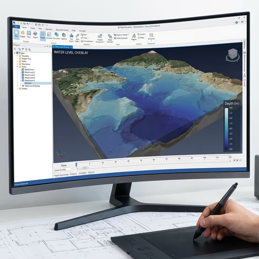
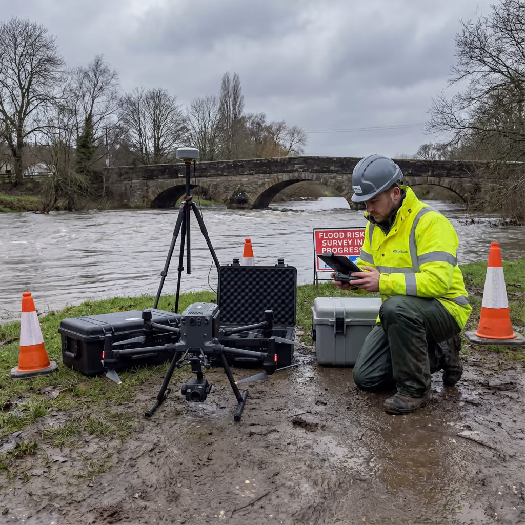
At Hire Drone Pilot, we operate survey-grade UAVs with RTK positioning to capture centimetre-accurate terrain models. Our data integrates with flood modelling software, enabling engineers and planners to comprehend how water will behave during storm events and pinpoint areas vulnerable to flooding.

Peter Leslie
Owner & Drone Pilot
"Have questions? Ring me directly - I'm happy to discuss your project requirements."
Call NowFRA-Ready Survey Data,Swift Delivery
What You'll Receive
- Digital Terrain Model (DTM)
- Catchment boundary analysis
- Contours at specified intervals
- FRA-ready elevation data
Delivered in 5-7 working days
Why Use HireDronePilot
- CAA certified with full insurance
- Environment Agency compatible outputs
- Survey-grade precision (±2-5cm)
- Nationwide service delivery
Relied upon by environmental consultants, planners, and developers throughout Britain.
Relied upon by major organisations
Flood Risk Assessment Pricing Guide
Costs vary based on catchment size, site complexity, and specified outputs. Here's a breakdown to assist your planning:
| Catchment Size | Guide Price |
|---|---|
| Small CatchmentUnder 5 ha | £700+ |
| Medium Catchment5–20 ha | £1,400+ |
| Large Catchment20–50 ha | £2,500+ |
| Major Catchment50+ ha | POA |
| Post-Flood AssessmentAny size | POA |
*Indicative prices cover standard outputs. Final quotation depends on site demands, accessibility, and particular needs.
Factors influencing your quotation
- Catchment extent & topography
- Specified outputs
- Delivery timeframe
- Site access needs
Our UAV-based methodology typically reduces costs by 40–60% versus conventional ground surveys of flood-prone areas. Share your project specifications and we'll deliver a customised quotation within 24 hours.
Prepared for a quotation on your flood risk project?
Complimentary, no-commitment quotes within 24 hours
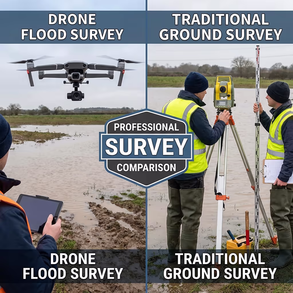
Drone Assessment vs Conventional Survey Methods
Conventional flood risk surveys depend on ground-based teams manually gathering spot heights across floodplains. This methodology is time-intensive, costly, and frequently yields sparse data points that overlook critical terrain features influencing water flow.
Drone flood risk assessments capture millions of elevation points in a fraction of the time, generating detailed terrain models that reveal every undulation, drainage channel, and flow path. This data density produces more precise flood models and identifies hazards that conventional surveys might miss.
Selecting the Right Approach
Opt for Drone Assessment
Rapid & comprehensive
Conventional Ground Survey
Situations where it may still apply
Uncertain which method fits your flood risk needs?
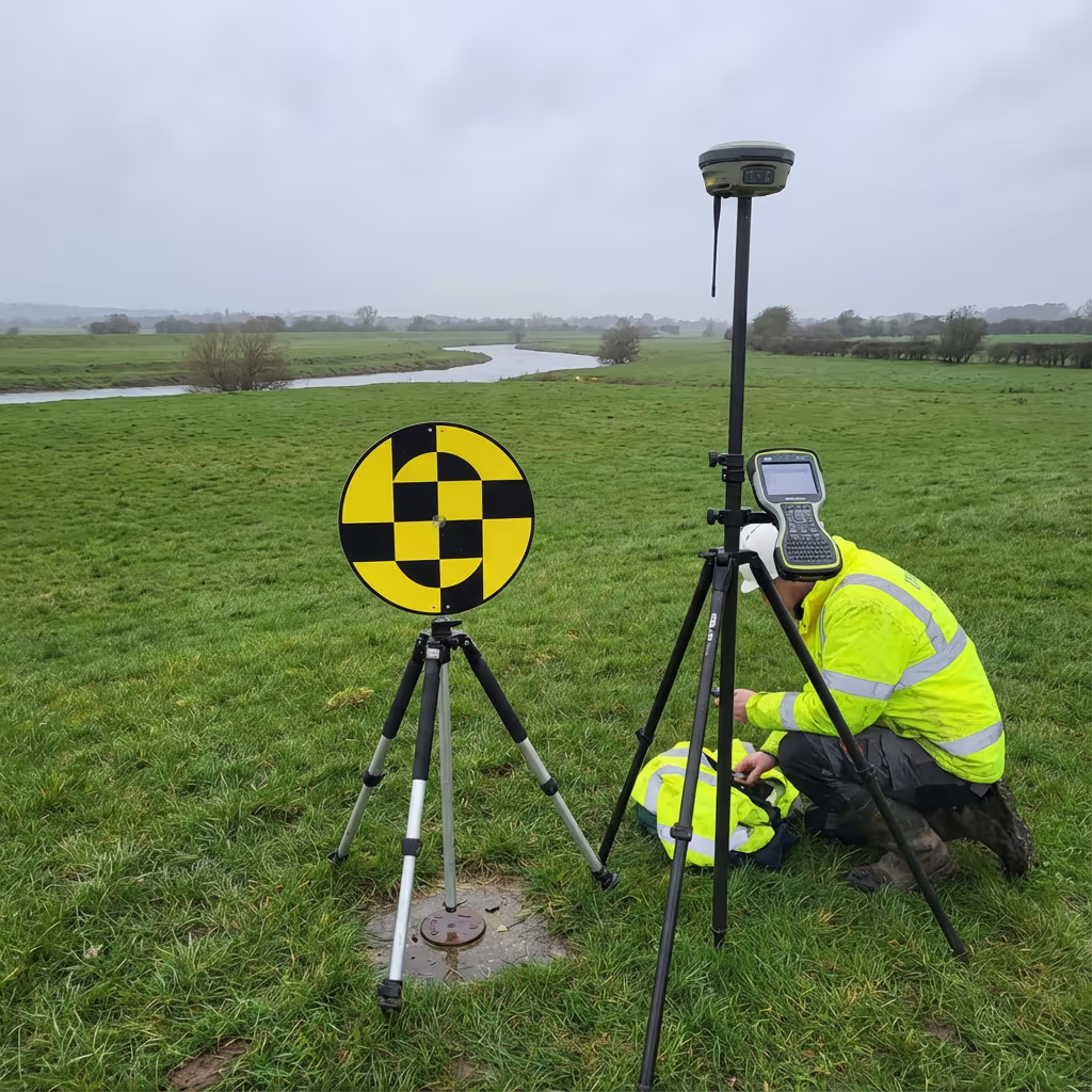
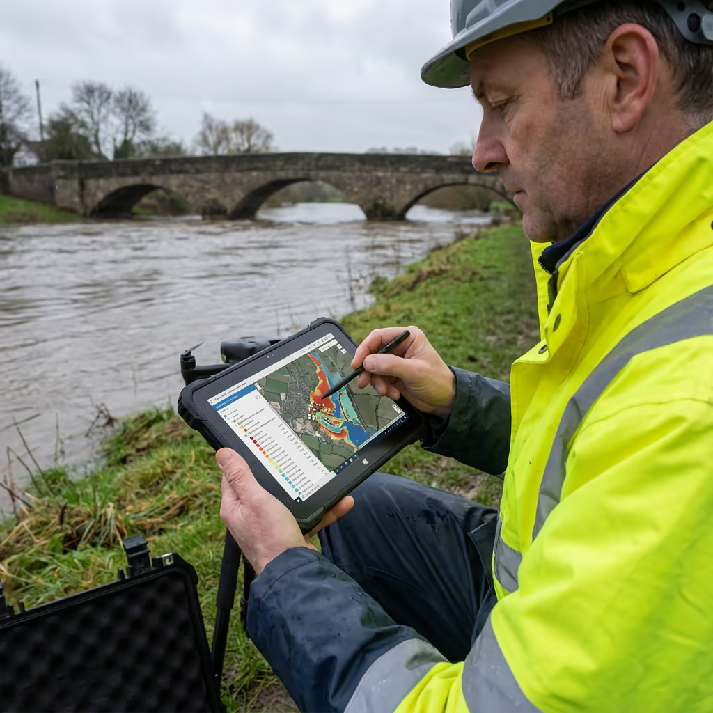
Precision Standards for Drone Flood Risk Surveys
Our drone flood risk assessments attain vertical precision of ±2-5cm and horizontal precision of ±5-10cm when employing ground control points. This accuracy level is vital for flood modelling, where even minor elevation changes can substantially influence predicted water depths and flow patterns.
We utilise RTK/PPK-enabled UAVs with high-resolution sensors to capture dense point clouds. For Environment Agency submissions and planning applications, we establish surveyed control networks and furnish comprehensive accuracy reports with every project. The resulting data surpasses the requirements for most Flood Risk Assessments and hydraulic modelling applications.
Key Uses for Drone Flood Risk Surveys
Drone flood risk assessments supply essential data across numerous applications where precise elevation information determines project success:
Flood Risk Assessments (FRAs)
Planning application support with accurate terrain data for sequential and exception test submissions.
Drainage Design
SuDS design, surface water management, and drainage infrastructure planning with precise ground levels.
Hydraulic Modelling
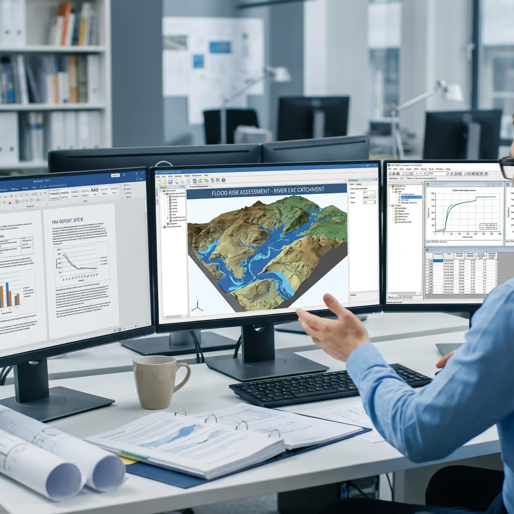
DTM data for flood modelling software including TUFLOW, MIKE, and HEC-RAS applications.
Insurance Assessments
Property-level flood risk evaluation for insurance underwriting and risk management.
Natural Flood Management
Catchment analysis for NFM schemes, attenuation features, and environmental flood mitigation.
Post-Flood Assessment
Emergency response surveys to document flood extents, damage assessment, and recovery planning.
Got a flood risk project requiring survey data?
Supporting Environment Agency Flood Assessments
Absolutely—our drone flood risk survey data is specifically prepared to satisfy Environment Agency requirements. We comprehend the technical specifications demanded for FRA submissions, pre-application discussions, and formal planning consultations with Lead Local Flood Authorities.
Our outputs integrate directly with Environment Agency flood mapping data and modelling software. We supply data in standard formats (GeoTIFF, ASCII grid, LAS/LAZ) that hydraulic engineers can import straight into their flood models. We also furnish accuracy statements and methodology reports necessary for regulatory submissions.
Whether you're undertaking a strategic flood risk assessment, site-specific FRA, or furnishing evidence for a planning appeal, our data delivers the foundation for defensible conclusions regarding flood risk.
Survey Outputs & Deliverable Packages
We customise outputs to match your specific flood risk application. Our standard packages encompass:
Digital Terrain Model (DTM)
Bare-earth elevation model with vegetation removed. Essential for flood modelling and FRA submissions.
Digital Surface Model (DSM)
Top surface including buildings and vegetation. Useful for surface water flow analysis and visualisation.
Catchment Mapping
Watershed boundaries, flow accumulation analysis, and drainage catchment delineation.
Contours & Cross-Sections
Contour lines at your specified interval, plus river and channel cross-sections for hydraulic modelling.
CAD Files & GIS Data
DWG/DXF files for design software and georeferenced GIS formats (GeoTIFF, Shapefile, ASCII Grid).
FRA Support Data
Accuracy statements, methodology reports, and survey metadata for regulatory submissions.
Require particular outputs for your FRA?
Project Timelines & Delivery Schedules
On-site data acquisition is remarkably efficient. A typical 10-hectare catchment survey requires just 2-3 hours of flight time, plus setup and ground control establishment. Larger catchments can be surveyed during a single day visit.
Processing and final delivery varies with the complexity of outputs required. Standard DTM and contour deliverables are typically complete within 5-7 working days. For urgent FRA deadlines, we provide expedited processing with 48-72 hour turnaround offered.
| Phase | Duration |
|---|---|
| Planning & Permissions | 1-3 days |
| On-Site Data Capture | ½-1 day |
| Data Processing | 2-3 days |
| Quality Control | 1-2 days |
| Total (Standard) | 5-7 working days |
Fast-Track Processing Option
Require data urgently for an FRA deadline? 48-72 hour turnaround offered.
Selecting a Flood Risk Survey Provider
Flood risk assessments demand specific expertise beyond standard drone photography. When evaluating potential providers, we suggest examining these critical aspects:
- CAA certification – Verify they possess valid GVC or legacy PfCO authorisation for commercial operations
- Flood risk expertise – Enquire about their background with FRAs and Environment Agency requirements
- Survey-grade precision – Confirm they employ RTK/PPK positioning and ground control for accuracy work
- Compatible formats – Ensure they can supply data in formats your hydraulic engineers require
- Insurance coverage – Public liability and professional indemnity appropriate to your project scope
At Hire Drone Pilot, we satisfy every criterion. We hold CAA approval, maintain comprehensive insurance, and have supplied flood risk survey data for planning applications, major developments, and environmental projects throughout Britain.
Prepared to collaborate with a dependable flood risk survey specialist?
Drone Assessment Cost Advantages
In the majority of situations, substantially so. Conventional ground surveys of floodplains necessitate teams working in demanding terrain, frequently near water and in wet conditions. The time required to manually capture adequate elevation points makes traditional surveys expensive, particularly for larger catchments.
Our drone flood risk assessments gather equivalent or superior data in a fraction of the time. A catchment that might occupy a ground team for several days can be surveyed in hours, with considerably denser data coverage. The savings typically span 40-60% compared with conventional approaches, whilst delivering quicker turnaround and superior data for flood modelling.
Prepared to Talk Through Your Flood Risk Project?
Specialist guidance • Customised pricing • Avg Response within 5 Mins

Peter Leslie
Owner & Drone Pilot
With extensive experience in surveying and UAV operations, Peter personally oversees every flood risk project to ensure survey-grade accuracy and professional delivery.
Quick Guide: Drone Flood Risk Assessments
Flood Risk Assessment Outputs
- Digital Terrain Model (DTM)
- Digital Surface Model (DSM)
- Catchment boundary analysis
- Contours & cross-sections
- CAD drawings (DWG/DXF)
- FRA support materials
Talk Through Your Project
Obtain specialist guidance and customised pricing for your flood risk assessment.
Drone Pilot Reviews
Why Drone Pilots Rate HireDronePilot 5 Stars
Don't just take our word for it. Here's what drone pilots in our UK network say about getting work through the platform.
“I get relevant commercial briefs with clear scopes, so quoting is fast and accurate. It has helped me win consistent survey work without chasing low-quality leads.”
Adam Carter
Drone Pilot
“Since joining the platform, I have filled gaps in my schedule with quality roof and inspection jobs. The enquiry details are much better than generic lead forms.”
Sophie Bennett
Drone Pilot
“HireDronePilot makes it easier to focus on delivery. I can review project briefs quickly, submit competitive quotes, and pick up work in new regions.”
Daniel Khan
Drone Pilot