Surveying & Mapping
Drone Estate Survey Service
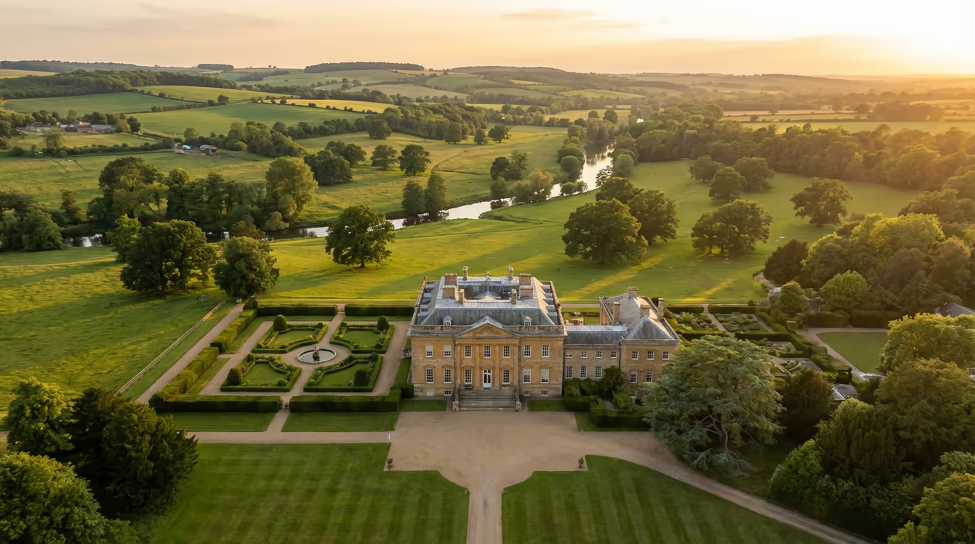
Thorough drone assessments for country estates, manor houses, and landed properties. Chart boundaries, buildings, woodland, and every feature across your landholding.
Avg Response within 5 Mins • Or call +44 1334 804554
Understanding Drone Estate Assessment
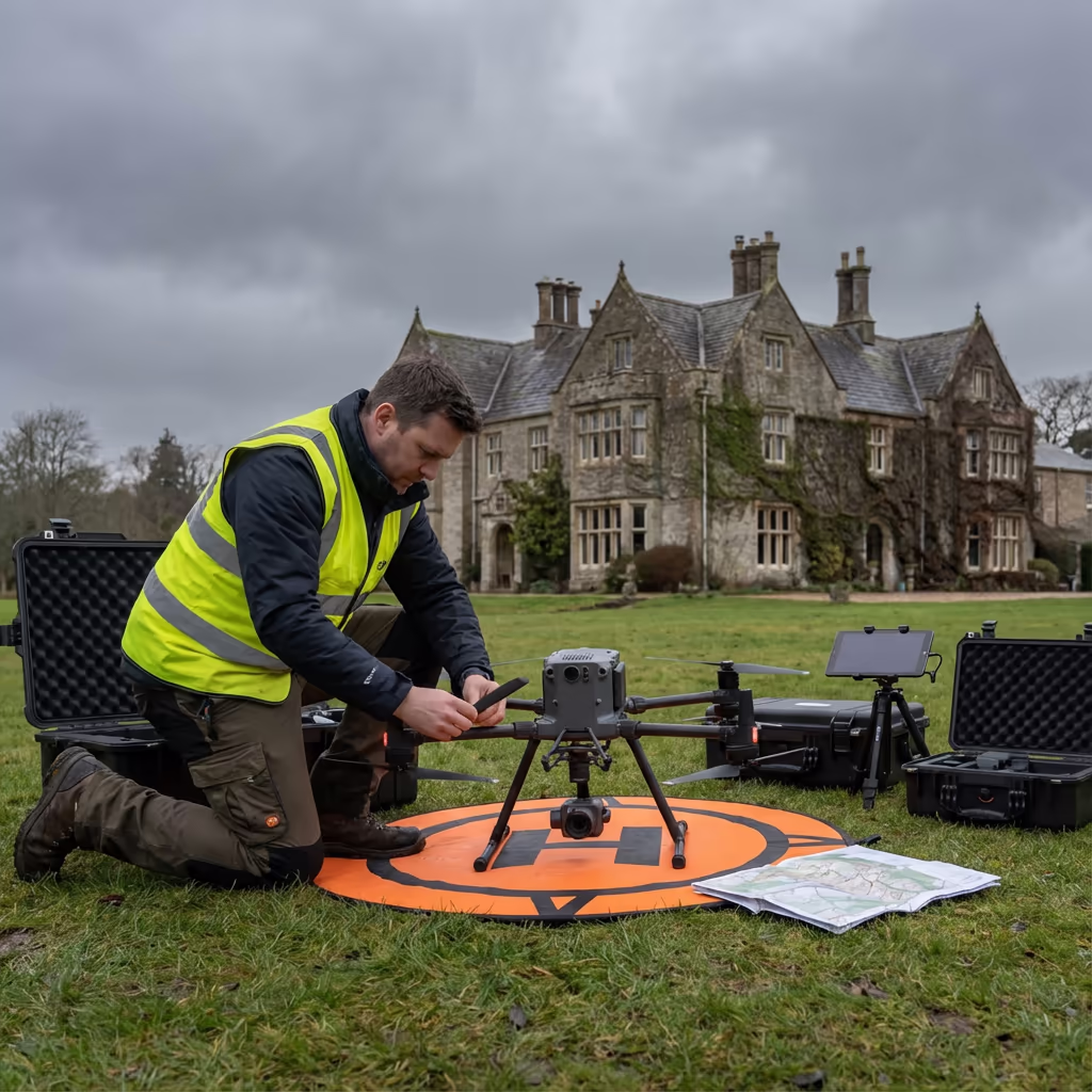
A drone estate assessment furnishes thorough documentation of country estates, manor houses, and substantial landed properties from above. Employing professional-grade UAVs fitted with high-resolution cameras, we gather detailed imagery of every facet of your estate - from the principal residence and outbuildings to parkland, woodland, and boundary features.
At HireDronePilot, we recognise that estates are complex properties demanding careful, methodical documentation. Our assessments yield accurate boundary mapping, comprehensive building surveys, woodland evaluations, and complete orthomosaic imagery providing a full picture of your landholding. Whether you are planning enhancements, managing succession, or simply require current records of your estate, our drone surveys furnish the data you need.

Peter Leslie
Owner & Drone Pilot
"Have questions? Ring me directly - I'm happy to discuss your project requirements."
Call NowThorough Estate Documentation,Efficiently Delivered
What You'll Receive
- Estate orthomosaic & drone imagery
- Boundary mapping & verification
- Building condition surveys
- Woodland & landscape assessment
Delivered in 5-10 working days
Why Use HireDronePilot
- CAA approved & fully insured
- Experience with historic estates
- Latest DJI drone technology
- Nationwide service delivery
Relied upon by estate owners, land agents & surveyors throughout the UK.
Relied upon by leading organisations
Estate Assessment Pricing Guide
Estate survey investment varies according to the size and complexity of your property. Here is a reference to assist with budgeting:
| Estate Size | Guide Price |
|---|---|
| SmallUnder 10 ha | £800+ |
| Medium10–50 ha | £1,500+ |
| Large50–100 ha | £2,800+ |
| Major100+ ha | POA |
| Building SurveysAdd-on | +£400 |
*Guide prices include standard deliverables. Final quote based on site complexity, number of buildings, and specific requirements.
Factors influencing your estimate
- Estate size & terrain
- Number of buildings
- Woodland coverage
- Required deliverables
Our UAV-based approach typically delivers 40-60% savings compared to conventional ground surveys, whilst providing considerably more thorough documentation. Reach out with your estate specifications and we will furnish a bespoke estimate within 24 hours.
Prepared to receive an estimate for your estate?
Complimentary, obligation-free quotes within 24 hours
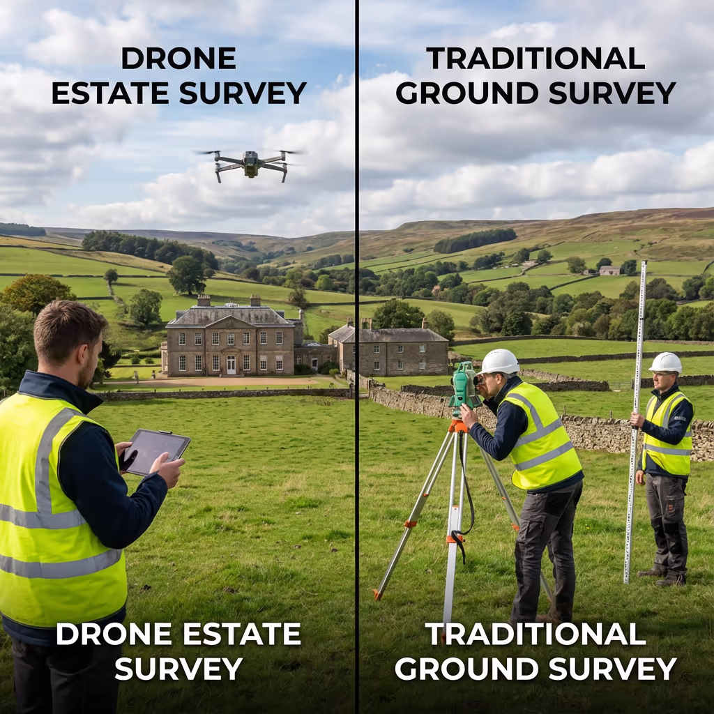
Drone Assessment vs Conventional Methods
Conventional estate surveys typically entail ground-based surveying teams traversing the complete property over multiple days, supplemented by limited drone photography from manned aircraft. Whilst thorough, this approach proves time-intensive, costly, and frequently overlooks features visible only from above.
A drone estate assessment transforms this process. We can capture comprehensive coverage of even the most extensive estates in a single day, generating detailed orthomosaic imagery that exposes every feature of your land. From concealed drainage patterns and archaeological remains to boundary anomalies and building defects - drone surveys capture particulars that ground teams simply cannot observe.
Selecting the Right Methodology
Select Drone Estate Assessment
Thorough coverage
Select Conventional Survey
Ground-level particulars
Uncertain which methodology fits your estate?
Precision Standards for Estate Assessment
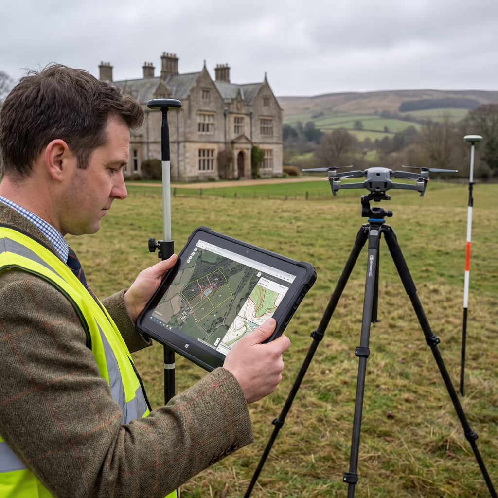
Our drone estate assessments routinely attain horizontal accuracy of 2-5cm and vertical accuracy of 3-8cm when employing ground control points. This surpasses the specifications for most estate management, planning, and documentation requirements.
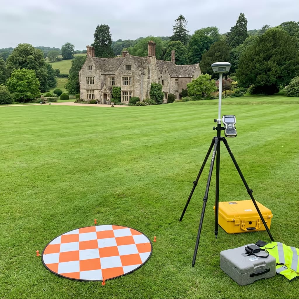
We deploy RTK/PPK-enabled aircraft with professional-grade cameras to guarantee precise positioning of all imagery. For boundary verification and planning submissions, we establish ground control networks spanning your estate. The outcome is survey-grade data that land agents, solicitors, and planning authorities can depend on with assurance.
Key Uses for Estate Assessment
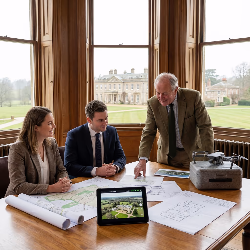
Drone estate assessments support estate owners, land agents, solicitors, and property professionals across an extensive array of applications:
Estate Administration
Thorough documentation for daily management, maintenance scheduling, and long-term stewardship of your property.
Succession Preparation
Comprehensive records for inheritance tax planning, estate division, and wealth transfer across generations.
Property Transactions
High-quality drone imagery and accurate mapping for marketing materials and due diligence documentation.
Planning Submissions
Supporting documentation for development proposals, change of use applications, and Listed Building consents.
Insurance Records
Thorough visual documentation of buildings, structures, and land for insurance valuations and claims.
Environmental Stewardship
Baseline surveys for environmental schemes, woodland management plans, and habitat documentation.
Have an estate requiring assessment?
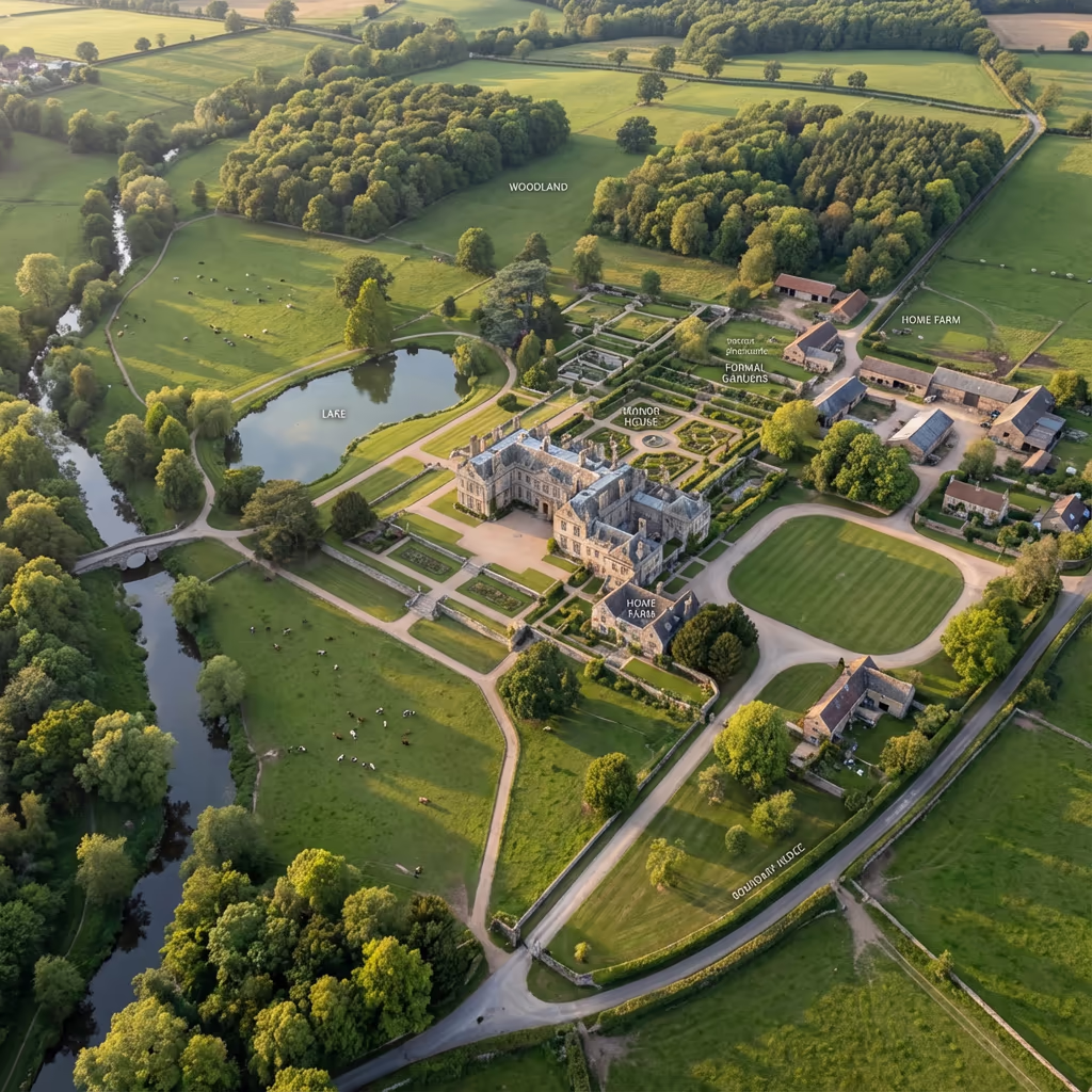
Features an Drone Estate Assessment Can Capture
A thorough drone estate assessment captures every facet of your property, furnishing documentation that would require weeks to compile using conventional methods. Our assessments typically encompass:
Buildings & Structures
- • Principal residence & wings
- • Estate cottages & lodges
- • Farm buildings & barns
- • Walled gardens & glasshouses
- • Stables & outbuildings
Land & Landscape
- • Parkland & formal gardens
- • Woodland blocks & plantations
- • Agricultural land & fields
- • Water features & lakes
- • Boundaries & hedgerows
Infrastructure
- • Driveways & access roads
- • Gates, walls & fencing
- • Drainage & water courses
- • Utilities & services
- • Rights of way & paths
Special Features
- • Historic features & monuments
- • Archaeological remains
- • Tree preservation orders
- • Wildlife habitats
- • Views & vistas
Every feature is recorded in high-resolution imagery and charted to precise coordinates, generating a complete digital record of your estate that serves for years to come.

Survey Outputs & Deliverable Packages
We customise deliverables to match your estate requirements, though our standard survey outputs comprise:
Estate Orthomosaic Imagery
High-resolution, georeferenced drone imagery encompassing your complete estate, assembled into a single seamless map. Ideal for estate records and management scheduling.
Boundary Documentation
Accurate mapping of all estate boundaries, encompassing hedgerows, walls, fencing, and watercourses. Cross-referenced to title plans where obtainable.
Building Assessments
Comprehensive drone photography of all buildings from multiple vantage points, including roof condition evaluation and facade documentation.
Woodland Evaluation
Drone mapping of woodland areas with tree canopy coverage analysis. Beneficial for forestry management and environmental scheme submissions.
CAD Plans & Three-Dimensional Models
Professional CAD drawings in DWG/DXF format, accompanied by 3D terrain models for design and visualisation applications.
Require particular deliverables for your estate?
Project Timelines & Delivery Schedules
On-site data capture proves remarkably efficient. A typical 50-hectare estate can be surveyed in a single day, encompassing all buildings and landscape features. Larger estates may necessitate 2-3 days of flying, contingent on the detail level demanded.
Processing and delivery hinges on estate size and your specified outputs. Standard deliverables are typically prepared within 5-10 working days. For pressing projects, we provide expedited processing with swifter turnaround available at supplementary cost.
| Phase | Duration |
|---|---|
| Planning & Permissions | 1-3 days |
| On-Site Survey | 1-3 days |
| Data Processing | 3-5 days |
| Deliverable Production | 2-4 days |
| Total (Standard) | 5-10 working days |
Accelerated Processing Offered
Require faster delivery? Expedited processing available for time-critical projects.
Selecting an Estate Survey Provider
When choosing a provider to assess your estate, we recommend examining these essential factors:
- CAA certification - Verify they possess valid GVC or legacy PfCO permissions for commercial operations
- Comprehensive insurance - Public liability and professional indemnity coverage suitable for operating on private estates
- Estate track record - Seek evidence of prior work on comparable properties and appreciation of estate management requirements
- Discretion - Estates are private properties; confirm your provider appreciates confidentiality requirements
- Quality deliverables - Request examples of their mapping and documentation standards
At HireDronePilot, we satisfy every criterion. We are CAA certified, comprehensively insured, and have executed surveys for estates spanning from modest manor houses to substantial landed properties throughout the UK.
Prepared to collaborate with a dependable estate survey provider?
Drone Assessment vs Conventional Survey Costs
In virtually every instance, yes - considerably. Conventional estate surveys demand teams of surveyors operating over multiple days or weeks, frequently supplemented by costly manned aircraft photography. Expenses accumulate swiftly, particularly for larger estates with extensive woodland or numerous buildings.
Our drone estate assessments capture equivalent or superior data in a fraction of the duration. An estate that might occupy a ground team for a fortnight can be flown in 1-3 days. Cost reductions typically span 40-60% compared to conventional methods, whilst furnishing more thorough drone coverage and frequently superior quality imagery. For estates of any substantial size, drone surveys present compelling value.
Prepared to Explore Your Estate Survey?
Specialist guidance - Bespoke pricing - Avg Response within 5 Mins

Peter Leslie
Owner & Drone Pilot
With extensive experience surveying estates across the UK, Peter personally oversees every project to ensure comprehensive documentation and professional delivery.
TLDR: Drone Estate Assessments Explained
Estate Survey Outputs
- Estate orthomosaic imagery
- Boundary mapping & plans
- Building surveys & photography
- Woodland assessment
- CAD plans (DWG/DXF)
- 3D terrain models
Talk Through Your Estate
Receive specialist guidance and bespoke pricing.
Drone Pilot Reviews
Why Drone Pilots Rate HireDronePilot 5 Stars
Don't just take our word for it. Here's what drone pilots in our UK network say about getting work through the platform.
“I get relevant commercial briefs with clear scopes, so quoting is fast and accurate. It has helped me win consistent survey work without chasing low-quality leads.”
Adam Carter
Drone Pilot
“Since joining the platform, I have filled gaps in my schedule with quality roof and inspection jobs. The enquiry details are much better than generic lead forms.”
Sophie Bennett
Drone Pilot
“HireDronePilot makes it easier to focus on delivery. I can review project briefs quickly, submit competitive quotes, and pick up work in new regions.”
Daniel Khan
Drone Pilot