Surveying & Mapping
Drone Industrial Survey Service
Thorough drone surveys for industrial facilities, factories, warehouses, and manufacturing sites. Minimise downtime with rapid data capture.
Avg Response within 5 Mins • Or call +44 1334 804554
Understanding Drone Industrial Surveys
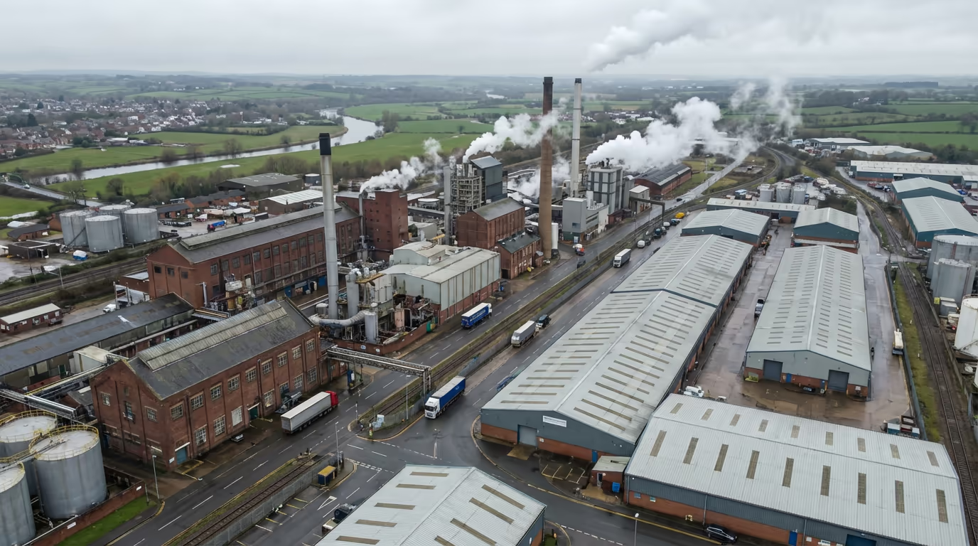
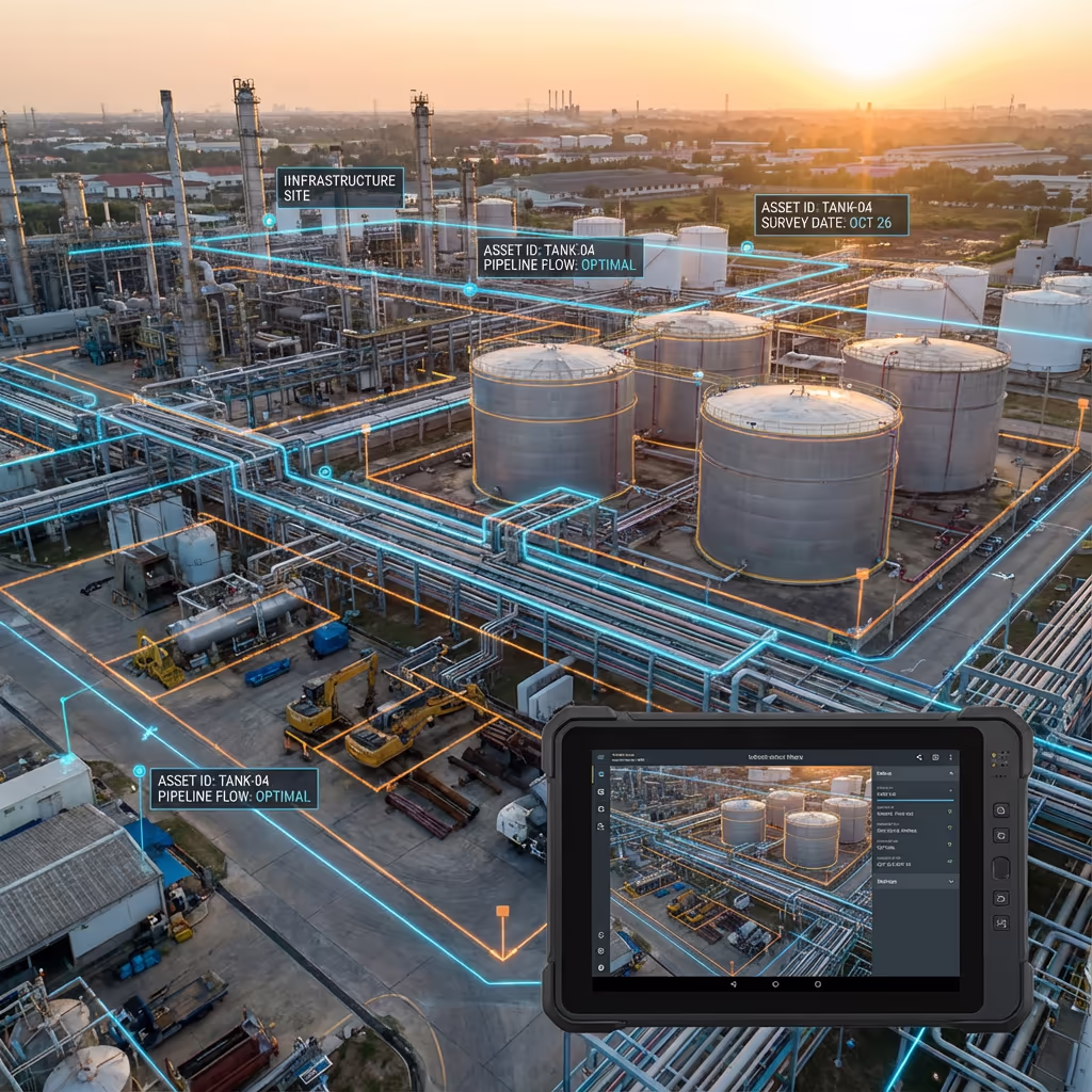
A drone industrial survey uses UAV technology to capture thorough data of industrial facilities, manufacturing plants, warehouses, and production sites. Our UAVs equipped with high-resolution cameras and sensors can map entire facilities, inspect rooftops and infrastructure, and create detailed records of your industrial assets.
At Hire Drone Pilot, we specialise in surveys of active industrial sites throughout the UK. Our approach minimises operational disruption while delivering the accurate spatial data you need for facility management, maintenance planning, insurance documentation, and regulatory compliance.

Peter Leslie
Owner & Drone Pilot
"Have questions? Ring me directly - I'm happy to discuss your project requirements."
Call NowIndustrial Survey Data,Minimal Downtime
What You'll Receive
- High-resolution site orthomosaic
- Detailed asset mapping
- Building & roof surveys
- CAD-ready drawings & 3D models
Delivered in 5-7 working days
Why Use HireDronePilot
- CAA certified & fully insured
- Active site experience
- Latest DJI enterprise UAVs
- Nationwide coverage
Relied upon by facility managers, engineers & industrial operators throughout the UK.
Relied upon by leading organisations
What Does an Drone Industrial Survey Cost?
Pricing depends on your facility size and requirements. Here's a guide to help you budget:
| Facility Size | Guide Price |
|---|---|
| SmallUnder 2 ha | £600+ |
| Medium2–10 ha | £1,200+ |
| Large10–25 ha | £2,200+ |
| Major Complex25+ ha | POA |
| With ThermalAny size | +£300 |
*Guide prices include standard outputs. Final quote based on site complexity, access, and specific requirements.
What influences your quote?
- Site size & complexity
- Required outputs
- Active operations
- Access & safety requirements
Our UAV-based approach typically saves 40-60% compared to conventional ground surveys and scaffolding-based inspections. Contact us with your project details and we'll provide a tailored quote within 24 hours.
Ready to get a quote for your facility?
Free, no-obligation quotes within 24 hours
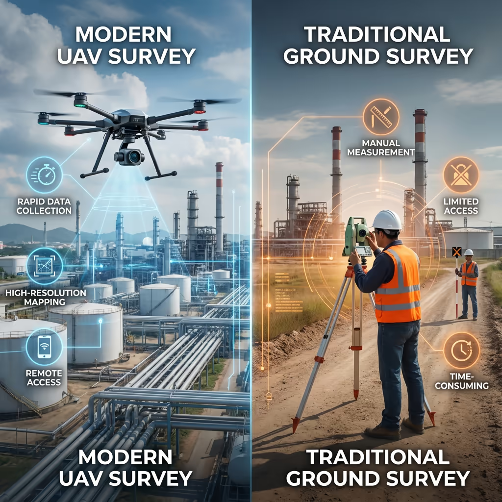
What Is the Difference Between Drone Industrial Survey and Conventional Methods?
Conventional industrial surveys typically require ground teams, scaffolding, cherry pickers, or rope access to inspect and measure facilities. This approach is time-consuming, expensive, and often requires shutting down operations for safety.
Drone industrial surveys capture the same data - and often more - from the air in a fraction of the time. Our UAVs can survey rooftops, facades, pipework, and storage tanks without scaffolding, reach areas inaccessible to ground teams, and capture data while your facility continues normal operations.
When to Choose Each Approach
Select Drone Survey
Fast & non-disruptive
Select Conventional
Detail & close access
Not sure which approach suits your facility?
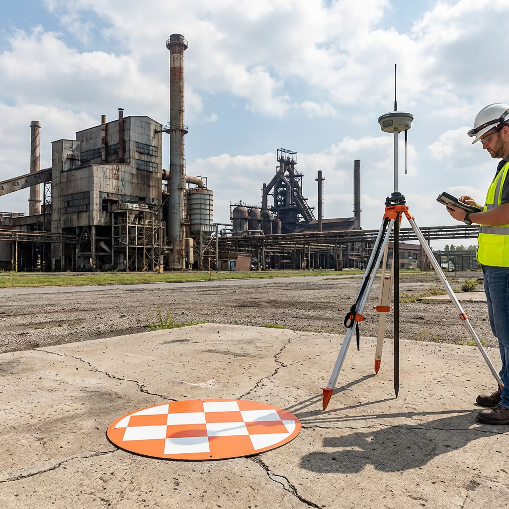
What Accuracy Can an Drone Industrial Survey Achieve?
Our drone industrial surveys routinely achieve positional accuracy of plus or minus 2-3cm when using ground control points and RTK-enabled UAVs. This level of precision is suitable for asset management, facilities planning, insurance documentation, and most engineering applications.
For projects requiring higher accuracy, we can increase GCP density and employ specialist processing workflows. Our orthomosaics typically achieve ground sample distances (GSD) of 1-2cm per pixel, capturing detail down to individual bolts, joints, and surface defects visible from above.
Where Are Drone Industrial Surveys Used?
Drone industrial surveys serve a wide range of industries and purposes. Here are the key applications where our clients see the greatest value:
Facility Management
Complete site mapping for asset registers, space planning, and facilities management systems integration.
Roof & Building Surveys
Condition assessments of roofs, cladding, and building fabric without scaffolding or disruption to operations.
Insurance & Compliance
Detailed visual records for insurance valuations, claims documentation, and regulatory compliance.
Infrastructure Mapping
Pipework, storage tanks, conveyors, and utility runs captured in precise 3D for maintenance planning.
Progress Monitoring
Regular survey flights to track construction, expansion, or remediation projects over time.
Site Security
Perimeter mapping, fence line surveys, and security assessments from comprehensive drone imagery.
Have a facility that needs surveying?
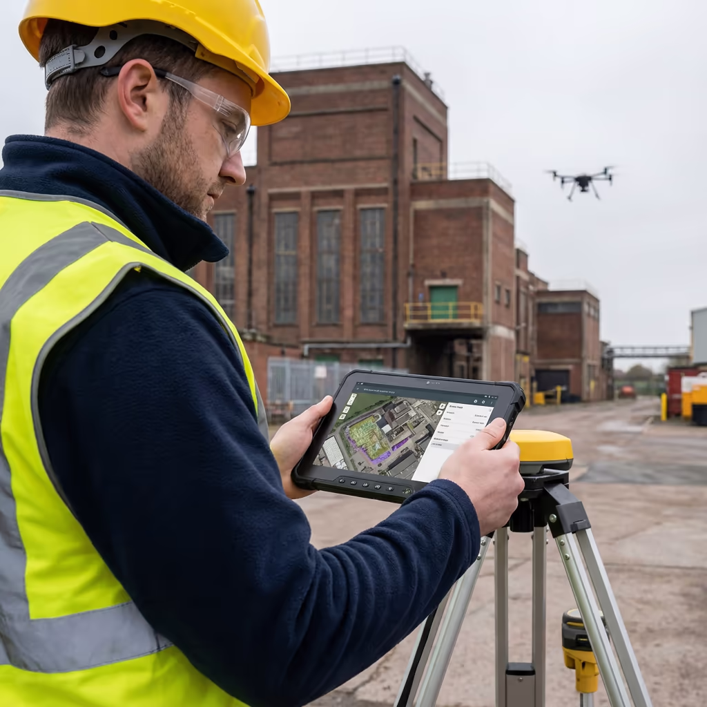
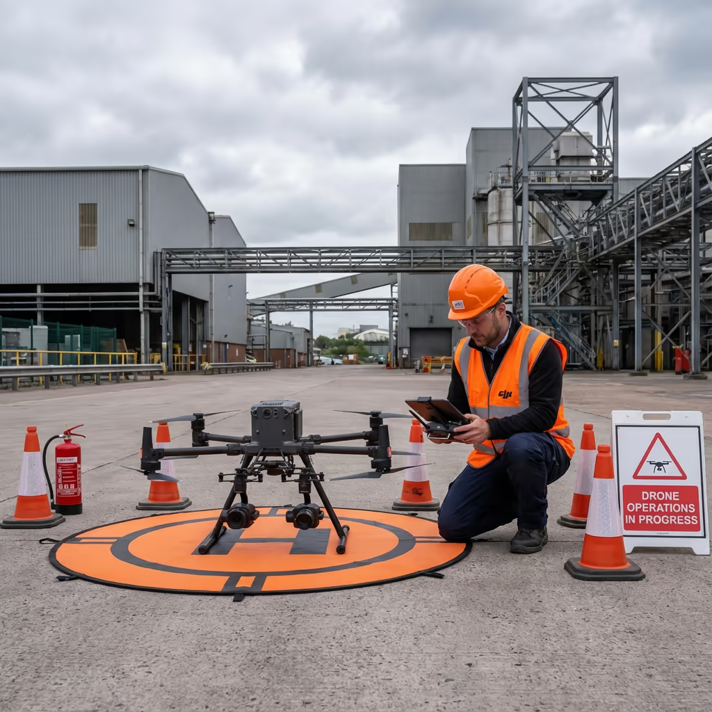
Can UAVs Survey Active Industrial Sites?
Yes - this is one of the key advantages of drone surveys. Our drone pilots are trained in industrial safety protocols and hold relevant certifications for working on operational sites. We conduct thorough risk assessments before every flight and coordinate closely with your site management team.
We can operate around:
- Active production lines and manufacturing processes
- Vehicle and forklift movements
- Loading and unloading operations
- Ongoing maintenance activities
- Shift changes and personnel movements
For sites with specific hazards (chemical plants, refineries, etc.), we hold ATEX-rated equipment and can obtain additional permits as required. We work with your HSE team to ensure full compliance with site-specific safety requirements.

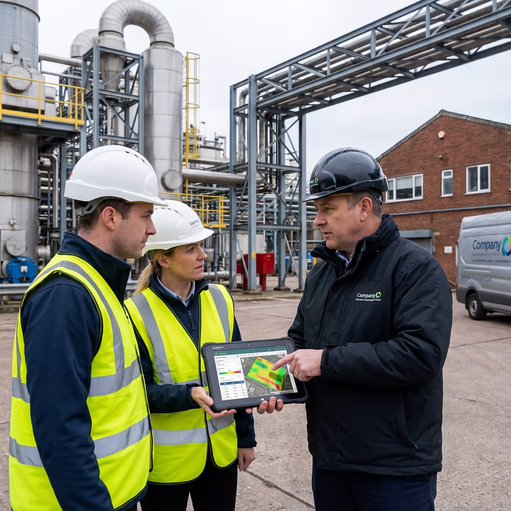
What Outputs Do You Receive From an Drone Industrial Survey?
We tailor outputs to your specific requirements, but our standard industrial survey deliverables include:
Site Orthomosaic
High-resolution, georeferenced drone map of your entire facility. Perfect for GIS integration and as-built documentation.
Asset Mapping
Detailed inventory of visible assets including buildings, tanks, pipework, and infrastructure with precise locations.
Building Surveys
Roof condition reports, elevation imagery, and facade documentation for maintenance and insurance purposes.
Infrastructure Plans
Traced drawings of visible infrastructure including road layouts, drainage, and utility runs.
CAD Files & 3D Models
DWG/DXF files compatible with AutoCAD, plus 3D mesh models for visualisation and BIM integration.
Need specific outputs for your facility?
What's the Duration of an Drone Industrial Survey?
On-site data capture is remarkably fast. We can survey most industrial facilities in half a day to a full day depending on size and complexity. A typical 10-hectare site takes 3-4 hours of flight time, plus setup, safety briefings, and ground control establishment.
Processing and delivery depends on your required outputs. Standard outputs are typically ready within 5-7 working days. For urgent projects, we offer expedited processing with 48-72 hour turnaround available at additional cost.
| Phase | Duration |
|---|---|
| Planning & Coordination | 1-2 days |
| On-Site Data Capture | ½-1 day |
| Data Processing | 2-3 days |
| Output Production | 2-3 days |
| Total (Standard) | 5-7 working days |
Express Processing Available
Need it faster? 48-72 hour turnaround available for urgent projects.
How Do I Select an Drone Industrial Survey Provider?
Not all UAV operators have the experience and credentials needed for industrial sites. When evaluating providers, we recommend checking these key factors:
- CAA certification - Ensure they hold valid GVC or legacy PfCO permissions for commercial operations
- Industrial site experience - Ask about previous work on operational facilities similar to yours
- Appropriate insurance - Public liability (5M+) and professional indemnity cover
- Safety credentials - CSCS cards, site safety training, risk assessment capability
- Processing capability - In-house data processing and CAD production
At Hire Drone Pilot, we tick every box. We're CAA certified, carry 10M public liability insurance, and have delivered industrial surveys across manufacturing, logistics, energy, and chemical sectors throughout the UK.
Ready to work with an experienced industrial survey provider?
Is Drone Industrial Survey More Economical Than Conventional Methods?
In most cases, significantly more economical. Conventional roof surveys requiring scaffolding can cost 10,000+ just for access. Cherry pickers and MEWPs add hire costs, operator fees, and extended site time. Ground-based surveys of large facilities require multiple days of surveyor time.
Our drone surveys capture equivalent or better data in a fraction of the time and cost. A complete facility survey that might take a ground team a week can be flown in hours. The cost savings typically range from 40-70% compared to conventional methods, with the added benefit of minimal operational disruption.
Ready to Talk Through Your Industrial Survey?
Specialist advice - Tailored pricing - Avg Response within 5 Mins

Peter Leslie
Owner & Drone Pilot
With extensive experience surveying operational industrial sites, Peter personally oversees every project to ensure accurate data capture and professional delivery.
TLDR: Drone Industrial Surveys Explained
Industrial Survey Outputs
- Site orthomosaic
- Asset mapping
- Building surveys
- Infrastructure plans
- CAD files (DWG/DXF)
- 3D models
Talk Through Your Facility
Receive specialist advice and tailored pricing.
Drone Pilot Reviews
Why Drone Pilots Rate HireDronePilot 5 Stars
Don't just take our word for it. Here's what drone pilots in our UK network say about getting work through the platform.
“I get relevant commercial briefs with clear scopes, so quoting is fast and accurate. It has helped me win consistent survey work without chasing low-quality leads.”
Adam Carter
Drone Pilot
“Since joining the platform, I have filled gaps in my schedule with quality roof and inspection jobs. The enquiry details are much better than generic lead forms.”
Sophie Bennett
Drone Pilot
“HireDronePilot makes it easier to focus on delivery. I can review project briefs quickly, submit competitive quotes, and pick up work in new regions.”
Daniel Khan
Drone Pilot