How Much Does a Drone Survey Cost in the UK

Peter Leslie
10 Oct 2025

Key Takeaways
- A UK drone survey typically runs from about £300 for a basic visual roof check up to several thousand pounds for complex topographical or thermal work
- Site size is the obvious driver, but accessibility, airspace complexity, deliverable format and required accuracy usually matter more
- Drone roof surveys sit at the lower end of the range; topographical, LiDAR and thermal surveys are where the invoices climb
- Almost every UK drone survey quote is stated excluding VAT — the standard twenty per cent is added on top
- The commercial drone pilot must be insured, registered with the CAA, and — in most urban and close-range jobs — operating under an Operational Authorisation
A UK drone survey can cost anywhere from about £300 for a quick visual roof check up to several thousand pounds for a complex topographical, LiDAR or thermal survey. The rest of the article is about why, and where the honest middle of that range sits for the most common briefs a client brings to me.
If you are working back from a specific budget or scoping a job for a client, this is the cost structure the drone pilots in our network actually quote against — not the sticker prices on the first page of Google, and not the inflated enterprise numbers that turn up on corporate slide decks.
Drone roof surveys are the cheapest end of the UK survey market
The most common UK drone survey brief is a roof inspection. A standard residential drone roof survey — a detached or semi-detached property, photography only, same-day or next-day flight — typically lands between £300 and £700, depending on access, height, and complexity of the roof plan.
Commercial and industrial roof surveys run higher because the roofs are larger, the airspace is usually tighter, and the deliverable is usually a longer structured report rather than a folder of imagery. A standard commercial roof job tends to fall between £600 and £1,500. Thermal roof surveys — which need a specific sensor, specific flight timing, and more post-processing — usually add a several-hundred-pound premium on top.
If this is the survey type you are looking at, the piece on drone roof survey cost goes into deeper detail, and the inspection frequency question sits on the roof inspection frequency page.
Topographical, LiDAR and thermal surveys are where the invoices really climb
Once you move beyond roof inspection, UK drone survey prices climb for three overlapping reasons: larger sites, more demanding sensors, and much heavier post-processing workloads.
A drone topographical survey on a small-to-medium commercial site typically lands in the £800 to £1,800 bracket for a photogrammetry-based deliverable, with accuracy tied back to Ground Control Points. Larger sites or sites requiring extra deliverables like contour maps, Digital Terrain Models and CAD-ready exports push the price into the £2,000 to £4,000 band. The drone survey services overview covers what that actually looks like in practice.
A drone LiDAR survey is typically the highest-cost option per hectare, because the sensor hardware, the flight planning, and the point-cloud post-processing are all specialist. UK LiDAR surveys normally sit in the £1,200 to £3,000 range for a standard commercial site, and readily pass £5,000 on corridor, vegetated or complex terrain jobs. The detailed cost breakdown sits on drone LiDAR survey cost, and the full workflow is on step-by-step LiDAR survey process.
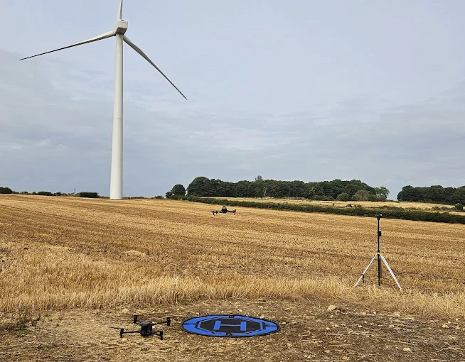
A drone thermal survey on a commercial building or asset typically runs £1,200 to £2,400, with solar farm and wind turbine thermal work sitting at the upper end of that and industrial inspection work of large estates sometimes passing £3,500. Thermal surveys are flown at specific times of day for contrast reasons, usually dawn or dusk, which narrows the scheduling window and makes them slightly less price-sensitive to site size than photogrammetry work.
Site access and airspace complexity can easily double a quote on paper
Past the sensor choice, the single biggest price driver is where the site actually sits in UK airspace. A rural site with no airspace restrictions and easy road access is the cheapest version of any given survey. A site in central London, near a major airport, inside a Flight Restriction Zone, or next to a prison, royal palace, or military installation is considerably more expensive — not because the flight itself is more complicated, but because of the pre-flight paperwork.
For FRZ work, the drone pilot has to coordinate written permission from the aerodrome operator before the flight. For sensitive sites, the coordination is with the landowner and sometimes with local police. For historic or Royal sites — Stirling Castle, Windsor, Holyrood, the Tower of London — additional permissions and stand-off distances apply on top of normal rules.
In practice, this administrative work can add anywhere from a few hundred pounds to more than a thousand to a UK drone survey quote, and in some cases it is the only honest line-item difference between a £700 quote and a £1,500 quote for the same flight.
Deliverables are usually a bigger part of the invoice than the flight itself
One of the most common surprises for first-time drone survey clients is how much of the cost sits in post-processing rather than on-site time. The raw flight time on a small commercial site is often under an hour. What comes after can be several days of work depending on the deliverable.
A visual-only deliverable — a folder of imagery with light annotation — is the cheapest output format and fine for quick inspection work. Moving up to an orthomosaic map with measurements, a 3D model, a Digital Terrain Model, or a classified LiDAR point cloud adds meaningful processing time. CAD-ready files, contour maps and BIM-compatible outputs are specialist work and usually add several hundred pounds on top of the base price.
Thermal deliverables are similar. A visual thermal inspection with a report is one price point. A full radiometric thermal orthomosaic with temperature-tagged defect analysis is another price point entirely. Ask any surveying drone pilot what the final deliverable contains before you compare quotes, because comparing an image folder quote to a classified orthomosaic quote is not comparing like for like.
VAT, travel, and rush fees are the lines most clients miss
Most UK drone survey quotes are stated excluding VAT. The standard twenty per cent sits on top, and on any commercial-scale invoice it adds meaningful money. A nominal £2,500 survey quote is £3,000 all-in. Always check whether the number you are reading is VAT-inclusive or not.
Travel and mobilisation fees are the second line most clients miss. For a drone pilot travelling more than about an hour from their base, expect a mobilisation fee somewhere between £50 and £150 on top of the base quote. Longer journeys, overnight stays, or multi-day jobs push that line higher.
Rush delivery is the third common line. Standard UK turnaround for a non-visual deliverable is five to ten working days. A rush delivery of two or three working days typically carries a twenty-five to fifty per cent premium. My honest advice is that a real deadline usually justifies a real rush fee, but a self-imposed deadline rarely does.
The commercial drone pilot's CAA competence and insurance are already priced in
Every one of the numbers above assumes a commercial operator who meets UK drone law. That is UK drone law in full — the Air Navigation Order 2016 and the UAS Regulations — plus the Drone and Model Aircraft Code. The drone pilot must hold the relevant competence, the drone must be registered with an Operator ID, and the flight must be insured with third-party liability cover.
For most UK commercial survey briefs outside open rural ground, the drone pilot is flying under a Specific Category Operational Authorisation — typically PDRA01 — rather than the Open Category. The CAA's own flying drones for work page is the single best reference on what that means in practice, and all of it is already baked into any legitimate quote. If a quote looks abnormally low, this is usually where the corners have been cut — the operator is uninsured, unqualified, or flying outside their authorisation. Those are not corners to save money on.
For the accuracy side of the cost question — which is where the technical spec feeds back into price — the companion piece on drone survey accuracy is the next read.
So — quick mental model when you are reading a UK drone survey quote. Start with the sensor and the site size for the headline figure. Layer in airspace and access for the paperwork. Separate out the deliverable format. Add VAT and any travel or rush lines. And always check that the competence, Operational Authorisation and third-party insurance are there.
If you want the single best way to avoid the scope-creep trap, write a detailed brief — site boundary, sensor, deliverable format, number of revisions, deadline — and send it to three different operators. The three quotes that come back will tell you exactly where the value is in your specific job.
Got a specific brief you want sanity-checked — a roof, a solar farm, a topographical map, a thermal building envelope, or something more unusual? Drop a note to peter@hiredronepilot.uk and I will come back to you directly. If you prefer the video version of this explainer, the comments are open on YouTube.
References
Primary source material for this article is the UK Civil Aviation Authority. External links open in a new tab.
- UK CAA — Flying Drones for Work · commercial drone activity, Operator ID, competence and insurance framework
- UK CAA — Where You Can Fly · Flight Restriction Zones, aerodrome permissions, Open Category sub-categories
- UK CAA — PDRA01 Operational Authorisation Overview · Specific Category authorisation underpinning commercial survey work close to buildings
- UK CAA — UK Regulatory Framework for Drones · Air Navigation Order 2016 and the UAS Regulations governing commercial survey flights
Peter Leslie
Founder & GVC Drone Pilot
Peter is the founder of HireDronePilot. With thousands of logged commercial flight hours, he writes about drone technology, commercial surveying tactics, and UK aviation compliance.
Connect on LinkedIn