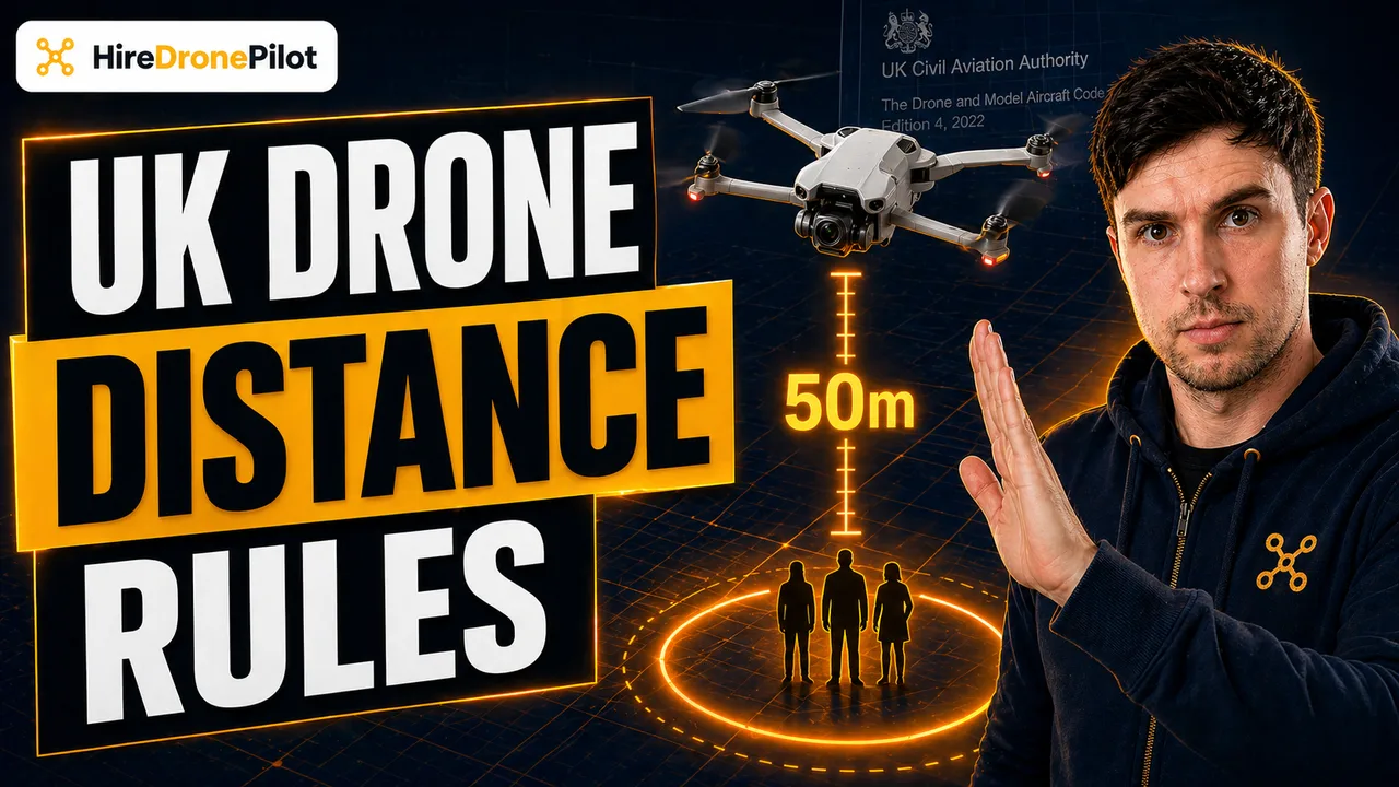
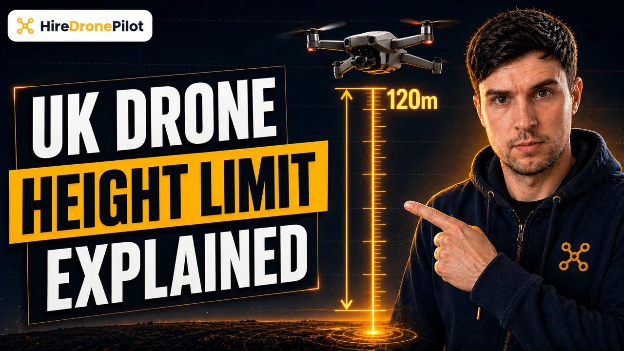
The UK Drone Height Limit: What 120 Metres Really Means
Peter Leslie
12 Sept 2025
Key Takeaways
- The UK drone height limit is 120 metres, roughly 400 feet, measured from the closest point of the earth's surface to the drone
- The ceiling applies to every Open Category drone regardless of class mark or weight, with no recreational or commercial distinction
- Over hills, cliffs and mountains the 120-metre ceiling follows the ground, so the drone must never be more than 120 metres above the nearest point of the surface below it
- A tall-structure exemption lets an operator tasked by the structure's owner fly above 120 metres, but only within 15 metres vertically and 50 metres horizontally of the structure
- Going above 120 metres without an Operational Authorisation is an offence under the Air Navigation Order 2016, and endangering an aircraft in flight carries up to five years in prison
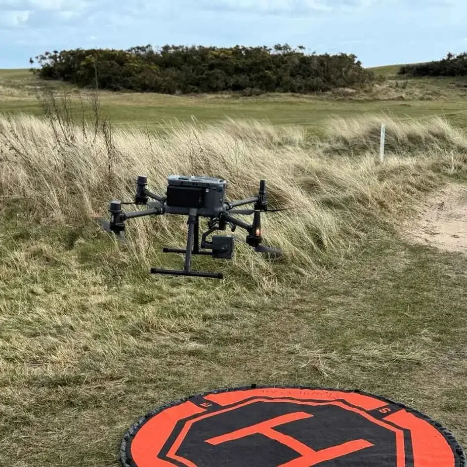
The UK drone height limit is one of the most quoted numbers in the hobby, and one of the most frequently misunderstood. The answer is 120 metres, which is close enough to 400 feet for the Civil Aviation Authority to treat the two as interchangeable. That single figure governs almost every legal flight in the Open Category.
What trips drone pilots up is not the number itself. It is where the CAA measures it from, how it behaves over sloped terrain, and the narrow set of circumstances that allow an operator to lift above it legally.
The UK drone height limit is 120 metres measured from the closest point of the earth's surface to the drone
Rule 3 of the Drone and Model Aircraft Code sets the legal ceiling at 120 metres, or roughly 400 feet, above the surface. The figure exists to keep drones safely separated from manned aircraft, which in most of the country fly above 500 feet, and to give air ambulances, police helicopters and low-flying military aircraft a protected corridor underneath.
The critical phrase in the Code is closest point of the earth's surface. The 120 metres is not measured from your take-off point, and it is not measured from sea level. It is measured from whatever ground, water or slope happens to sit directly below the drone at that moment. If the drone drifts out over a valley, the allowable height changes with it.
Almost every consumer drone reports height above the take-off point, not height above the ground. That gap between what the display shows and what the law actually measures is the single most common way careful operators end up on the wrong side of the rule.
The 120-metre ceiling applies to every Open Category drone regardless of class mark or weight
Most UK drone laws scale with the weight or the class mark of the drone. The height limit does not. Whether you are flying a sub-250g drone under the A1 sub-category, a UK2 in A2, or a UK3 in A3, the 120-metre figure applies unchanged.
Nothing in the Open Category unlocks more altitude. A C0 or UK0 class mark lets you fly closer to people. A2 competence lets you fly closer to uninvolved people with the right drone. None of those concessions raise the ceiling. The only way to legally climb above 120 metres is to leave the Open Category entirely.
There is one small, easy-to-miss exception inside the Code itself: model gliders up to 10 kilograms may measure their 120 metres from the remote pilot's standing position rather than the ground directly below the glider, which is what makes hill-launched slope soaring workable. Every other drone measures from the surface.
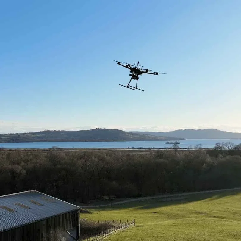
Over hills, cliffs and mountains the 120-metre ceiling follows the ground beneath the drone
This is the part that confuses people most, and the part the Drone Code is most explicit about. When you are flying somewhere the ground is not flat, the 120-metre limit is measured to the closest point of the earth's surface at every instant of the flight. Launching from the top of a 200-metre cliff does not give you 320 metres of legal airspace over the sea below.
Flown correctly over a hill, the drone can climb 120 metres as it rises up the slope with the terrain, staying within the rule because the ground is also rising with it. The moment the drone passes the summit and heads out over a valley or coastline, the nearest surface drops away, and the drone must descend with it to stay legal.
This is where the onboard altimeter reading becomes genuinely dangerous. A consumer drone taking off from the top of a cliff and flown out to sea will happily report an altitude of 90 metres while actually sitting 290 metres above the water. The display is giving an honest answer to the wrong question.
The practical fix is to treat launch-point readings as a rough guide only, and to keep the drone visibly close to the surface it is flying over. Coastal, hillside and mountainous flights are the ones where I plan the route by eye before the first take-off, not by staring at the controller display.
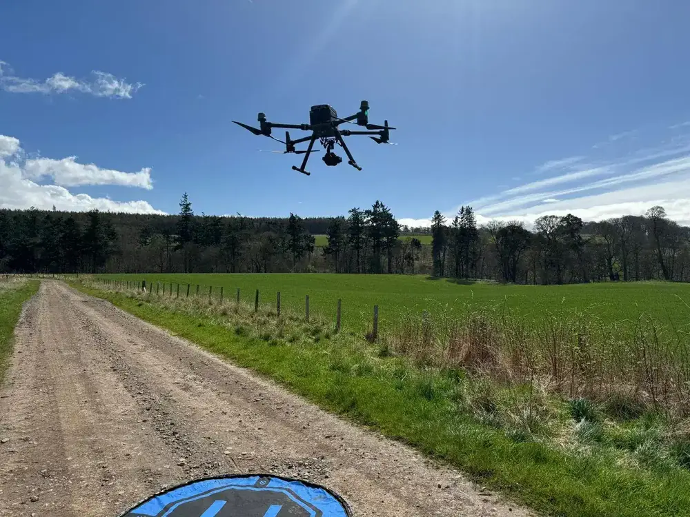
The practical ceiling for most Open Category flights is Visual Line of Sight, not 120 metres
On paper the ceiling is 120 metres. In practice, most operators hit a tighter limit long before that: Visual Line of Sight. Rule 2 of the Drone Code is unambiguous. You must be able to see the drone directly, with your own eyes, clearly enough to tell which way it is facing and clearly enough to spot other aircraft entering your airspace.
A small consumer drone becomes a dot in the sky well before it reaches 400 feet. At that point it is not possible to tell orientation or direction, which means line of sight has been lost and the flight has stepped outside the Code. A larger professional platform is easier to see, but even then the viewing angle and background sky matter as much as raw distance.
This is also why the horizontal people-buffer rule matters: the 50-metre minimum distance from uninvolved people scales up as altitude grows, and a drone directly overhead is the hardest of all to track. Pushing the drone out to at least match its altitude keeps the viewing angle honest. Breaking line of sight over people is a far easier way to end up in trouble than clipping the legal ceiling.
The tall-structure exemption is the only on-the-fly way to lift above 120 metres in the Open Category
Rule 39 of the Drone Code carves out one narrow exception. If the person or organisation responsible for a very tall structure over 105 metres asks you to carry out a task on that structure, such as a survey or an inspection photo set, you may fly higher than 120 metres to do it. Wind turbines, communication masts, tall chimneys and some skyscrapers all qualify.
The exemption comes with hard geometric limits. The drone must never be more than 15 metres above the top of the structure, and it must stay within 50 metres of the structure horizontally whenever it is above 120 metres. Those two numbers together describe a small dome of legal airspace around the top of the structure, not an open invitation to climb.
This is not a hobbyist concession. It is an operational exemption written for drone operators contracted to work on the structure itself, and it runs alongside the usual obligations: landowner permission, a site-appropriate risk assessment, and the right pre-flight checks. Turn up and fly 130 metres above a church spire for a cinematic shot and none of the exemption applies.
Going above 120 metres otherwise requires the Specific Category and an Operational Authorisation
Every other reason to fly higher than 120 metres, from cinematography to mapping to long-range inspection, sits in the Specific Category. That is the regulatory route for anything the Open Category rules cannot contain.
Most drone operators enter the Specific Category through PDRA01, the pre-defined operational authorisation most professionals hold. PDRA01 unlocks flights in residential, commercial, industrial and recreational areas — but it explicitly keeps the same 120-metre altitude ceiling as the Open Category. Holding PDRA01 is not a shortcut to flying higher. It is a shortcut to flying closer.
A higher ceiling requires a bespoke Operational Authorisation. The operator submits an operational safety case to the CAA that documents the drone, the qualified remote crew, the site, the risk mitigations, and the exact altitude needed. Approvals come written with specific conditions: a defined altitude block, a defined geographic volume, and a defined validity period. Nothing in the authorisation is generic, and nothing transfers to another site without fresh approval.
Exceeding 120 metres without authorisation is a criminal offence under the Air Navigation Order 2016
Breaching the height limit is not a civil slip-up. The legal backbone is the Air Navigation Order 2016, working alongside the UK Regulations (EU) 2019/945 and 2019/947. The penalties scale with how badly the flight goes wrong.
Routine breaches can attract a fine. Endangering an aircraft in flight, which is exactly what an uncontrolled drone above 500 feet risks, carries a maximum sentence of five years in prison. Flying outside the rules also invalidates third-party drone insurance, which turns any incident from a claim into a direct personal liability. For commercial work that alone ends the job and the client relationship.
Police officers have the power to direct a flight to land, to seize the drone, and to forward the incident to the CAA for enforcement. The most serious prosecutions have involved flights over prisons, airports, and crowds — but a height breach near a flight path is in the same legal category.
So the headline answer holds: 120 metres, measured from the closest point of the earth's surface, applied to every drone in the Open Category, with one narrow exemption for tasked work around tall structures and a formal Specific Category route for anything else. The number is easy. The measurement point and the terrain are what catch people out.
Climbing above 120 metres for real commercial work is as much a qualifications question as an altitude question, and the drone pilot qualifications overview walks through the training routes the CAA expects you to have in place before that conversation starts.
Got a site with awkward terrain, a tall-structure survey, or a height question you want the legal route laid out on? Drop a note to peter@hiredronepilot.uk and I will come back to you directly. If you prefer the video version of this explainer, the comments are open on YouTube.
References
Primary source material for this article is the UK Civil Aviation Authority. External links open in a new tab.
- UK CAA — The Drone and Model Aircraft Code (CAP2320) · Rule 3 (120m ceiling), Rule 38 (model glider height), Rule 39 (tall-structure exemption)
- UK CAA — Where You Can Fly (A1, A2, A3 sub-categories) · Open Category altitude applies across all sub-categories
- UK CAA — PDRA01 Operational Authorisation Overview · PDRA01 retains the 120m ceiling, 500m range, and overflight rules
- UK CAA — Beyond Visual Line of Sight (BVLOS) · higher altitudes require the Specific Category and an Operational Authorisation
- UK CAA — UK Regulatory Framework for Drones · Air Navigation Order 2016 and the UAS Regulations that back the criminal penalties

Peter Leslie
Founder & GVC Drone Pilot
Peter is the founder of HireDronePilot. With thousands of logged commercial flight hours, he writes about drone technology, commercial surveying tactics, and UK aviation compliance.
Connect on LinkedIn