How to Spot a Police Drone at Night With an App

Peter Leslie
5 May 2026
Key Takeaways
- No civilian app on Android or iOS can positively identify a drone overhead as police-operated — police drones do not advertise themselves in plain English
- Free Remote ID receiver apps such as Drone Scanner can pick up nearby drones broadcasting Remote ID and show their Operator ID, position, height and route
- From 1 January 2026 Remote ID is mandatory in the UK for UK1, UK2, UK3, UK5 and UK6 class drones, and the broadcast does not include personal identifying information
- The green flashing anti-collision light on a drone at night is the most reliable visual cue you have, but it tells you nothing about who is flying
- Hardware tools such as DJI AeroScope are professional kit reserved for police, airports and prisons, not consumer apps
- If a drone over your home looks dangerous or threatening, the right route is the police on 101 or 999, not an app
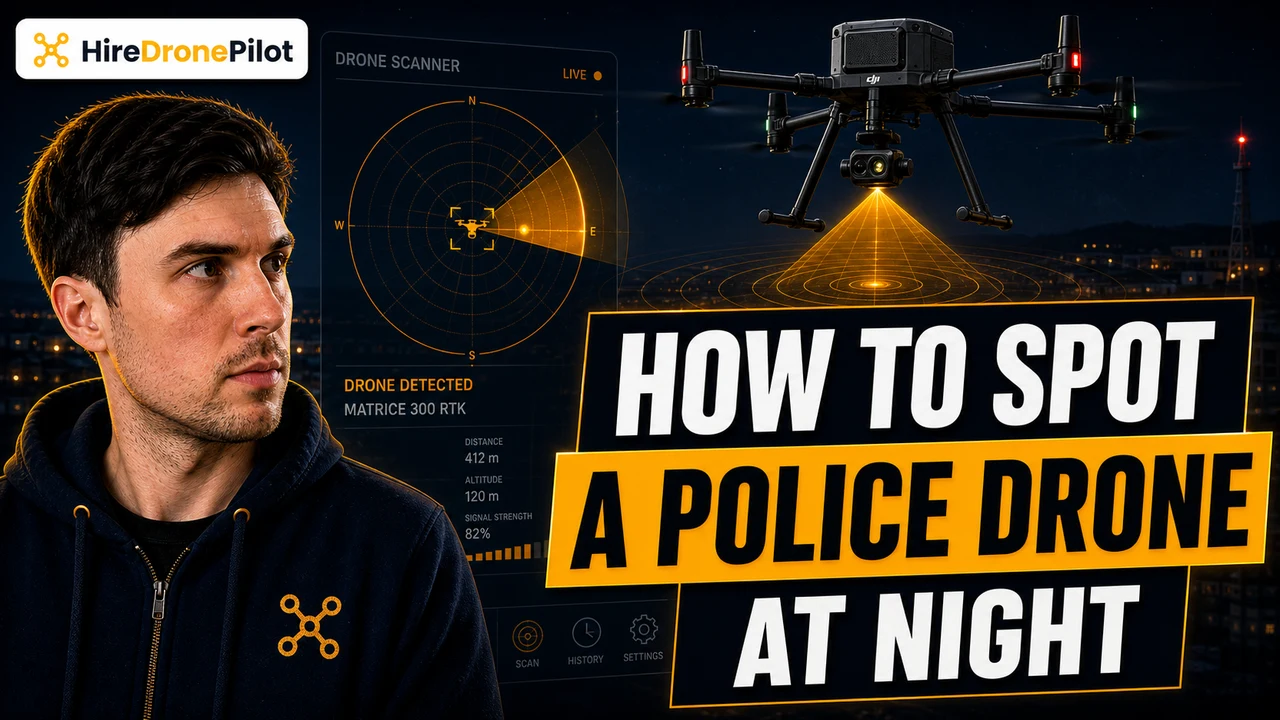
There is no single app that tells you a drone hovering over your street at night is a police drone. That is the honest answer. What there is — and what most people searching for one are really after — is a category of free smartphone apps that read the Remote ID broadcast every modern UK drone is now legally required to transmit. Those apps will show you a drone's Operator ID, height, position, and where the drone operator is standing. They will not flag the drone as police in big red letters, because police drones broadcast the same anonymous identifier as every other class-marked drone in UK airspace.
This is the practical rundown. Which apps are worth installing, what they actually pick up, what the green flashing light tells you in the dark, and where the legal line sits between civilian curiosity and professional drone detection systems like DJI AeroScope. If your worry is privacy or harassment rather than aviation, the better route is almost always a phone call to the police on 101.
No civilian app can positively identify a drone overhead as police
The first thing to settle is the question itself. UK police forces operate drones for searches, public-order events, road traffic incidents and pursuits, but the drone in the sky does not carry a livery you can read from the ground at night, and it does not broadcast a "this is a police drone" flag. The Remote ID system was built deliberately not to do that. Operator details sit behind the CAA, and only the CAA and authorised bodies can resolve a broadcast Operator ID back to an organisation or a person.
That design choice cuts both ways. It protects the privacy of every law-abiding hobby drone pilot, and it means a civilian with a phone cannot legally distinguish a police aerial from a wedding videographer's aerial filming drone or a roof inspector's roof inspection drone. What you can do is read the drone's broadcast and judge its behaviour. Hovering over a search area, tracking a road, holding station above a crowd — that pattern is more telling than any app label would be.
If the question behind the search is "is the police watching me", the calmer answer is also the right one. UK police powers over drones are real and well-defined, but routine police aerial work is overt. A directed surveillance operation is governed by the Regulation of Investigatory Powers Act and is not the kind of thing you stumble across by accident in a residential street.
Drone Scanner is the closest thing to a free Remote ID app on Android and iOS
The category you actually want is a Remote ID receiver. The most widely available option is the open-source Drone Scanner app, originally written by drone-defence company Dronetag and free on the Apple App Store and Google Play. There is also OpenDroneID on Android for the more technically minded, and a handful of paid airspace-awareness apps that surface the same broadcasts inside a wider map. None of them can see beyond the drones legally transmitting Remote ID — they are receivers, not radars.
When a drone within Bluetooth or Wi-Fi range is broadcasting Remote ID, an app like Drone Scanner will display the drone's Operator ID, the aircraft's serial number, its position, its altitude above take-off, its heading, and the drone operator's own GPS position. That last field is the useful one at street level. If you can see the drone in the sky and the app shows the drone operator standing two roads over, you have a rough idea of where the flight is being run from.
Two practical limits. First, Bluetooth Remote ID has a typical reception range of around fifty metres on a standard phone — sometimes more, often less in built-up areas. A drone at the legal 120 metre altitude ceiling directly overhead will usually still be picked up; one circling a kilometre away on Wi-Fi may not be. Second, the app needs Bluetooth and location services on, and a phone with reasonably modern Bluetooth chipset support. Older budget phones can struggle.
Remote ID became mandatory for most UK drones in January 2026
Detection apps only work because of the regulation behind them. From 1 January 2026, Remote ID is mandatory in the UK for UK1, UK2, UK3, UK5 and UK6 class drones whenever they fly. UK0 sub-100g toys, UK0 drones over 100g with a camera, UK4 model aircraft, and pre-class-mark legacy drones with a camera over 100g have a longer run-up — they have until 1 January 2028 to comply.
The broadcast is short and standard. Per UK Regulation (EU) 2019/947, every Remote ID transmission carries the Operator ID, the drone's serial number, the drone's geographical position and height above take-off, the route course, the remote pilot's geographical position, and an emergency status field for situations like low battery. It does not carry a name, an address, a phone number, or any personal identifying information. The broadcast is deliberately anonymous from the public's point of view.
That is why an app cannot tell you the drone above your roof belongs to a particular force. Even the identifier is generic. Only the CAA and the authorised organisations they share with — police forces investigating a specific incident, for example — can match a broadcast Operator ID back to the registered operator. The companion guide to how police identify a drone operator covers what happens after that point.
DJI AeroScope is hardware, not an app, and it is reserved for police and critical sites
If you have read about AeroScope, that is the system airports, prisons and police forces have been using to detect drones since long before Remote ID went mainstream. It is not an app. It is a passive receiver — sometimes a small portable unit, sometimes a fixed antenna installation — that decodes the proprietary signal DJI drones transmit between drone and controller. It can show a DJI drone's flight path, the drone operator's position, and the model and serial number, often before the drone is even visible.
DJI announced it was sunsetting AeroScope in favour of its DJI RID system that aligns with public Remote ID, and the practical UK position is that AeroScope is not a tool a member of the public can buy and use. Critical sites like the airspace around an airport with active drone detection use AeroScope or its successor under controlled conditions. Civilian use is not the design intent and not realistic on price.
There is a wider professional category beyond AeroScope — multi-sensor systems that combine RF detection, radar and optical tracking, used by national infrastructure operators and policing units. For the same reason, those are not in the consumer app store. The civilian toolkit is Remote ID receiver apps, and that is where this article stays.
The green flashing light on a drone at night is your most reliable visual cue
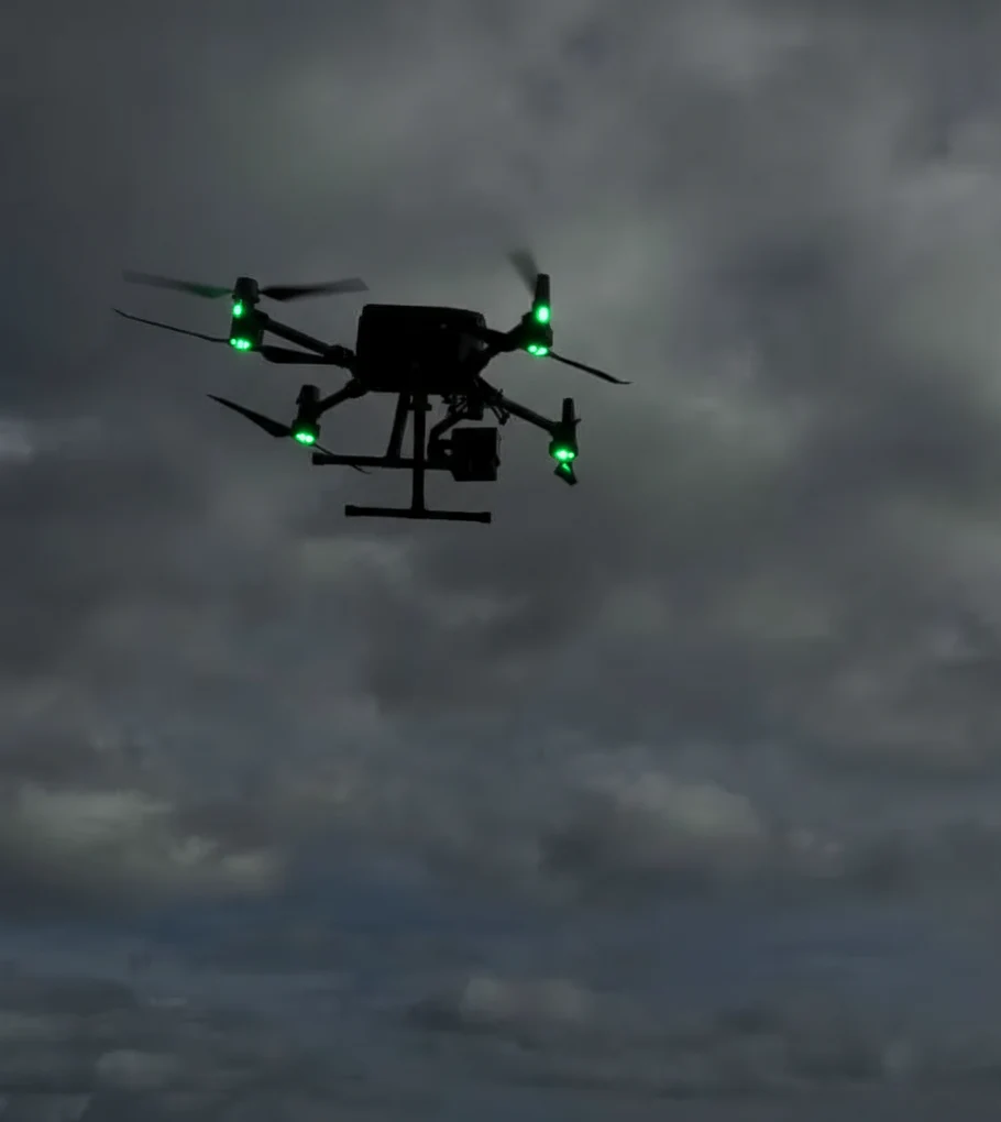
An app is one input, but the sky itself is another. From January 2026, every Open Category drone flown at night in the UK must display a green flashing anti-collision light throughout the flight, and that light is what lets the drone operator hold Visual Line of Sight after dark. The deeper rule set on this lives in the companion piece on how to see a drone at night, and the wider rule on night flying.
For a person on the ground trying to work out what is overhead, the colour matters. A green flashing light is the legally required civilian drone signal. A manned aircraft — a helicopter, an air ambulance — uses a more complex pattern of red, green and white navigation lights with a steady anti-collision strobe, and the noise profile is wholly different. A drone that is silent, low, and showing only a green flash is almost always a class-marked Open Category drone. Whether it is police or a hobbyist, you cannot tell from the light alone.
A drone flying at night with no green flashing light is not compliant with the Drone Code. That is a useful piece of information to pass to the police if you ring 101, alongside the time, the rough altitude, the colour, and any controller position you picked up from a Remote ID app.
If a drone over your home looks dangerous, the answer is a phone call, not an app
The honest framing for anyone searching "how to spot a police drone at night app" is to ask what the worry actually is. If it is curiosity, a Remote ID receiver app like Drone Scanner is a fine evening's reading and will pick up most legal flights nearby. If it is a privacy concern about a drone over a garden, the route is the broader guide on stopping drones flying over your property and a non-emergency report on 101.
If a drone is causing immediate alarm — flying erratically over a crowd, low over a road, or over a clearly sensitive site — that is a 999 call, not an app problem. The local police can request a CAA trace on a Remote ID broadcast in real time. A civilian using Drone Scanner cannot do that. The app is useful colour, not evidence in itself, although a screenshot of an Operator ID and a route track is exactly the sort of detail a 101 call handler will note down.
For drone pilots reading from the other side: the same broadcast that protects you from being personally named also makes you visible. Anyone within fifty metres of your launch site can pull your Operator ID and your remote-pilot position out of the air with a free app. That is not a problem when your operation is legal — but it is a reason to keep a clean Operator ID label, current insurance, and a flight log to hand if a curious neighbour turns into a phone call to the local force.
So the practical answer. Install Drone Scanner if you want to see what is broadcasting nearby. Read the green flashing light to confirm the drone is at least flying lawfully at night. Accept that no app will ever flag a drone as police, because Remote ID is designed to be anonymous to the public. And if any of this stops being curiosity and starts being concern, the police are the right next call.
Got a specific scenario you want covered — a drone hovering over your street, an event where you want to log everything in the sky, an airfield neighbour with questions — drop a note to peter@hiredronepilot.uk and I will come back to you directly. If you prefer the video version of this explainer, the comments are open on YouTube.
References
Primary source material for this article is the UK Civil Aviation Authority. External links open in a new tab.
- UK CAA — Remote ID (RID) · the broadcast fields, the 2026 and 2028 mandatory dates, and the privacy framing of Operator ID
- UK CAA — Flying at Night in the Open Category · the green flashing anti-collision light requirement and which class marks ship one
- UK CAA — The Drone and Model Aircraft Code (CAP2320) · the 120 metre altitude ceiling and Visual Line of Sight rules
- UK CAA — UK Regulatory Framework for Drones · UK Regulation (EU) 2019/947 and 2019/945, the legal basis for Remote ID
- UK CAA — Safety Advice for Drone Operations · airspace awareness and reporting routes for unsafe flights
Peter Leslie
Founder & GVC Drone Pilot
Peter is the founder of HireDronePilot. With thousands of logged commercial flight hours, he writes about drone technology, commercial surveying tactics, and UK aviation compliance.
Connect on LinkedIn