How to Detect a Drone in the Sky

Peter Leslie
5 May 2026
Key Takeaways
- The first detection channel for almost everyone is visual — a steady, slow-moving point that does not behave like a bird and is far smaller than any manned aircraft at the same apparent altitude
- The second channel is sound — a high-pitched propeller whine in the 200–400 Hz range that carries further than the motor hum and gives you direction before you see the drone
- The third channel, since 1 January 2026, is Remote ID — a Bluetooth and Wi-Fi broadcast that any compatible phone app can read to pull the Operator ID and the remote pilot's ground position out of the air
- Free apps such as Drone Scanner, OpenDroneID and Aerial Armor turn a modern smartphone into a basic Remote ID receiver, and a non-broadcasting drone overhead from January 2026 is itself evidence of an unlawful flight
- Purpose-built radio-frequency, acoustic and radar detectors exist, but they are airport-grade kit — for a member of the public the realistic toolkit is eyes, ears and a phone
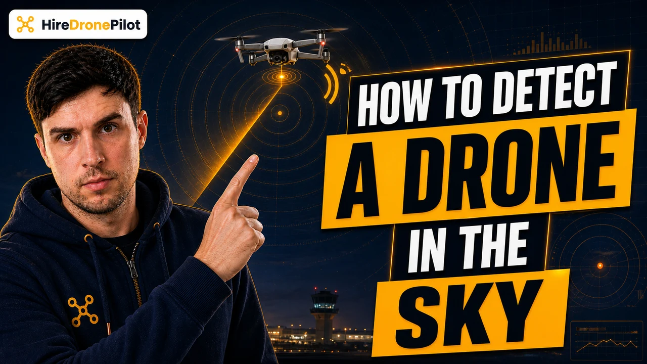
If you want to know how to detect a drone in the sky, the honest answer in 2026 is that you have three channels working at once — your eyes, your ears, and your phone. The visual cues tell you the drone is there. The sound tells you which direction. And since January 2026 the drone itself broadcasts a digital number plate that any compatible smartphone can read at a range of roughly one kilometre, which gives you the Operator ID and a map fix on where the drone pilots are standing.
This guide walks through how to detect a drone in the sky using each of those three channels — visual, audio and radio — and where the limits of each one sit. The phrase how to detect drones covers a wide spectrum, from the airport-grade kit deployed at major UK airports to the free phone app you can install in two minutes, and the right tool depends on what you are actually trying to do. For most people the answer is the phone app, plus a calmer reading of what is already in the sky.
A drone in the sky usually looks like a slow-moving, steady point that is far smaller than any aircraft at the same apparent height
The first thing that makes a drone detectable is the way it sits in the air. A consumer drone holding a hover or running a survey grid is doing something no manned aircraft does — it is parked. A light aircraft, a helicopter and an air ambulance are all moving across the sky in a clear direction at a clear speed. A drone holding station looks wrong against that backdrop, which is why most people clock one before they hear it.
Size is the second tell. The legal 120-metre altitude ceiling in the UK Open Category caps how high a drone can sit, and at 120 metres a Mavic-class drone is roughly the apparent size of a sparrow at twenty metres. A helicopter at the same point in the sky would be obviously a helicopter. If the moving point looks too small for the height it appears to be at, it is almost always a drone rather than a manned aircraft.
Position lights are the third visual cue. From 1 January 2026 every UK Open Category drone flown at night has to show a green flashing anti-collision light, and the rules on spotting your drone at night are written around that light. In daylight there is no equivalent rule, but most modern drones still carry a small red or green LED on each arm, which becomes useful at dusk. A point in the sky that is flashing green at a steady rhythm after sunset is, by design, a drone telling you it is there.
Hover patterns are the fourth. Drones running automated tasks — aerial photography orbits, survey transects, ActiveTrack follows — move in geometrically clean patterns. Straight lines. Right-angle turns. Perfect circles around a fixed point. Birds do not fly in circles for ten minutes; aerial videographer rigs do. If the moving point in the sky is repeating the same path, that is the geometry of a flight plan, not wildlife.
Knowing how to detect drones by ear comes down to a high-pitched propeller whine, not the motor hum
The audio side of detecting a drone is more useful than people give it credit for, because sound gives you direction before vision does. The frequency band that carries furthest is the propeller-tip noise — a high-pitched whine that sits roughly in the 200 to 400 hertz range and tracks the speed at which the rotors are spinning. The motor hum sits underneath that and is largely a low rumble, which the wind, the road and the rest of ambient life mask very effectively.
Consumer drones in the field measure roughly 70 to 90 decibels at close range, and that drops sharply with distance under the inverse-square law. A drone at the legal ceiling is usually barely audible over normal traffic. A drone at thirty metres directly above a quiet garden is unmistakable. The transition between those two states happens fast, and the high-frequency whine is the part that gives the position away first.
A practical detection habit if you suspect a drone overhead is to cup your hand behind one ear and slowly turn through the compass. The directional gain on the propeller whine is enough to point you at the drone within a few seconds, and at night that is often the only directional cue you get. Once you have a bearing on the sound, the eyes can do the rest.
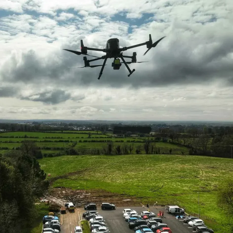
There is a noticeable variation by drone class. A sub-250-gram Mini-class drone is genuinely quiet at altitude. A larger Mavic or Air-class drone is louder. A heavy commercial drone — a Matrice or a heavy-lift rig — is loud enough to clear the ambient floor at distances of a hundred metres or more. If the sound is loud, low and constant rather than passing, you are listening to a drone holding station, not a vehicle moving through.
Since January 2026, knowing how to detect a drone in the sky means installing a Remote ID receiver app on your phone
The biggest change in detection arrived legally rather than technically. From 1 January 2026, every drone carrying a UK1, UK2, UK3, UK5 or UK6 class mark has to broadcast Remote ID whenever it flies. From 1 January 2028 the rule extends to UK0 drones over 100 grams with a camera, UK4 model aircraft, legacy drones and privately built drones above the same threshold.
What Remote ID broadcasts is exactly the list a detection workflow wants. The Operator ID. The drone's serial number. The drone's live position and height. Its course. The remote pilot's geographical position on the ground. Plus an emergency-status flag — for example a low-battery warning. The signal goes out in unencrypted Bluetooth and Wi-Fi at roughly one-second intervals, which means any compatible smartphone within about a kilometre can read it.
Several free apps turn a modern phone into a basic Remote ID receiver. The names to look for on Android and iOS are Drone Scanner, OpenDroneID and Aerial Armor. Open the app, point the phone at the sky, and any compliant drone in range will appear as a live card with its Operator ID, its position and the remote pilot's position pinned on a map. That last field is the one that has changed everything — for the first time, a member of the public can see where the drone operator is standing while the drone is still airborne, which is the same workflow used to identify a drone operator through legitimate channels.
There is a hard limit to what the broadcast tells you. Remote ID does not contain a name, an address, a phone number or a photograph. Only the CAA and authorised organisations such as the police can convert an Operator ID into a person, and that is by deliberate design under UK data protection law. The receiver app gives you a verifiable identifier and a coordinate. It does not give you a doorbell.
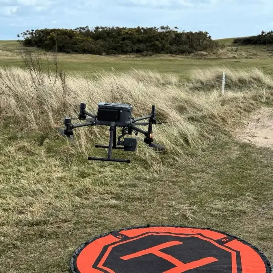
Consumer detection apps work because Remote ID is mandated, and a non-broadcasting drone overhead is itself evidence
A point worth being explicit about. The reason Drone Scanner and OpenDroneID can detect drones at all is that UK law now requires the drone to volunteer its identity. The phone is not pulling information out of an unwilling target — it is reading a signal the drone is legally obliged to broadcast. That is the same architecture used in air traffic control transponders for manned aviation, scaled down to consumer Bluetooth.
Which means the app has a blind spot, and it is a useful blind spot to know about. A drone that is not broadcasting Remote ID will not appear in the app. From 1 January 2026 forward, a UK1, UK2, UK3, UK5 or UK6 class drone in the air without an active Remote ID broadcast is itself flying outside the rules — that absence is the evidence. From 1 January 2028 the same applies to UK0, UK4, legacy and privately built drones above 100 grams with a camera. Before those dates the older drones were not yet required to broadcast, and many will need a manufacturer firmware update to comply.
In practice, almost every consumer drone sold in the UK by a major manufacturer in 2026 broadcasts Remote ID out of the box. DJI, Autel, Skydio and the other mainstream brands all ship the function active with the right Operator ID entered during setup. If you scan the sky and see a hovering drone but no Remote ID card on the app, the most likely explanations are an out-of-date drone running pre-class-mark legacy firmware, a non-compliant flight, or a drone outside the roughly one-kilometre range of your phone's Bluetooth radio. Each of those changes the conversation in a different way.
Purpose-built RF detection hardware exists, but it is airport-grade kit and out of scope for almost every reader
Above the level of a phone app sits a different category of detection — purpose-built radio-frequency scanners, acoustic arrays, electro-optical and infrared cameras, and dedicated drone radar. This is the equipment running at major UK airports, at prison perimeters, at large public events and at critical-national-infrastructure sites, and it is the reason an aerodrome can pinpoint an unauthorised drone within seconds.
Each sensor in that stack has a strength. RF scanners detect the command-and-control link between the drone and its controller and can classify the make and model. Acoustic arrays listen for propeller signatures at close range. Electro-optical and thermal cameras provide visual confirmation through long lenses. Drone radar is tuned for small, slow, low targets where airport primary surveillance radar struggles. Layered together they give a coverage pattern that is hard to defeat.
For a member of the public this category is mostly a curiosity. The hardware is expensive — five to six figures for a credible installation — and operating an active jammer or signal interceptor as a civilian is illegal under the Wireless Telegraphy Act 2006 regardless of what the drone in the sky is doing. Drone jammers are firmly off the table. The realistic toolkit for someone reading this guide is, and stays, eyes, ears and a phone.
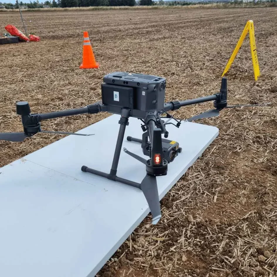
What you can — and cannot — tell about the drone operator from the broadcast
Once you have a drone detected on at least one of the three channels, the next question is what you can actually conclude from it. The honest line is narrow. You can confirm the drone is there. You can pin its altitude and rough position. If Remote ID is reading, you can place the operator on a map and read off an Operator ID. You can compare what you see against the rules of the Drone and Model Aircraft Code — the 120-metre altitude ceiling, the 50-metre people-distance rule, the no-flying-over-crowds rule, the airspace and Flight Restriction Zone rules — and form a view on whether the flight looks lawful.
What you cannot do is convert the Operator ID into a name, an address or a face. The CAA register is not a public search tool, and the data-protection regime under the Air Navigation Order 2016 and the UK Regulations (EU) 2019/945 and 2019/947 deliberately blocks that lookup. You also cannot tell from the broadcast whether the operator holds a GVC or any other qualification, whether they are flying under PDRA01 or in the Open Category, or what their intent is. Only the police and the CAA can pull those threads, and the right route into both is the boring one. Document what you see, screenshot the Remote ID card if you can, and report on 101 for non-urgent suspicious flying or 999 if there is an immediate threat to life.
The broader point is that detection is not the same thing as enforcement. Knowing how to detect drones is a useful skill, especially if you suspect a drone following you or hovering over your property. Acting on what you have detected is the job of the police powers framework, and the legal route is always document, identify, report.
So the short answer to how to detect a drone in the sky in 2026. Use your eyes for the visual signature — a steady, slow-moving point that is too small for the apparent altitude, often with a flashing position light. Use your ears for direction — the high-pitched propeller whine carries furthest and gives you a bearing before you see the drone. Use your phone for identity — a free Remote ID receiver app reads the Operator ID and the remote pilot's ground position straight off the air. Three channels, no specialist hardware, and a clearer picture than was possible at any point in the last decade.
Got a specific scenario you want covered — a drone you keep seeing over a particular spot, a question about the Remote ID app, or a flight you suspect is unlawful? Drop a note to peter@hiredronepilot.uk and I will come back to you directly. If you prefer the video version of this explainer, the comments are open on YouTube.
References
Primary source material for this article is the UK Civil Aviation Authority. External links open in a new tab.
- UK CAA — Remote ID (RID) · 1 January 2026 mandatory broadcast date, broadcast data list, Operator ID and remote pilot position
- UK CAA — The Drone and Model Aircraft Code (CAP2320) · 120-metre altitude ceiling, 50-metre people-distance rule, anti-collision light at night, VLOS
- UK CAA — Concerns about privacy and illegal use of drones · 101 and 999 reporting routes for suspicious or unlawful flights
- UK CAA — Where you can fly (A1, A2, A3 sub-categories) · Open Category sub-categories, distance and crowd rules used to assess a flight
- UK CAA — UK Regulatory Framework for Drones · Air Navigation Order 2016 and the UK UAS Regulations underpinning detection and enforcement
Peter Leslie
Founder & GVC Drone Pilot
Peter is the founder of HireDronePilot. With thousands of logged commercial flight hours, he writes about drone technology, commercial surveying tactics, and UK aviation compliance.
Connect on LinkedIn